STORM WATCH: Intense lightning, strong winds and flash flooding are biggest storm threats today in Brooklyn
Showers and storms are in the forecast through the evening commute. Flood watch until late tonight!
More Stories


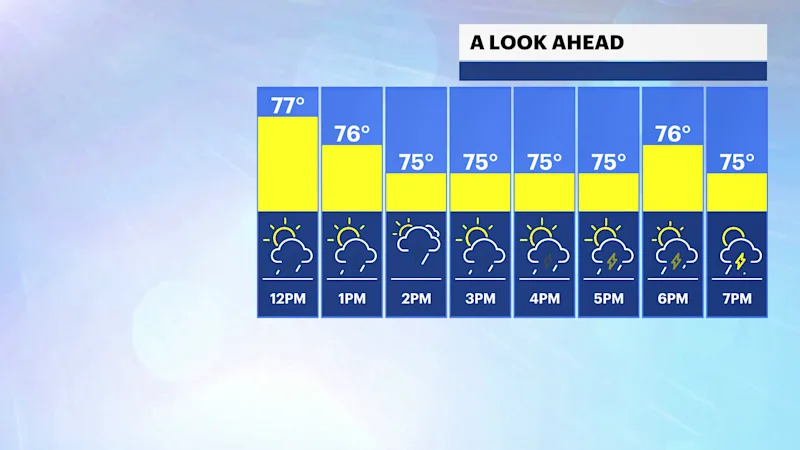
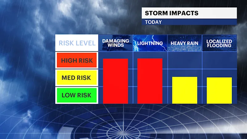
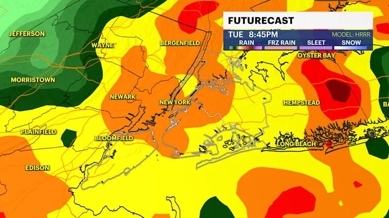
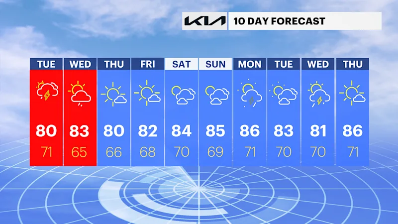
Severe storms are likely in the city today. Expect multiple rounds of scattered storms throughout the day. Storms are more likely to start firing off across the city around noon and continue until through the evening commute and dinner. Wednesday will be a cloudy, wet and muggy day! It will feel more humid than yesterday. Temperatures will be in the upper 70s for the afternoon — clouds and rain will keep temperatures below average. Here are the main concerns with storms that develop
RAIN: Heavy rain is possible with the strongest of storms. Rainfall totals by Tuesday afternoon could be up to 3" in some spots. Some areas may be significantly less depending on where storms move through. There is a risk of flash flooding with storms today.
WIND: The more organized severe storms could bring gusts up to 50mph! Either way, winds will be strong at times through the afternoon gusting up to 30 mph.
TORNADO: The Storm Prediction Center is warning that there is a 2% chance the city could get a tornado; however, extremely uncommon for this region.
Majority of the severe storms should exit by late tonight with a few scattered downpours possible later.
WEDNESDAY: Showers and storms are possible. Cloudy and muggy. Highs in the low 80s.
THURSDAY: Sun returns. Humidity lowers. Highs in the low 80s.
FRIDAY: Sunny and comfortable. Highs in the low 80s.