Decent weekend ahead with a stray shower; heavy rain chance returns Monday
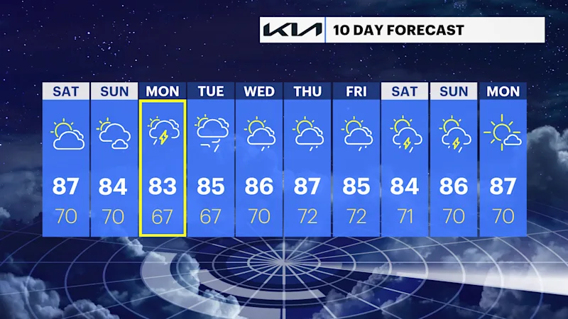
Saturday and Sunday will be mostly dry with more clouds than sun, but rounds of moderate to heavy rain look to return in time for Monday.
More Stories


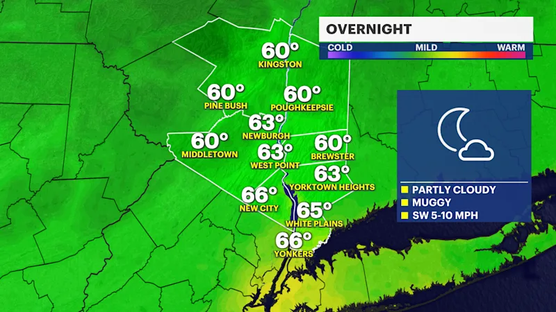
OVERNIGHT
Partly cloudy to mostly clear, with lows in the 60s to low 70s into early Saturday morning.
WEEKEND OUTLOOK
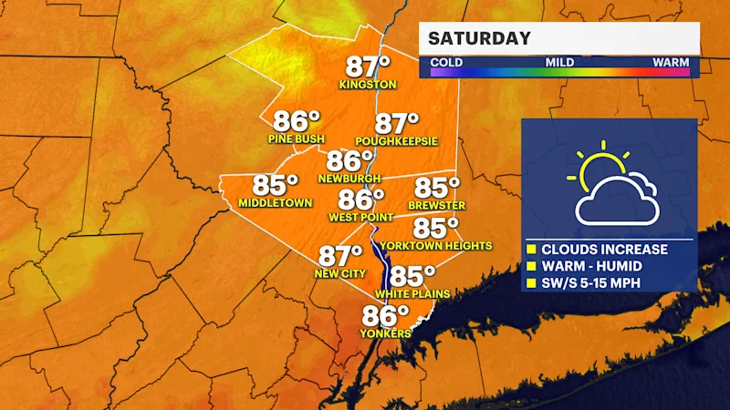
Saturday will be the better weekend day. There will be a mix of sun and clouds, with temperatures in the 80s, and it will still be humid. It will be dry and decent, but with times of more clouds than sunshine.
Sunday is mostly cloudy. There is the chance for a few rain showers in the afternoon and evening, but most of the day is dry until late Sunday night. High temperatures will be in the 80s and you will still feel the high humidity.
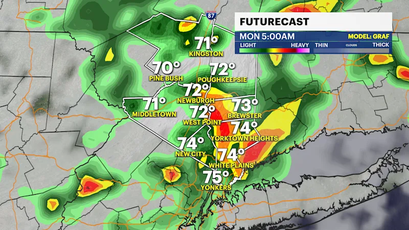
MONDAY: NEXT STORM WATCH DAY?
There is increasing confidence for periods of moderate to heavy rain and a few thunderstorms to arrive starting Monday morning. For now, plan on Monday being wet, with some dry breaks from time to time. The News 12 Storm Watch Team will keep you updated on Monday's wet weather chance through the weekend on-air, on social media and the News 12 app.
EXTENDED FORECAST
OVERNIGHT: A stray shower this evening. Otherwise, partly cloudy overnight, warm and muggy, with lows in the 60s to low 70s into early Saturday morning.
SATURDAY: Partly sunny. Warm and humid. Highs around 87. Lows near 70.
SUNDAY: Mostly cloudy, with late-day showers into the evening and overnight. Warm and humid, with highs around 84. Lows near 70.
MONDAY: WEATHER TO WATCH -- Mostly cloudy and breezy, with periods of moderate to heavy rain and a few thunderstorms likely. Highs around 83. Lows near 67.
TUESDAY: Mostly cloudy, with lingering showers likely. Highs around 85. Lows near 67.
WEDNESDAY: Partly sunny, with scattered showers possible. Highs around 86. Lows near 70.
THURSDAY: Sun and clouds. Shower chance. Highs around 87. Lows near 72.
FRIDAY: Sun and clouds. Chance for a shower. Highs around 85. Lows near 72.