More Stories
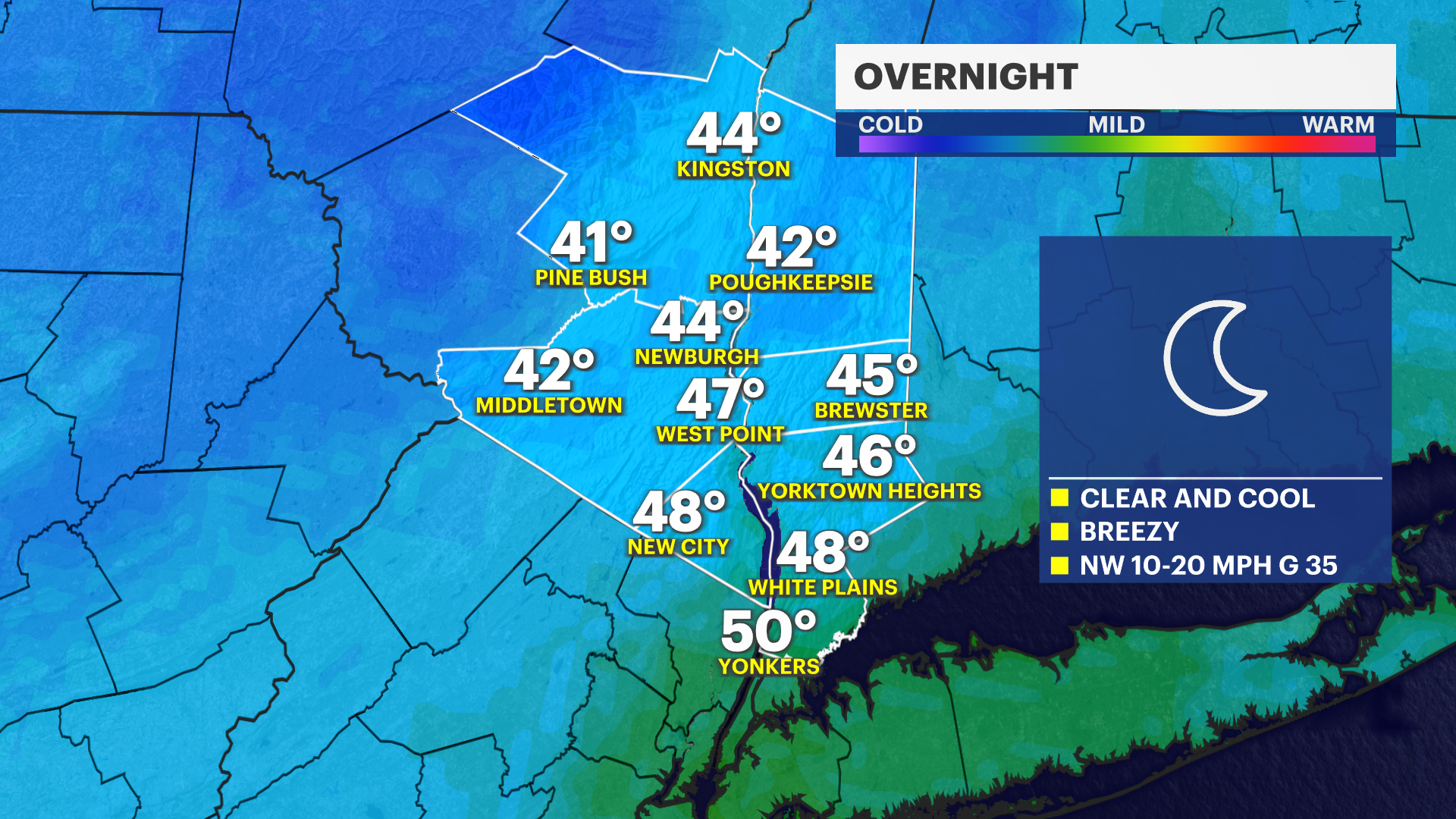
OVERNIGHT: Winds will remain breezy with gusts around 30 mph. These winds will weaken by sunrise with clear skies Monday morning. Monday looks gorgeous, a complimentary breeze, plenty of sunshine and temperatures warming into the low and middle 70s. A great day to be outdoors, so take advantage of it.

MIDWEEK: Tuesday through Wednesday the weather will be similar, a few more clouds mixing in, but still staying very pleasant. Temperatures will vary for some but many will still warm into the lower and middle 70s. It will be a bit breezier on Tuesday but the day will overall still be great.
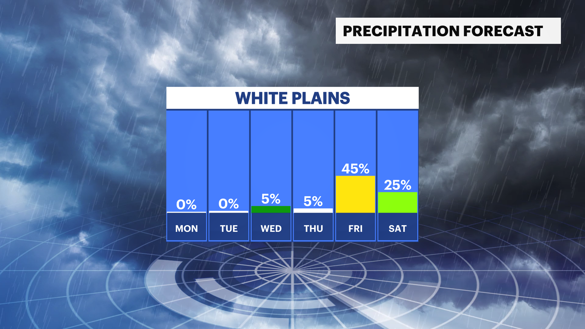
END OF THE WEEK: Thursday's temperatures will be closer to normal for this time of year. Friday will be warmer, but there is a storm system that we are monitoring that may bring rain to the region Friday night. There are still details to iron out since it is so far out. So be sure to stay up to date with our hyperlocal forecasts.

More from News 12
1:11

Chilly start, bright finish: A cool week ahead before milder rebound in the Hudson Valley
1:22

Blizzard of 2026 is now a "bomb cyclone"

25 tips to keep you safe during a winter storm
4:12

What you need to know about the snowstorm heading toward the tri-state Sunday into Monday
1:37

Warmer temps finally on the way after brutal stretch
0:55
