More Stories
For most of you reading this article, if you've ever woken up to 30 inches of fresh snow on the ground, I'd imagine you were at a ski lodge.
Or maybe in Buffalo.
Two feet of snow in our neck of the woods qualifies as historic. But 2 1/2 to 3 feet? Borderline biblical.
That's exactly what I woke up to on Saturday, Feb. 9, 2013. The night before, I was lucky enough to make it home from work as the snow came down at 3-4 inches per hour. It was wild. One minute, heavy rain, the next, a snow globe of epic proportions. "Plows won't be able to keep up with this!" I thought to myself multiple times. I was right, of course. Cars were stopped dead in their tracks, abandoned in the middle of the road like some post-apocalyptic movie.
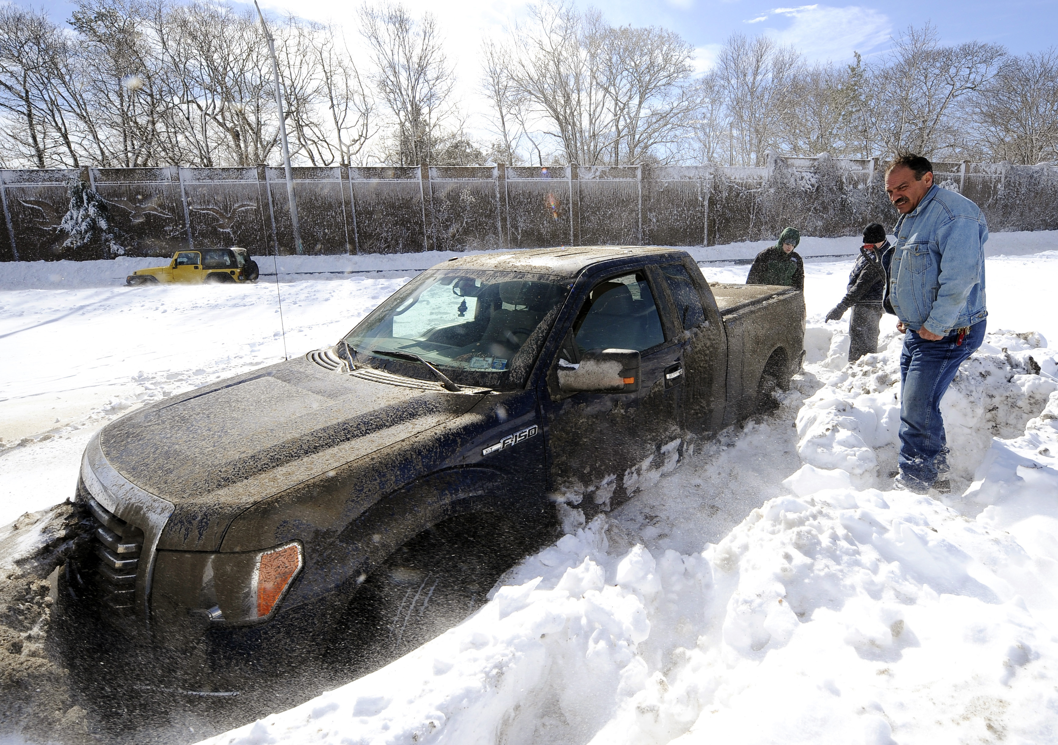 Wayne Gingo, of Medford, looks at his car that got stuck in the snow on the Long Island Expressway, eastbound near Exit 60 in Ronkonkoma. Gingo was driving home from his job as a postal worker at JFK Airport and got stuck at 1:45 a.m. Saturday. He spent the night in the car waiting for a tow truck.
As it turned out, the town I lived in at the time was not at all prepared for the storm and really dropped the ball. Not a single plow came down my street until Sunday evening. Alas, if only the storm had occurred during the week, it would have meant two snow days off from work. I literally couldn't have gone anywhere.
But I digress... this was the greatest snowstorm I had ever witnessed. A weekend completely snowed in. Never before had I seen so much snowfall at one time.
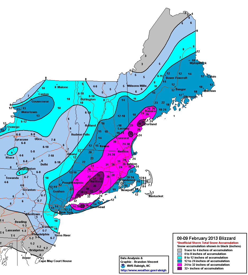 The "bullseye" for this storm was from central Connecticut down onto Long Island. I lived somewhere in that dark purple area. Image courtesy NY National Weather Service.
Waking up to 30 inches was like winning the winter weather jackpot. I watched as my friends to the west of me reported "only" around 12-18 inches. It was early on in my meteorology days, still working some odd jobs while trying to break into the field. Since I didn't have to cover this for work, I was able to take in every second of the storm for myself.
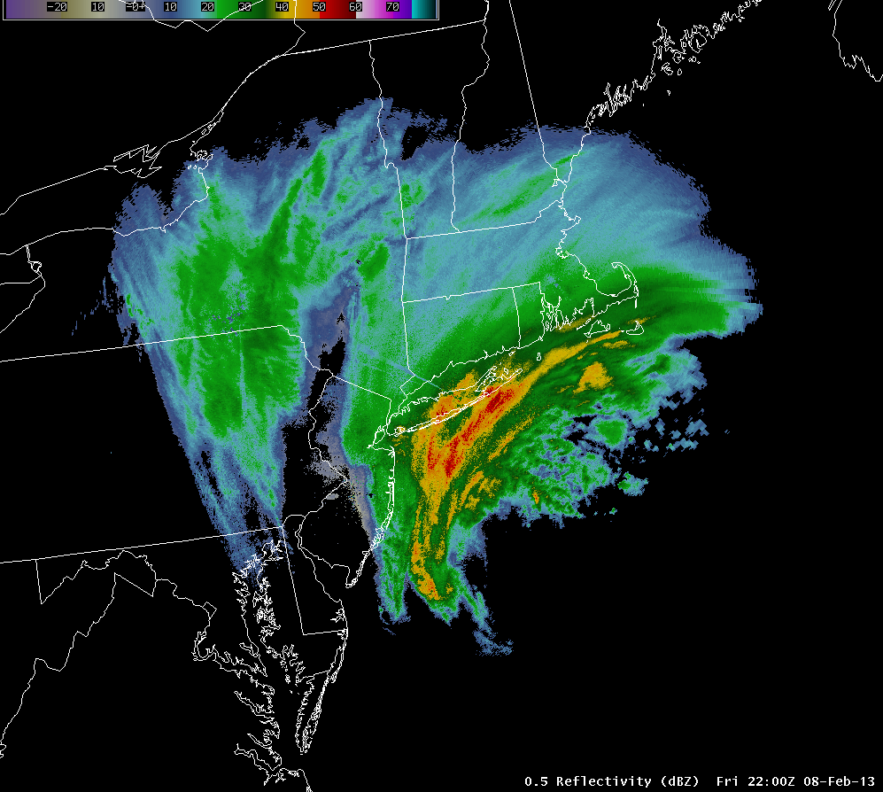 The dynamics of this storm were pretty incredible. This is what the radar looked like right when the rain changed over to snow. Explosive! Image courtesy NY National Weather Service.
Friday night was wild. Watching this monster blizzard evolve only fueled my love of weather. Of course, it wasn't just the snow. Being labeled a blizzard meant winds needed to be over 35 mph, and boy were they. Ferocious 40-60 mph gusts throughout the course of the night caused blinding, white-out conditions.
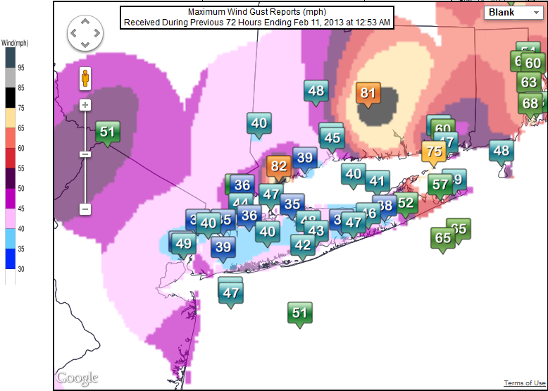 Most wind gusts ranged from 40 to 60 mph, with a few outliers. Image courtesy NY National Weather Service.
Do you remember the storm? Share your thoughts and photos with me on social media!
More from News 12
2:12

Rockland County residents travel through rough road conditions
2:35
Rain in store for Earth Day across the Hudson Valley
2:08
Rainy Monday morning in the Hudson Valley; dry stretch starts Tuesday
2:22
STORM WATCH: Cloudy Saturday before periods of wet snow on Sunday for the Hudson Valley
2:06
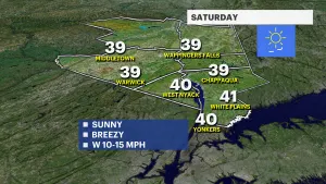
Sunny, breezy and cold weekend for the Hudson Valley
2:09