Mostly sunny Saturday with a chance of record temperatures for the Hudson Valley
News 12 Storm Watch Team Meteorologist Addison Green says the Hudson Valley will see a mostly sunny Saturday with a possible record warm temperatures.
More Stories




News 12 Storm Watch Team Meteorologist Addison Green says the Hudson Valley will see a mostly sunny Saturday with a possible record warm temperatures.
WHAT'S NOW: Temperatures trended above average again on Friday, but just shy of record levels for White Plains. As of 4 p.m., the high for the day was 74 degrees. The record is 78 (1963).
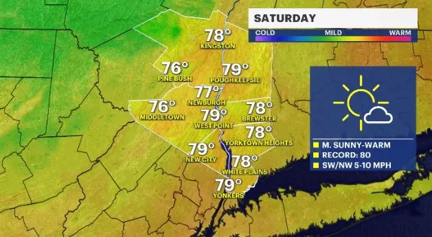
WHAT'S NEW: Saturday will continue to feel very “summery” around the Hudson Valley with temps 15 to 20 degrees above average. The record at White Plains of 80 (1963), could be challenged.
WHAT'S NEXT: Rain arrives Sunday midday from an approaching low pressure. It will keep rain in the forecast for the rest of the day and through Monday. After the showers end Monday night, it will feel quite colder than Saturday. Temperatures will be about 30 to 40 degrees cooler between this Saturday and Halloween.
FORECAST:
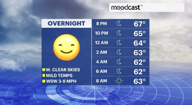
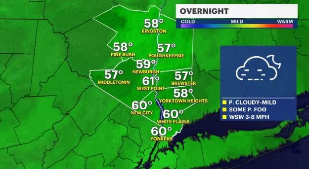
OVERNIGHT: Mostly cloudy to overcast, some patchy fog and mild temperatures. Lows in the upper-50s to low-60s.
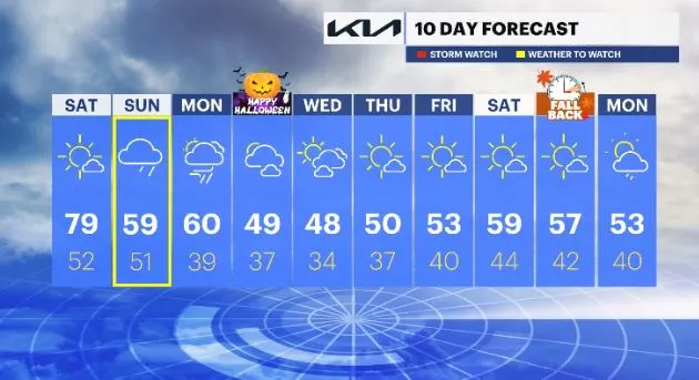
SATURDAY -- PICK OF THE WEEK: Mostly sunny with possible record warm temperatures. Record: 80 (1963). Highs in the mid- to upper-70s. Lows in the mid-40s to low-50s.
SUNDAY: Mainly cloudy through the morning hours with rain showers arriving by midday. They will last through the rest of the day. Highs in the mid-50s to low-60s. Lows in the low-50s.
MONDAY: Mostly cloudy with scattered showers. After a cold front passes by, drier and colder air moves in with breezy winds. Highs in the upper-50s to low-60s. Lows in the mid- to upper-30s.
TUESDAY -- HALLOWEEN: Partly cloudy with colder temperatures. Highs in the mid-40s to low-50s. Lows in the mid- to upper-30s.
WEDNESDAY: After a chilly start, temperatures warm up, but will trend below average. Skies will be a mix of sun and clouds. Highs in the mid- to upper-40s. Lows in the low- to mid-30s.
THURSDAY: Mostly sunny skies. Highs in the upper-40s to low-50s. Lows in the mid- to upper-30s.
FRIDAY: Mostly sunny to sunny. Highs in the low- to mid-50s. Lows in the upper-30s to low-40s.
SATURDAY: Partly cloudy to mostly sunny. Highs in the mid- to upper-50s. Lows in the low- to mid-40s.
SUNDAY (DAYLIGHT SAVINGS TIME ENDS AT 2 A.M.): Mostly sunny. Highs in the mid- to upper-50s. Lows in the upper-30s to low-40s.
MONDAY: Partly cloudy with scattered shower chances. Highs in the upper-40s to low-50s. Lows in the upper-30s to low-40s.