Scorching Thursday, chance for rain showers for Saturday
Get ready for a very warm Thursday, with temperatures hitting 90 degrees across parts of Long Island.
Share:
More Stories
1:59

Temps rise and humidity builds for Thursday, chances for rain increase headed into the weekend
7h ago1:59

Sunny and clear Monday in the Hudson Valley before temps soar later this week
3ds ago1:59

Memorial Day weekend ends with beautiful evening in the Hudson Valley
9ds ago
News 12 weather blog
19ds ago1:59

Sunny and pleasant Monday in Hudson Valley; more rain chances this week
24ds ago1:59

STORM WATCH: Downpours possible overnight in the Hudson Valley
31ds ago1:59
Temps rise and humidity builds for Thursday, chances for rain increase headed into the weekend
7h ago1:59
Sunny and clear Monday in the Hudson Valley before temps soar later this week
3ds ago1:59
Memorial Day weekend ends with beautiful evening in the Hudson Valley
9ds agoNews 12 weather blog
19ds ago1:59
Sunny and pleasant Monday in Hudson Valley; more rain chances this week
24ds ago1:59
STORM WATCH: Downpours possible overnight in the Hudson Valley
31ds agoHEADLINES:
The warmest day of the week is coming up, with highs in the 80s to near 90 degrees across the North Shore of Long Island.

Temperatures along the South Shore will be well into the 70s to near 80 degrees before an afternoon sea breeze kicks in. The day will be dry and mostly sunny, with some haze from time to time.
Dry weather continues for much of Friday, with highs near 82 degrees. There's a slight chance for a shower by the evening, but most will stay dry.
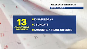
The chance for rain showers on Saturday has shifted to midday, with drier weather arriving for the evening and overnight.
Sunday could start with a spot shower and clouds before clearing for the afternoon.
Most of the weekend looks dry, with highs in the low to mid-70s.
FORECAST:
OVERNIGHT: Mostly clear and mild, with patchy fog by morning. Lows near 62 degrees, with southwest winds 5 to 10 mph. Sunrise: 5:22 a.m.
THURSDAY: Mostly sunny and very warm, with highs near 84 degrees. Southwest wind 5 to 10 mph. Sunset: 8:19 p.m. Partly cloudy and mild at night, with lows near 64 degrees. Light southwest winds.

FRIDAY: Warm, with sun and clouds. Highs near 82 degrees. Lows near 62 degrees. Slight chance for a late-day shower.
SATURDAY: Warm, with sun and clouds. Chance for scattered showers and possibly a rumble of thunder during the afternoon. Improving for the evening. Highs near 74 degrees. Lows near 60 degrees.
SUNDAY: Morning clouds give way to afternoon sun. Highs near 75 degrees. Lows near 60 degrees.
MONDAY: Partly sunny. Highs near 75 degrees. Lows near 60 degrees.
TUESDAY: Partly sunny. Chance for showers. Highs near 76 degrees. Lows near 62 degrees.


More from News 12
1:59
Temps rise and humidity builds for Thursday, chances for rain increase headed into the weekend
1:16
Streak of weekends with rain set to continue for lower Hudson Valley
1:59
Sunny and clear Monday in the Hudson Valley before temps soar later this week
1:59
Memorial Day weekend ends with beautiful evening in the Hudson Valley
News 12 weather blog
1:59