How Hurricane Lee's intensification is nearly unmatched
What is rapid intensification? Storm Watch Team Meteorologist Allan Nosoff explains.
More Stories
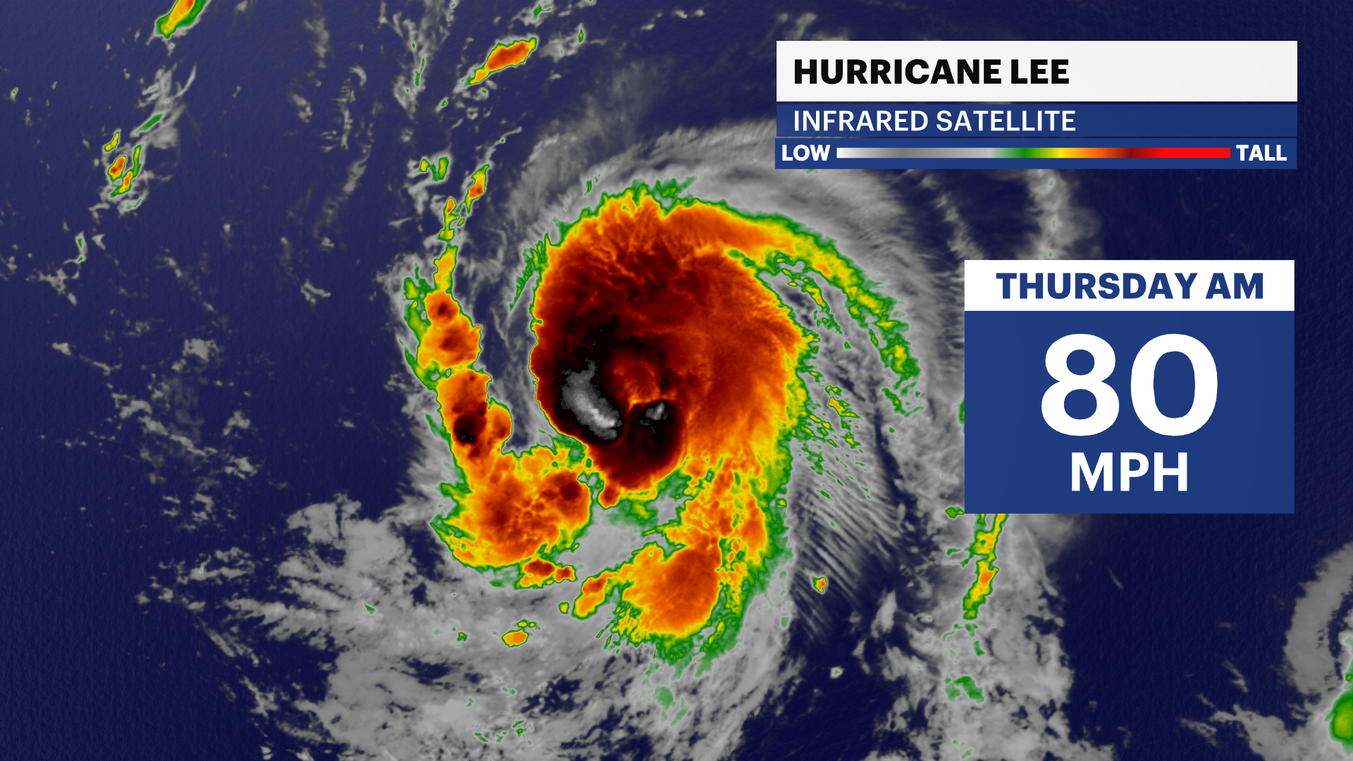
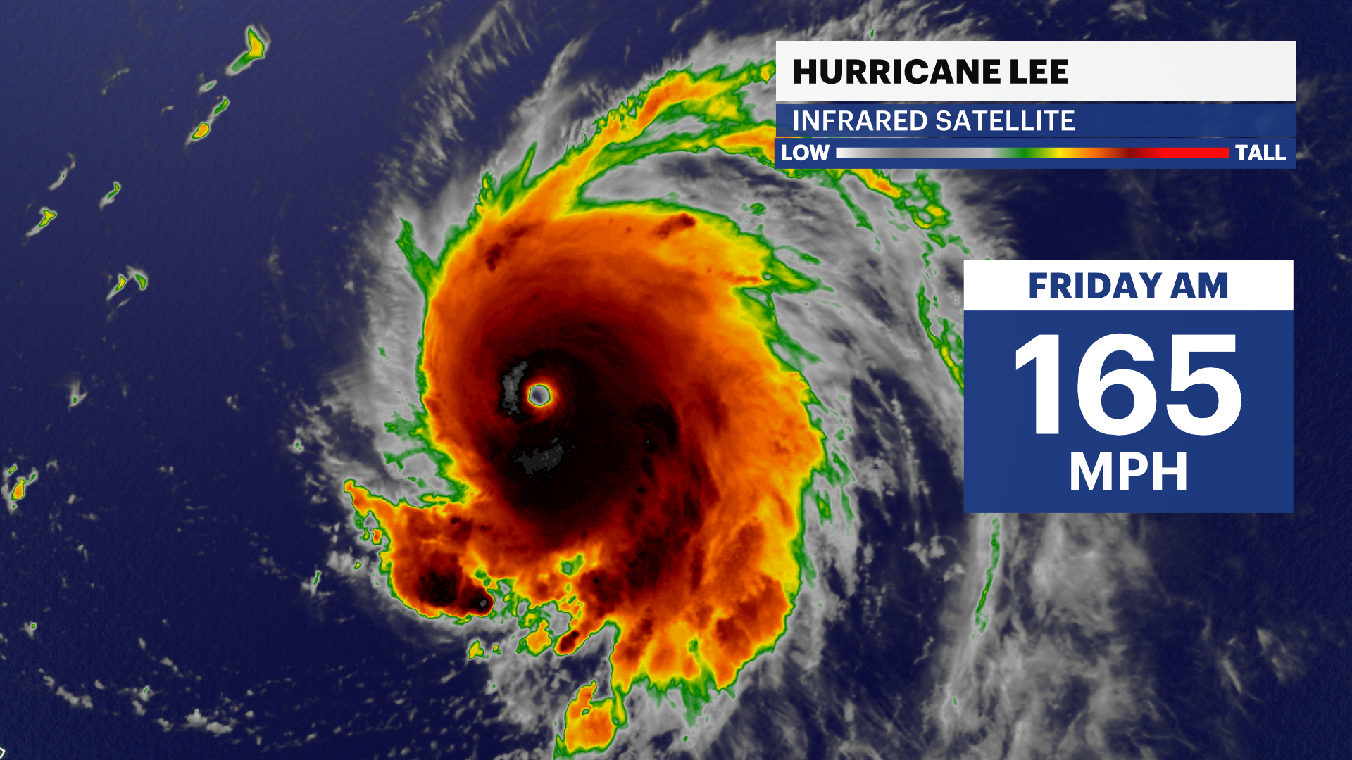
In just 24 hours, Hurricane Lee rapidly intensified from a Category 1 to a Category 5 hurricane.
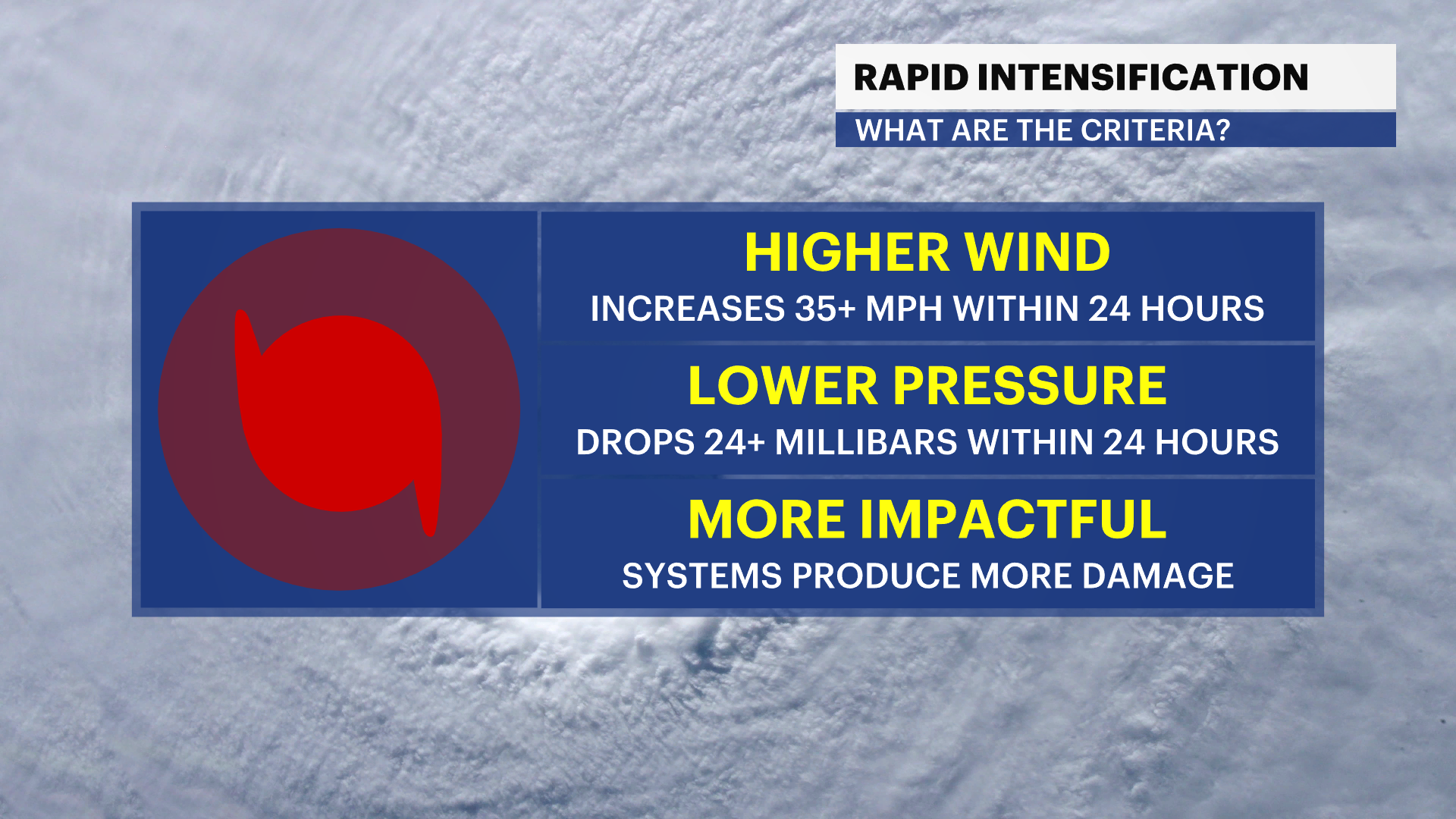
What is rapid intensification? There are two ways to measure this, either using wind speed or pressure. If a storm strengthens 35 miles per hour in 24 hours, or deepens 24 millibars in 24 hours, the storm has rapidly intensified. Lee strengthened at nearly three times those qualifications.
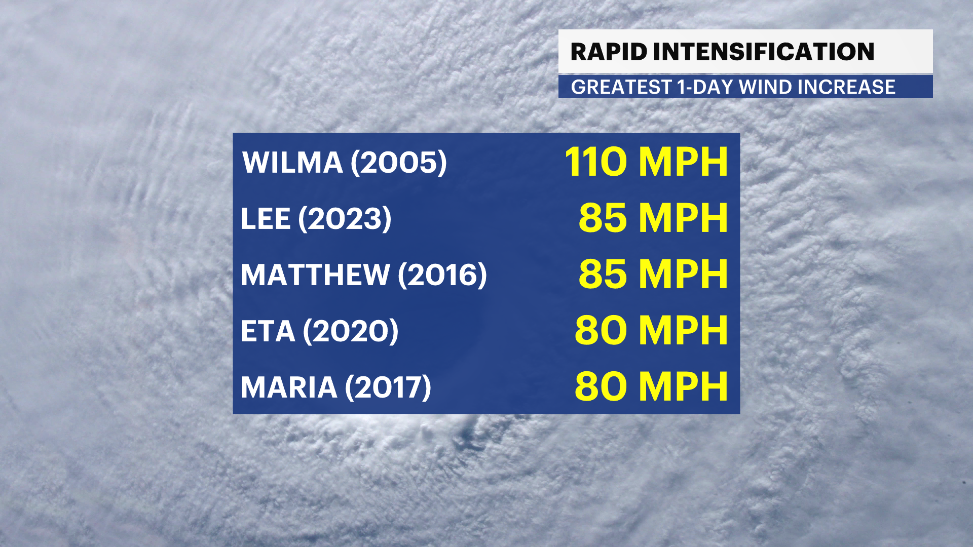
In doing so, it became the second-greatest wind increase on record in the Atlantic. The only other storm to have strengthened at a more rapid pace is Hurricane Wilma from 2005. Very warm water temperatures, minimal wind shear, and being located far from land made the perfect formula for a tropical cyclone to take full advantage of its environment, intensifying the way Lee did.
Since reaching its peak intensity early Friday morning, wind shear returned and has since weakened Lee to a Category 4 Friday afternoon. Regardless of exact intensity, Lee remains a powerful hurricane with room for more strengthening this weekend. The path of the storm is expected to stay safely north of the Caribbean islands, including the Lesser Antilles, Puerto Rico, the Dominican Republic, and Haiti. Only minimal fringe impacts are possible later this weekend, and tropical storm conditions are NOT expected.
Beyond this weekend, questions still remain on Lee's future, and the News 12 Storm Watch Team will continue to keep you updated on how Lee might impact weather conditions across the tri-state area next week.
