EXTREME HEAT WARNING: Triple-digit heat wave peaks before holiday weekend storms hit
Near-record heat peaks again Friday with heat index values near 110 degrees. Isolated afternoon and evening thunderstorms are possible each day, with a better chance for more widespread storms heading into the holiday weekend.
More Stories


Extreme heat warning: In effect until 9 p.m. Saturday for the Hudson Valley. Dangerous heat with afternoon heat index values between 100 and 110 degrees. Little overnight relief is expected.

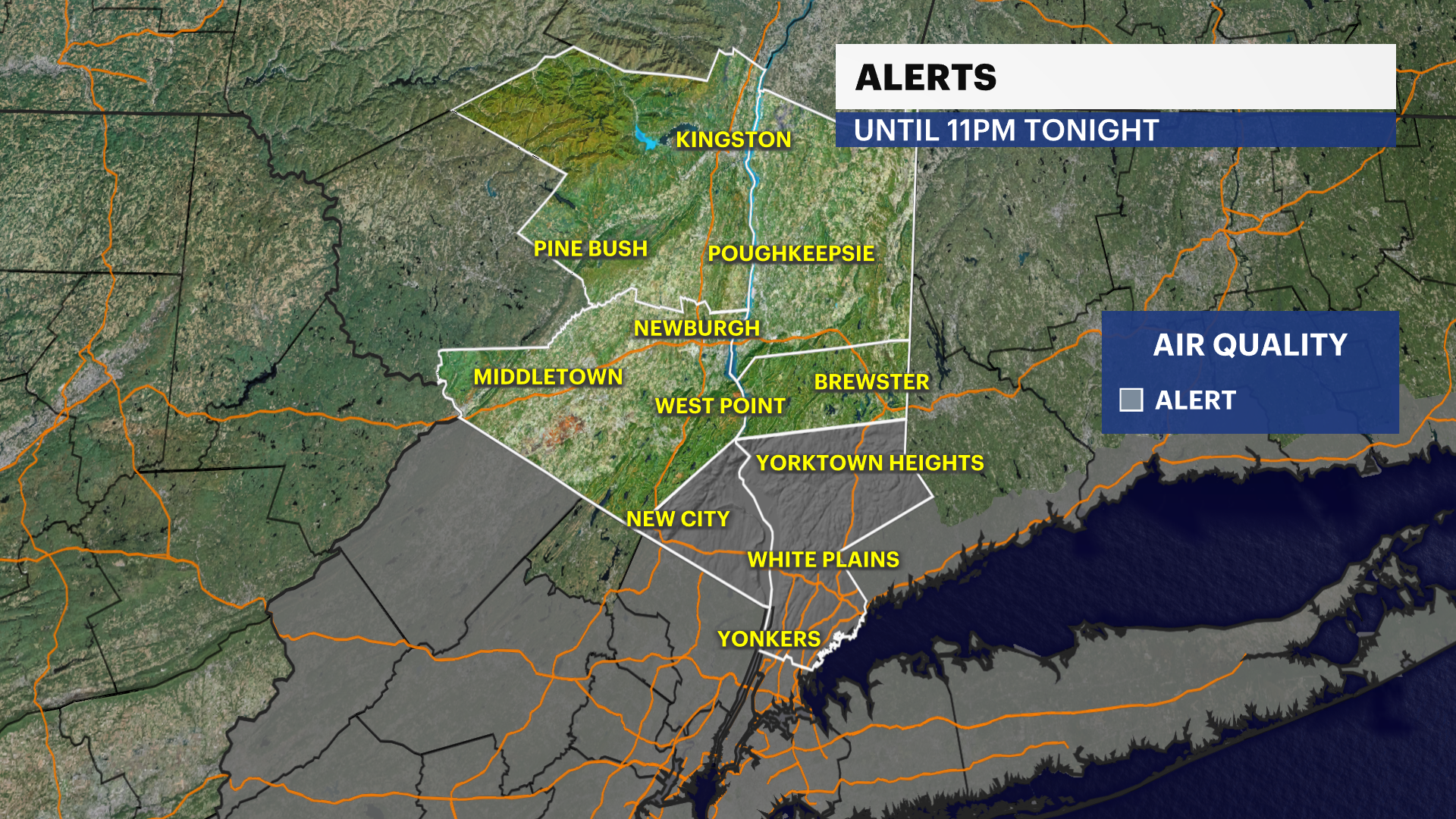
Air quality alert: For Rockland and Westchester counties until 11 p.m. due to high levels of ground-level ozone.
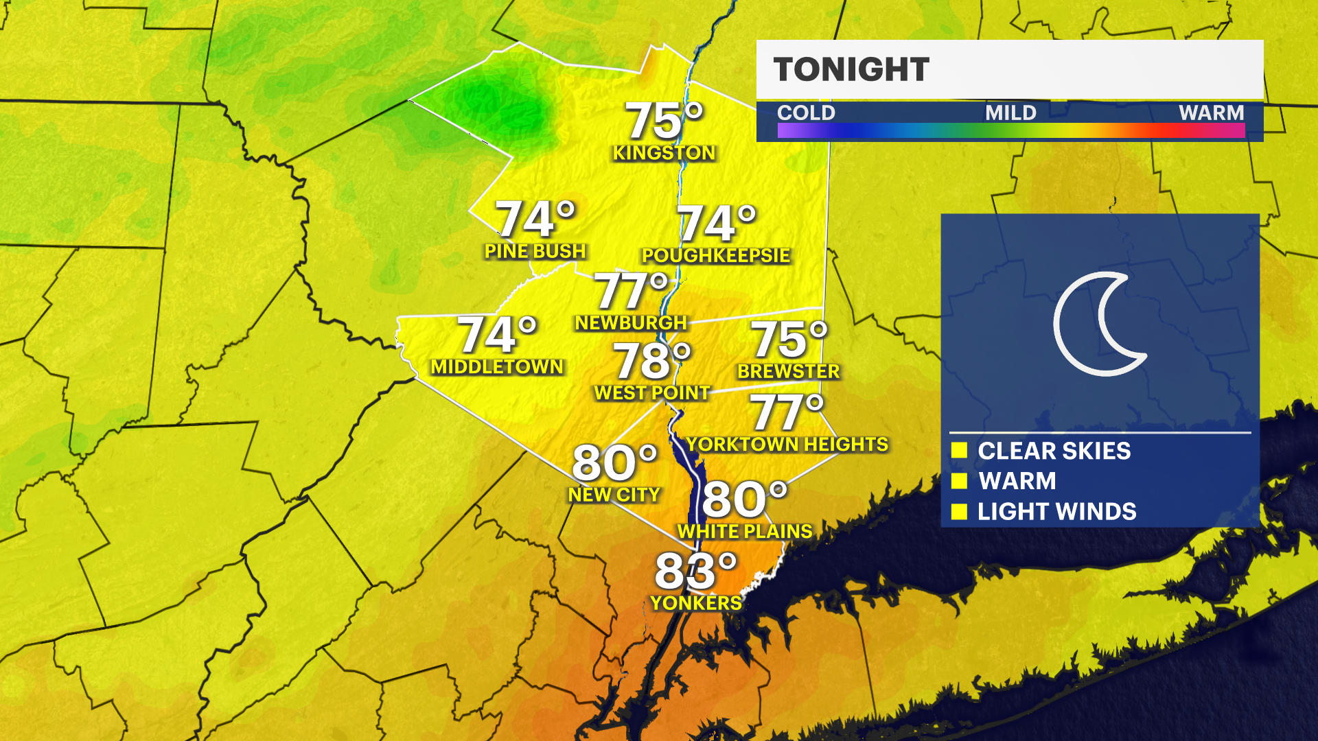
TONIGHT: We saw a record high this afternoon of 98 degrees at the Westchester County Airport, beating the previous record high of 97 degrees back in 1966 by just one degree. Feels-like temperatures today were at or around 105 degrees! Very warm and muggy conditions continue overnight with temperatures only falling into the mid and upper 70s. The combination of heat and humidity will make it feel uncomfortable even after sunset. Skies will be partly cloudy with little relief from the oppressive air mass.
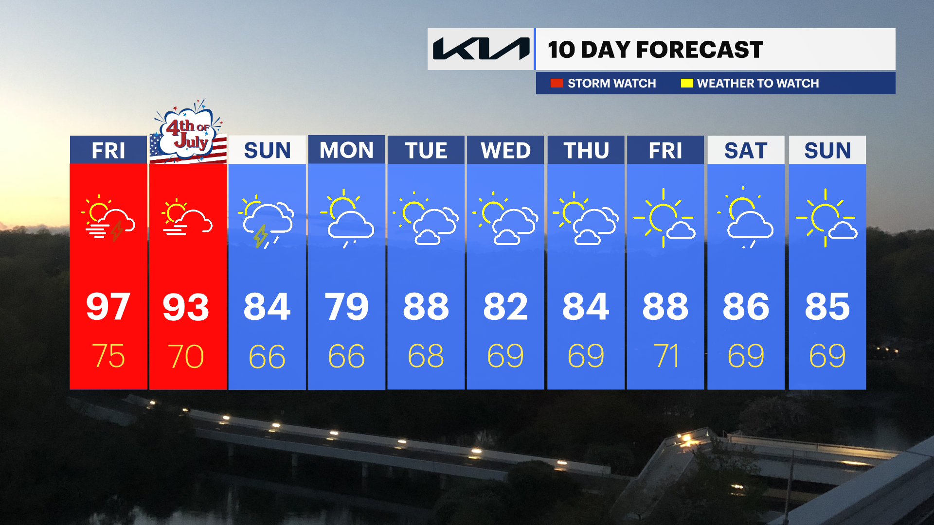
FRIDAY: Dangerous heat remains in place as extreme heat warnings continue through Saturday evening. Highs climb well into the 90s with heat index values pushing into the triple digits. By late afternoon and evening, isolated to scattered thunderstorms will develop. Some storms could become strong to severe, producing torrential downpours, frequent lightning, small hail, and damaging wind gusts. The Storm Prediction Center has placed the region under a Slight Risk (Level 2 of 5) for severe weather.
SATURDAY (INDEPENDENCE DAY): The heat and humidity stick around for another day with highs in the 90s and heat index values exceeding 100 degrees in spots. Scattered showers and thunderstorms are possible, with some storms capable of producing heavy rain, gusty winds, and small hail. The Storm Prediction Center continues a Slight Risk (Level 2 of 5) for severe thunderstorms. The good news is that the greatest storm threat currently looks to arrive during the early to mid-afternoon hours, which should help limit impacts to most evening Fourth of July celebrations and fireworks displays.
SUNDAY: Still hot with temperatures at or around 90. We will still have to keep our eyes on the sky for a chance of thunderstorms for parts of your afternoon.