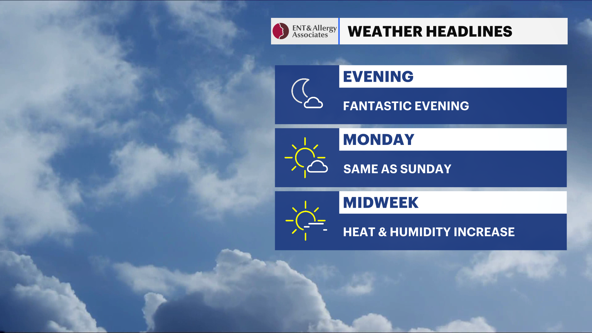
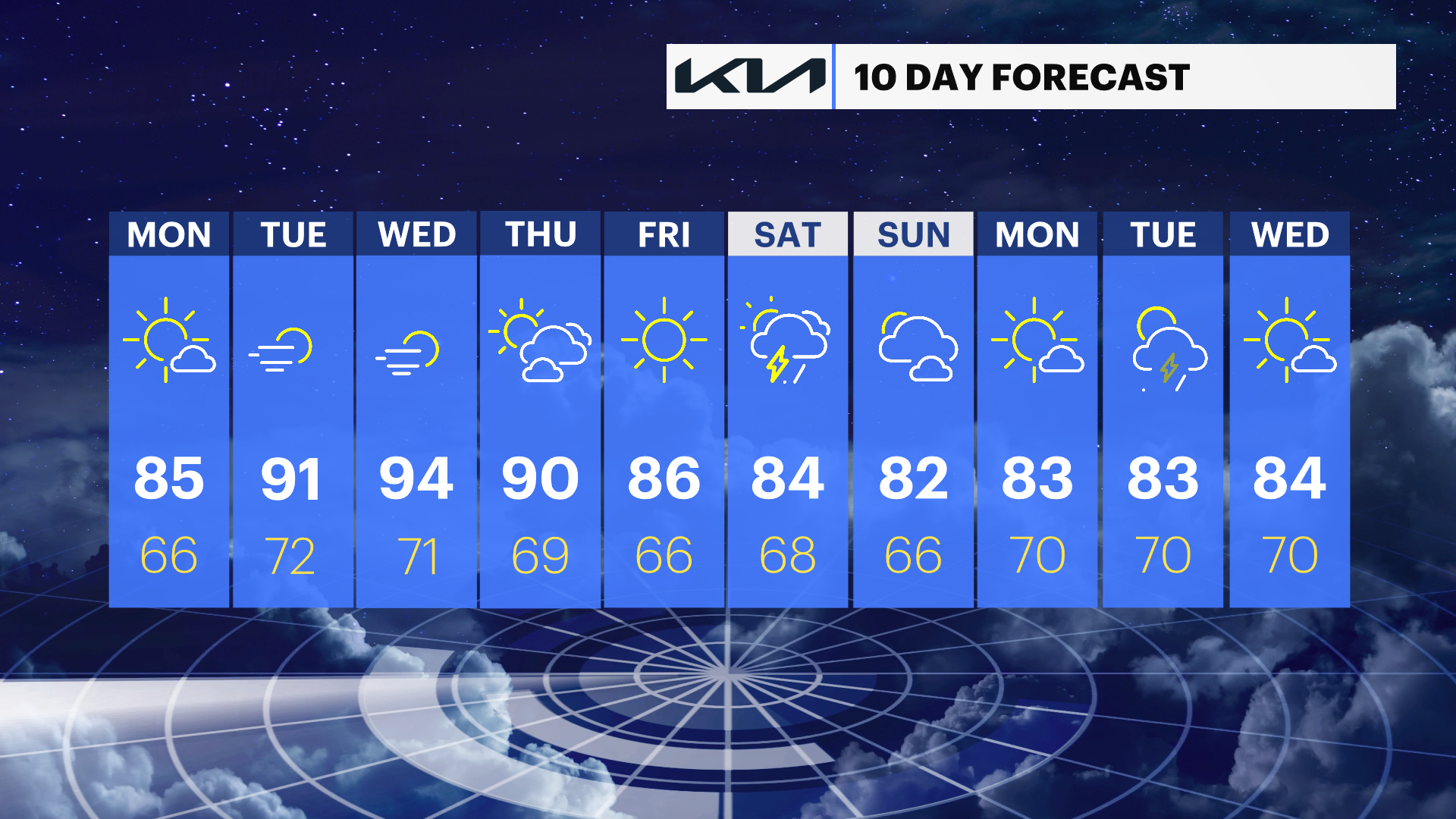
Dry and comfortable in the Hudson Valley through Monday, then hot and humid conditions return for the middle of the week
A pleasant start to the week gives way to increasing heat Tuesday and Wednesday before temperatures ease slightly late in the week.
More Stories


What to expect
Dry weather continues through Monday with comfortable humidity.
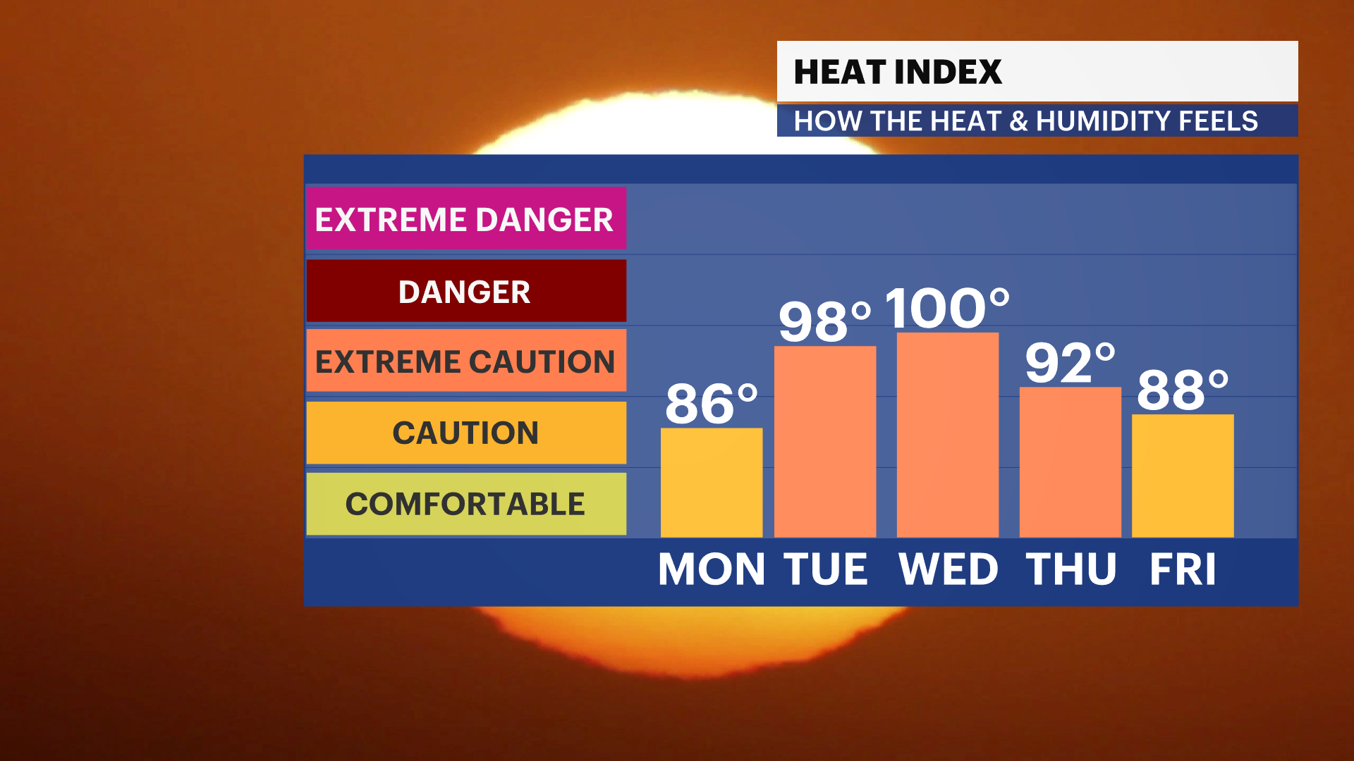
Heat and humidity build Tuesday and peak Wednesday, with heat index values reaching the upper 90s in some locations.
A weak upper-level disturbance late in the week brings a slight cooling trend, but conditions remain seasonably warm.
A slight chance for a shower returns by Saturday.
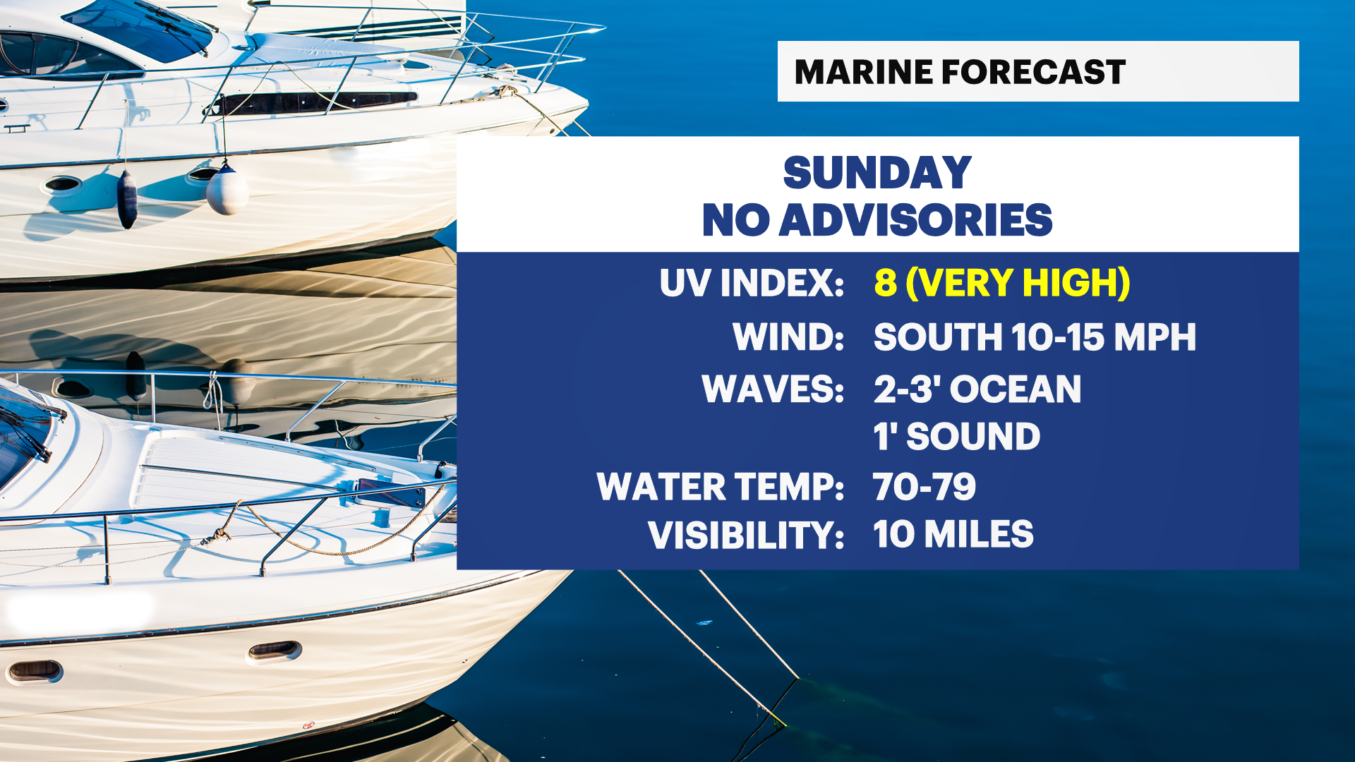
Weather alerts
None.
FORECAST
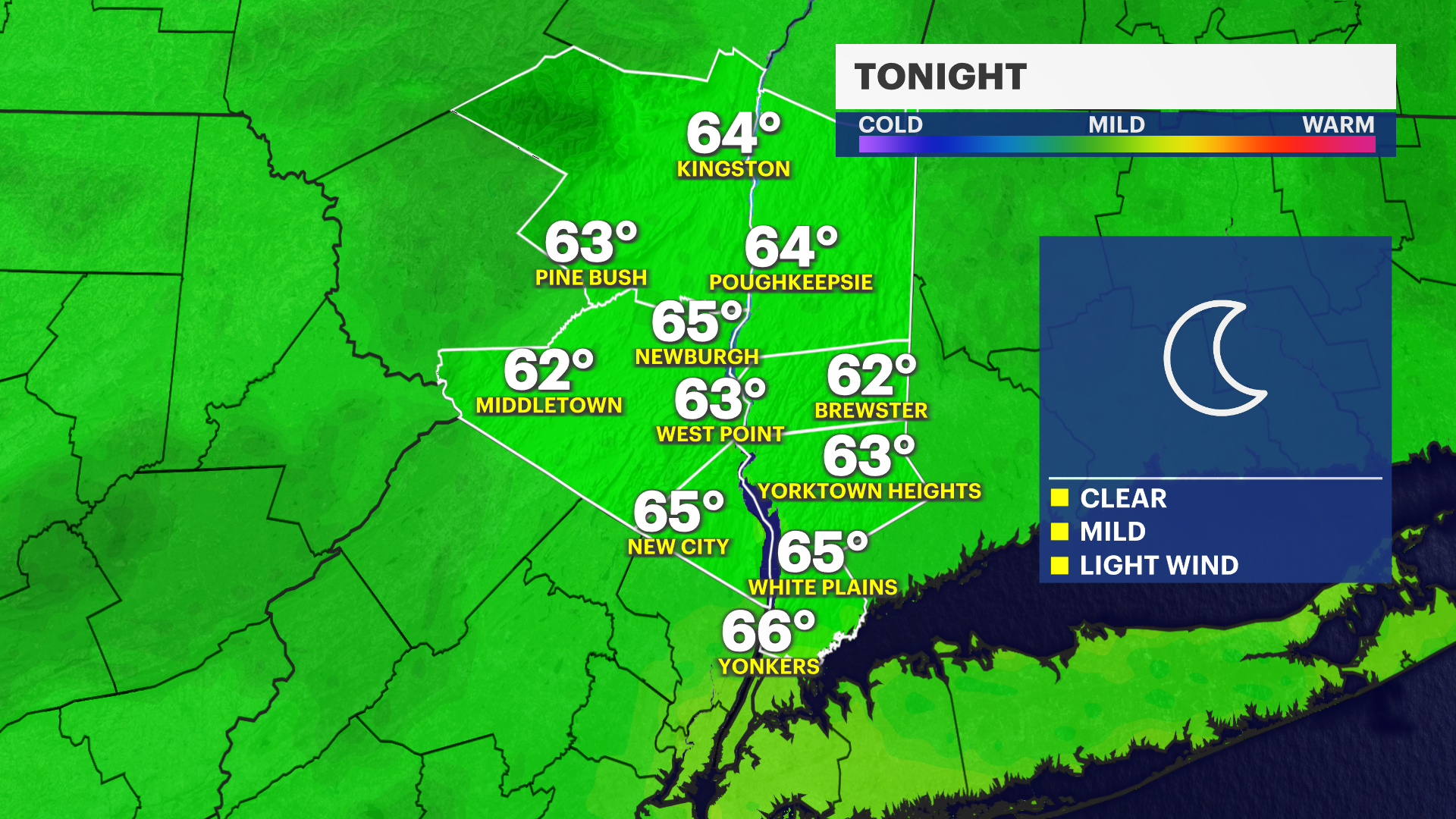
Overnight: Mostly clear and comfortable, with lows in the low 60s. Light winds.
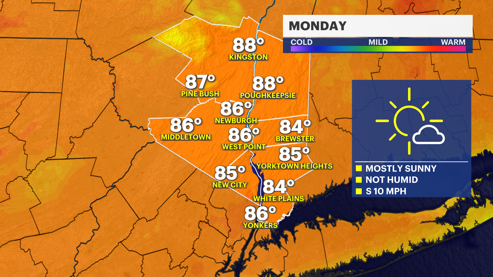
Monday: Sunny, with comfortable humidity. Temperatures in the low to mid-80s.
Monday night: Mostly clear and mild, with temperatures in the mid-60s.
Tuesday: Sunny, hotter and becoming more humid. Temperatures around 90, with heat index values in the low to mid-90s.
Tuesday night: Mostly clear and warm, with temperatures in the low 70s.
Wednesday: Sunny, hot and humid. Temperatures in the low to mid-90s, with heat index values in the mid- to upper 90s.
Wednesday night: Partly cloudy and warm, with temperatures in the upper 60s to around 70.
Thursday: Mostly sunny and slightly less hot. Temperatures in the upper 80s.
Thursday night: Partly cloudy, with temperatures in the upper 60s.
Friday: Mostly sunny and seasonably warm. Temperatures in the mid- to upper 80s.
Friday night: Partly cloudy, with temperatures in the mid-60s.
Saturday: Mostly sunny, with a slight chance of an afternoon shower. Temperatures in the mid- to upper 80s.