STORM WATCH: Multiple rounds of heavy rain, thunderstorms today will impact the Hudson Valley with a widespread flood risk
Flooding is the primary concern through Tuesday, with localized rainfall totals capable of exceeding 4," while improving conditions are expected beginning Wednesday.
More Stories


What to expect
Multiple rounds of showers and thunderstorms through Monday night.
Heavy rainfall may lead to flash flooding, especially in poor drainage, urban, and flood-prone locations.
Localized rainfall totals of 2" to 4" with isolated higher amounts possible.
Rain gradually tapers Tuesday, with improving conditions by Wednesday.
Warmer and more humid weather returns late week with another chance of showers and thunderstorms Friday into Saturday.
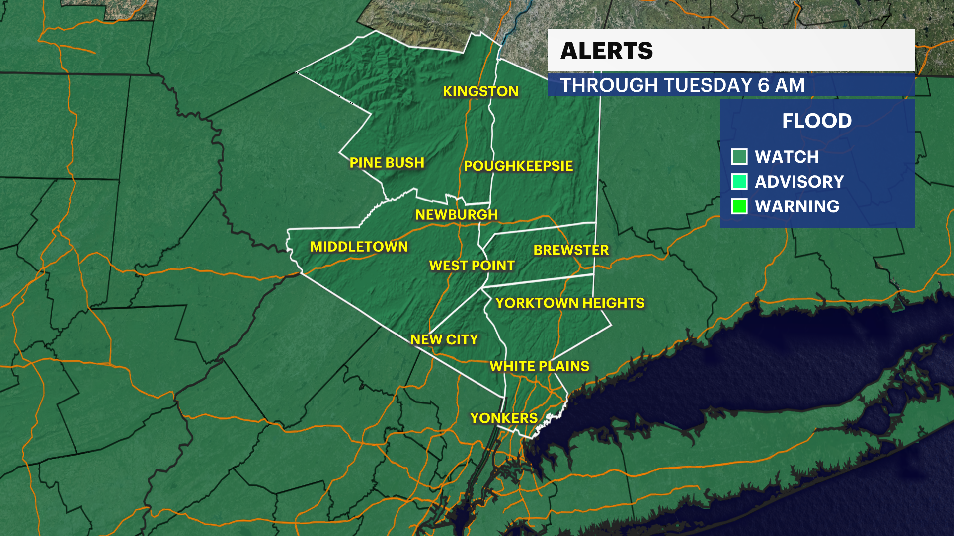
Weather alerts
A flood watch is in effect Tuesday morning for the Hudson Valley. Repeated rounds of heavy rain may lead to flash flooding, especially in low-lying areas, along small streams and in locations with poor drainage.
Forecast
Today: Periods of heavy rain and thunderstorms continue throughout the day. Heavy rainfall may lead to instances of flash flooding. Temperatures will be in the upper 60s.
Tonight: Rain and thunderstorms continue, with another round of heavy rainfall possible before gradually diminishing late. Temperatures will be in the low 60s.
Tuesday: Showers gradually become more scattered through the day, with a few thunderstorms still possible during the afternoon. Temperatures will range from the low to mid-70s.
Wednesday: Partly sunny, with lower humidity and improving conditions. Temperatures will be in the upper 70s.
Thursday: Mostly sunny, warmer and more humid. Temperatures will be in the mid- to upper 80s.
Friday: Mostly sunny, warm and humid, with scattered afternoon and evening showers and thunderstorms possible. Temperatures will be in the upper 80s.
Saturday: Partly sunny and warm, with another chance for scattered showers and thunderstorms. Temperatures will be in the mid 80s.