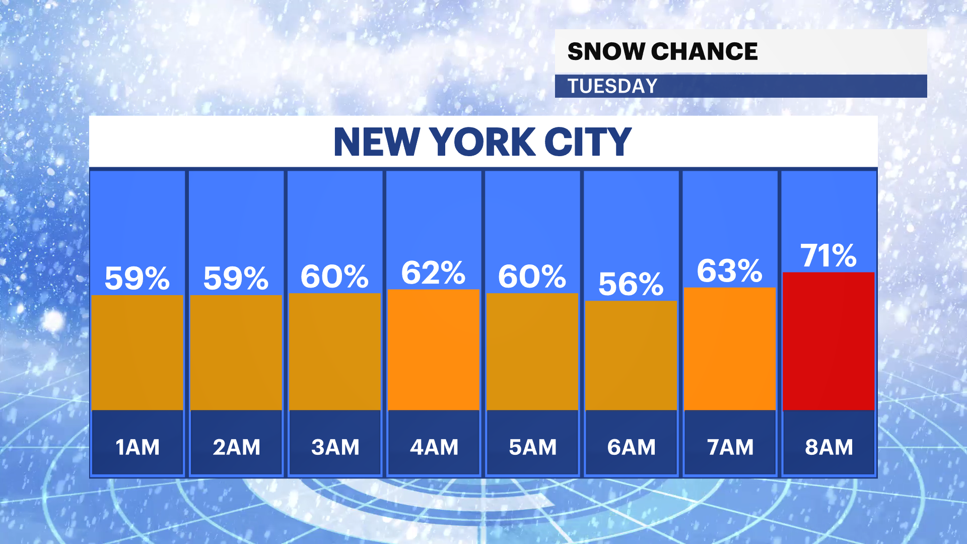
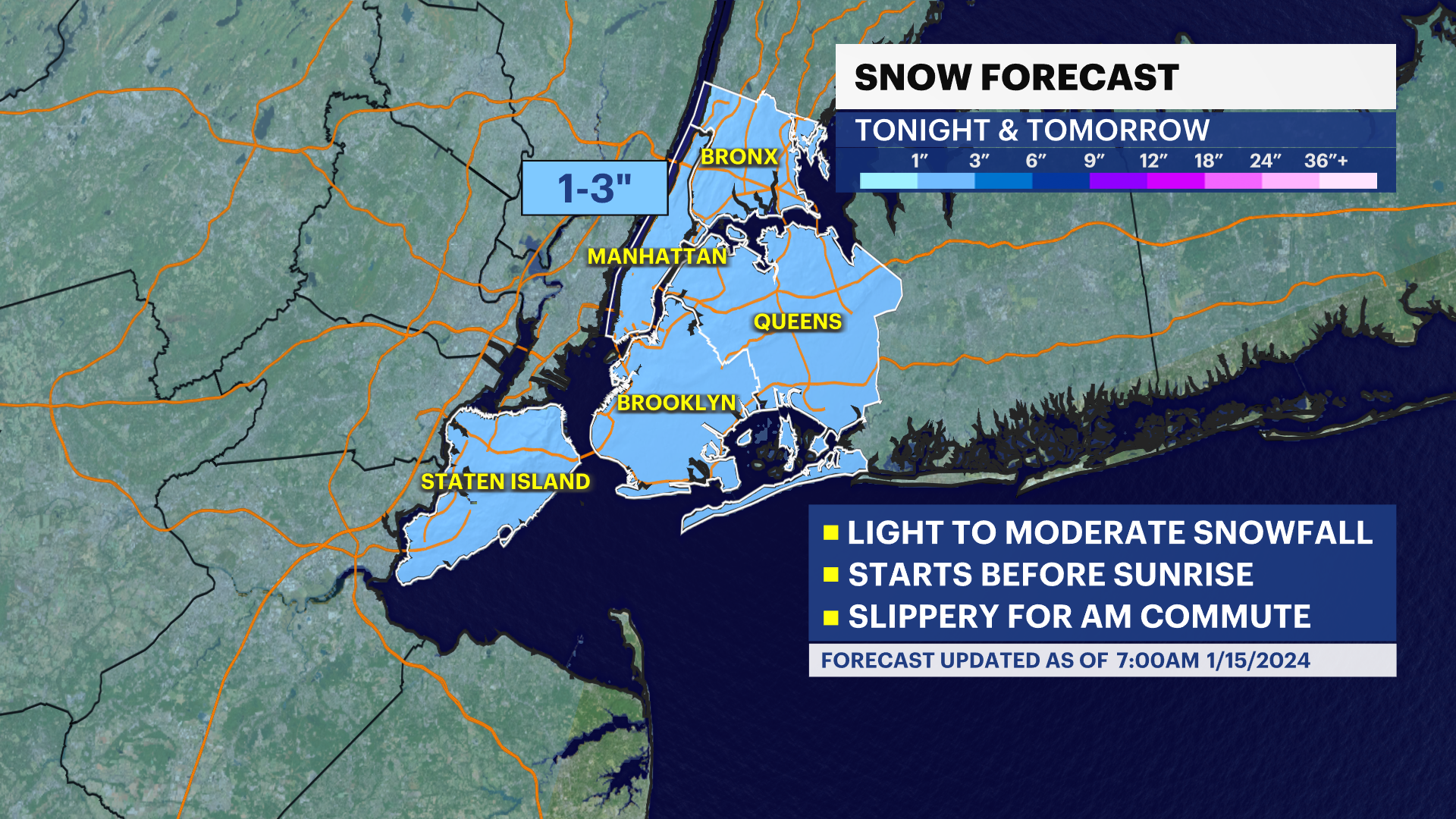
STORM WATCH: 1-3 inches of snow to coat NYC into Tuesday, arctic air chills all week
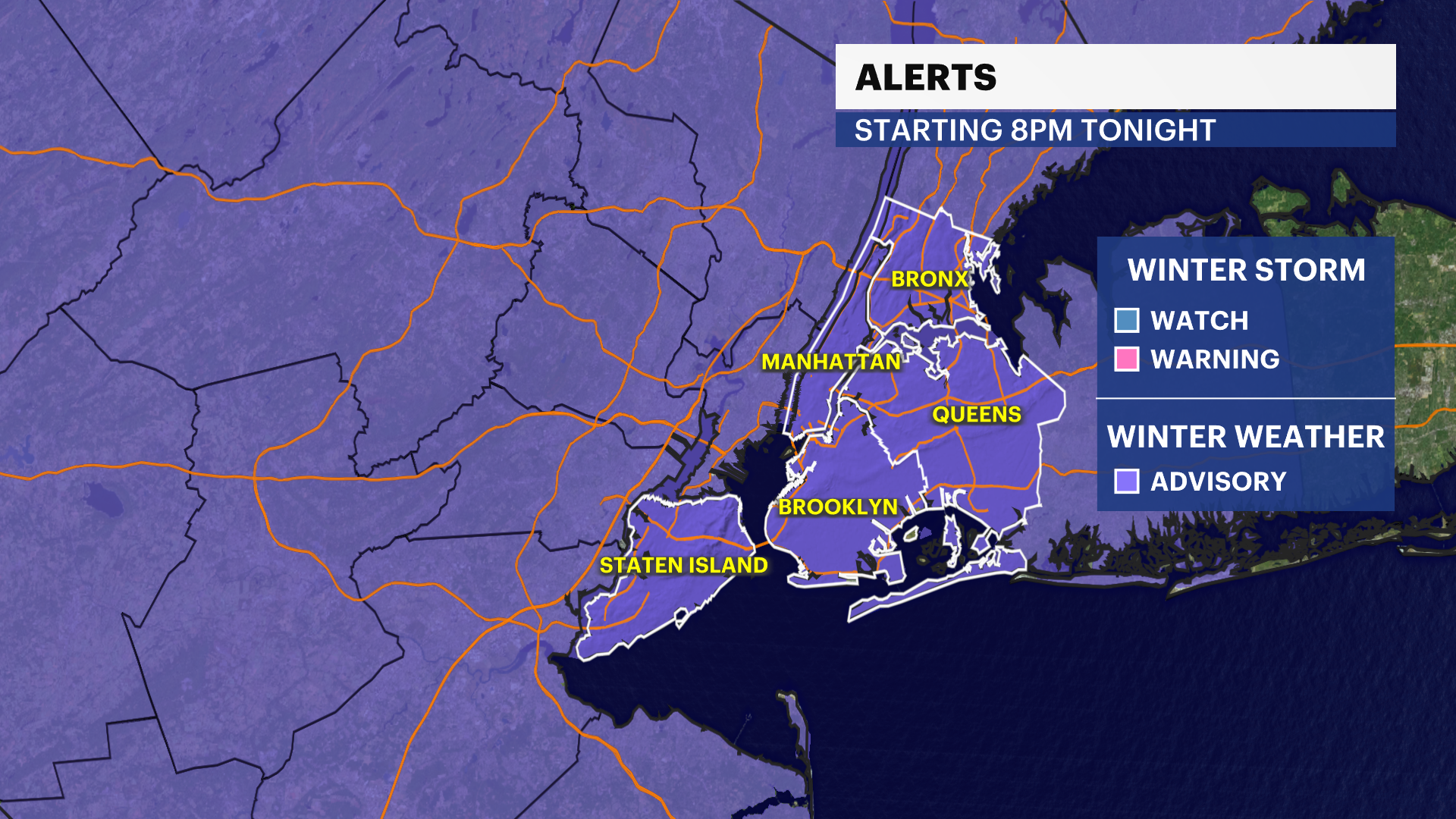
A winter weather advisory is in effect through 1 p.m. Tuesday.
Top Stories


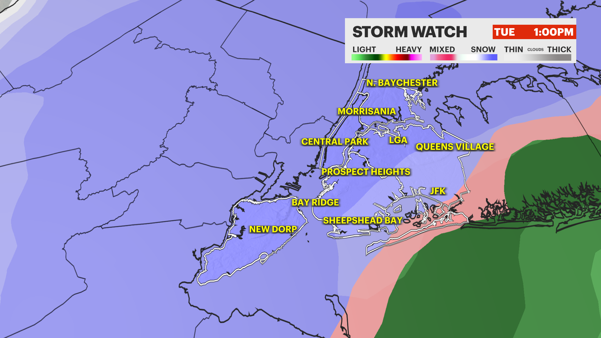
Storm Watch Team Meteorologist Hope Osemwenkhae says a winter weather advisory is in effect through 1 p.m. Tuesday. A total of 1 to 3 inches of snow with a light glaze of ice expected.
FORECAST
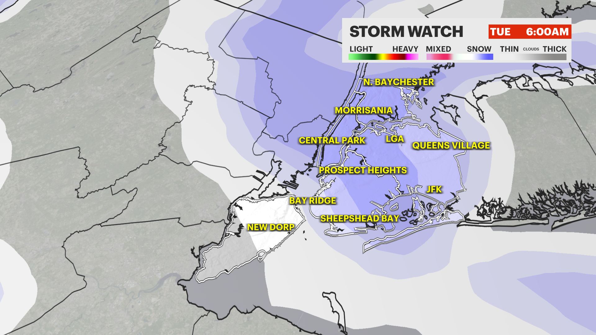
TONIGHT - STORM WATCH: Snow showers arrive on either side of midnight, with light to moderate snow by the morning commute. Lows down to 26. A coating to an inch of snow likely by the morning commute.
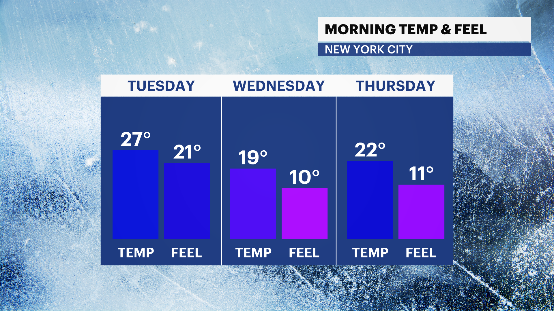
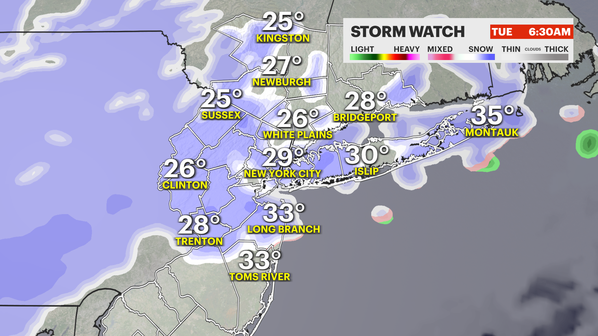
TUESDAY - STORM WATCH: Snow likely through the early afternoon. Some sleet/freezing rain possible for Brooklyn towards the tail-end, but most remain as all-snow. An additional inch or so of snow expected. Highs near 33. Lows drop to just 19.
WEDNESDAY - BITTER BLAST: 19 will feel like just 10 degrees in the morning. Lots of sunshine but very cold and breezy. Highs near 28, feeling like the teens. Lows down to 22.
THURSDAY: Bitterly cold start with highs up to 33. Clouds increase with light snow possible by daybreak. Lows down to 27.
FRIDAY - STORM WATCH: Snow likely. The strength and track of the storm is still TBD, and dependent on how Tuesday's storm plays out. We will know much more by Wednesday morning. Right now, a light to moderate snowfall is most likely, but a signal for significant snow is still there. Highs near 32. Lows drop to 23.
NEXT WEEKEND - BITTER BLAST: Saturday will be the coldest day of the season so far with highs only up to 26 after a morning start at just 15 degrees, feeling like near-zero!