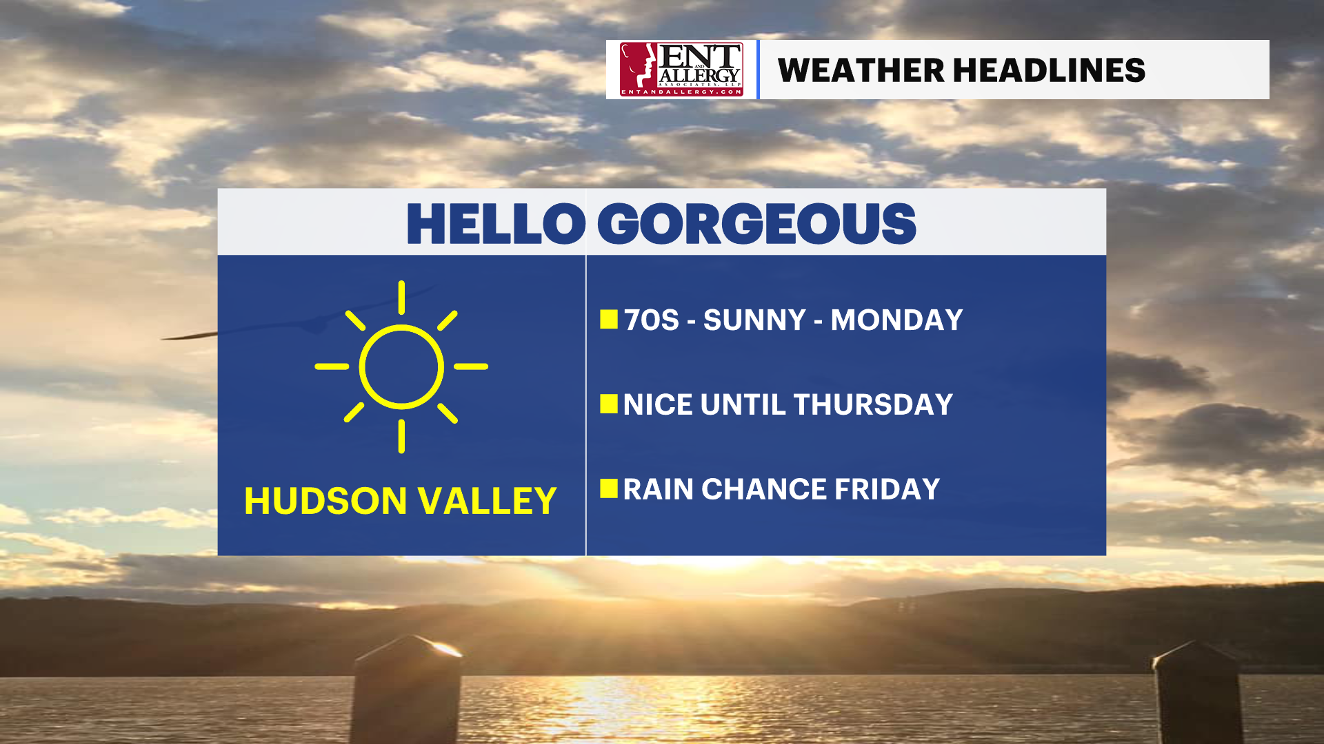
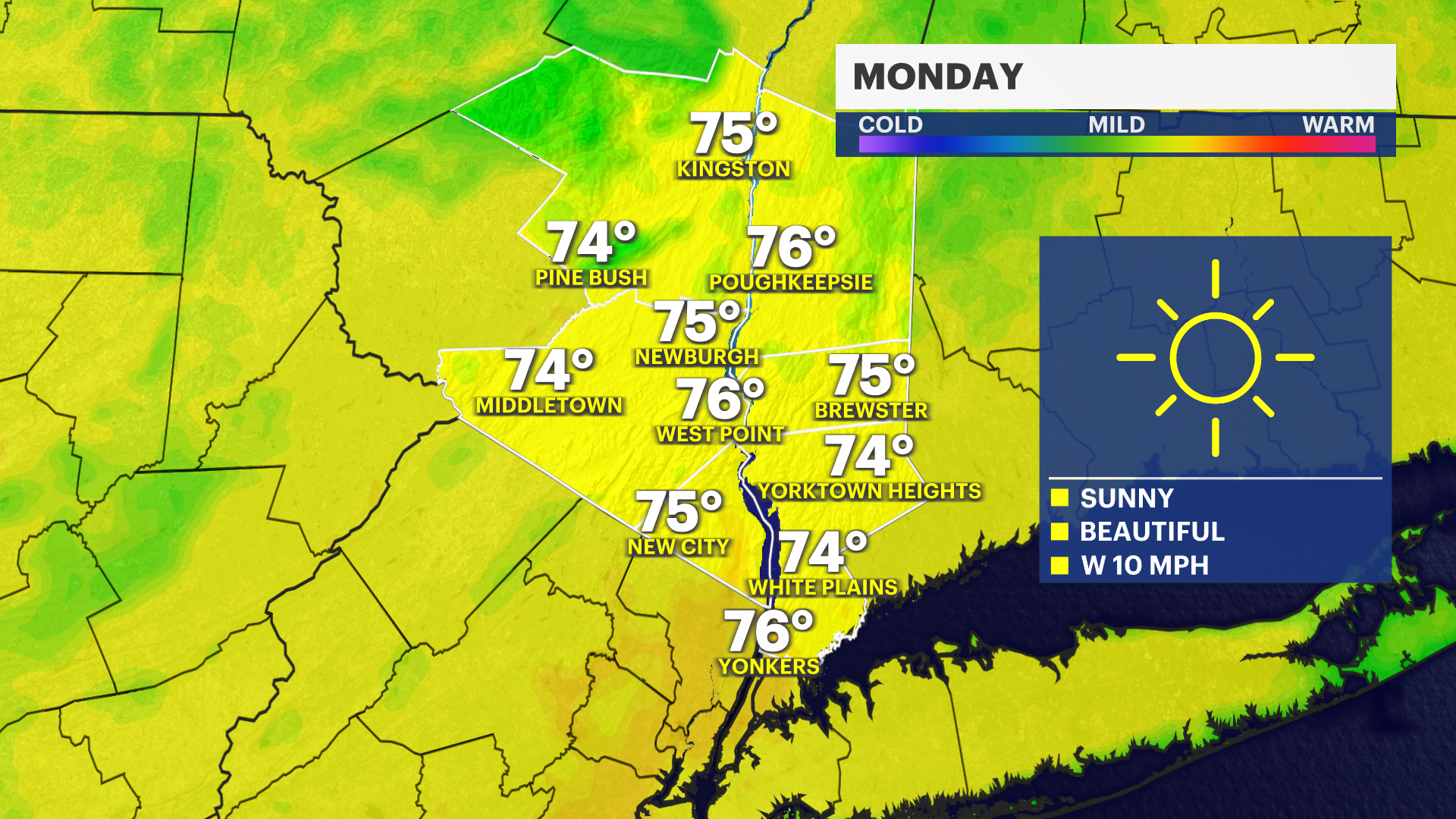
Sunny and warm Monday in the Hudson Valley
Sunshine and mild temperatures are on tap for next week. Prepare to bring out the sunglasses.
More Stories


OVERNIGHT: Winds will remain breezy with gusts around 30 mph. These winds will weaken by sunrise with clear skies Monday morning. Monday looks gorgeous, a complimentary breeze, plenty of sunshine and temperatures warming into the low and middle 70s. A great day to be outdoors, so take advantage of it.
MIDWEEK: Tuesday through Wednesday the weather will be similar, a few more clouds mixing in, but still staying very pleasant. Temperatures will vary for some but many will still warm into the lower and middle 70s. It will be a bit breezier on Tuesday but the day will overall still be great.
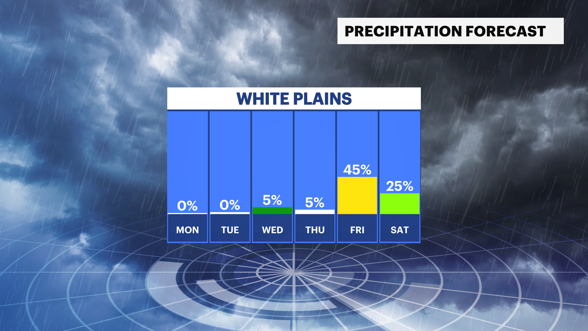
END OF THE WEEK: Thursday's temperatures will be closer to normal for this time of year. Friday will be warmer, but there is a storm system that we are monitoring that may bring rain to the region Friday night. There are still details to iron out since it is so far out. So be sure to stay up to date with our hyperlocal forecasts.