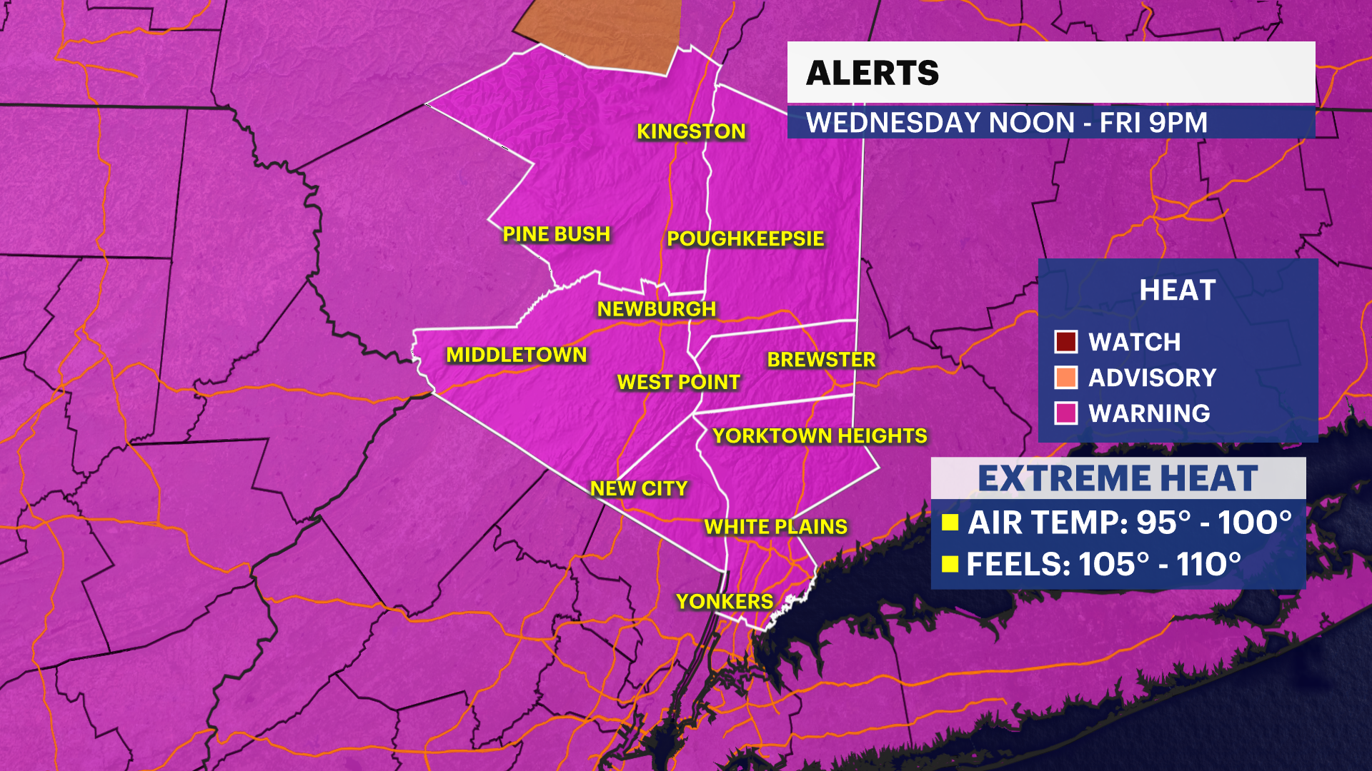
HEAT ALERT: Extreme heat and humidity builds through the end of the week, followed by increasing thunderstorm chances
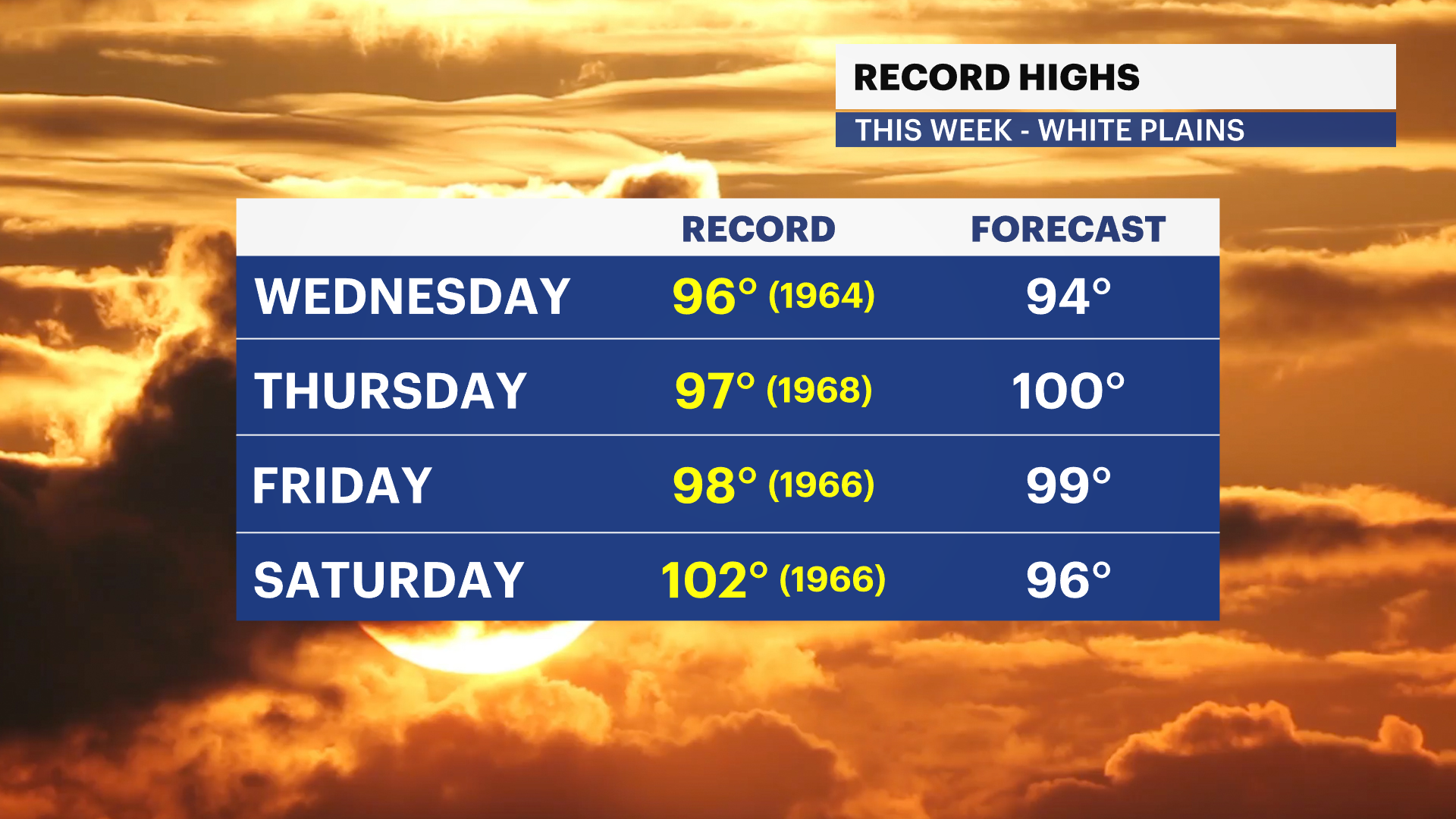
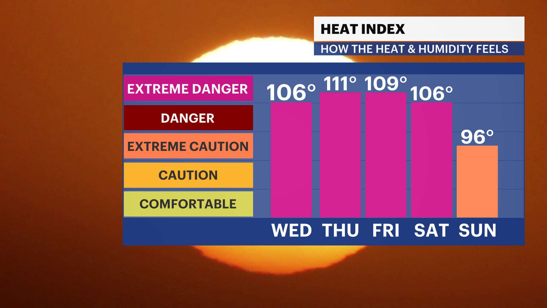
Near-record heat peaks Thursday and Friday with heat index values over 100 degrees. Isolated afternoon and evening thunderstorms are possible each day, with a better chance for more widespread storms heading into the holiday weekend.
More Stories


Extreme Heat Warning in effect from noon on Wednesday until 9 p.m. Friday for much of the Hudson Valley. Dangerous heat with afternoon heat index values between 100 and 110 degrees. Little overnight relief is expected.
Extreme Heat Watch in effect from 9 p.m. Friday to 9 p.m. Saturday
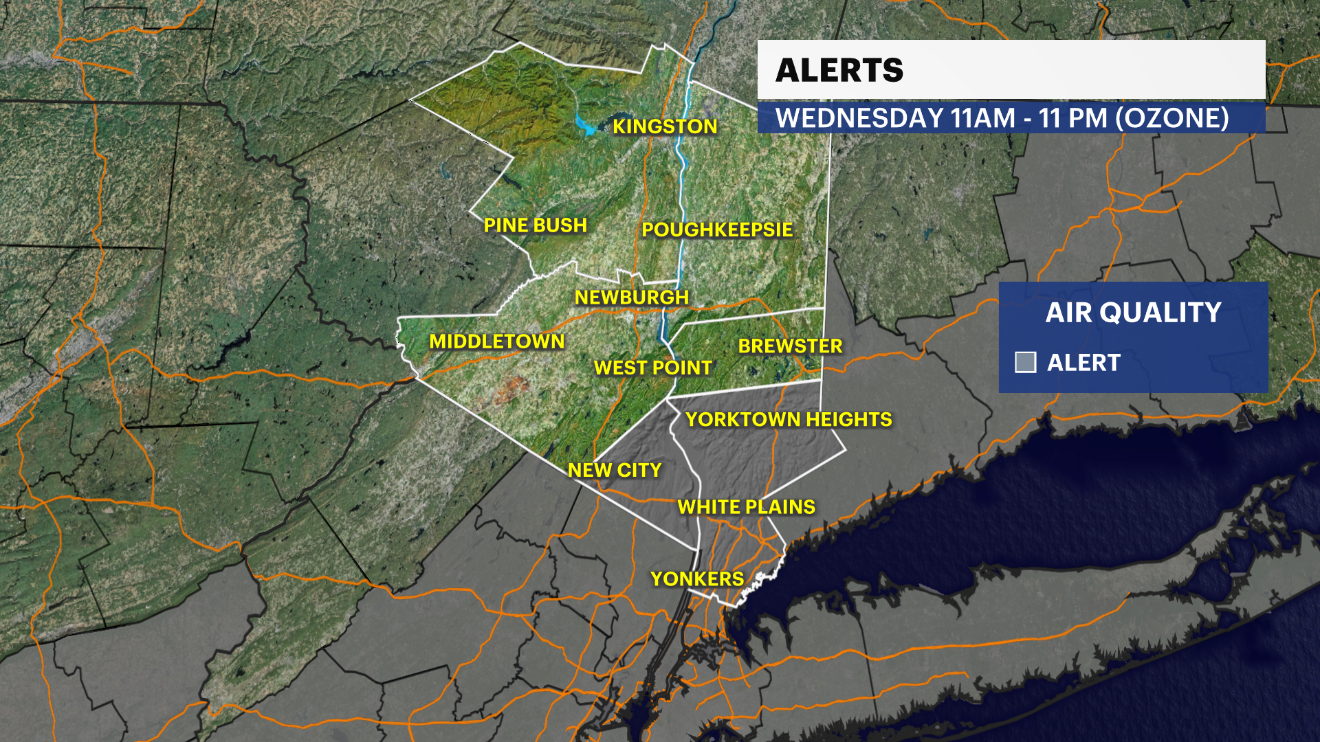
Air Quality Alert: For Rockland and Westchester counties from 11 a.m. to 11 p.m. Today due to high levels of ground-level ozone.
What to expect:
Dangerous heat develops Wednesday and intensifies Thursday and Friday, with little overnight relief.
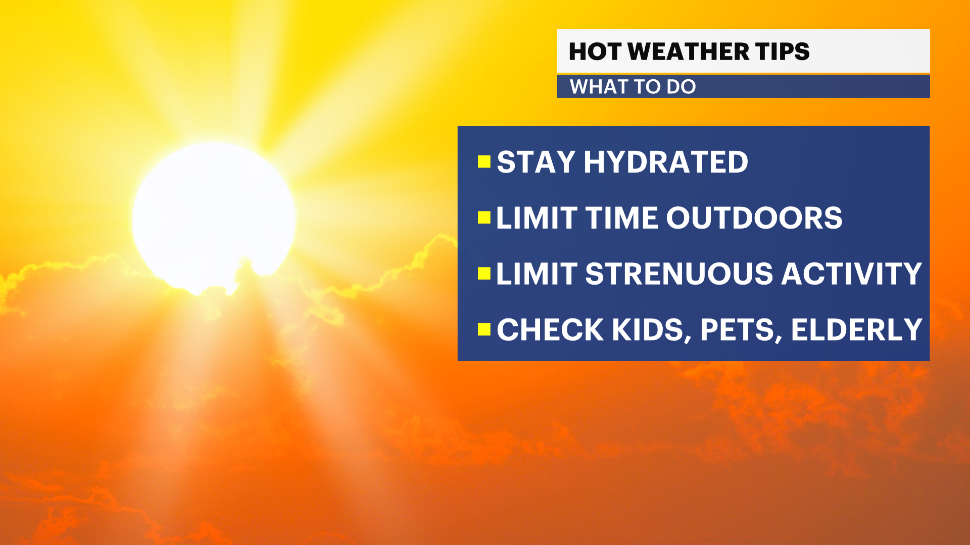
Heat index values could reach 100 to 115 degrees, creating dangerous conditions for anyone without adequate cooling or hydration.
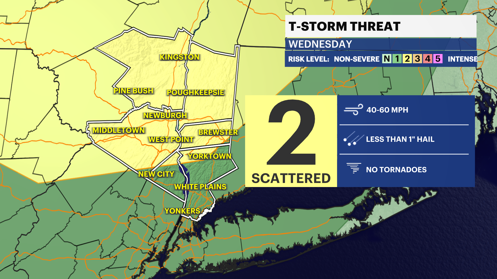
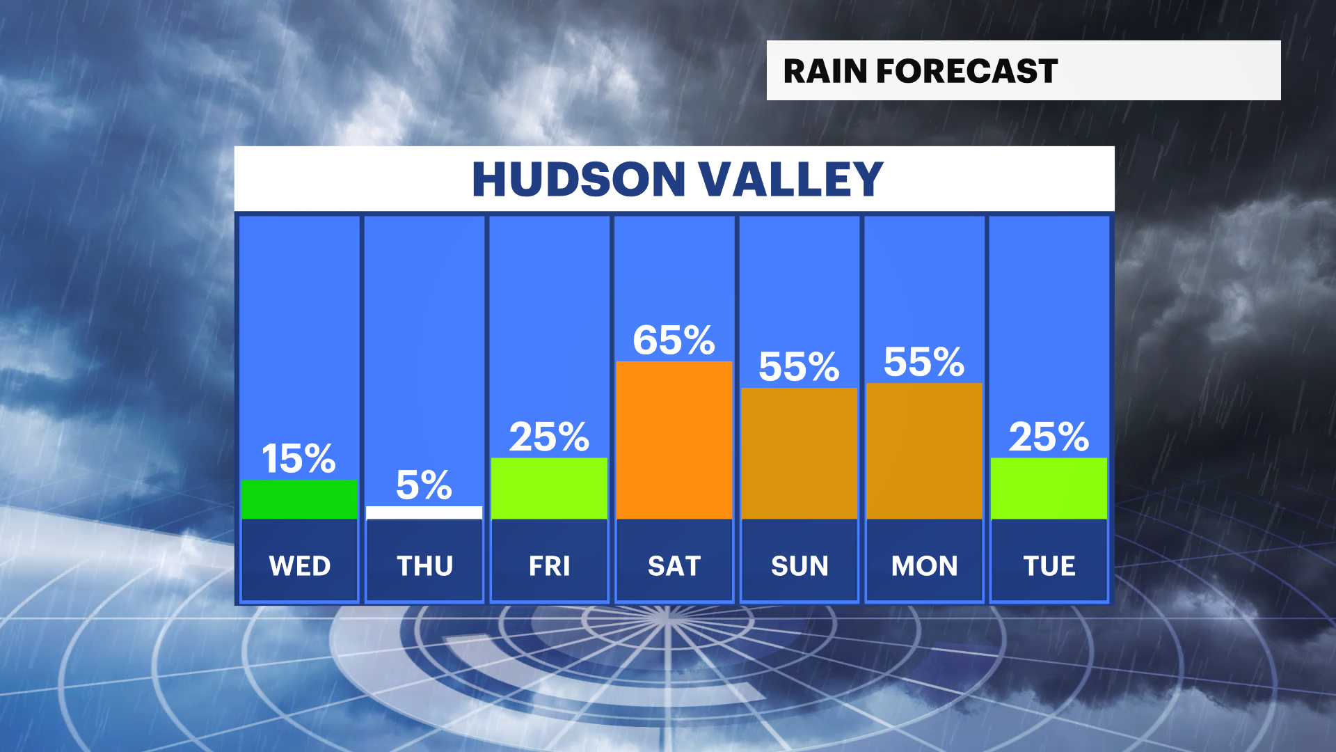
A few afternoon and evening thunderstorms are possible each day through Saturday, with isolated strong to severe storms possible.
Thunderstorm coverage increases for the Independence Day weekend before temperatures ease early next week.
Overnight: Partly cloudy with a slight chance of showers and thunderstorms during the evening, then dry overnight. Lows in the upper 60s to around 70.
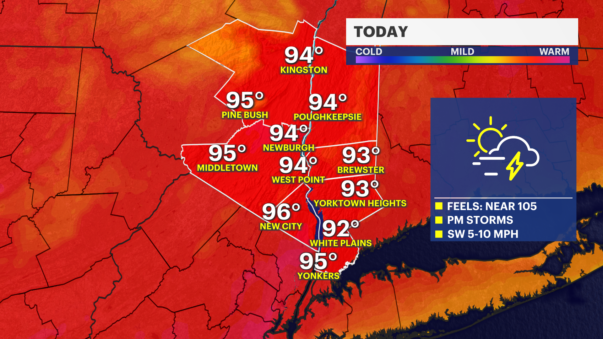
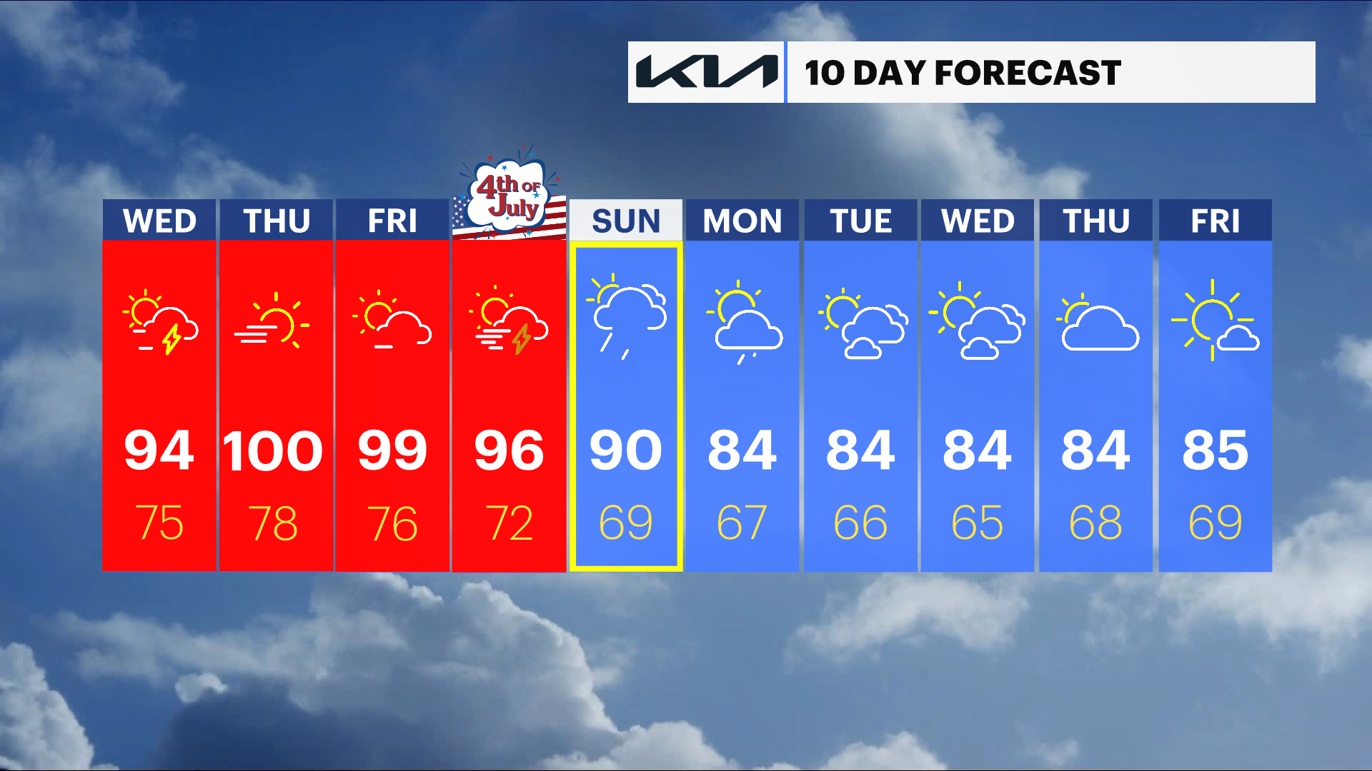
Today: Mostly sunny, hot and humid. A slight chance of an afternoon shower or thunderstorm. Highs in the low to mid-90s with heat index values around 100 to 105.
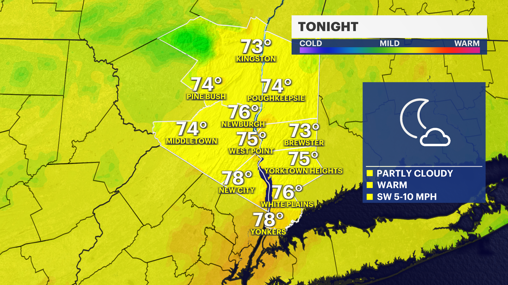
Tonight: Partly cloudy and warm with a slight chance of an evening shower or thunderstorm. Lows in the low to mid-70s.
Thursday: Sunny, dangerously hot and humid. Highs around 100 degrees with heat index values between 105 and 115.
Thursday Night: Clear and very warm. Lows in the mid- to upper 70s.
Friday: Mostly sunny and dangerously hot. Highs near 100 degrees with heat index values again above 100.
Independence Day: Partly to mostly sunny with scattered afternoon and evening showers and thunderstorms developing. Highs in the low to mid-90s.
Saturday: Partly sunny with scattered showers and thunderstorms possible. Highs in the upper 80s.
Sunday: Partly sunny with scattered afternoon showers and thunderstorms. Highs in the upper 80s.
Monday: Partly sunny with scattered showers possible. Highs in the lower 80s.
Tuesday: Mostly sunny with seasonably warm temperatures. Highs in the low to mid-80s.