DANGEROUS HEAT: Extreme temperatures continue into the holiday weekend
Heat, humidity, and storm chances continue to plague us.
More Stories


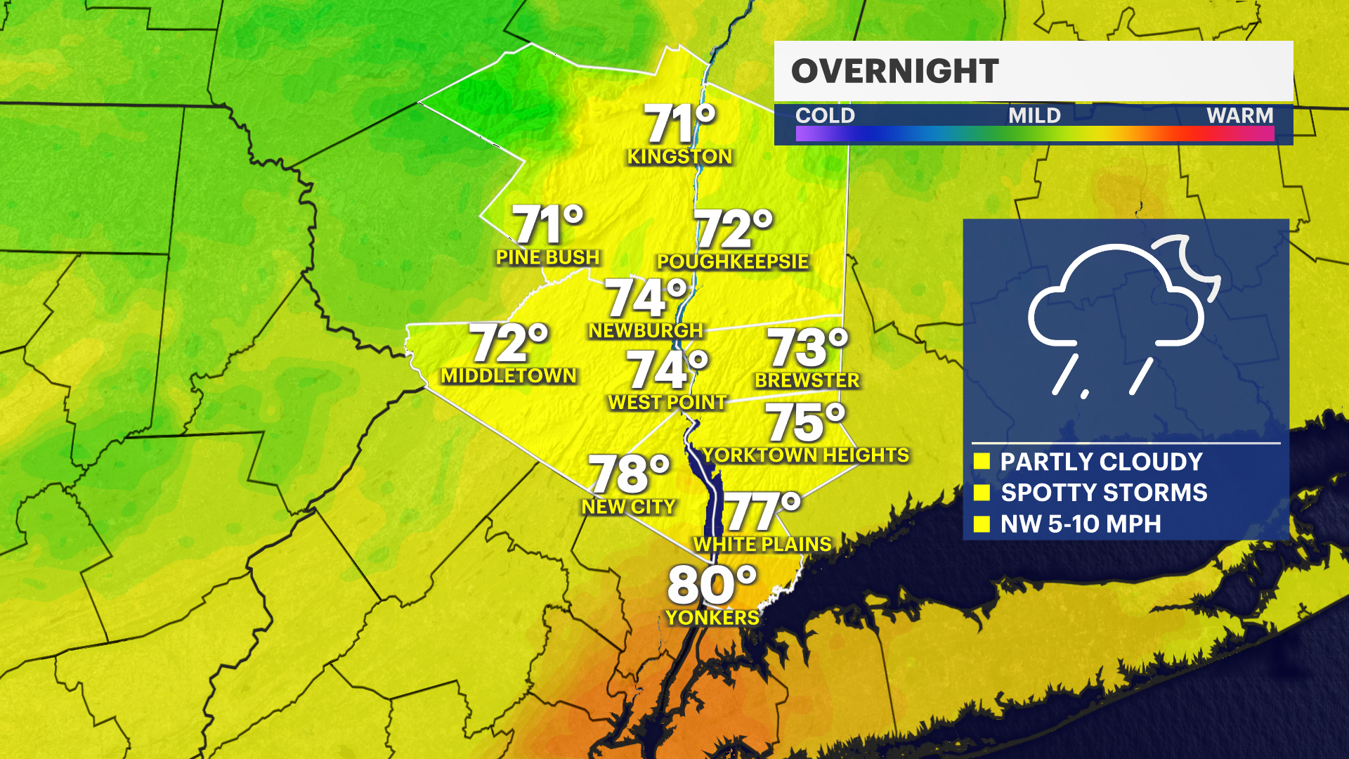
The high level of heat and humidity we have seen can easily breed thunderstorms. We could continue to see some showers and storms during early portions of the overnight.
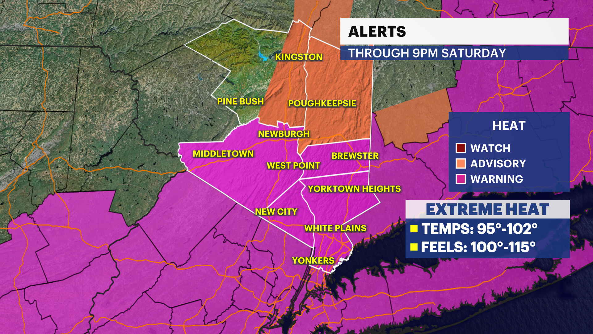
Extreme heat warning: In effect until 9 p.m. Saturday for the Hudson Valley. The warning has been adjusted to an advisory for portions of Ulster and Dutchess. Intense and dangerous heat with temperatures that feel between 100 and 110 degrees. There will be little relief as we don't cool down much overnight.
The good news? We are ALMOST through this major stretch of brutal temperatures. The bad news? The Fourth of July will feature another round of atrocious heat and humidity.
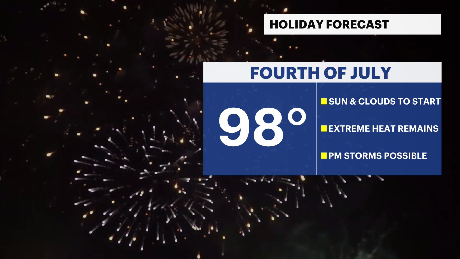
Temperatures will near 100 degrees with humidity making it feel even worse. Late day thunderstorms are possible throughout the area with any one of them easily becoming strong and producing heavy rain and gusty winds. These will be spotty in nature but depending on when and where they develop could impact firework displays.
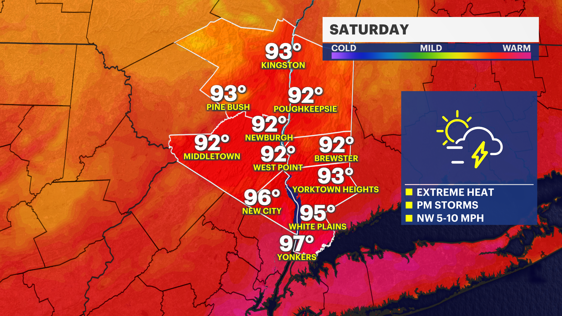
Until then, it will be a hot and humid day with a combination of sun and clouds. Remember that everything will be hot! Beach sand, picnic tables, asphalt, cars and seatbelts, and more. Make sure you are taking precautions to avoid burning or overheating.
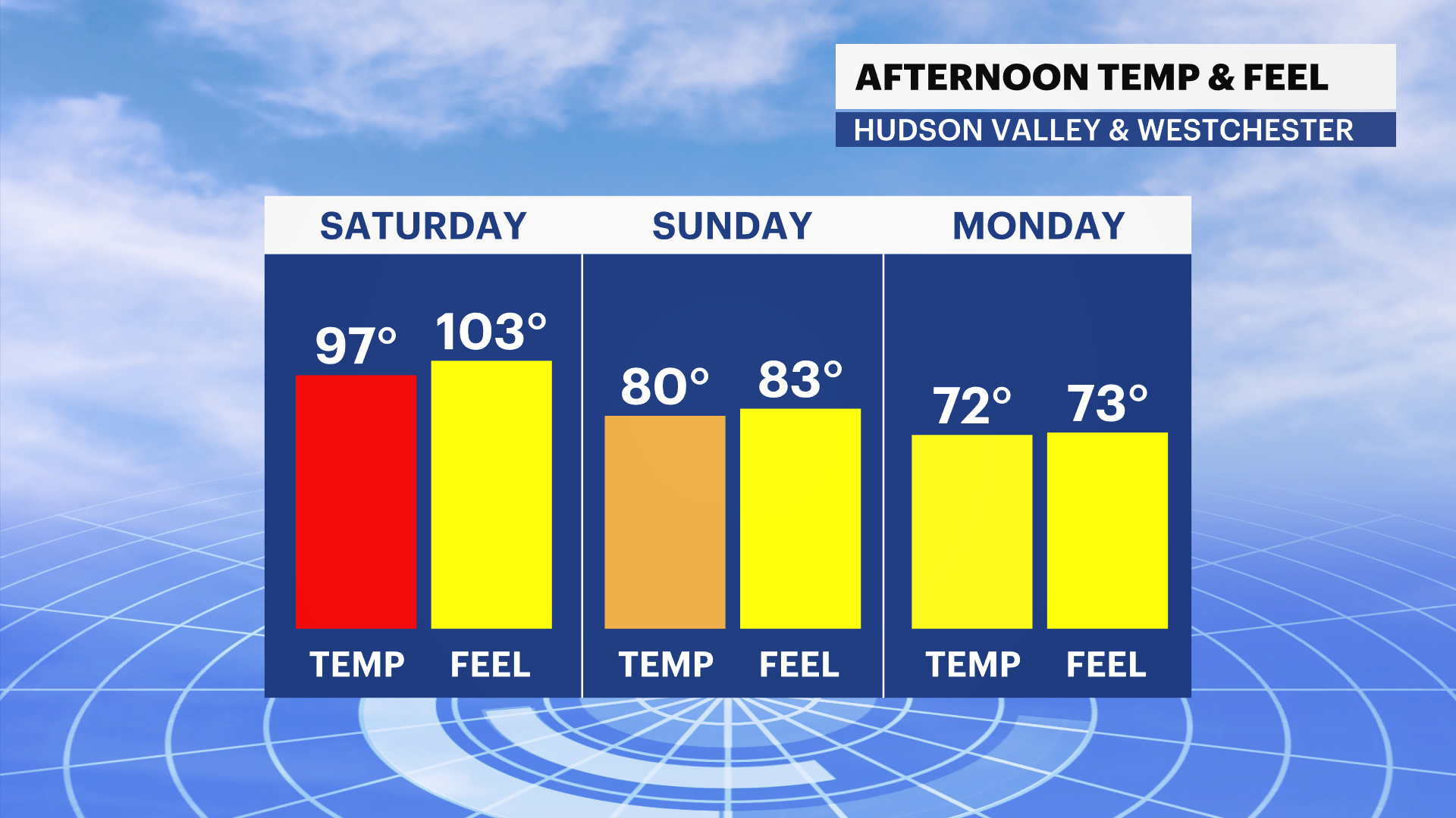
A cool down is on the way. Those Saturday afternoon and evening thunderstorms will help to break up some of this heat-- with temperatures feeling a whole lot better for the second half of the weekend and into next week.


