Hot, muggy & cloudy finish to the week on Long Island with a stray storm
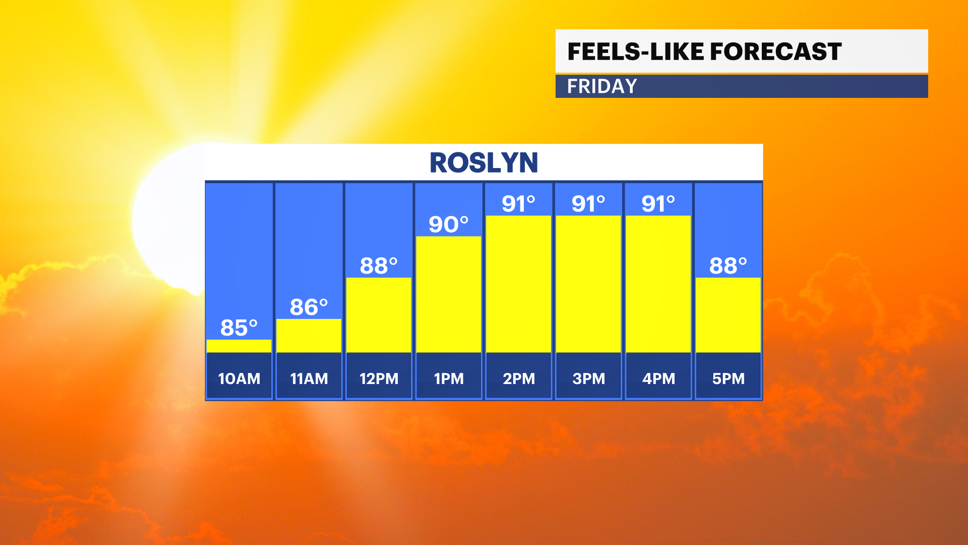
Temperatures will feel like 95 degrees this afternoon but the sun will be shy to peek out with a pop up storm possible later.
More Stories
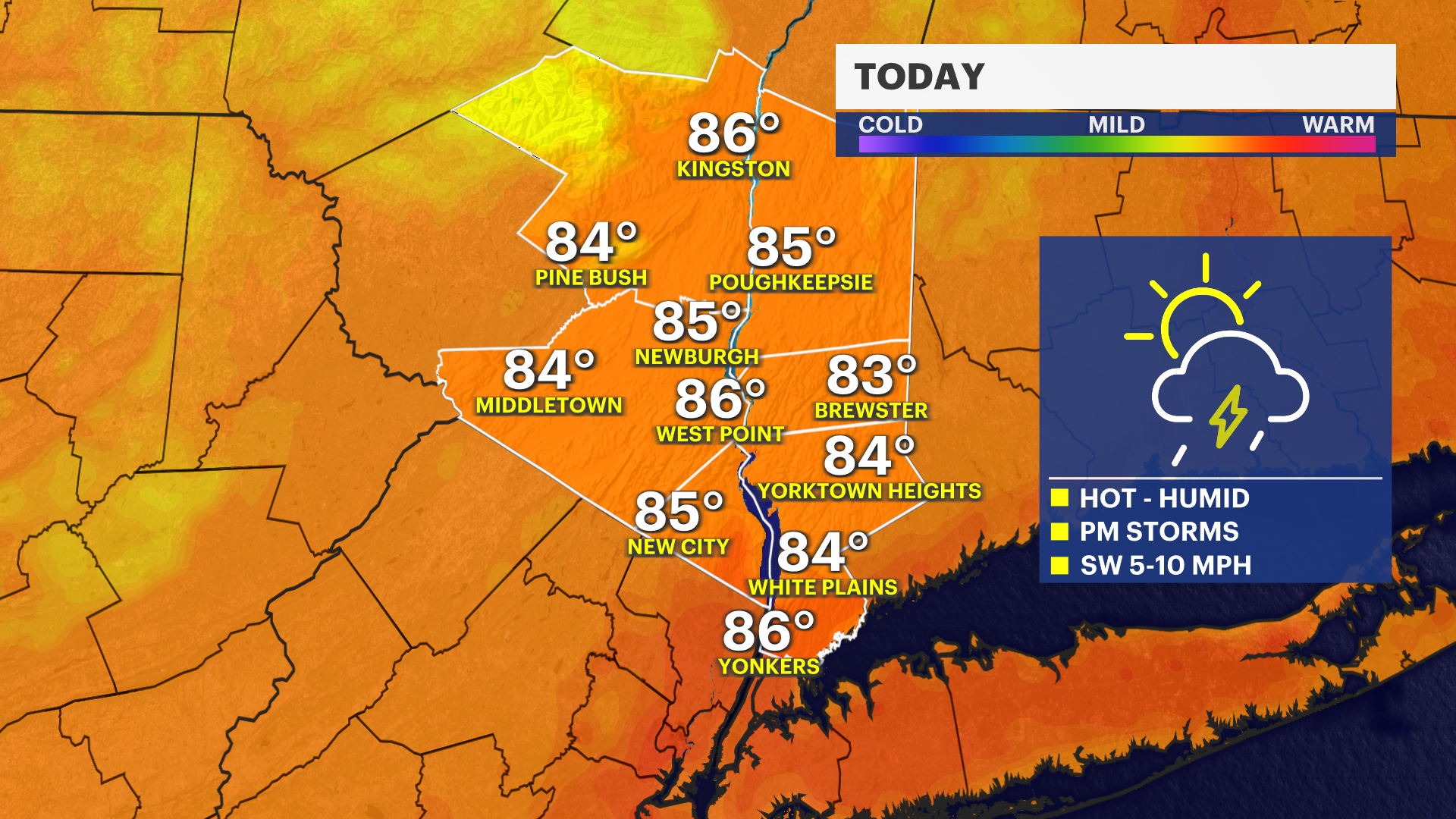


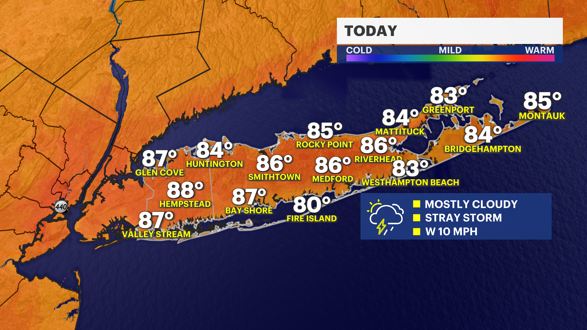
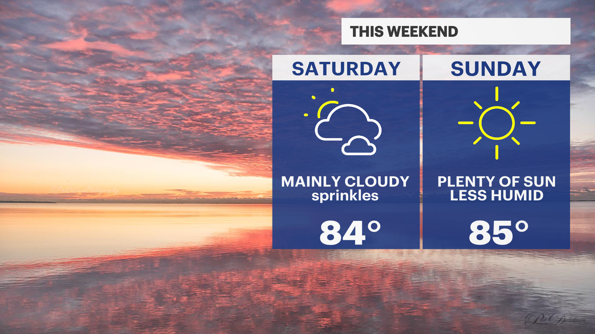
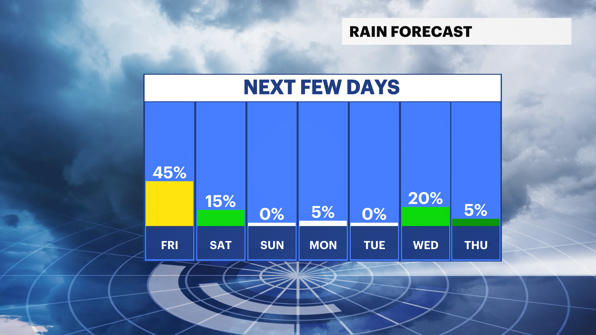
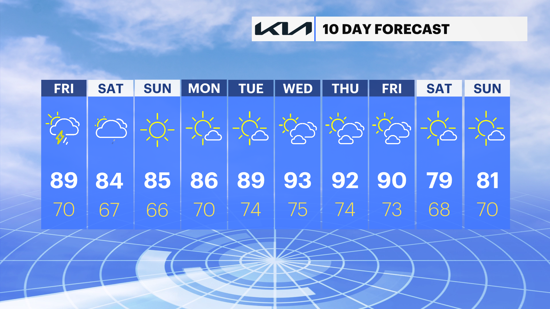
It's a very muggy finish to the week with temperatures soaring to near 90-degrees today. Despite the heat, the sky will be generally cloudy by the afternoon with a stray pop-up evening storm. The weekend starts off cloudy with a stray shower, but thunderstorms are not expected. Sunshine will become more widespread late Saturday afternoon and Sunday looks spectacular. We do have our eyes on another hot stretch of days by the middle of next week.
Hot, muggy, and cloudy today
Friday will be the hottest day this week with high temperatures near 90 degrees, paired with tropical-like humidity. Despite the clouds, it will feel like at least 95-degrees this afternoon when you factor in the humidity. One or two pop up storms are possible this evening, mainly after 5 p.m. Any storms that pop up today will be capable of producing damaging wind.
Saturday's "so-so"
It's a cloudy start to the weekend with a stray shower on and off until skies clear in mid afternoon. Overall not a bad day, but not the prettiest for the beach. Thunderstorms are not expected, any showers will be light.
Sunday's sunshine
Clear skies arrive Saturday evening and last through early next week. Sunday looks absolutely spectacular with temperatures in the mid 80s and plenty of sun.
Marine Forecast
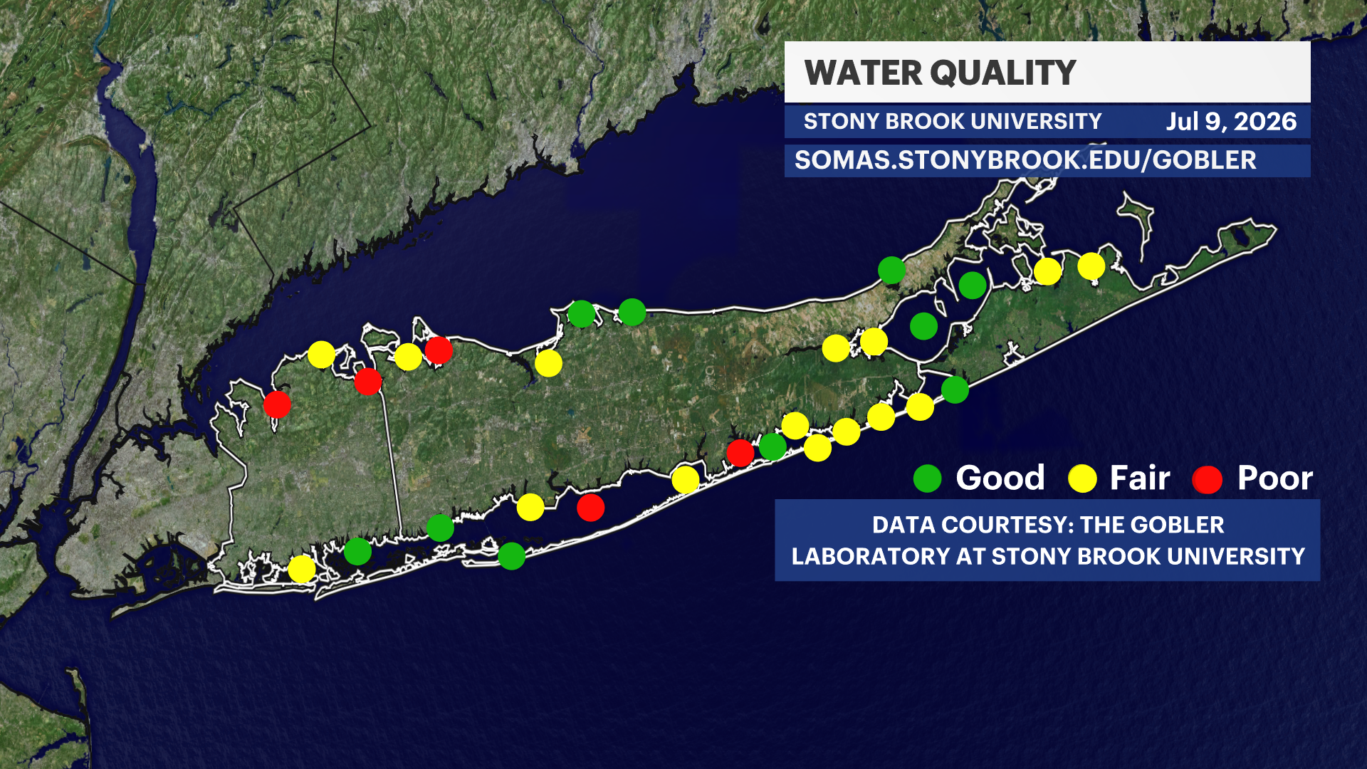
Every Thursday, water quality index updates come out from The Gobler Laboratory at Stony Brook University. This week's update shows generally FAIR water quality around Long Island. Last week's generally good water quality was reduced, in part, by recent heavy rains.
There is a moderate risk for rip currents today and improvements are expected for Saturday. Waves are generally 2-4 feet on the south shore today and around 2 feet for Saturday. There are no weather related alerts for boaters.