A wonderful Wednesday is on tap ahead of August feels to end the week
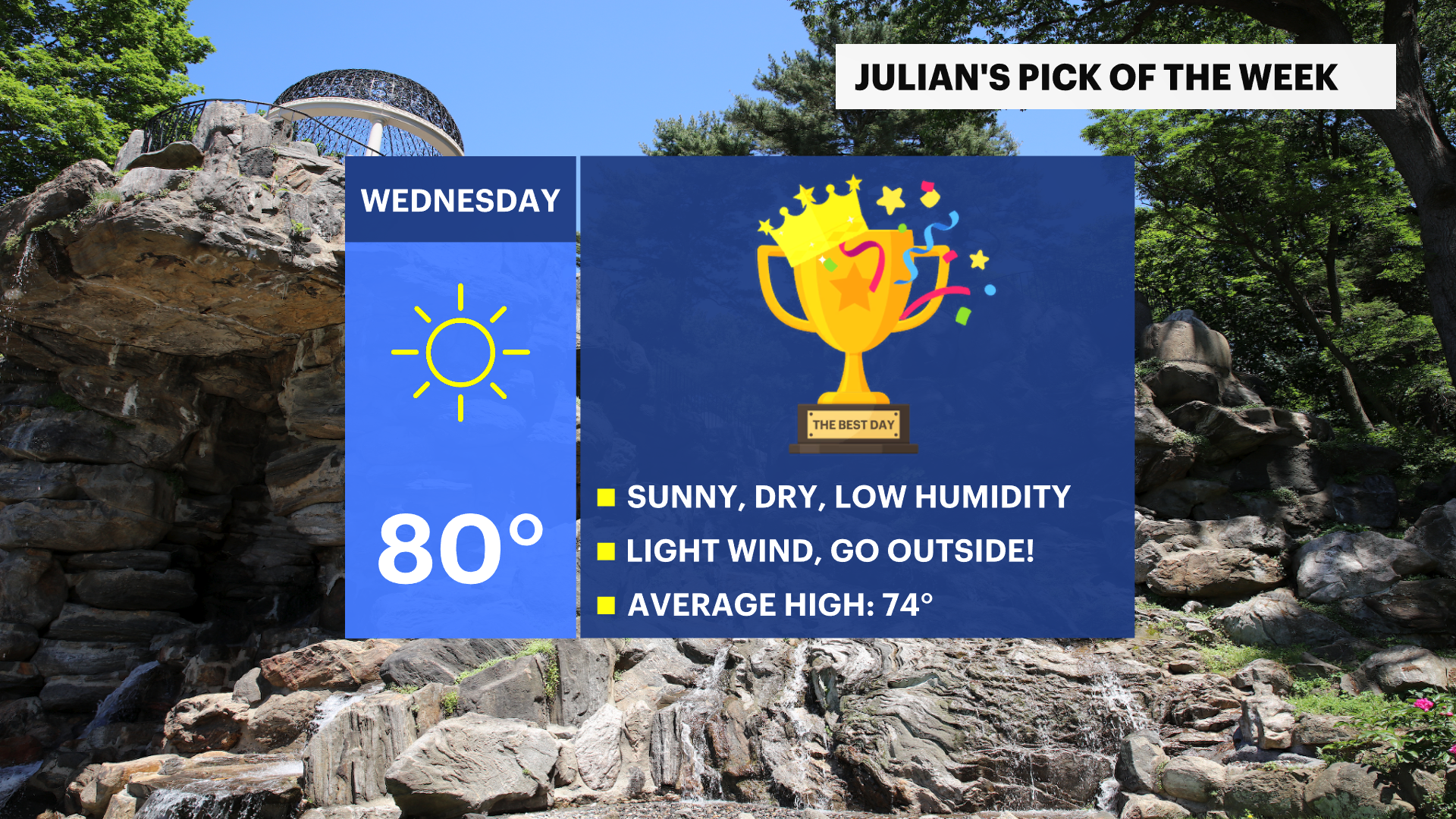
Wednesday remains the Pick of the Week as temperatures climb from the 80s into the upper 80s and near 90 before a wetter pattern arrives Sunday.
More Stories


The Hudson Valley's warming trend continues through the rest of the week, bringing the region its first extended stretch of summerlike weather this season.
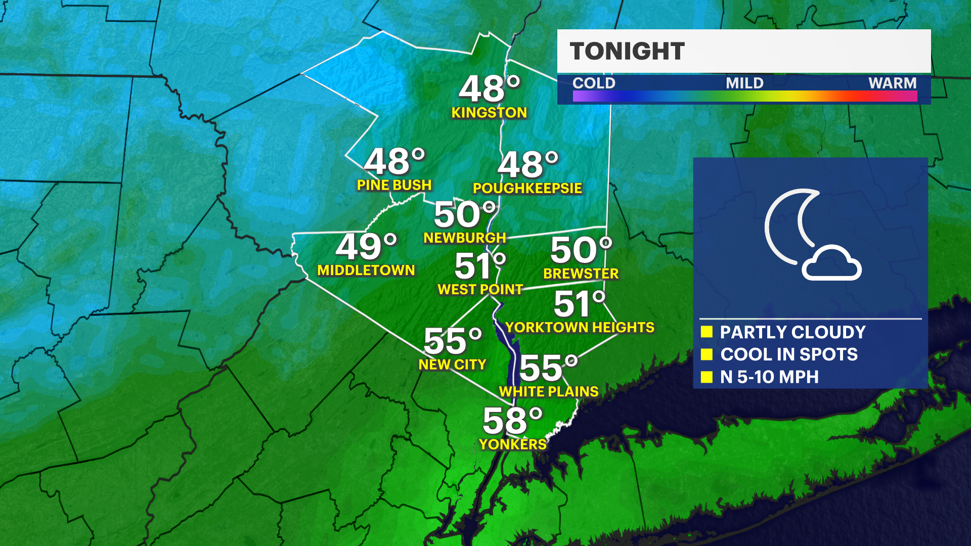
Tonight will be partly cloudy and milder than recent nights, with temperatures settling into the mid-50s.
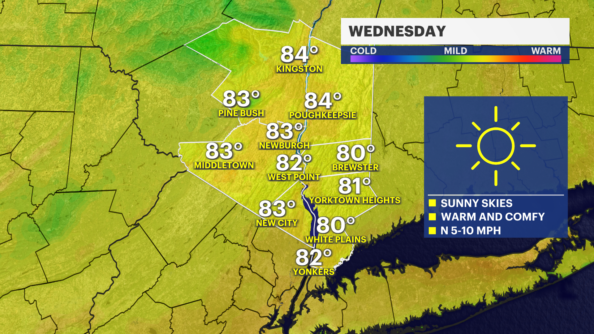
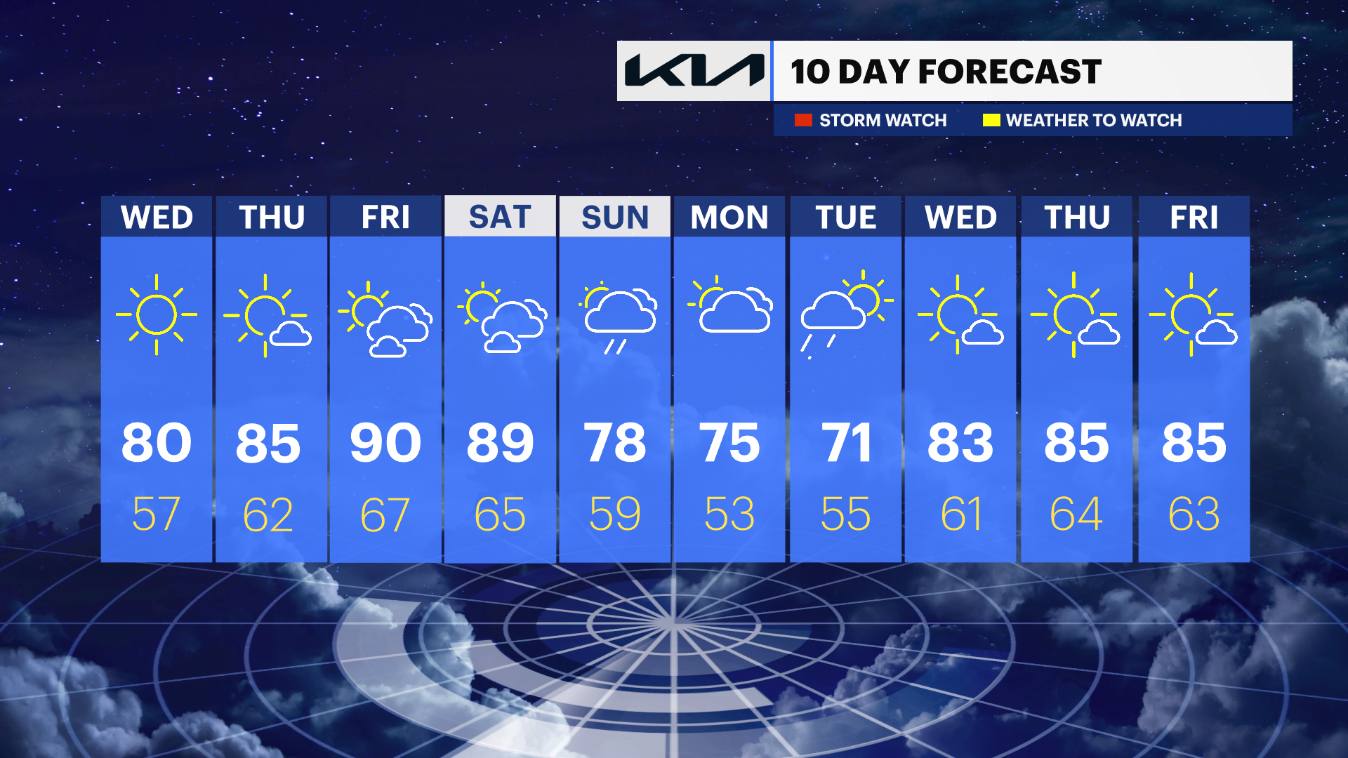
Wednesday remains the "Pick of the Week," featuring plenty of sunshine, low humidity, light winds and highs near 80 degrees. It will be one of the most comfortable days of the week and a great day to spend time outdoors.
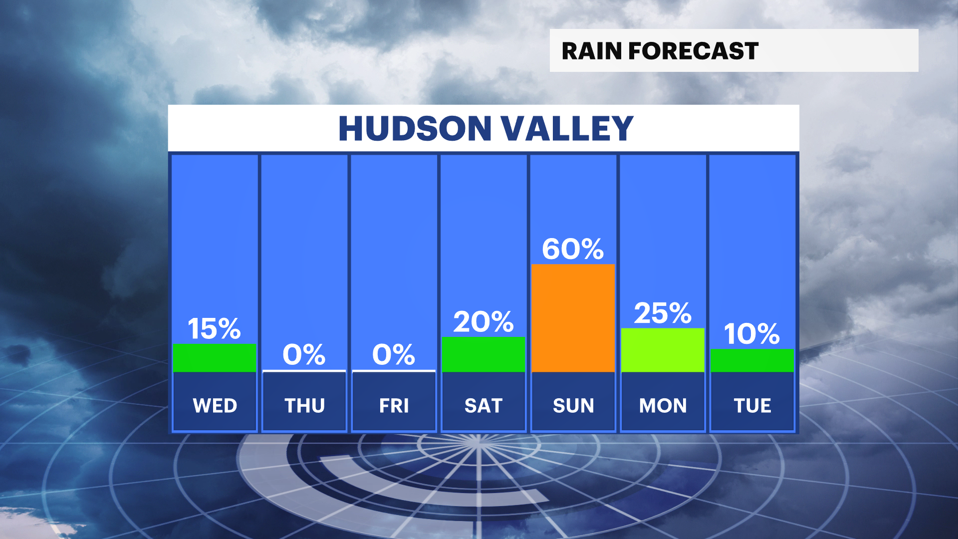
Temperatures continue to climb on Thursday, reaching the mid-80s under mostly sunny skies. By Friday and Saturday, highs will push into the upper 80s and near 90 degrees as summerlike conditions take hold.
Changes arrive late Saturday as humidity increases and clouds begin to build. The next chance for widespread rain arrives late Saturday night and continues through Sunday, which currently appears to have the highest likelihood for showers. Some rain may linger into Monday before conditions improve.
Until then, expect plenty of sunshine, warm temperatures and mainly dry weather across the Hudson Valley.
THE FORECAST:
TONIGHT: Partly cloudy to start, then gradually clearing skies with a light breeze. Lows: Low 40s to low 50s.
WEDNESDAY: PICK OF THE WEEK - Sunny and pleasant with very comfortable humidity levels. Highs: Upper 70s to low 80s. Lows: Mid-50s.
THURSDAY: Mostly sunny with rising temps. Highs: Mid-80s. Lows: Upper 50s to low 60s.
FRIDAY: Mix of sun and clouds with very warm temps and humidity slowly rising. Highs: Upper 80s to low 90s. Lows: Mid-60s.
SATURDAY: Mix of sun and clouds with humidity and very warm temps. Highs: Upper 80s to low 90s. Lows: Mid-60s.