Less wind and warmer Sunday across the island for Sunday plans
Increasing clouds are expected this afternoon with a stray sprinkle, but most of Sunday is looking very nice.
More Stories
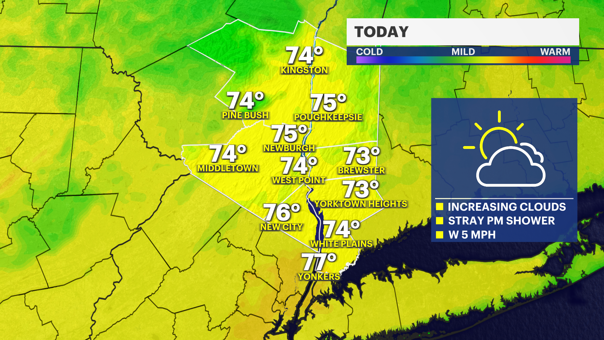


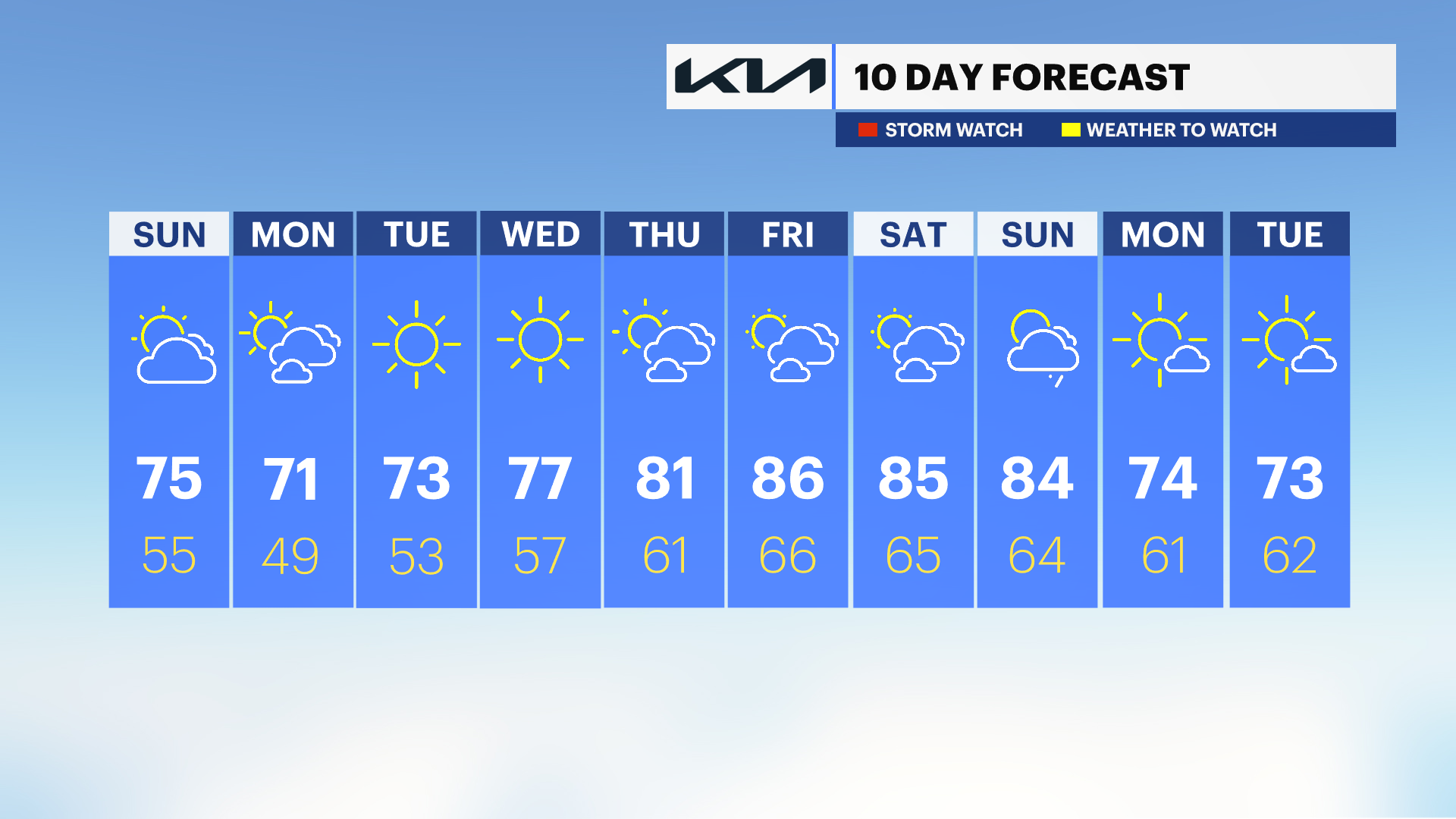
After a windy and chilly start to the weekend, Sunday brings a much more comfortable day for outdoor plans. Expect plenty of sunshine during the morning with clouds arriving later in the day. Temperatures will climb into the lower to middle 70s. Overnight lows are in the mid 50s with mostly cloudy skies.
Monday will feature a mix of sun and clouds with the chance for a brief rain cloud. Temperatures will remain in the lower to middle 70s. Overnight lows are in the upper 40s, which is unseasonably chilly.
Tuesday is chilly in the morning, but very pleasant overall with mainly sunny skies and high temperatures in the mid-70s.
The rest of the week is much warmer than average. High temperatures will soar into the upper 80s Thursday through Saturday with a mix of sun and clouds. The warmest day of the week will likely be Friday, but above average temperatures will linger into next weekend.
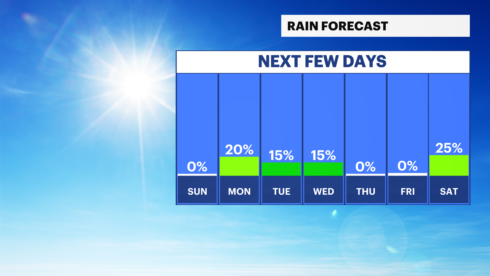
No significant risk for rain is expected in the next 7-10 days.
SUNDAY MARINE FORECAST: Boating conditions will be much improved compared to Saturday as winds and seas continue to subside across the Long Island Sound, South Shore bays, and Atlantic waters. A small craft advisory remains in effect for Atlantic waters and seas will remain choppy there. A west to northwest breeze may still produce occasional gusts around 15 to 20 knots, but conditions are expected to remain below advisory levels for the Long Island Sound.