Hudson Valley flirts with record highs over the next 48 hours
Temperatures will move up to near-record levels into the weekend. Rain chances will be rising by that time, however.
More Stories


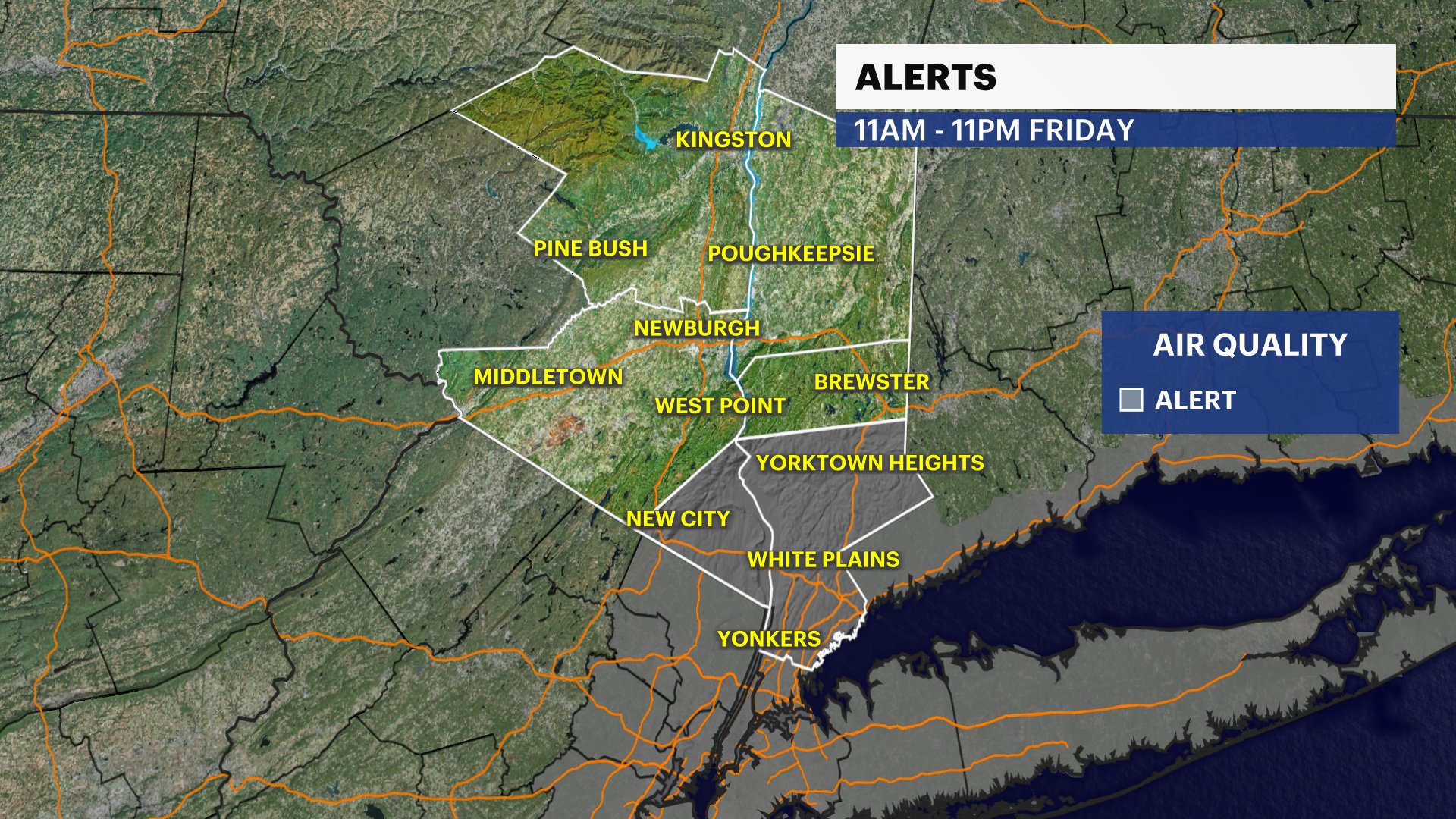
AIR QUALITY ALERT FRIDAY 11 A.M. - 11 P.M.
FORECAST:
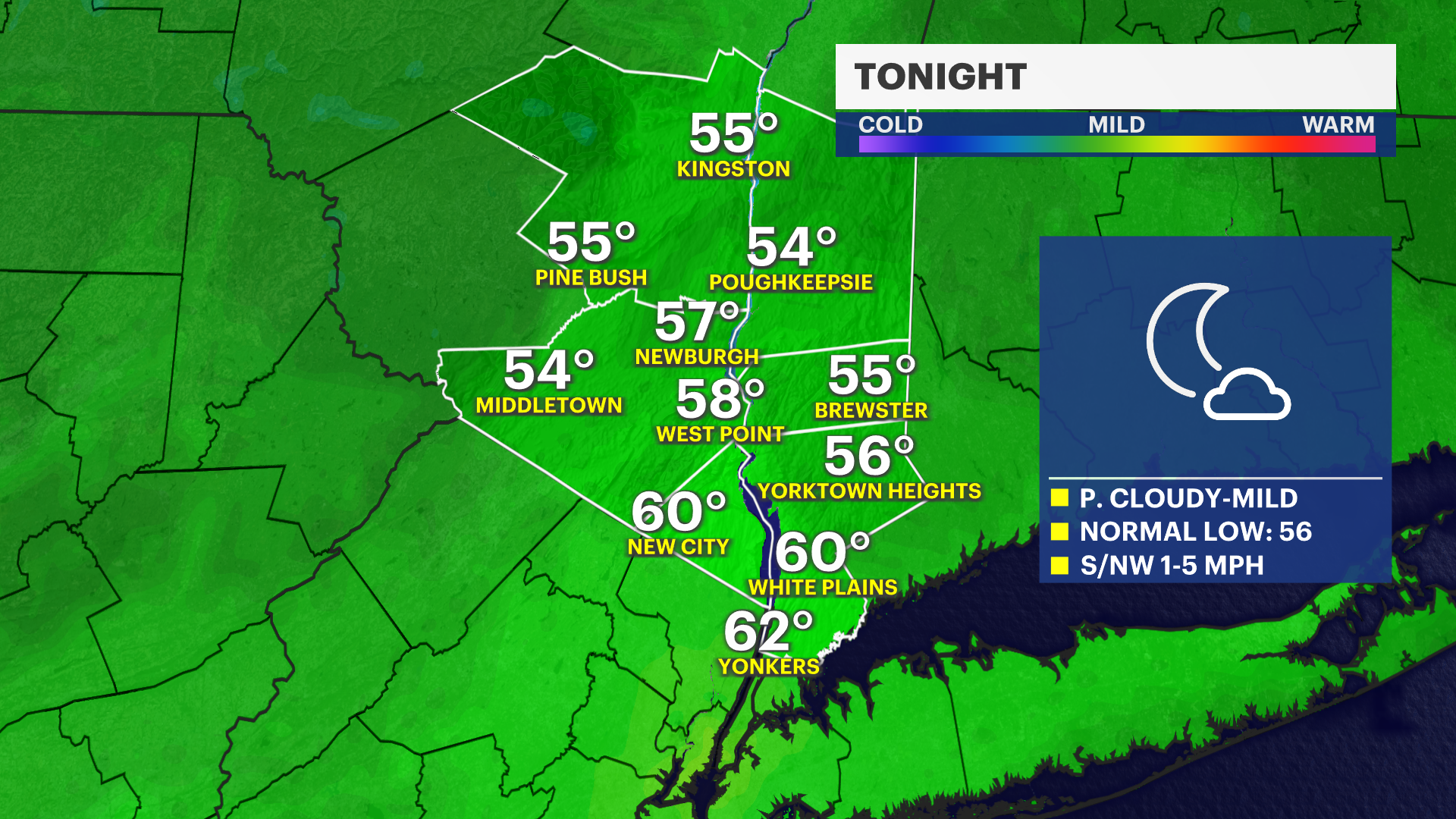
Highs today reached the mid- to upper 80s across the Hudson Valley as this heat continues. Tonight, lows will stay mild in the mid-50s to lower 60s. That warming trend holds strong into Friday and Saturday. You'll definitely start to feel the humidity creeping up by the weekend.
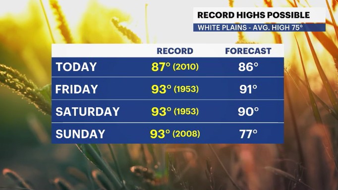
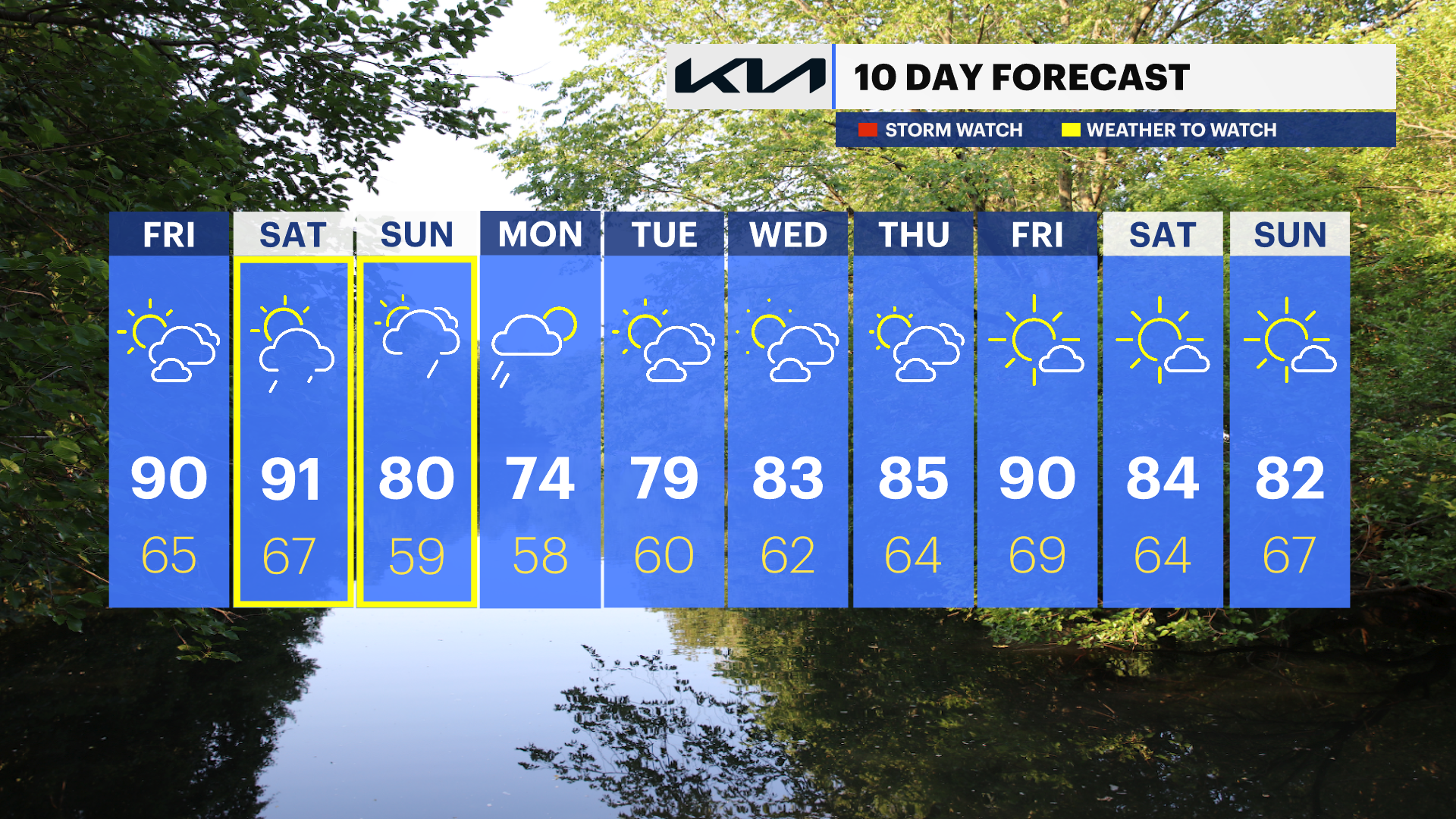
In fact, we’re keeping a close eye on the record books. We are forecast to climb into the low 90s. The record high for both Friday and Saturday is 93 degrees, set all the way back in 1953. We could very well challenge those records.
As we wrap up the workweek, look for fair skies with a mix of sun and clouds. However, there is a storm system approaching the Northeast that we'll need to watch closely, as it brings rain back into the picture for the weekend.
Most of Saturday will stay completely dry, but rain chances will start to rise by late afternoon. Closer to sunset, expect batches of showers to move in, and we can't rule out an isolated thunderstorm late in the day.
Sunday brings on-and-off rain along with another chance for an isolated thunderstorm. It will be cooler than Saturday, but temperatures will still trend at or above our normal high of 75 degrees. Showers will linger into Monday morning with highs in the 70s, but looking ahead at next week, those warmer temperatures will gradually make a comeback.
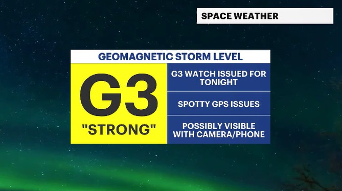
*SPACE WEATHER*
There was a recent burst of solar radiation sent towards the Earth and we may have a chance of seeing some of the Northern Lights tonight.
Now, don't go out expecting "ribbons of light" in the sky. But instead, we may see some displays of colors visible, with a long-time exposure setting on your camera or phone, in a photo. We have a G3, (out of scale of 1-5) Geomagnetic Storm alert for tonight across the region. The best chances to see any glimpse of the Northern Lights will involve you getting away from city lights and being out between 11 p.m. and 1 a.m. The chances will be very sporadic and inconsistent. But, there is still a chance.
ALMANAC:
Average High: 75 | Average Low: 56
Record High: 87 (2010) | Record Low: 44 (2023)
Sunrise: 5:24 a.m. | Sunset: 8:22 p.m.
THE FORECAST:
TONIGHT: Partly cloudy with a light to calm breeze. Lows: Mid-50s to low 60s.
FRIDAY: Partly cloudy, feeling hotter and more humid. Highs: Upper 80s to low 90s. Lows: Mid-60s.
SATURDAY: WEATHER TO WATCH - Partly cloudy skies with breezy winds and temps feeling hot and humid. There is a chance for a late-day shower and storm anytime after 7-8 p.m. Highs: Upper 80s to low 90s. Lows: Mid-60s.
SUNDAY: WEATHER TO WATCH - Mostly cloudy with a chance for rain and isolated thunderstorms. Highs: Upper 70s to low 80s. Lows: Upper 50s to low 60s.
MONDAY: Morning showers fade to drier skies. Highs: Mid-70s. Lows: Upper 50s.