More Stories
The only break much of America can hope for anytime soon from eye-watering dangerous smoke from fire-struck Canada is brief bouts of shirt-soaking sweltering heat and humidity from a southern heat wave that has already proven deadly, forecasters say.
And then the smoke will likely come back to the Midwest and East.
That’s because neither the 235 out-of-control Canadian wildfires nor the stuck weather pattern that's responsible for this mess of meteorological maladies are showing signs of relenting for the next week or longer, according to meteorologists at the National Oceanic and Atmospheric Administration’s Weather Prediction Center.
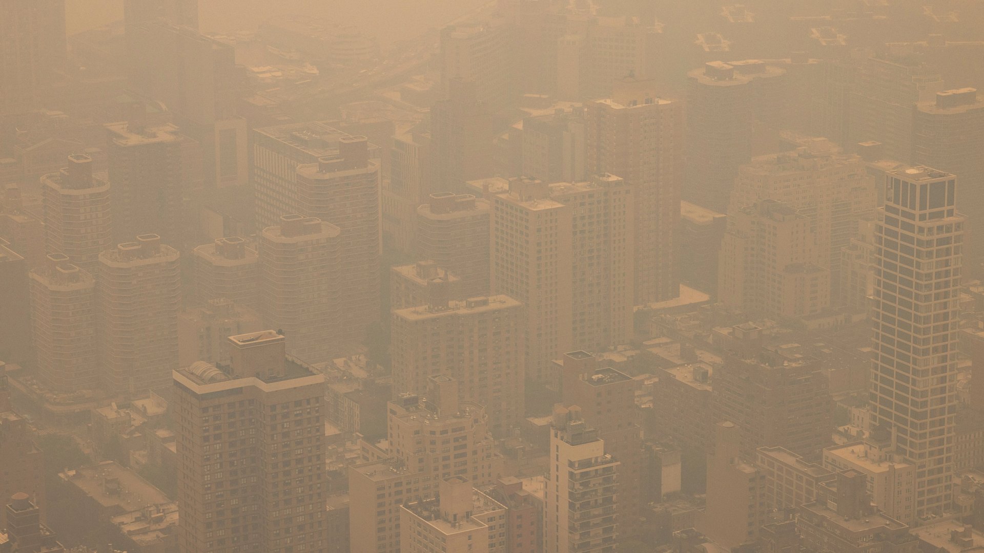
 An aerial view shows New York City in a haze-filled sky from the Empire State Building observatory, Wednesday, June. 7, 2023, in New York. Smoke from Canadian wildfires poured into the U.S. East Coast and Midwest on Wednesday, covering cities of both nations in an unhealthy haze, holding up flights at major airports and prompting people to fish out pandemic-era face masks. (AP Photo/Yuki Iwamura)
First, the stuck weather pattern made abnormally hot and dry conditions for Canada to burn at off-the-chart record levels. Then it created a setup where the only relief comes when low pressure systems roll through, which means areas on one side get smoky air from the north and the other gets sweltering air from the south.
Smoke or heat. “Pick your poison,” said prediction center forecast operations chief Greg Carbin. “The conditions are not going to be very favorable.”
“As long as those fires keep burning up there, that’s going to be a problem for us,” Carbin said. “As long as there’s something to burn, there will be smoke we have to deal with.”
Take St. Louis. The city had two days of unhealthy air Tuesday and Wednesday, but for Thursday “they’ll get an improvement of air quality with the very hot and humid heat,” said weather prediction center meteorologist Bryan Jackson. The forecast is for temperatures that feel like 109 degrees (42.8 degrees Celsius) — with 101 degree (38.3 degrees Celsius) heat and stifling humidity.
On Wednesday, the low pressure system was parked over New England and because winds go counter-clockwise, areas to the west – such as Chicago and the Midwest – get smoky winds from the north, while areas east of the low pressure get southerly hot winds, Jackson said.
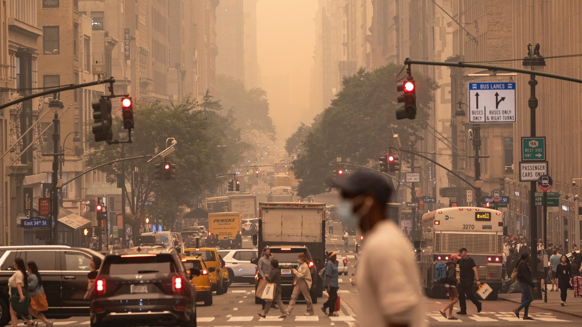
 A man wears a mask as he crosses an intersection in a haze-filled sky of Manhattan, New York, Wednesday, June. 7, 2023. Smoke from Canadian wildfires poured into the U.S. East Coast and Midwest on Wednesday, covering cities in both nations in an unhealthy haze, holding up flights at major airports and prompting people to fish out pandemic-era face masks. (AP Photo/Yuki Iwamura)
As that low pressure system moves on and another one travels over the central Great Plains and Lake Superior, the Midwest gets temporary relief, Jackson said. But when low pressure moves on, the smoke comes back.
“We have this this carousel of air cruising around the Midwest, and every once in a while is bringing the smoke directly onto whatever city you live in,” said University of Chicago atmospheric scientist Liz Moyer. “And while the fires are ongoing, you can expect to see these periodic bad air days and the only relief is either when the fires go out or when the weather pattern dies.”
The stuck weather pattern is “awfully unusual,” said NOAA's Carbin who had to look back in records to 1980 to see anything even remotely similar. “What gets me is the persistence of this.”
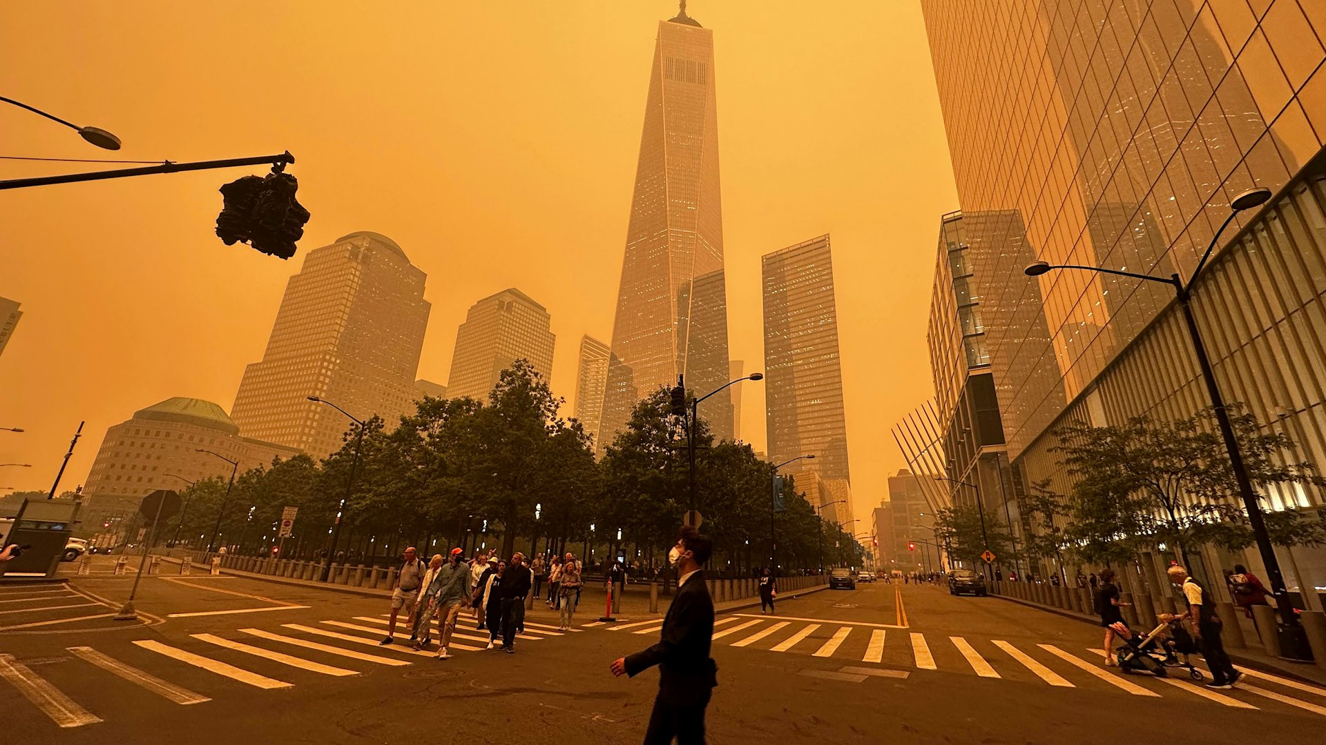
 Pedestrians pass the One World Trade Center, center, amidst a smokey haze from wildfires in Canada, Wednesday, June 7, 2023, in New York. Smoke from Canadian wildfires poured into the U.S. East Coast and Midwest on Wednesday, covering the capitals of both nations in an unhealthy haze, holding up flights at major airports and prompting people to fish out pandemic-era face masks. (AP Photo/Julie Jacobson)
Why is the weather pattern stuck? This seems to be happening more often — and some scientists suggest that human-caused climate change causes more situations where weather patterns stall. Moyer and Carbin said it’s too soon to tell if that’s the case.
But Carbin and Canadian fire scientist Mike Flannigan said there’s a clear climate signal in the Canadian fires. And they said those fires aren’t likely to die down anytime soon, with nothing in the forecast that looks likely to change.
Nearly every province in Canada has fires burning. A record 30,000 square miles (80,000 square kilometers) have burned, an area nearly as large as South Carolina, according to the Canadian government.
And fire season usually doesn’t really get going until July in Canada.
“It’s been a crazy crazy year. It’s unusual to have the whole country on fire,” said Flannigan, a professor at Thompson Rivers University in British Columbia. “Usually it’s regional... not the whole shebang at once.”
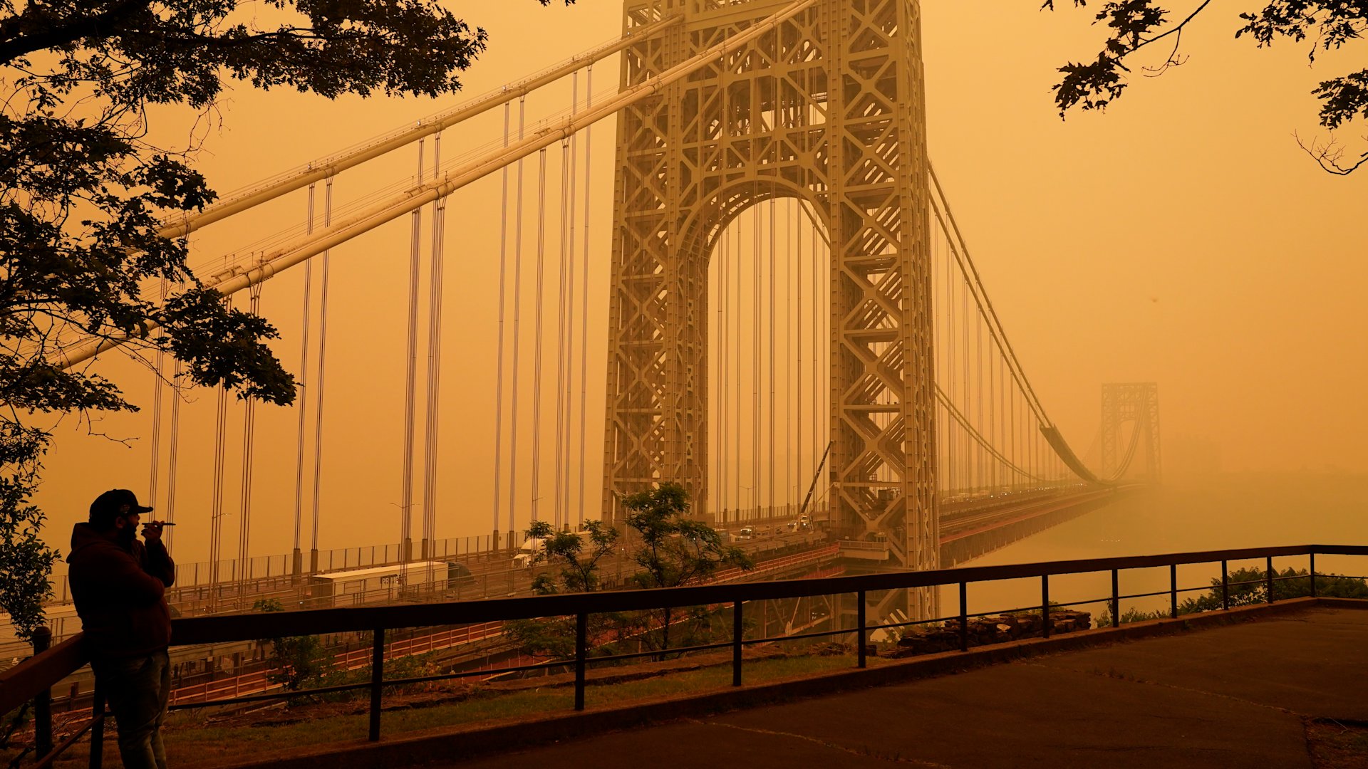
 A man talks on his phone as he looks through the haze at the George Washington Bridge in Fort Lee, N.J., Wednesday, June 7, 2023. Intense Canadian wildfires are blanketing the northeastern U.S. in a dystopian haze, turning the air acrid, the sky yellowish gray and prompting warnings for vulnerable populations to stay inside. (AP Photo/Seth Wenig)
Hotter than normal and drier air made for ideal fire weather, Flannigan said. Warmer weather from climate change means the atmosphere sucks more moisture out of plants, making them more likely to catch fire, burn faster and hotter.
“Fires are all about extremes,” he said.
And where there’s fire, there’s smoke.
Both high heat and smoky conditions are stressors on the body and can present potential challenges to human health, said Ed Avol, a professor emeritus at the Keck School of Medicine at University of Southern California.
But Avol added that while the haze of wildfire smoke provides a visual cue to stay inside, there can be hidden dangers of breathing in harmful pollutants such as ozone even when the sky looks clear. He also noted there are air chemistry changes that can happen downwind of wildfire smoke, which may have additional and less well-understood impacts on the body.
It’s still only June. The seasonal forecast for the rest of the summer in Canada “is for hot and mostly dry” and that’s not good for dousing fires, Flannigan said. “It’s a crazy year and I’m not sure where it’s going to end.”
More from News 12
2:00

AC technician shares tips to keep your system running smoothly
1:15

What you should know about heat stroke
14:52:13

13 cool tips to help you stay healthy during the summer heat
1:32

8 tips for working safely during hot weather
3:39

Safety tips: Know the signs of heat exhaustion and heat stroke
9:43:53
