Clouds clear overnight; nice Wednesday with late-week heat and a storm chance
We trade Tuesday's gloomy, showery weather for a beautiful Wednesday. But a few showers and thunderstorms, along with hot and humid weather, move in for the end of the week.
More Stories


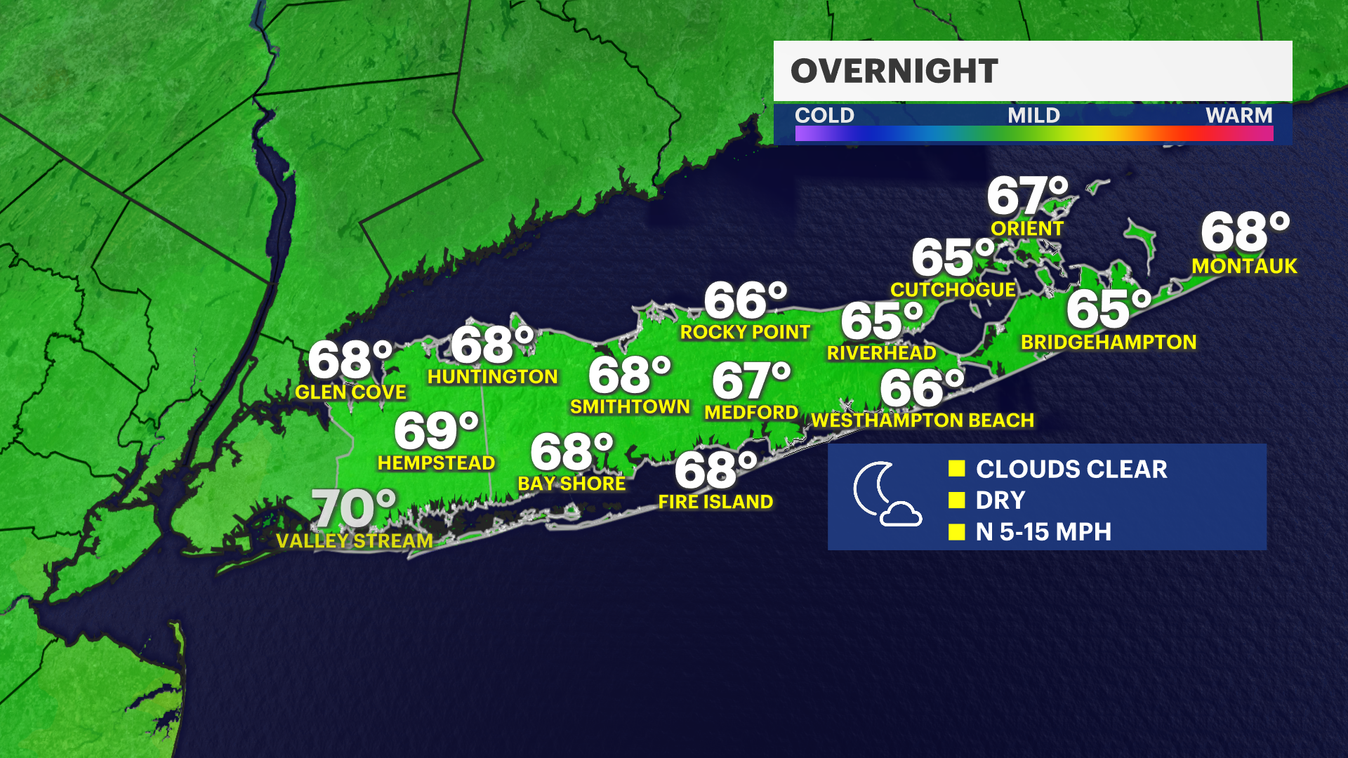
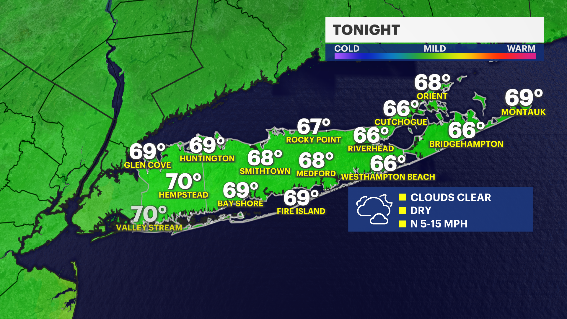
OVERNIGHT
Clouds gradually clear into Wednesday morning with low temperatures in the mid- to upper 60s.
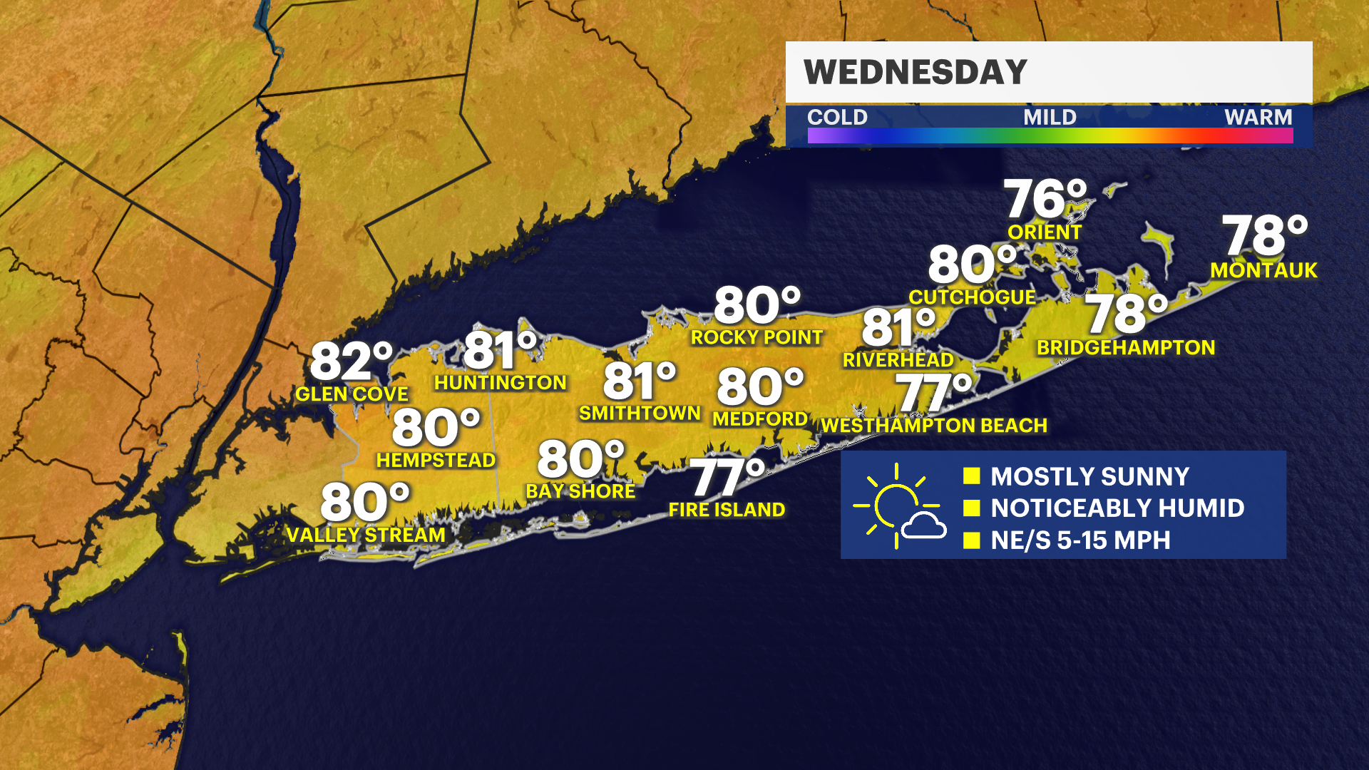
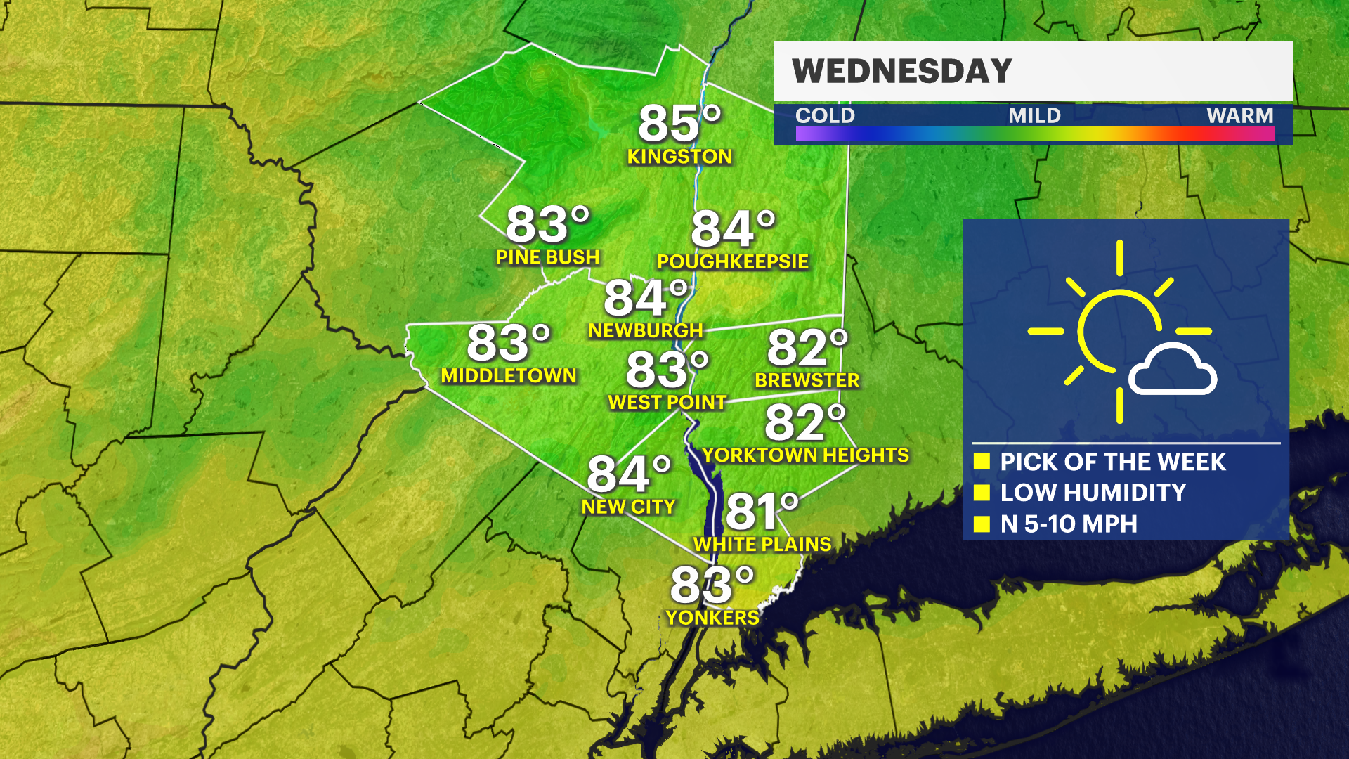
BEAUTIFUL WEDNESDAY
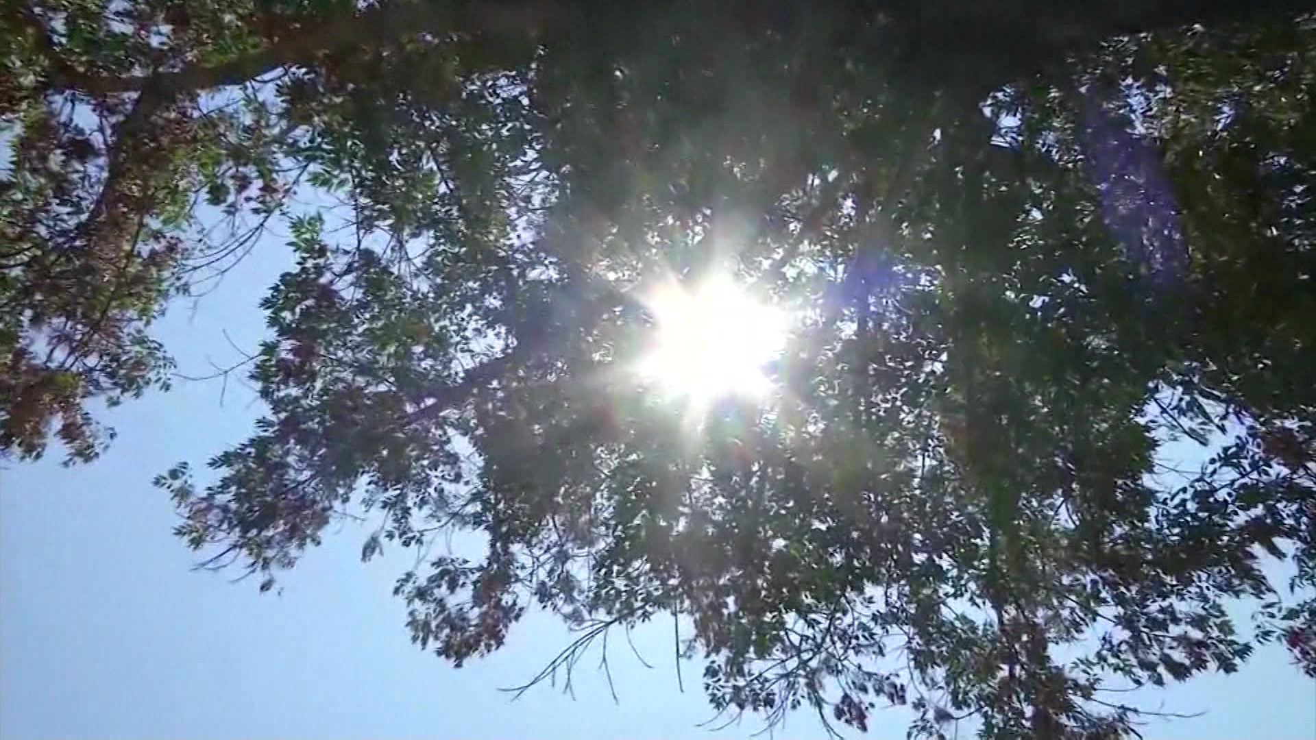
All outdoor activities are a go! It is going to be noticeably humid, but nice on Wednesday, with a mostly sunny sky and high temperatures in the upper 70s to low 80s. The UV Index will also be back up to an eight, which is very high, so reapplying sunscreen every two hours will help you avoid a sunburn in around 10 minutes on unprotected skin.
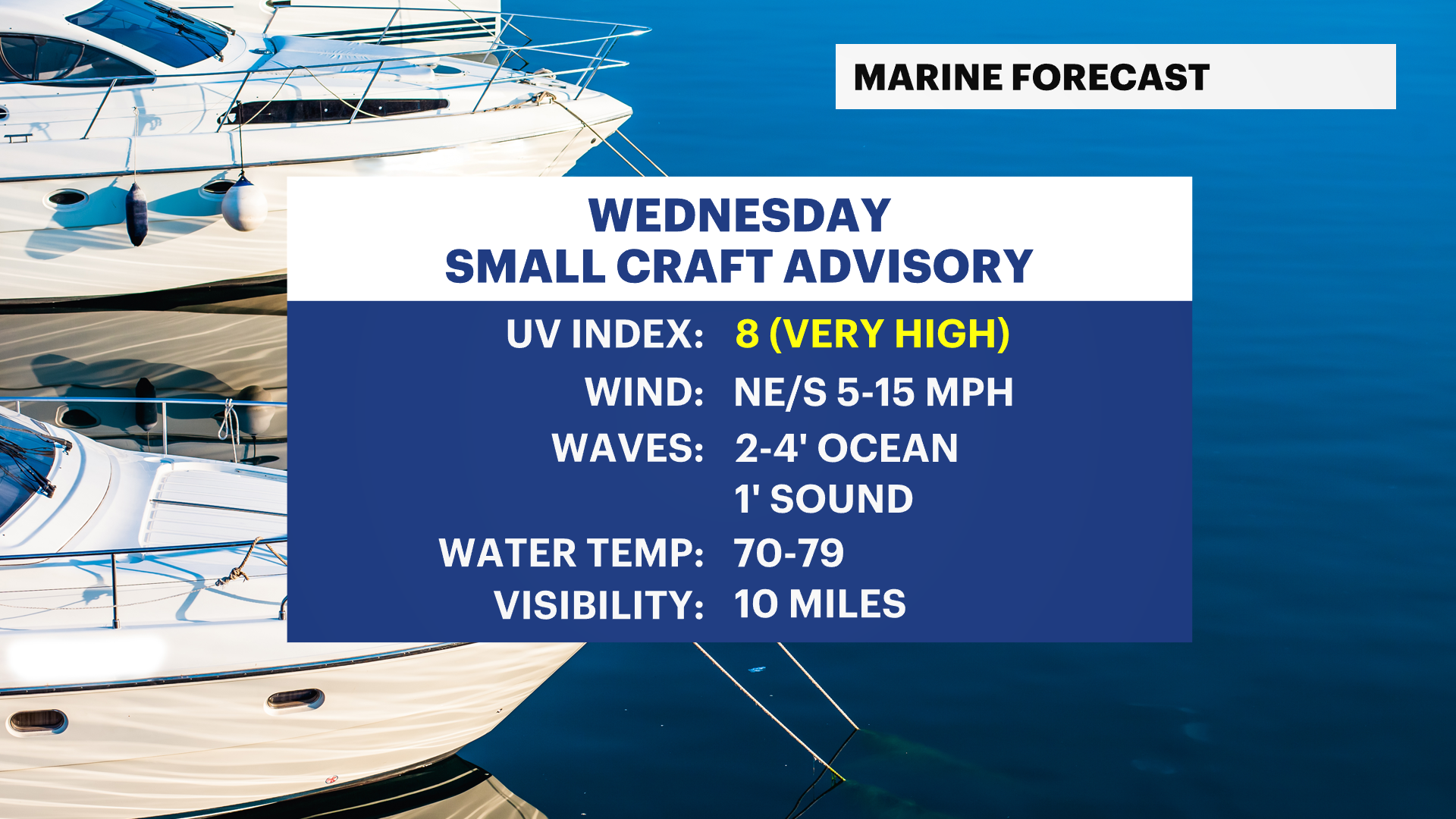
BOATERS: A small craft advisory will continue along the Atlantic Ocean in Suffolk County, but waves will drop to around two to four feet even there into the afternoon.
HEATING UP LATE-WEEK WITH A THUNDERSTORM CHANCE
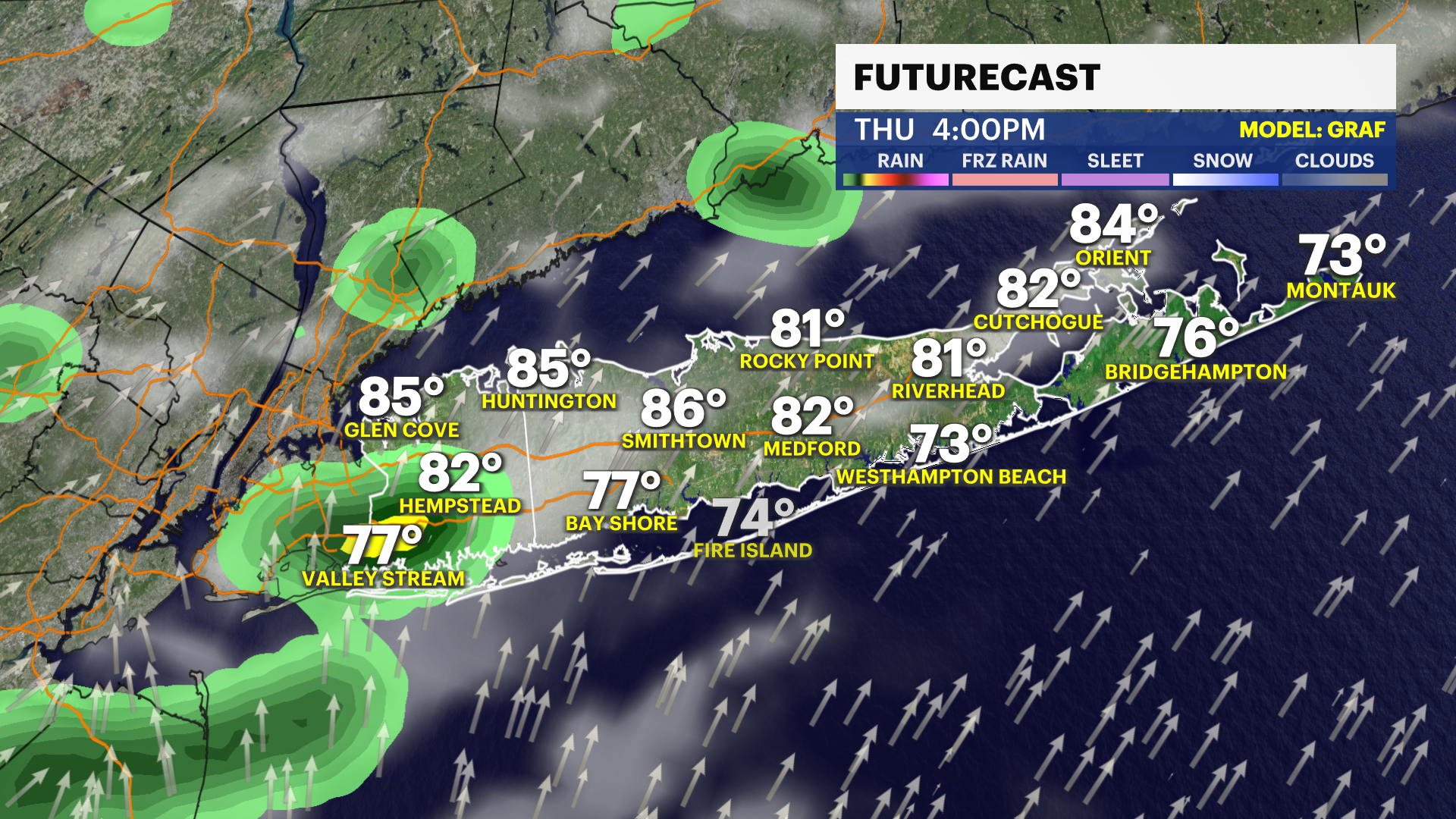
It will be warm and humid on Thursday with temperatures returning to the lower to middle 80s. There can be a pop-up shower or thunderstorm in the afternoon or evening, but we are not expecting too much rain or any severe weather on Thursday.
Friday will be the hottest day this week with high temperatures back in the upper 80s to near 90 degrees, paired with tropical-like humidity. This is only expected to last one day at this time, but plan on it feeling like the middle 90s on Friday. As a front approaches Long Island late in the day, this can help spark a few showers and thunderstorms into the evening. At this time, no severe weather is expected locally, but the News 12 Storm Watch Team will monitor this for you throughout the week.
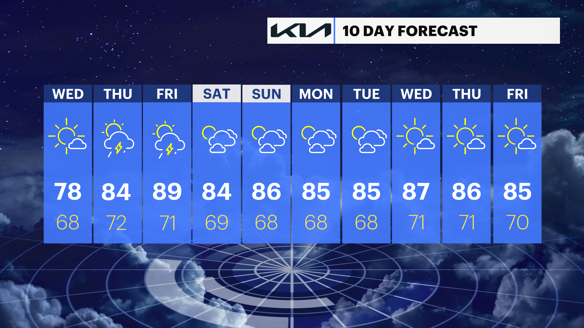
EXTENDED FORECAST
OVERNIGHT: Clouds clear overnight. Lows in the mid- to upper 60s. Wind: North 5 to 15 mph.
WEDNESDAY: Mostly sunny to partly cloudy. Highs around 80 degrees. Lows near 69 degrees.
THURSDAY: Sun and clouds. Highs around 85 degrees. Lows near 72 degrees.
FRIDAY: Partly sunny with a few showers and thunderstorms possible. Highs around 88 degrees. Lows near 71 degrees.
SATURDAY: Sun and clouds. A pop-up shower or thunderstorm possible. Highs around 86 degrees. Lows near 69 degrees.
SUNDAY: Sun and clouds. Highs around 84 degrees. Lows near 70 degrees.
MONDAY: Sun and clouds. Highs around 82 degrees. Lows near 68 degrees.
TUESDAY: Sun and clouds. Highs around 85 degrees. Lows near 68 degrees.