STORM WATCH: Flash flooding threat continues through tonight, then improving weather midweek
Multiple rounds of showers and embedded thunderstorms will produce torrential rainfall capable of causing scattered to numerous flash flooding events.
More Stories




What to expect
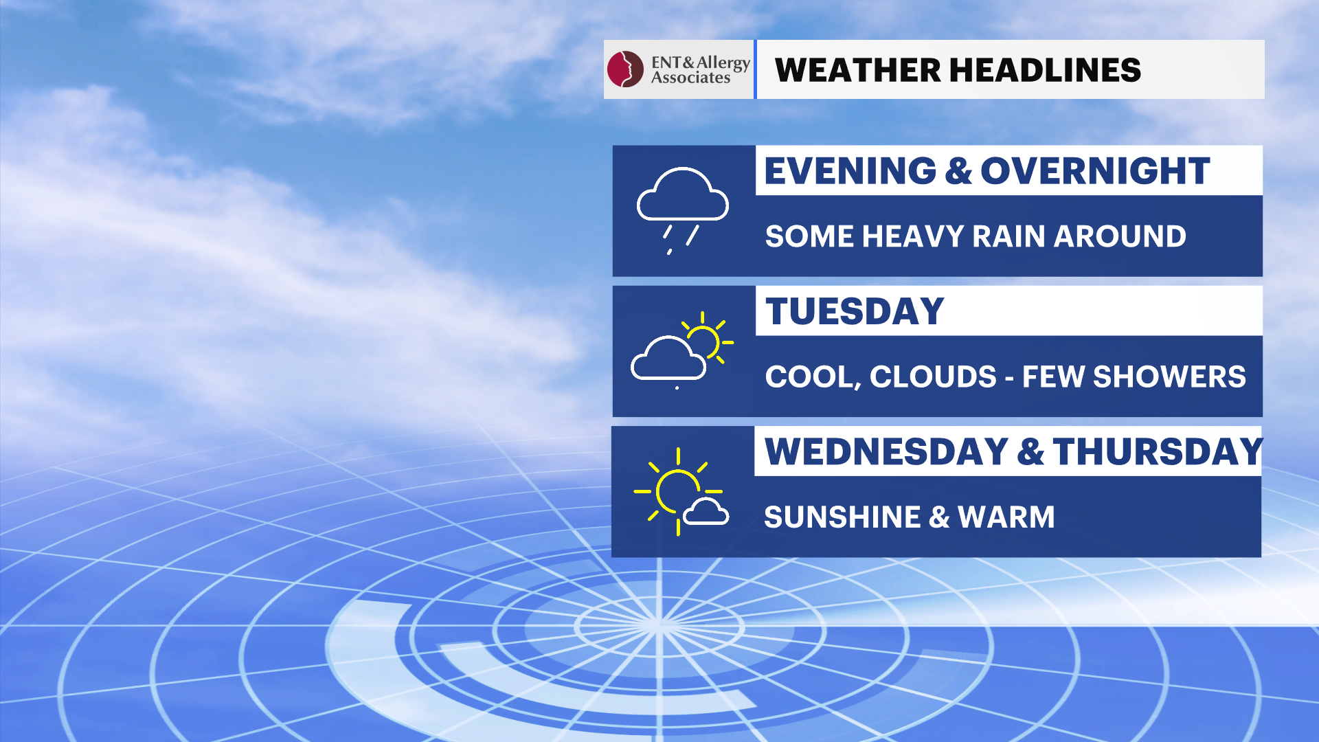
Flash flooding remains the greatest weather threat through tonight
Multiple rounds of heavy showers and thunderstorms will continue through this evening and overnight
Rainfall rates of 1 to 2 inches per hour could quickly overwhelm drainage systems
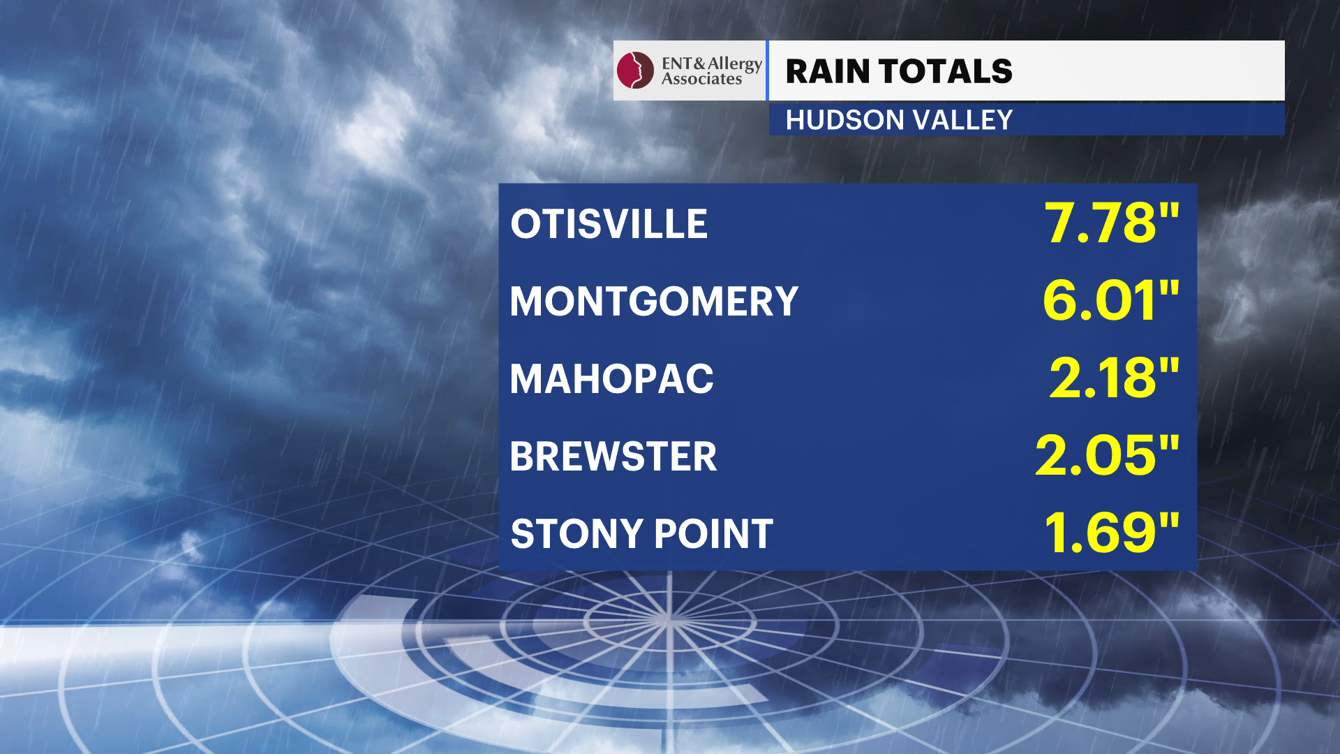
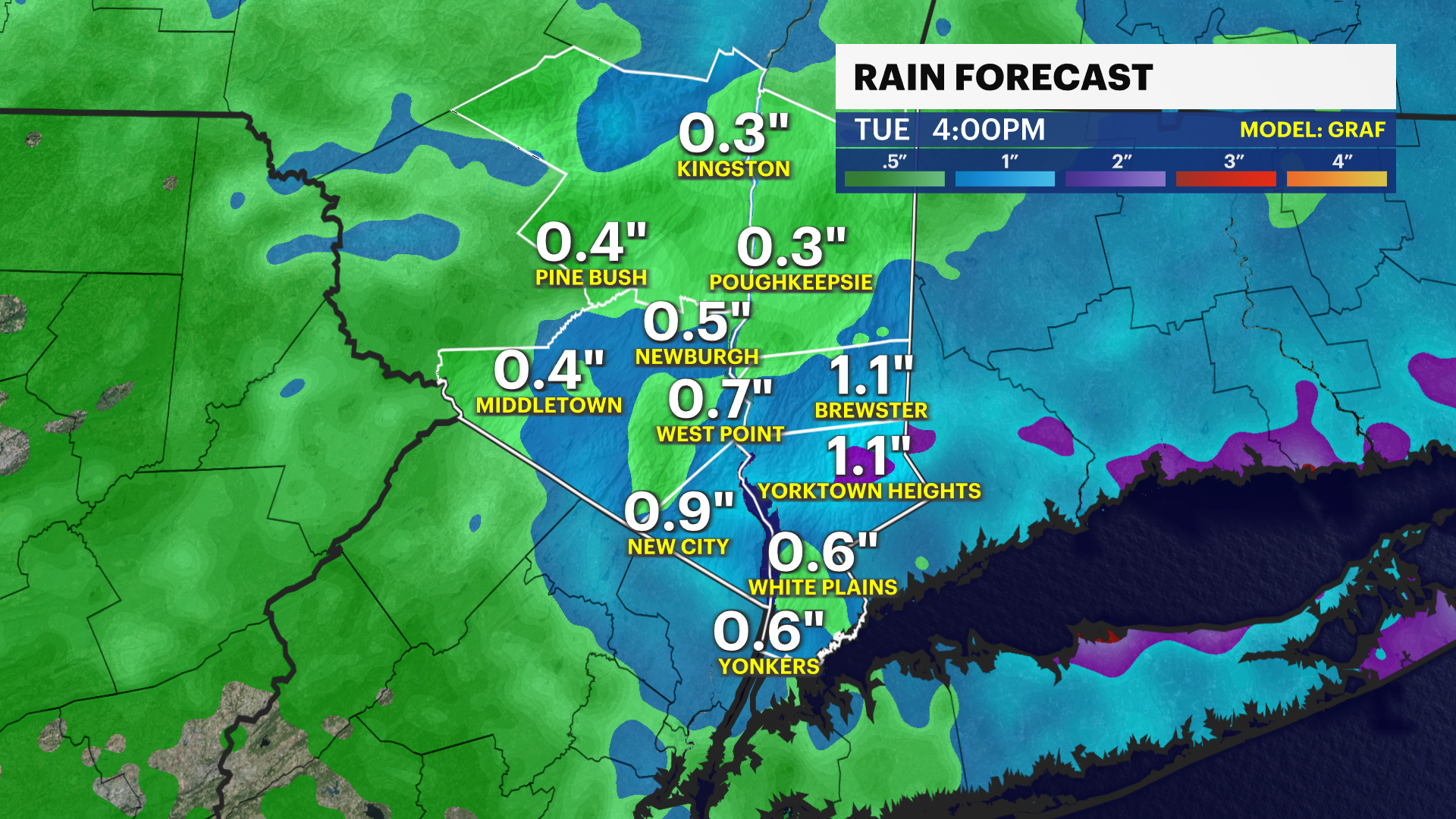
Localized storm totals of 2 to 3 inches are expected, with isolated amounts over 4 inches where storms repeatedly track over the same area
Flooding is most likely in poor drainage areas, low-lying locations, along small streams and creeks, and where water covers roadways
Showers gradually diminish Tuesday with much drier and quieter weather arriving Wednesday
Another chance for scattered showers and thunderstorms returns Friday into the weekend
Weather alerts
Flood Watch in effect through Tuesday morning for the Hudson Valley. Repeated rounds of heavy rain may lead to scattered to numerous instances of flash flooding. Some flooding could become locally significant, especially where thunderstorms repeatedly move over the same locations.
Forecast
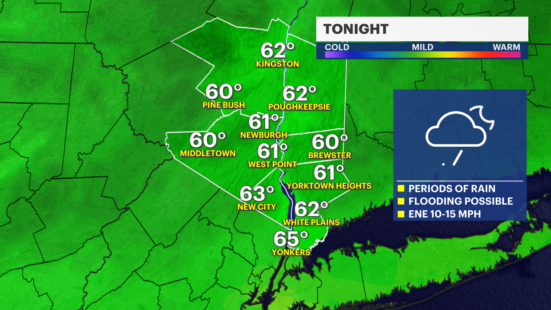
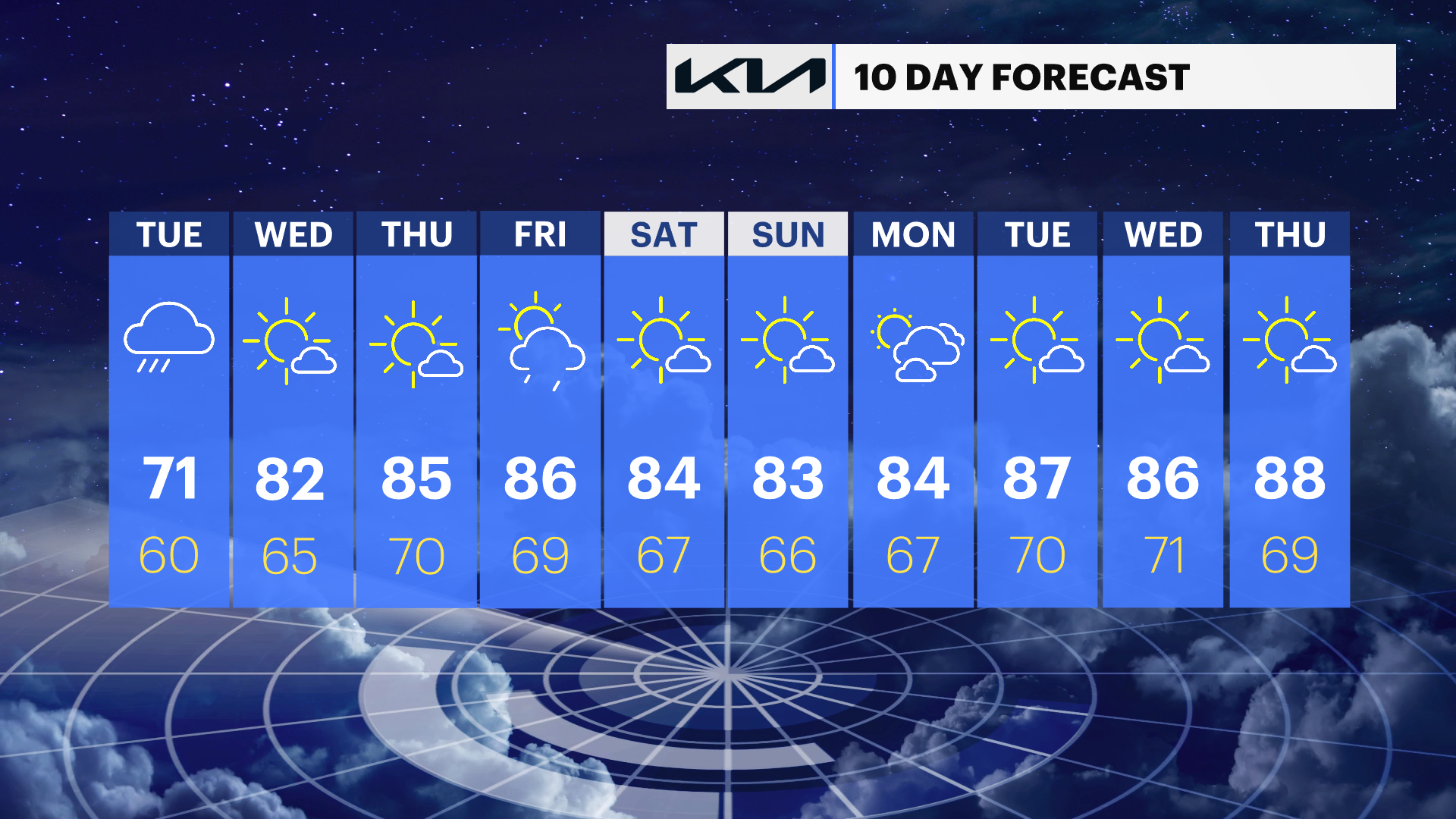
Tonight: Periods of showers and thunderstorms continue through the night with pockets of torrential rainfall. Flash flooding is possible, especially in flood-prone and poor drainage areas. Overnight lows will be around 60 degrees.
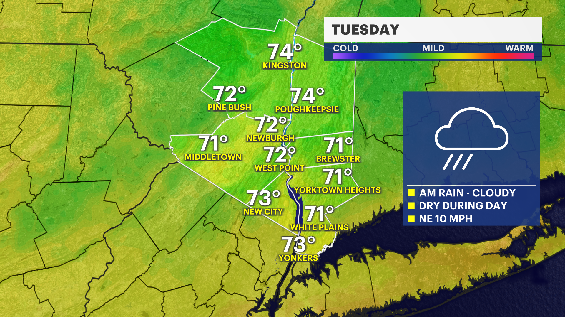
Tuesday: Showers remain likely through early afternoon before becoming more scattered later in the day. An isolated thunderstorm remains possible. Highs will range from the upper 60s to lower 70s.
Tuesday night: A lingering shower is possible early, then skies gradually begin to improve overnight. Lows will be in the upper 50s to around 60.
Wednesday: Mostly sunny with much lower humidity and a welcome return to dry weather. Highs will be around 80 degrees.
Thursday: Mostly sunny and warmer with increasing humidity. Highs will be in the mid-80s.
Friday: Partly sunny, warm, and more humid with scattered afternoon and evening showers and thunderstorms developing. Highs will be in the mid- to upper 80s.
Saturday: Mostly sunny with another chance for scattered showers and thunderstorms. Highs will be in the lower to mid 80s.