Scattered shower and brief thunderstorm chance Thursday on Long Island
Scattered rain and a passing gusty thunderstorm can be temporarily impactful Thursday ahead of nicer weather into the weekend.
More Stories


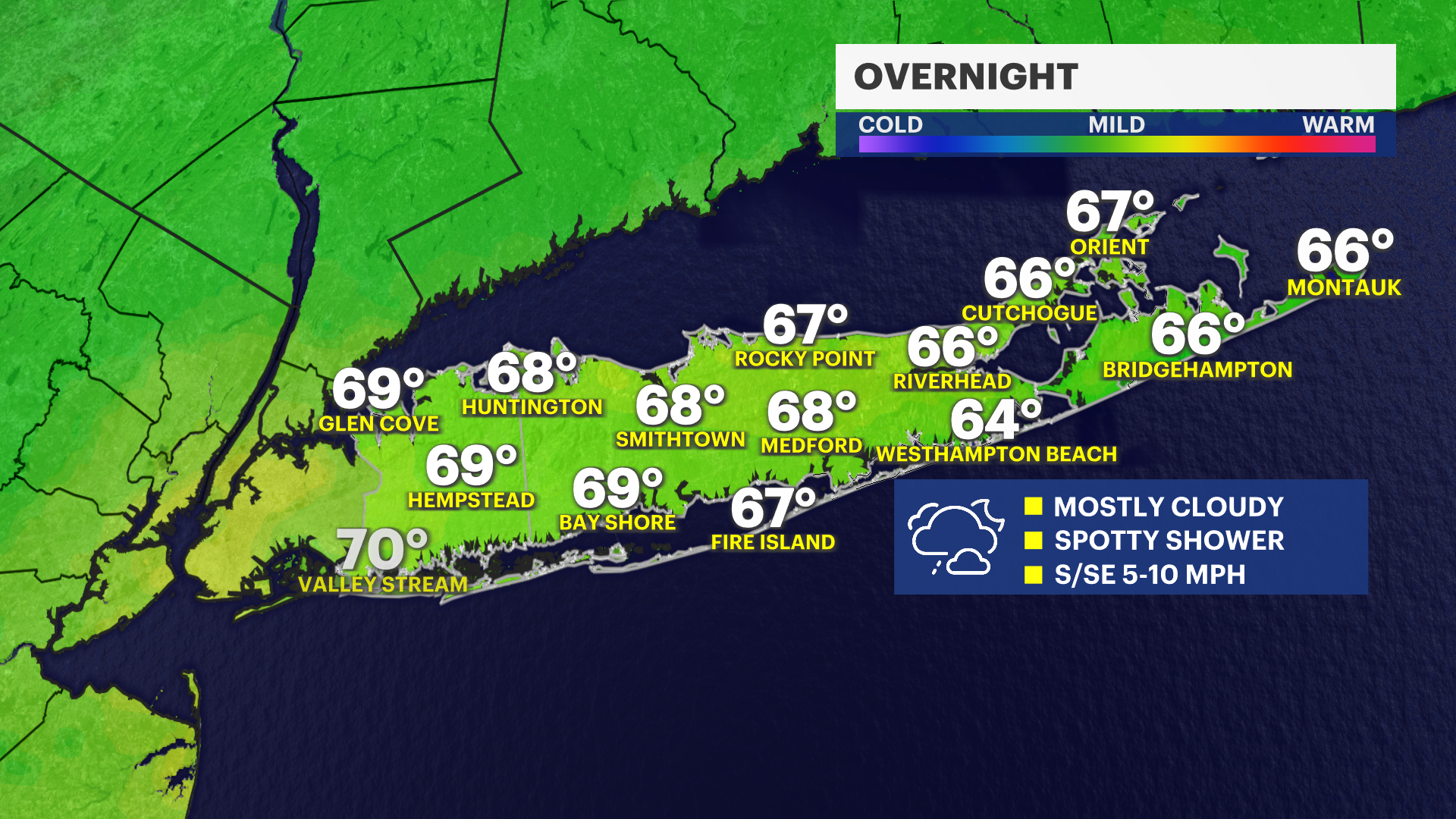
OVERNIGHT FORECAST
Mostly cloudy overnight with an ongoing slight chance for a rain shower with temperatures mostly in the middle to upper 60s.
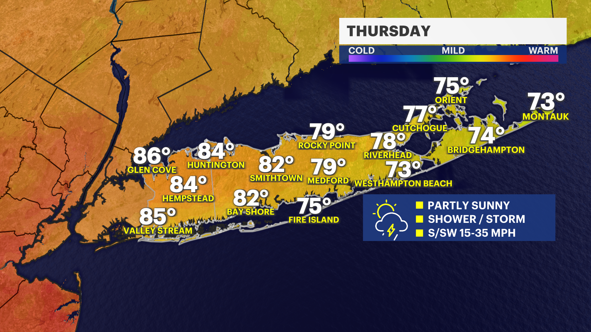
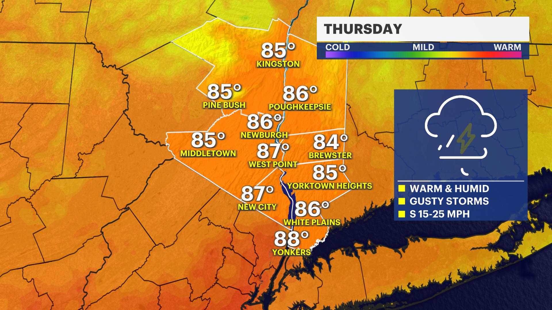
THURSDAY'S FORECAST
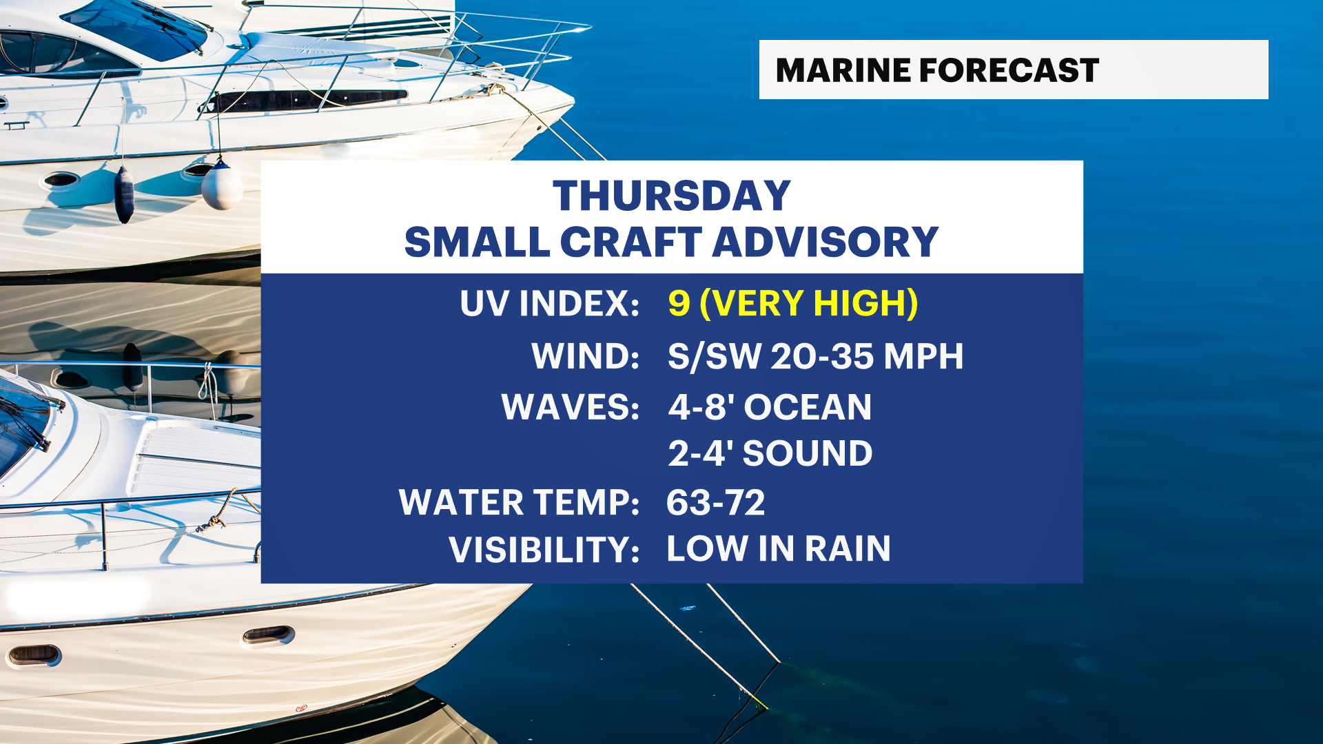
Thursday will be wet at times with a partly sunny to mostly cloudy sky along with scattered showers and a brief downpour in the morning. It will be warm and windy with wind gusts between 20 mph and 35 mph. There is even a slight chance for a gusty thunderstorm from noon to 5 p.m. as a cold front moves through that could have some brief higher winds. The weather will improve into the evening.
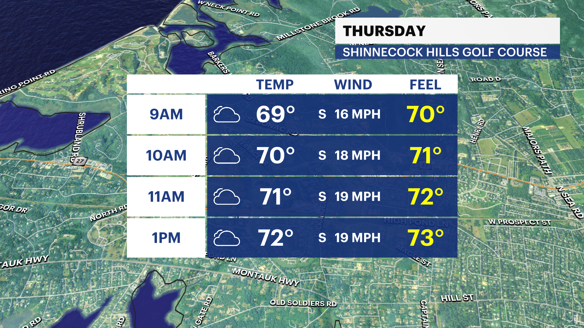
U.S. OPEN WEATHER
For round one on Thursday on Long Island, a few showers will be around, but the wind will be the bigger weather impact. The rest of the tournament looks nicer, but still a little breezy on Friday and Saturday.
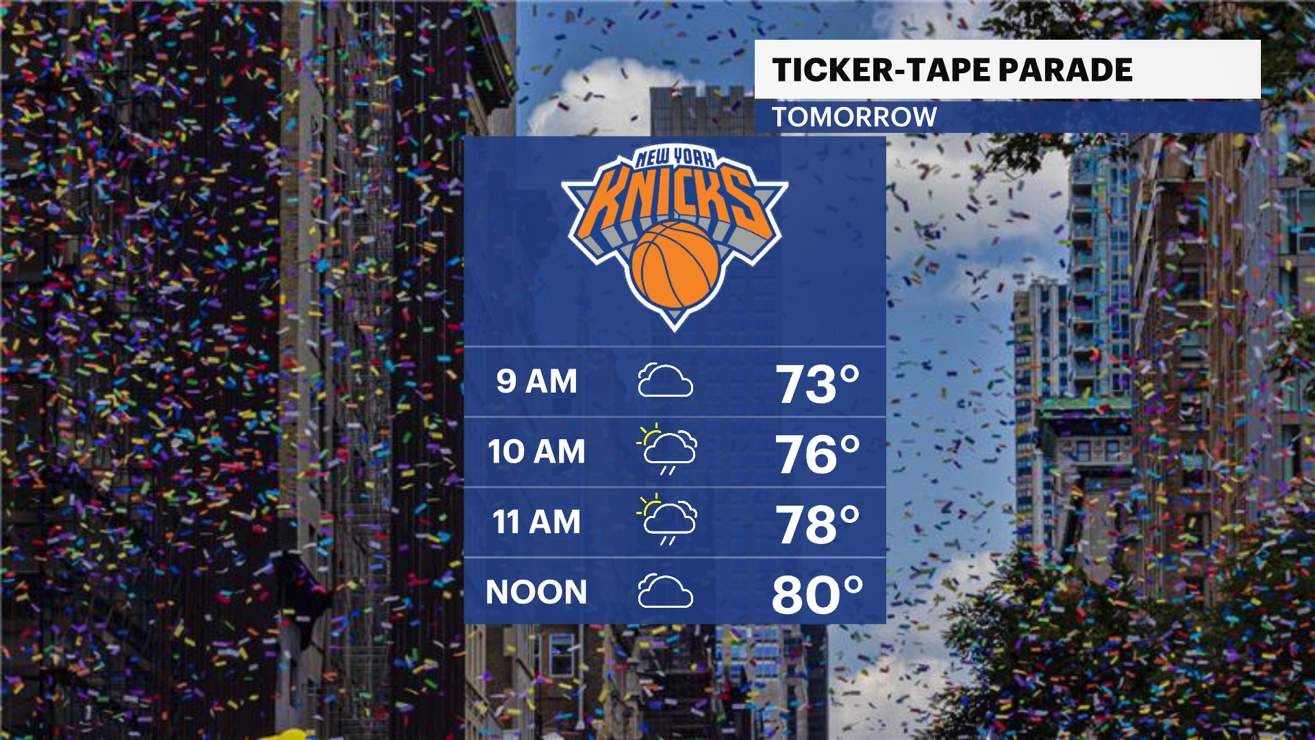
NY KNICKS TICKER-TAPE PARADE
Bring a rain jacket or poncho! Umbrellas are not allowed. We are expecting scattered rain and even a possible downpour during the parade. Have a great time if you are going, but plan on some periodic wet weather.
EXTENDED FORECAST
OVERNIGHT: A couple of evening showers are possible. Otherwise, partly to mostly cloudy with an isolated shower overnight. Lows will be mild - in the middle to upper 60s - into early Thursday morning.
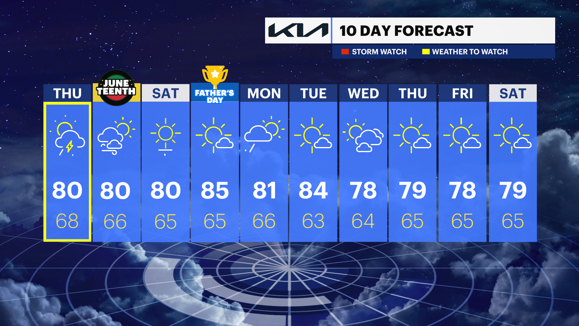
THURSDAY: SCATTERED RAIN - ISOLATED THUNDERSTORM -- Partly sunny with scattered rain showers during the morning. This may impact the Knicks parade in NYC and the US Open on Long Island from time to time. An isolated downpour is possible, too. During the afternoon, a gusty thunderstorm is also possible until around 4 p.m., but most of Long Island should not get strong thunderstorms and the afternoon is far from a complete washout. It will be windy, warm and humid all day with high temperatures mostly in the upper 70s to middle 80s. Wind gusts will be up to 35 mph at times, even without any passing thunderstorms. Lows near 68 degrees.
FRIDAY: JUNETEENTH -- Sun and clouds. Breezy and nice with highs around 80 degrees and lower humidity. Lows near 66 degrees.
SATURDAY: Sunny, breezy, nice and comfortable. Highs around 80 degrees. Lows near 65 degrees.
SUNDAY: FATHER'S DAY - SUMMER STARTS 4:24 A.M. - Mostly sunny to partly cloudy. Highs around 85 degrees. Lows near 65 degrees.
MONDAY: Mostly cloudy with periods of moderate to heavy rain possible. Highs around 81 degrees. Lows near 66 degrees.
TUESDAY: Mostly sunny. Highs around 84 degrees. Lows near 63 degrees.
WEDNESDAY: Sun and clouds. Highs around 78 degrees. Lows near 64 degrees.