A warm up before we look ahead to weekend rain in the Hudson Valley
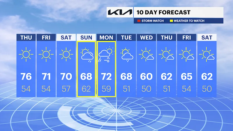
A seasonable and dry stretch takes us through most of the weekend. We're tracking our next storm early next week.
More Stories





White Plains Information
FORECAST
It was another brisk start with a decent rebound for the afternoon. Skies will remain mostly clear, making for another cool night with low temperatures settling comfortably into the mid-to-upper 50s, perfect weather for an extra blanket or a cozy sweater if you're stepping outside.
Skies will remain mostly clear, making for another cool night with low temperatures settling comfortably into the mid-to-upper 50s - perfect weather for an extra blanket or a cozy sweater if you're stepping outside.
Hold onto your light jackets because a delightful warm-up is on the way! Tomorrow bumps us up into the mid-70s, and that gorgeous combo of bright sunshine and mid-70s warmth will stick around right through Saturday.
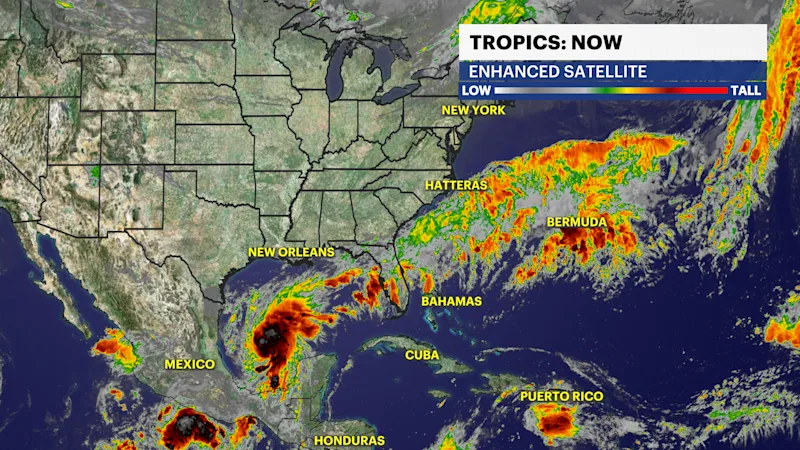
We're watching the Gulf as Tropical Storm Isaias has formed near the Yucatan Peninsula this morning. It is forecast to rapidly intensify into a hurricane by tomorrow.
The latest track brings the storm near the Gulf Coast states, with landfall as a Category 1 hurricane near the Florida Panhandle, which would make it the first hurricane of the Atlantic hurricane season.
After landfall, it is forecast to weaken and track north, bringing tropical moisture to the region Sunday into Monday. It is still too early to determine the exact track, timing and potential impacts from the remnants of Isaias.
What we do know is that there is a chance of rainfall on Sunday and Monday. Stick with your News 12 team of meteorologists for updates.
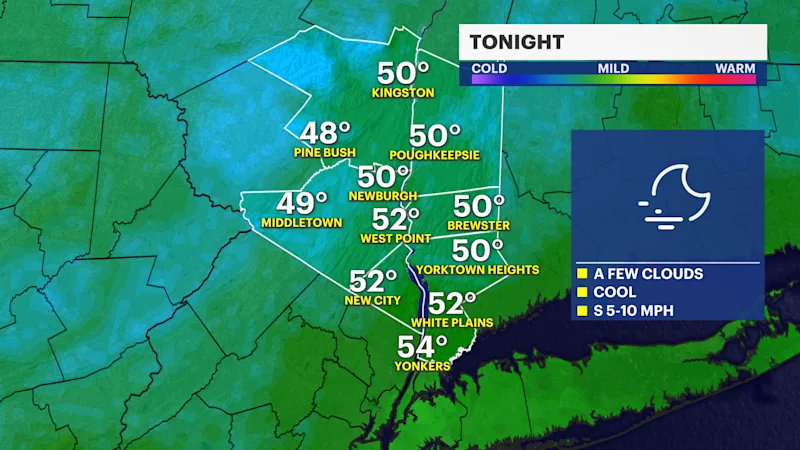
Tonight: Mostly clear and cool. Lows in the mid- to upper 50s.
Thursday: Mostly sunny and warmer. Highs in the mid-70s.
Friday: Sunny, mild and comfortable. Highs in the upper 60s to around 70.
Saturday: Sunny and seasonable. Highs in the upper 60s to around 70.
Sunday: Mostly cloudy and seasonable. Chance of PM rain. Highs in the mid- to upper 60s.
Monday: Mostly cloudy, breezy with a chance of AM showers. Highs in the upper 60s to low 70s.
Tuesday: Partly sunny, much cooler, with a chance of showers. Highs in the low to mid-60s.