Frost possible Wednesday morning as sunshine remains dominate in the Hudson Valley
Frosty conditions will develop overnight as a stretch of sunny, seasonable weather takes over through the week before shower chances increase for the second half of the weekend.
More Stories




White Plains Information
WHAT TO KNOW
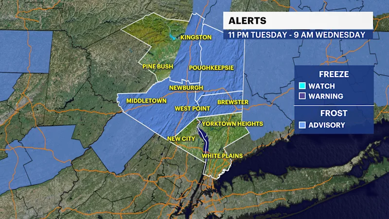
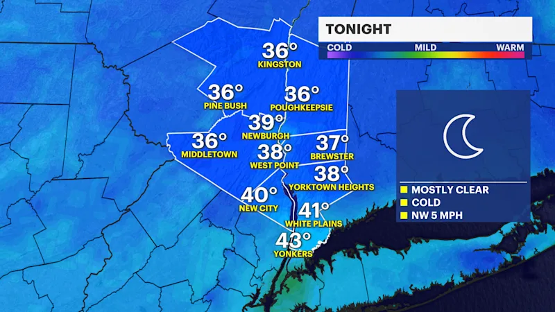
Frosty conditions are expected across parts of the region, where temperatures could drop to the 30s. Frost could harm or kill sensitive outdoor plants if left uncovered.
A chilly start will give way to plenty of sunshine Wednesday, with temperatures warming into the mid-60s. Thursday will be the warmest day of the week, with sunshine and highs climbing into the low to mid-70s.
Temperatures ease back Friday and Saturday, but sunshine sticks around. Sunday will remain mild with mostly sunny skies, although clouds will increase late ahead of the next weather system.
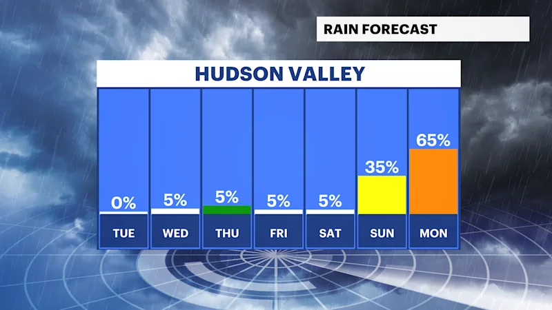
Showers become possible Sunday night and continue into Monday. The day looks mostly cloudy with a chance of showers before another round of sunshine returns Tuesday.
FORECAST
Wednesday: Sunny and pleasant, with highs in the mid- to upper 60s.
Thursday: Sunny and warmer, with highs in the low to mid-70s.
Friday: Mostly sunny and comfortable, with highs in the mid- to upper 60s.
Saturday: Sunny and seasonable, with highs in the upper 60s to around 70.
Sunday: Mostly sunny, with increasing clouds late. Highs in the upper 60s to around 70.
Monday: Mostly cloudy, with a chance of showers. Highs in the mid- to upper 60s.
Tuesday: Mostly sunny and comfortable, with highs in the upper 60s to around 70.