Leftover rain showers ahead of big improvements in the Hudson Valley
The worst of the rain is behind us, but some lingering rain showers are possible in spurts today. Then, sunshine and dry weather follow us into the weekend
More Stories


Reported Rainfall totals from the last 24 hours:
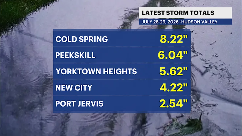
Full list can be found HERE.
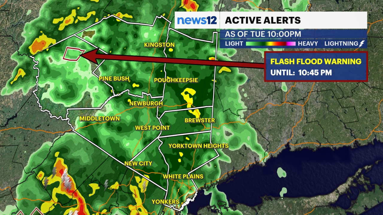
WHAT YOU NEED TO KNOW:
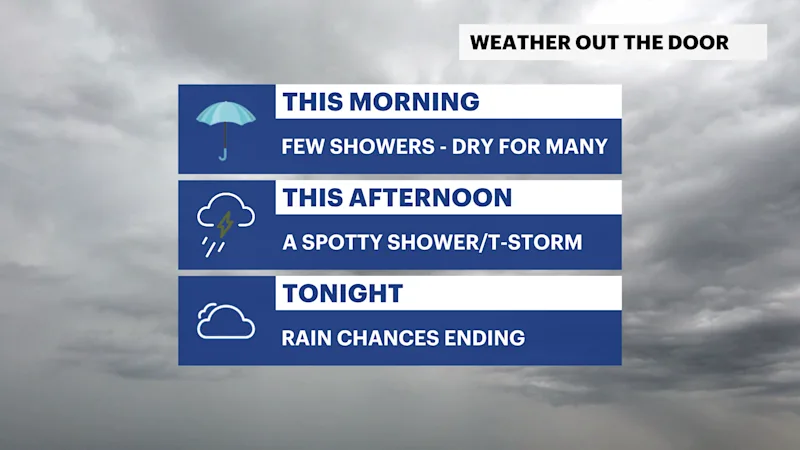
Lingering rain showers this morning
Isolated shower or thunderstorm possible this afternoon
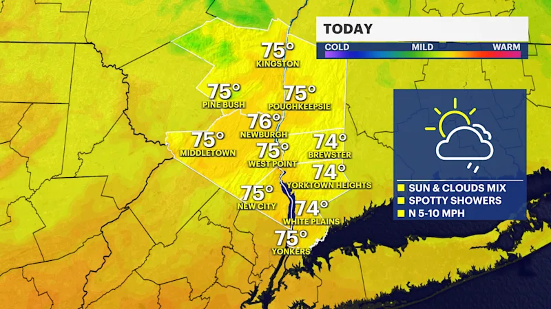
Temperatures in the mid-to-upper 70s Today
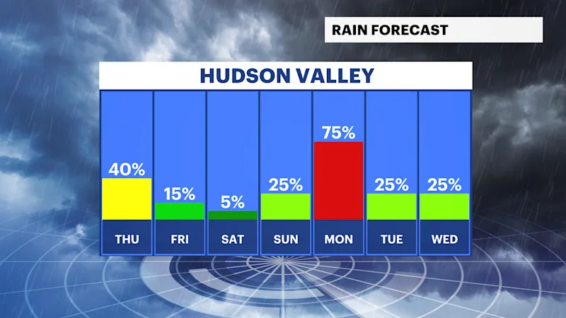
Sunshine returns on Friday
Dry through Sunday evening
Next rain chance is Sunday night into Monday
FORECAST:
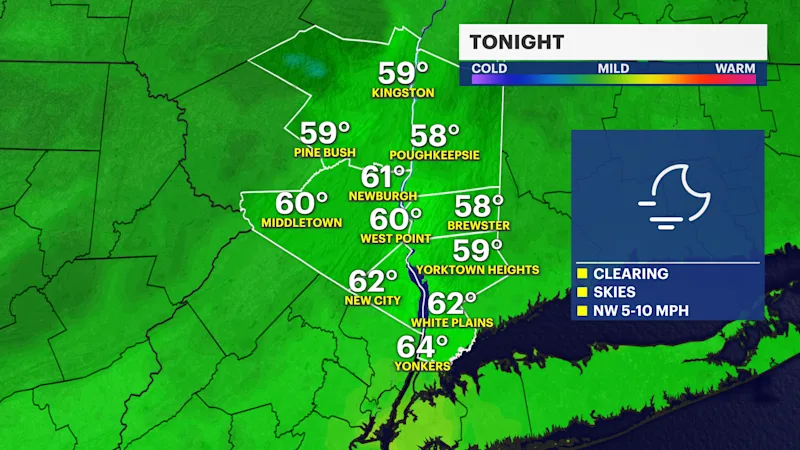
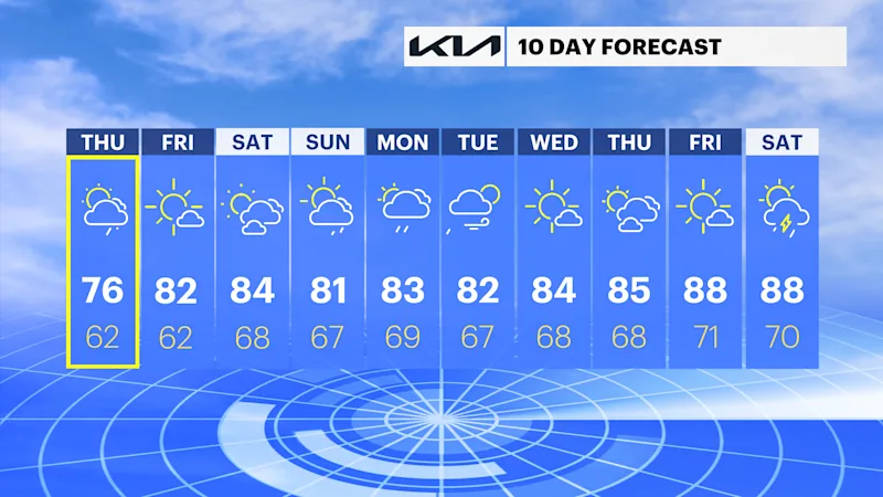
The storm system that produced widespread flooding and incredible amounts of rainfall continues to exit east today. Leftover rain showers or an isolated thunderstorm will be in spurts for today. Around sunset, you can expect skies to become clearer, and humidity to lower as drier air rushes in. Today's high temperatures will be in the mid-to-upper 70s.
Friday will be a nice reward after all the rain and flooding we experienced this week. Skies will be mostly sunny, temperatures around the low 80s, but the humidity will still be noticeable; however, not overwhelming. Friday night will continue the dry weather and be relatively comfortable.
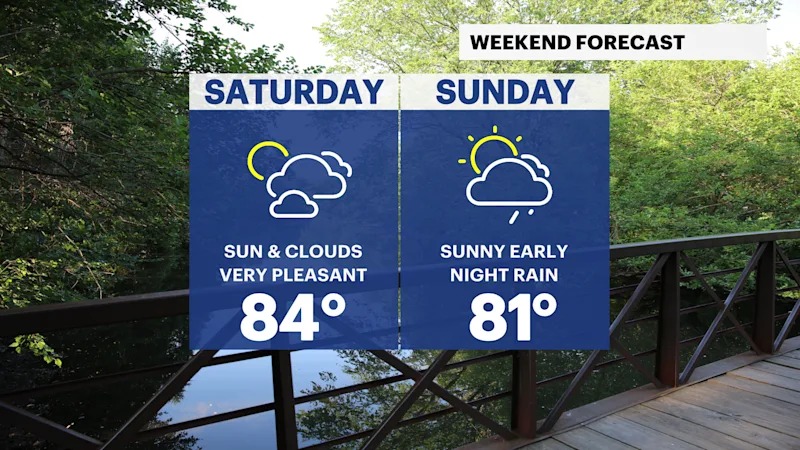
Saturday is the pick of the week. A warm day, sunshine and clouds mixing in, along with noticeable humidity levels, but again, not overwhelming. A great day to be outside, or at the beach! The nice weather follows us into Sunday under mostly sunny skies, with temperatures in the low to mid 80s all weekend.
The next rain chance will arrive Overnight Sunday into Monday, with some thunderstorms possible Monday afternoon.