STORM WATCH: Quiet tonight, then strong thunderstorms possible Tuesday into Wednesday
A developing storm system will bring rounds of showers and thunderstorms through midweek, with the greatest threat for strong to severe storms arriving Tuesday afternoon and evening.
More Stories


What to expect:
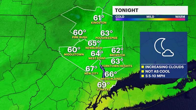
Dry weather tonight with increasing clouds.
Showers and thunderstorms develop late Tuesday morning and become widespread Tuesday afternoon through Tuesday night.
Some storms could become strong to severe, producing damaging winds, large hail, and an isolated tornado.
Localized flooding is possible, but widespread flash flooding is not expected at this time.
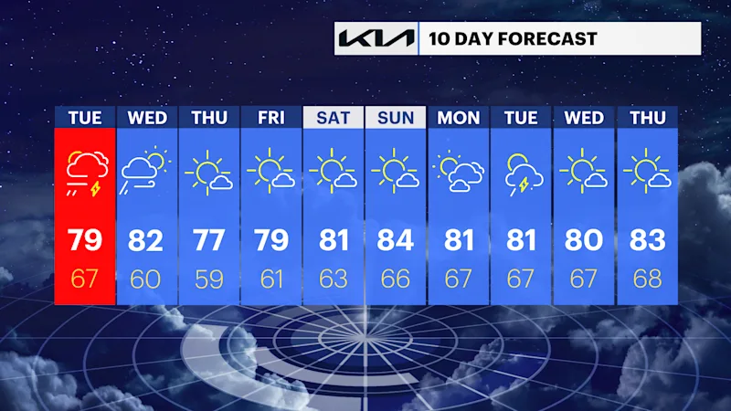
Dry, comfortable weather returns Thursday into the weekend.
Tonight
Increasing clouds with mild overnight temperatures. Dry conditions continue as moisture begins to increase ahead of the next storm system.
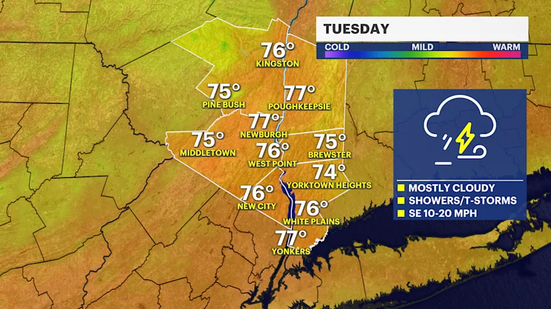
Tuesday
Clouds thicken during the morning with showers developing by late morning. Thunderstorms become more numerous during the afternoon, and some may become strong to severe. The primary threat will be damaging wind gusts, but large hail is also possible. An isolated tornado cannot be ruled out, especially near the advancing warm front if sufficient instability develops.
Tuesday night
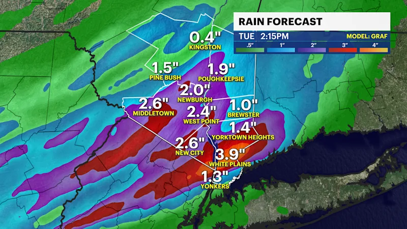
Showers and thunderstorms remain likely through much of the evening, then gradually become more scattered overnight. Heavy downpours will accompany stronger storms, with localized flooding possible in poor-drainage areas.
Wednesday
Additional showers and thunderstorms develop as the trailing cold front crosses the region. While the severe threat should be lower than Tuesday, a few stronger storms may still produce gusty winds and brief heavy rainfall before conditions improve later in the day.
Wednesday night
Showers gradually end during the evening with clearing skies and noticeably lower humidity arriving overnight.
Thursday
Sunny, cooler, and much less humid with refreshing summer weather.
Friday
Sunny and pleasant with seasonable temperatures and comfortable humidity.
Weather alerts, watches, and hazards
No active watches or warnings

Weather hazards for the Hudson Valley at this time.
Strong to severe thunderstorms (Tuesday afternoon through Tuesday evening):
Tuesday will have the highest potential for impactful weather. Conditions may support damaging wind gusts, large hail, and even a low risk for an isolated tornado, depending on how much sunshine develops ahead of the storms.
Heavy rainfall and localized flooding (Tuesday through Wednesday):
Thunderstorms will be capable of producing rainfall rates of 1 to 2 inches per hour. Storms are expected to keep moving, reducing the risk of widespread flash flooding, but localized nuisance flooding of poor drainage areas, low-lying roads, and small streams remains possible. Rainfall totals of 1 to 2 inches are expected, with isolated amounts approaching 3 inches.
Gusty winds outside of thunderstorms:
Southeast winds Tuesday may gust over 20 mph ahead of the approaching storm system before shifting southwest behind the warm front.
Improving conditions late week:
High pressure builds in Thursday through the weekend, bringing sunshine, lower humidity, and several days of quiet, comfortable summer weather.