STORM WATCH: Extreme heat and humidity set to trigger severe storms in western Connecticut Thursday
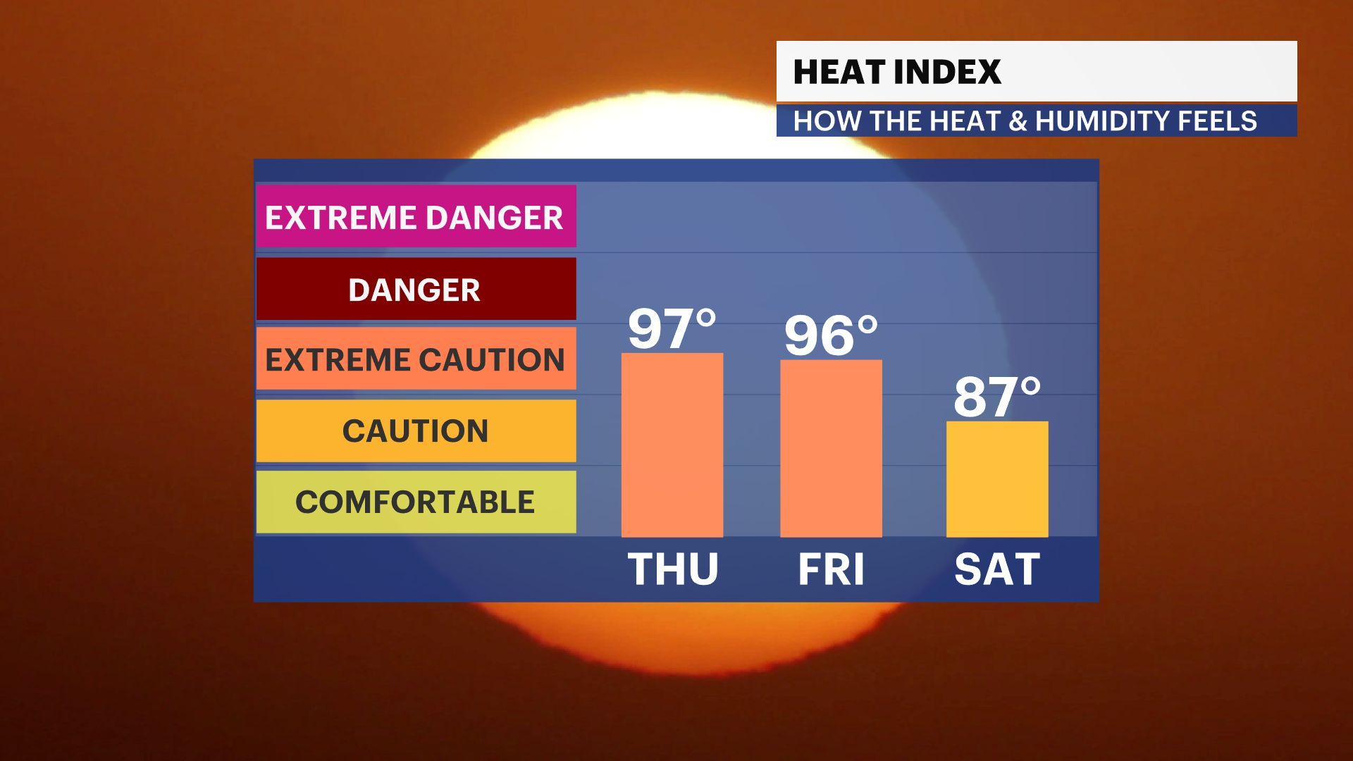
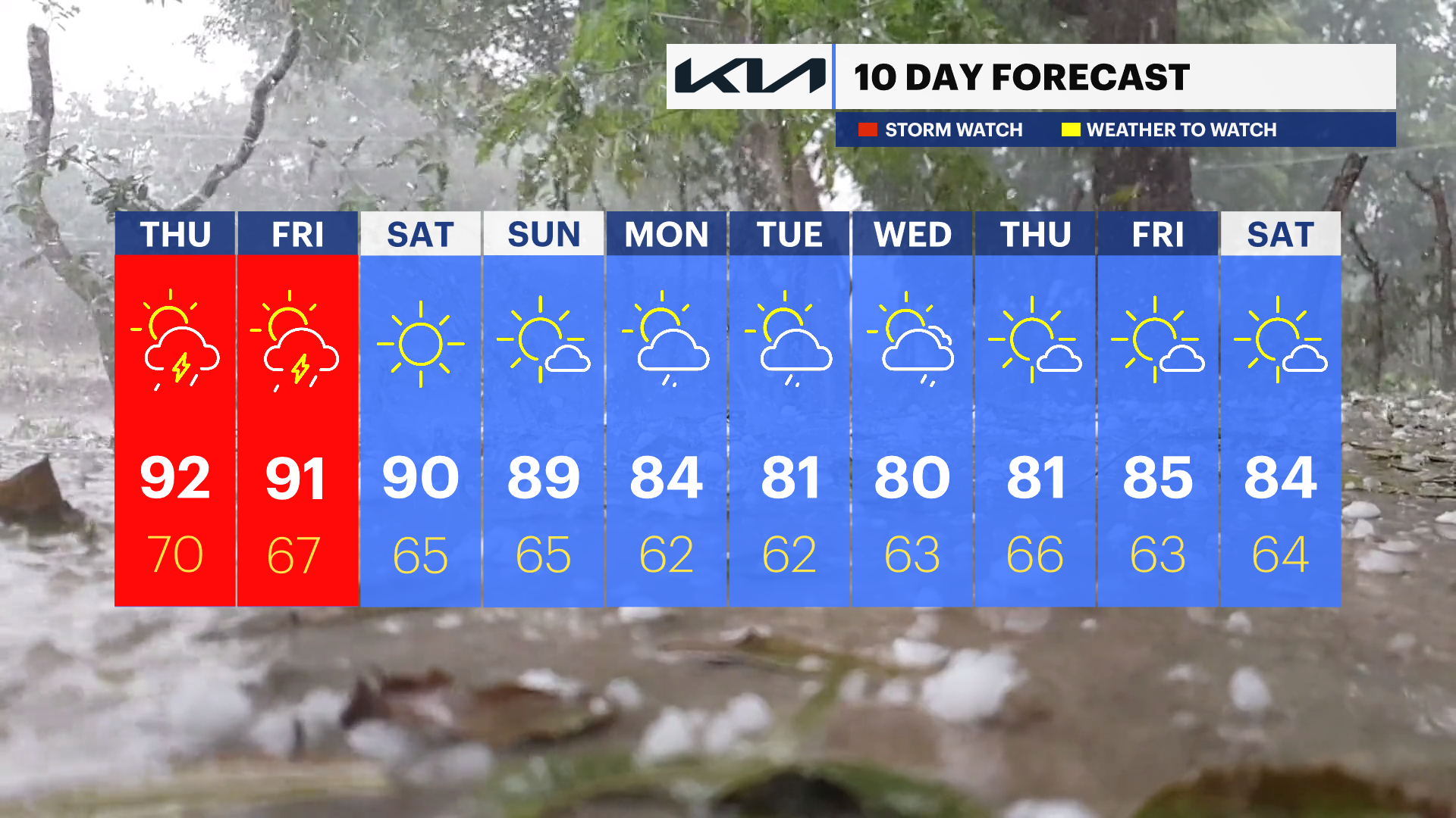
The heat index will approach 100 degrees on Thursday and Friday.
More Stories
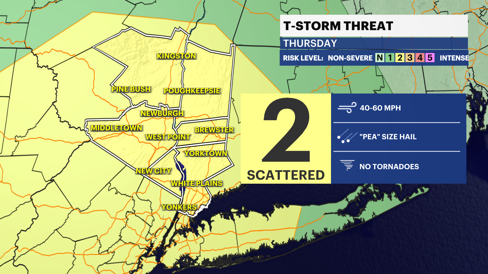


Be sure to stay weather-aware the next few days. It's all about the high heat, humidity and thunderstorms. Some storms could potentially become strong or severe with damaging winds and large hail. Localized heavy rain may also lead to flash flooding in spots.
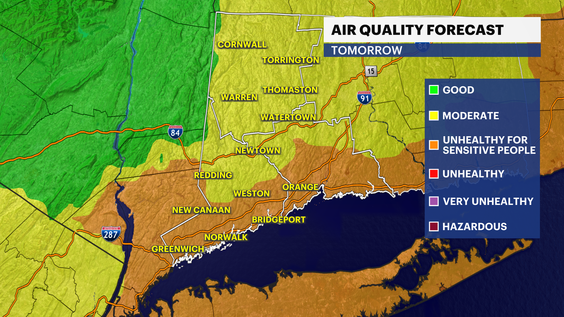
The National Weather Service has extended the heat advisory for Fairfield, New Haven and Litchfield counties from noontime Thursday through Friday night. There is also an Air Quality Alert for sensitive groups in southern Fairfield County. Moderate air quality is forecasted north.
With such extreme conditions, heat illnesses can strike. Take steps to stay cool and healthy during this weather, including staying out of the direct sun. Take breaks when working outdoors. Drink plenty of water to stay hydrated, and also make sure the pets have water and cooler conditions.
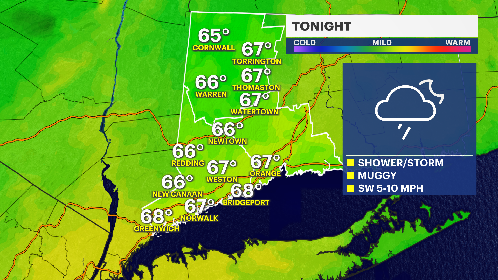
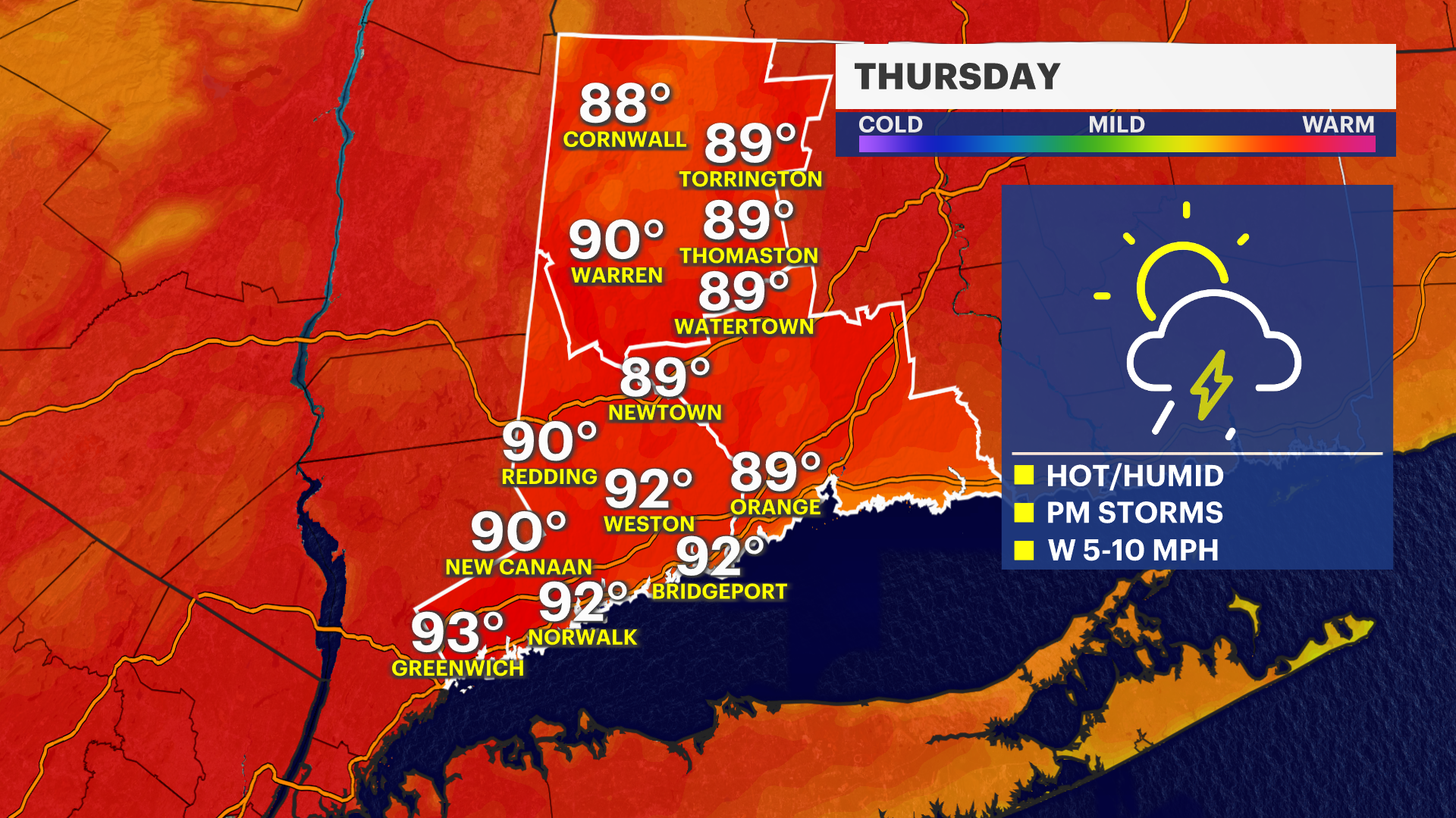
Some showers and thunderstorms are likely here late tonight and then again over the next few days. The difference for tomorrow will be temperatures in the lower 90s with high humidity. This is perfect fuel for thunderstorms to grow in and become severe later in the day. The best chance at seeing storms will be Thursday evening and then again late afternoon through the evening hours on Friday.
Friday's storms come with a cold front that will cross the area late, dropping humidity levels for the weekend. The weekend will still be hot with temperatures in the upper 80s to near 90.
Be sure to check back in for more updates on the dangerous heat and storms.