Sunny and warm Monday in the Hudson Valley before risk of strong storms, heavy rain Tuesday into Wednesday
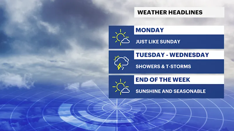
Pleasant weather holds through Monday before a much more active pattern returns with the potential for flooding, damaging winds and hail by midweek.
More Stories


What to expect:
Dry, comfortable weather continues through Monday, with seasonable temperatures and low humidity.
A warm front lifts north Tuesday, bringing increasing humidity and multiple rounds of showers and thunderstorms Tuesday afternoon through Wednesday.
Some storms could become strong to severe with torrential rainfall, damaging wind gusts, large hail and localized flash flooding.
Drier, quieter weather returns late Thursday into the weekend.
FORECAST
Overnight
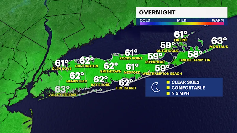
Clear skies, with comfortable overnight conditions. Light northwest winds and low humidity make for an excellent evening.
Monday
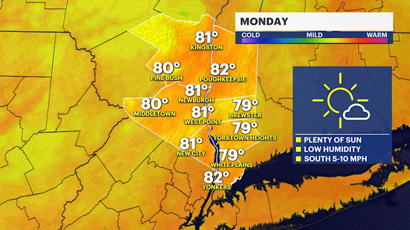
Sunny and seasonably warm, with comfortable humidity. A beautiful midsummer day with light winds.
Monday night
Clouds gradually increase as moisture begins returning ahead of the next storm system. Dry through the night.
Tuesday
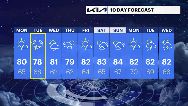
Clouds increase, with showers and thunderstorms developing during the afternoon. Some storms may become strong or severe, with heavy downpours, gusty winds and hail. Localized flooding will be possible where storms repeatedly move over the same locations.
Tuesday night
The most active period of the forecast. Numerous showers and thunderstorms continue, with torrential rainfall possible. Rainfall rates of 1" to 2" per hour may produce localized flash flooding, especially in poor drainage and low-lying areas. Strong to severe storms remain possible.
Wednesday
Additional showers and thunderstorms remain possible, especially if the cold front is slower to move through. Some storms could still produce heavy rain and gusty winds before conditions gradually improve later in the day.
Wednesday night
Showers diminish during the evening, with skies gradually clearing overnight as drier air moves in.
Thursday
Sunny, less humid and comfortable, with seasonable temperatures.
Friday
Mostly sunny, with pleasant summer weather continuing.
Weather alerts, watches, and hazards
No active watches or warnings are in effect for the Hudson Valley at this time.
Weather hazards
Strong to severe thunderstorms (Tuesday afternoon through Wednesday):
Damaging wind gusts and large hail are possible if enough sunshine allows the atmosphere to become unstable ahead of the approaching cold front.
Heavy rainfall and localized flash flooding (Tuesday afternoon through Tuesday night):
A very moisture-rich atmosphere will support torrential downpours, with rainfall rates of 1" to 2" per hour. Areas that receive repeated storms could experience localized flooding of roads, poor drainage areas and small streams.
Changing forecast confidence for Wednesday:
The timing of the cold front will determine how long showers and thunderstorms linger. A slower front would extend the threat later into Wednesday, while a faster passage would bring improving conditions sooner.
Improving conditions late week:
High pressure builds back into the region Thursday through the weekend, bringing lower humidity, sunshine and dry weather.