Heavy rain moves out with improving conditions to finish the week
Quiet evening ahead with seasonal temperatures for the next few days!
More Stories


Reported Rainfall totals from the last 24 hours:

Full list can be found HERE.
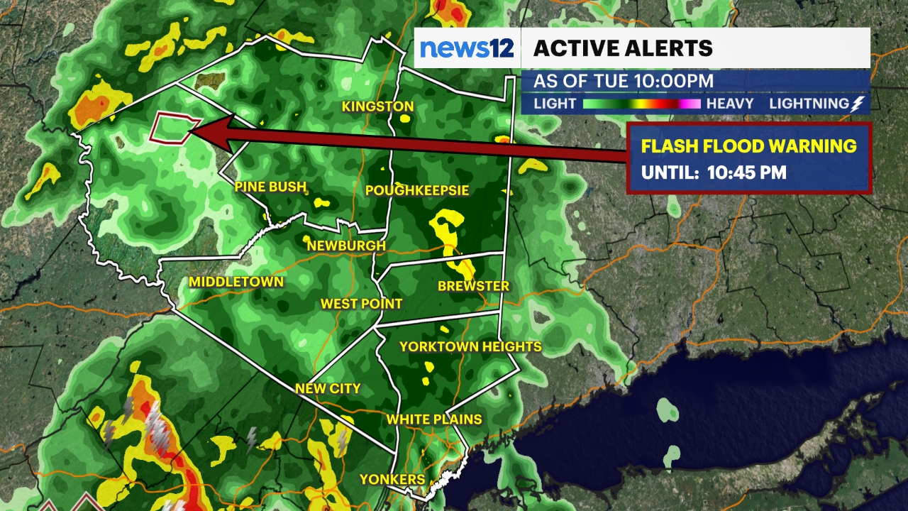
WHAT YOU NEED TO KNOW:
We've been tracking another round of significant rainfall across the region today, but conditions will continue to settle down as this slow-moving storm system gradually makes its exit. While the main rain pivot shifts further north and west, expect a few lingering, spotty showers through this evening, overnight, and into Thursday.
Temperatures will remain cooler than normal to round out the workweek. While sunshine will be tough to come by initially, Thursday offers a brief chance for the sun to peek through before a true clearing arrives by Friday afternoon.
Looking ahead, the weekend is shaping up nicely, with Saturday taking the crown as our pick of the week expect mostly sunny skies, comfortable humidity, and temperatures right where they should be. Sunday starts off just as bright and pleasant, but we're keeping a close eye on our next system approaching with a chance of rain late Sunday night.


