Turning up the warmth while the sun keeps shining brightly
Temperatures will move up to near-record levels into the weekend. Rain chances will be rising by that time though.
More Stories


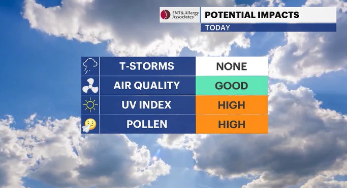
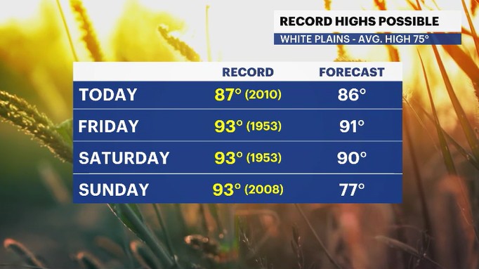
If you are a fan of warmer temperatures but without rising humidity, you will really like today in the Hudson Valley! Yesterday was a picture-perfect, TOP 10 weather day for us. Today, we'll turn up the warmth by several degrees, have fair skies but see a little more humidity come our way. The morning hours will start off mild and sunny. By midday, expect to feel that warmer feeling in the air and see a few clouds up above. If you are out in direct sunlight, you may feel a sizzling feeling after a while because the UV index is running high today. Sunscreen should be applied if you are going to be out for a prolonged period of time in direct sunlight. The afternoon hours will see the UV index slowly go down, while the air will feel warm and partly cloudy skies will be up above. Temperatures could towards record levels before the day is done today. The record is 87 degrees (set in 2010) and the forecast high is 86 degrees.
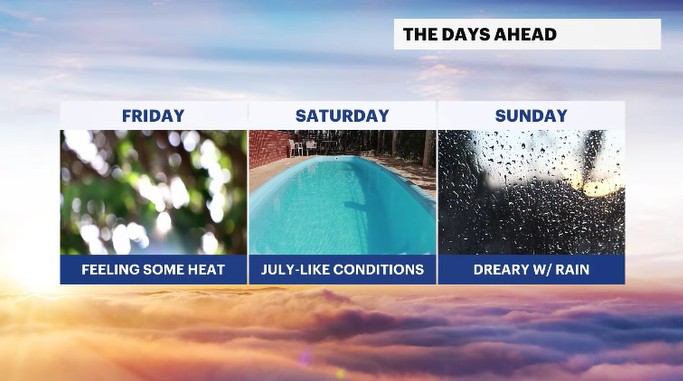
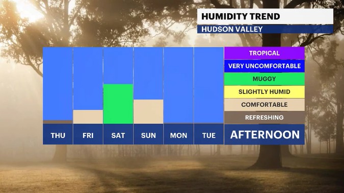
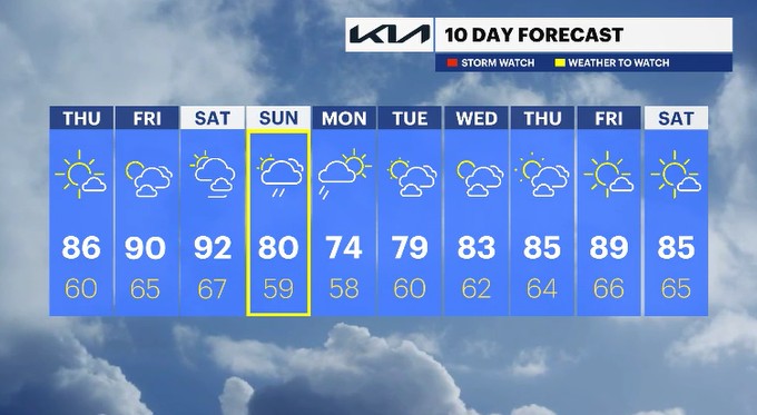
The warmer trend will continue into Friday and Saturday, with the humidity slowly rising by the weekend. The record high for both Friday and Saturday is 93 degrees (both set in 1953). We'll see high temps climb into the low 90s. So, we may see temperatures challenging records right into the weekend. Along the way, the skies will be fair, with a mix of sun and clouds going from the work week to the weekend. But we have a storm system approaching the Northeast, we have to keep our eyes on. It will bring increasing rain chances for the weekend.
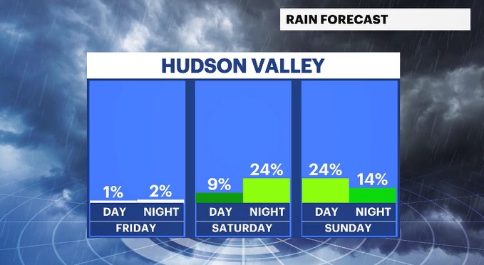
Rain chances will rise through the second half of the day on Saturday. Most locations will be dry through the daytime hours. Closer towards sunset though; batches of showers will be approaching. An isolated thunderstorm can't be ruled out late in the day. Sunday has on and off rain with an isolated thunderstorm chance as well. Temperatures will be cooler Sunday than Saturday but still trending either at or above the normal high of 75 degrees.
Rain showers will linger into Monday as temperatures trend into the 70s. Looking forward through next week, warmer temperatures will gradually return to the region.
ALMANAC:
Average High: 75 | Average Low: 56
Record High: 87 (2010) | Record Low: 44 (2023)
Sunrise: 5:24 a.m. | Sunset: 8:22 p.m.
THE FORECAST:
TODAY: Mostly sunny with rising temps to warmer levels. Highs: mid-80s.
TONIGHT: Partly cloudy with a light to calm breeze. Lows: mid-50s to low 60s.
FRIDAY: Partly cloudy, feeling hotter and more humid. Highs: upper 80s to low 90s. Lows: mid-60s.
SATURDAY: Partly cloudy skies with breezy winds and temps feeling hot and humid. Highs: upper 80s to low 90s. Lows: mid-60s.
SUNDAY: WEATHER TO WATCH - Mostly cloudy with a chance for rain and isolated thunderstorms. Highs: upper 70s to low 80s. Lows: upper 50s to low 60s.
MONDAY: Morning showers fade to drier skies. Highs: mid-70s. Lows: upper 50s.