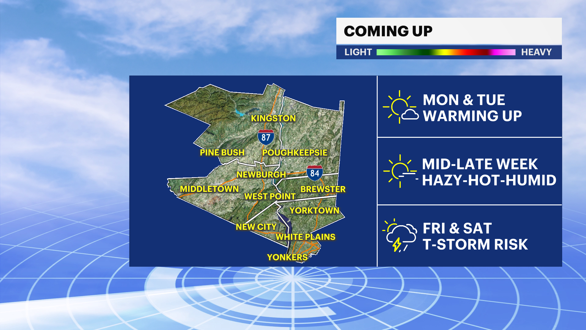
Warm and increasingly humid across the Hudson Valley through Tuesday, then dangerous heat builds for the second half of the week
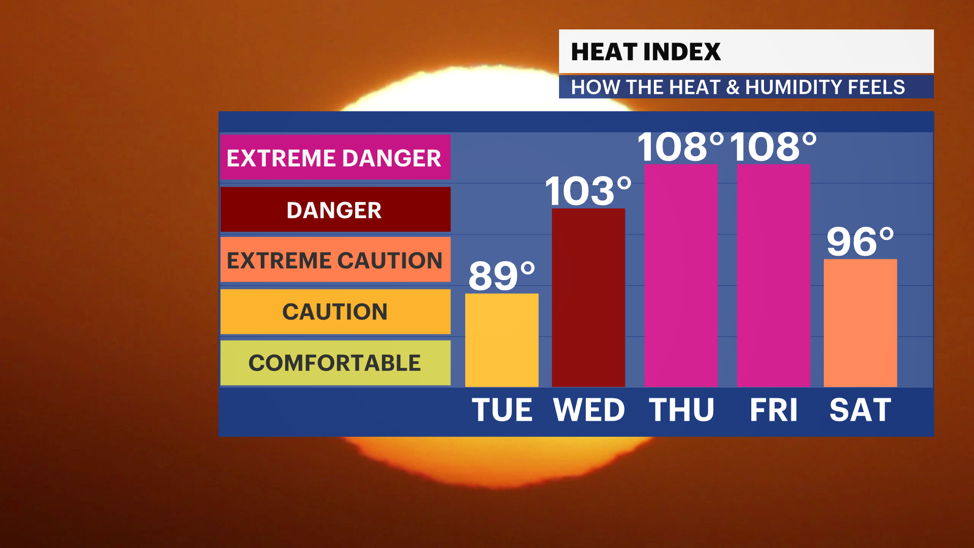
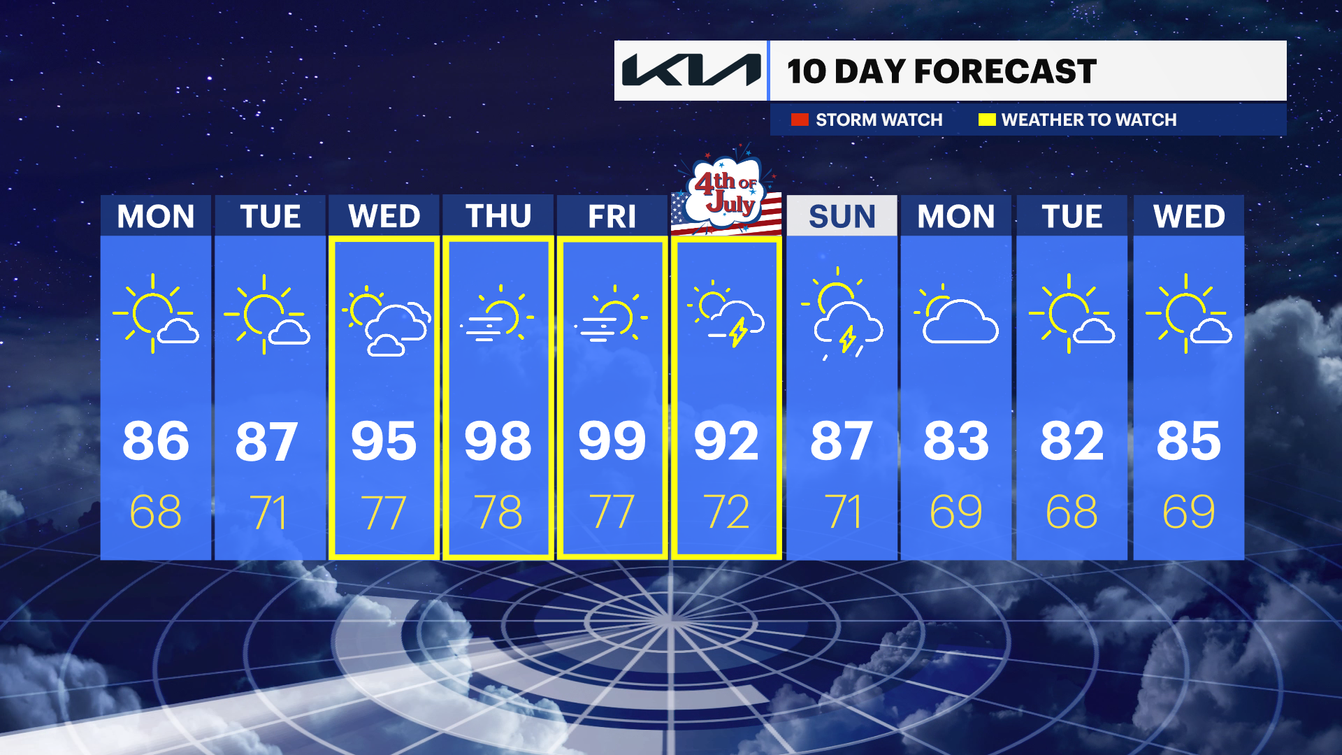
Summer heat rapidly intensifies beginning Wednesday, with the hottest weather expected Thursday and Friday. Heat indices could approach or exceed 100, and an isolated thunderstorm becomes possible by next weekend.
More Stories


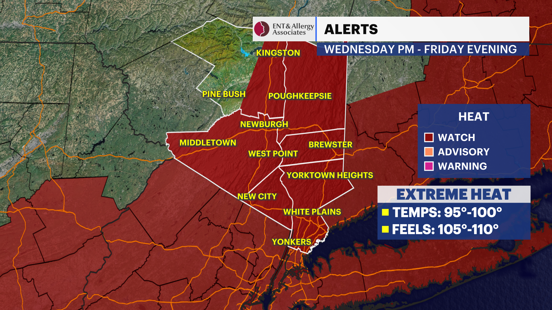
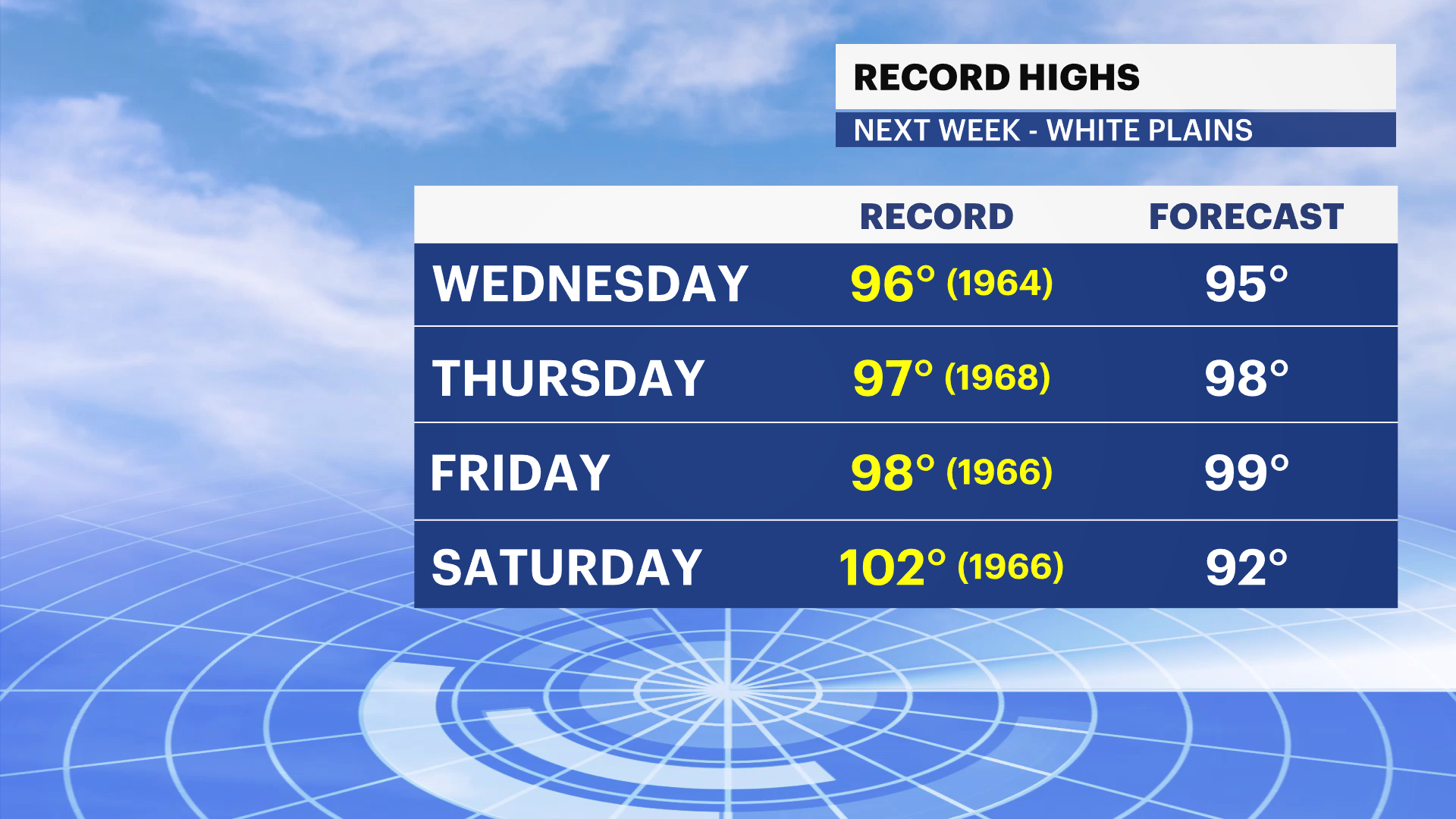
Alert: Excessive heat watch will be in effect from Wednesday afternoon through Friday evening.
What to Expect
Warm, mainly dry weather continues through Tuesday with gradually increasing humidity.
Heat ramps up quickly Wednesday through Friday as a strong upper-level ridge expands into the Northeast.
Thursday and Friday will likely be the hottest days, with widespread mid- to upper 90s and heat indices near or above 100.
Mild, muggy nights in the 70s will offer limited relief from the daytime heat.
Isolated afternoon and evening thunderstorms become possible by Saturday, with additional scattered showers possible Sunday as the pattern begins to break down.
Forecast
Overnight: Partly cloudy, warm and becoming more humid. Temperatures in the low 60s.
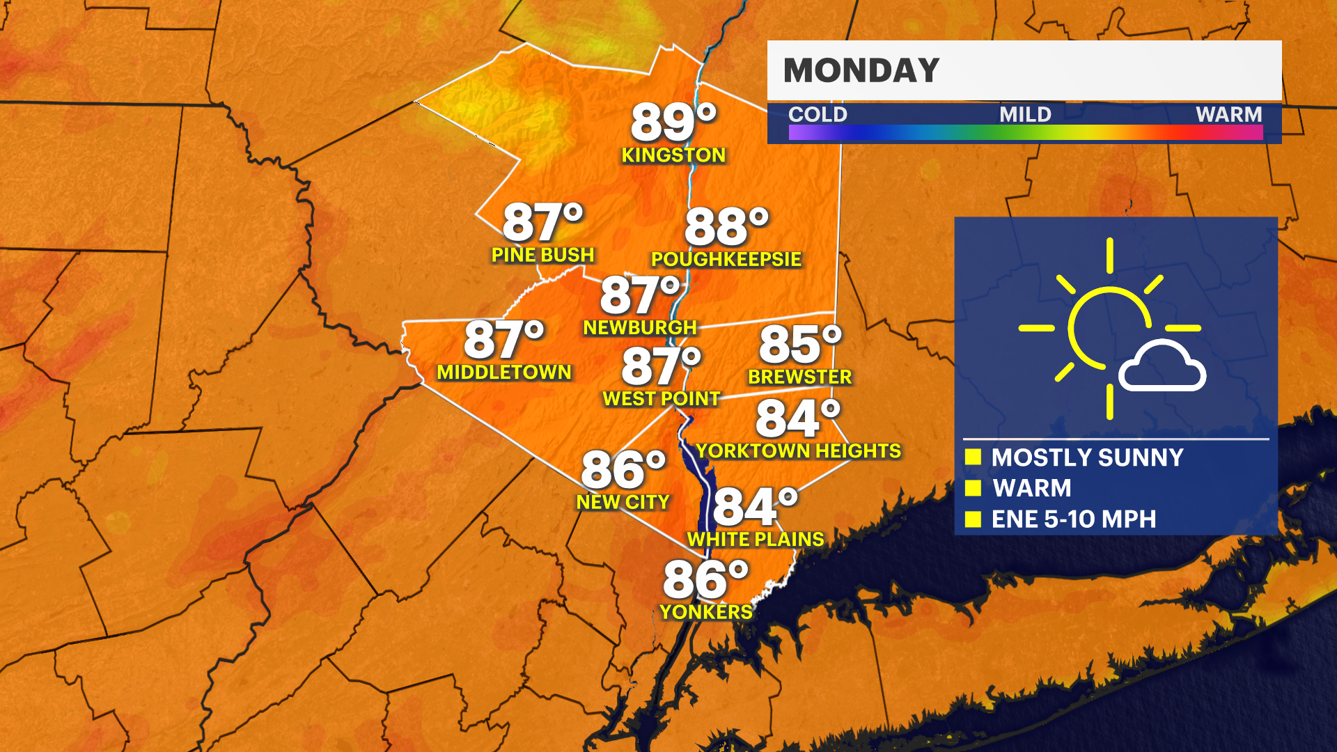
Monday: Partly sunny, warm and slightly more humid. Temperatures in the low to mid-80s.
Tuesday: Mostly sunny and very warm. Temperatures in the upper 80s.
Wednesday: Mostly sunny, hot and increasingly humid. Temperatures in the low-90s.
Thursday: Sunny and dangerously hot. Temperatures in the mid- to upper 90s, with heat index values around or above 100.
Friday: Mostly sunny and oppressively hot. Temperatures in the mid- to upper 90s.
Saturday: Hot and humid, with a mix of sun and clouds. An afternoon or evening thunderstorm is possible. Temperatures in the low to mid-90s.
Sunday: Partly sunny, still very warm and humid, with scattered afternoon showers and thunderstorms possible. Temperatures in the mid- to upper 80s.