Record high temperatures expected for the Hudson Valley Sunday before midweek cooldown
Storm Watch meteorologist Meredith Garofalo says daily record high temperatures are expected to be broken again Sunday and Monday before a cool-down Tuesday.
•
Nov 5, 2022, 12:21 PM
•
Updated 672 days ago
Share:
More Stories
2:09

Saturn to be visible this weekend, with best viewing on Sunday
22h ago1:39

Why has hurricane season quieted down?
2ds ago
LIVE BLOG: News 12 weather updates
10ds ago1:04

Cooler temperature trend into start of meteorological fall
10ds ago1:34

Greenwood Lake leaders warn visitors to use common sense in the heat
10ds ago2:26

Heat & humidity strengthen, storm chances weaken, to bring a pleasant end to week
11ds ago2:09
Saturn to be visible this weekend, with best viewing on Sunday
22h ago1:39
Why has hurricane season quieted down?
2ds agoLIVE BLOG: News 12 weather updates
10ds ago1:04
Cooler temperature trend into start of meteorological fall
10ds ago1:34
Greenwood Lake leaders warn visitors to use common sense in the heat
10ds ago2:26
Heat & humidity strengthen, storm chances weaken, to bring a pleasant end to week
11ds agoStorm Watch meteorologist Meredith Garofalo says daily record high temperatures are expected to be broken again Sunday and Monday before a cooldown Tuesday.
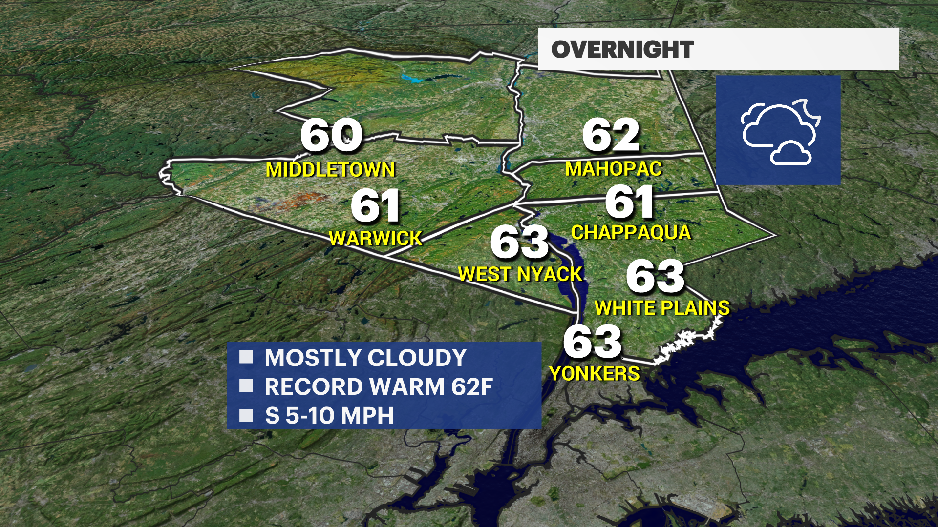
OVERNIGHT: Partly cloudy with increasing clouds overnight. Breezy and muggy. Lows: in the low 60s.
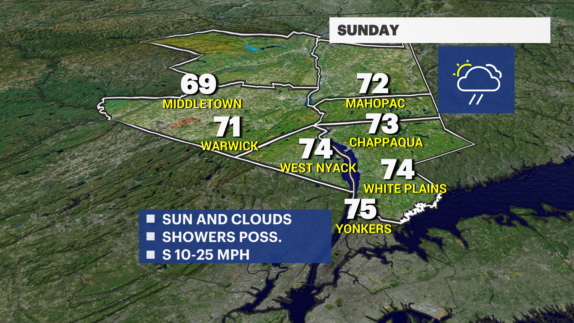
SUNDAY: Record warm temperatures expected again. Mostly cloudy & muggy. Passing afternoon showers. Highs in the low to mid-70s. Lows in the low 60s.
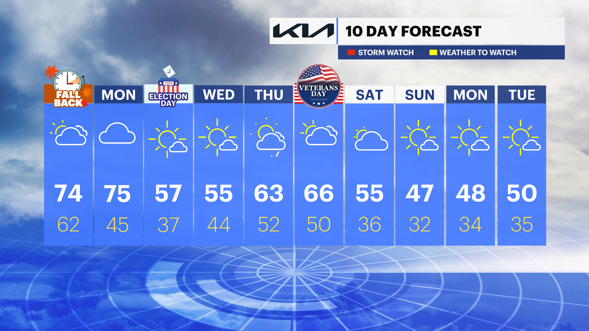
MONDAY: Cloudy early, then more sunshine. Isolated showers possible. Record temperatures expected. Highs in the mid-70s. Cooler overnight with lows in the 40s.
TUESDAY: ELECTION DAY – Mostly sunny, seasonably cool. Breezy Highs in the upper-50s. Lows in the 30s.
WEDNESDAY: Mostly sunny and seasonably cool. Highs in the 50s. Lows near 44.
THURSDAY: Partly cloudy & mild. Highs: mid-60s. Lows in the 50s.
FRIDAY: VETERANS DAY – Mostly cloudy with showers. Highs: mid-60s. Lows near 50.
More from News 12
2:09

Emergency sewer repair project in Greenburgh stinks – but it’s necessary, officials say
1:57

Chilly morning, pleasant afternoon Sunday in the Hudson Valley
1:58

Residents learn more about $12.9M facelift proposal for Nanuet Public Library
0:48

Rain doesn't damper celebration at 13th annual Italian Feast and Festival in Tappan
0:53

Nearly $2 million to fund intelligence center, body cameras for Orange County law enforcement
2:00
