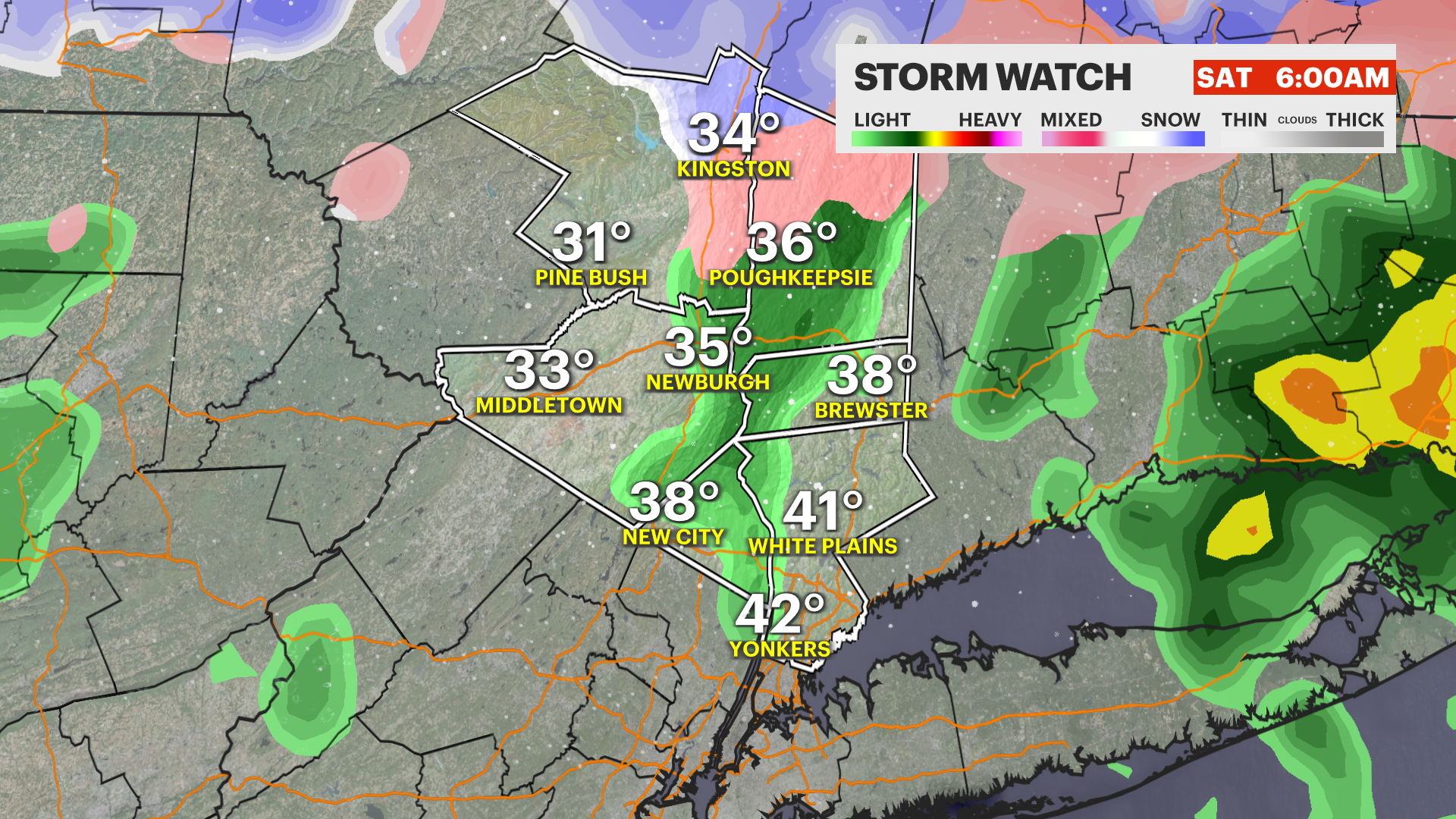
STORM WATCH: Wintry mix through the overnight hours; 3-plus inches of snow north of I-84
News 12 Storm Watch Team Meteorologist Meredith Garofalo says the lower Hudson Valley will see a wintry mix into the overnight hours with snow accumulations of 3-plus inches north of I-84.
•
Mar 3, 2023, 11:39 AM
•
Updated 553 days ago
Share:
More Stories
1:39

Why has hurricane season quieted down?
2ds ago1:53

Record rainfall: The deadly flooding by the numbers
19ds ago1:43

Tri-state drought monitor for Aug. 14, 2024
24ds ago0:28

Close call: Tree branch falls near News 12 crew covering Debby's impact in Rockland
28ds ago1:09

Heavy rain from Debby spares flooding on Rockland County's Route 59
28ds ago1:24

Major road closures in Yorktown after storm damages trees, power lines
29ds ago1:39
Why has hurricane season quieted down?
2ds ago1:53
Record rainfall: The deadly flooding by the numbers
19ds ago1:43
Tri-state drought monitor for Aug. 14, 2024
24ds ago0:28
Close call: Tree branch falls near News 12 crew covering Debby's impact in Rockland
28ds ago1:09
Heavy rain from Debby spares flooding on Rockland County's Route 59
28ds ago1:24
Major road closures in Yorktown after storm damages trees, power lines
29ds agoNews 12 Storm Watch Team Meteorologist Meredith Garofalo says the lower Hudson Valley will see a wintry mix into the overnight hours with snow accumulations of 3-plus inches north of I-84.
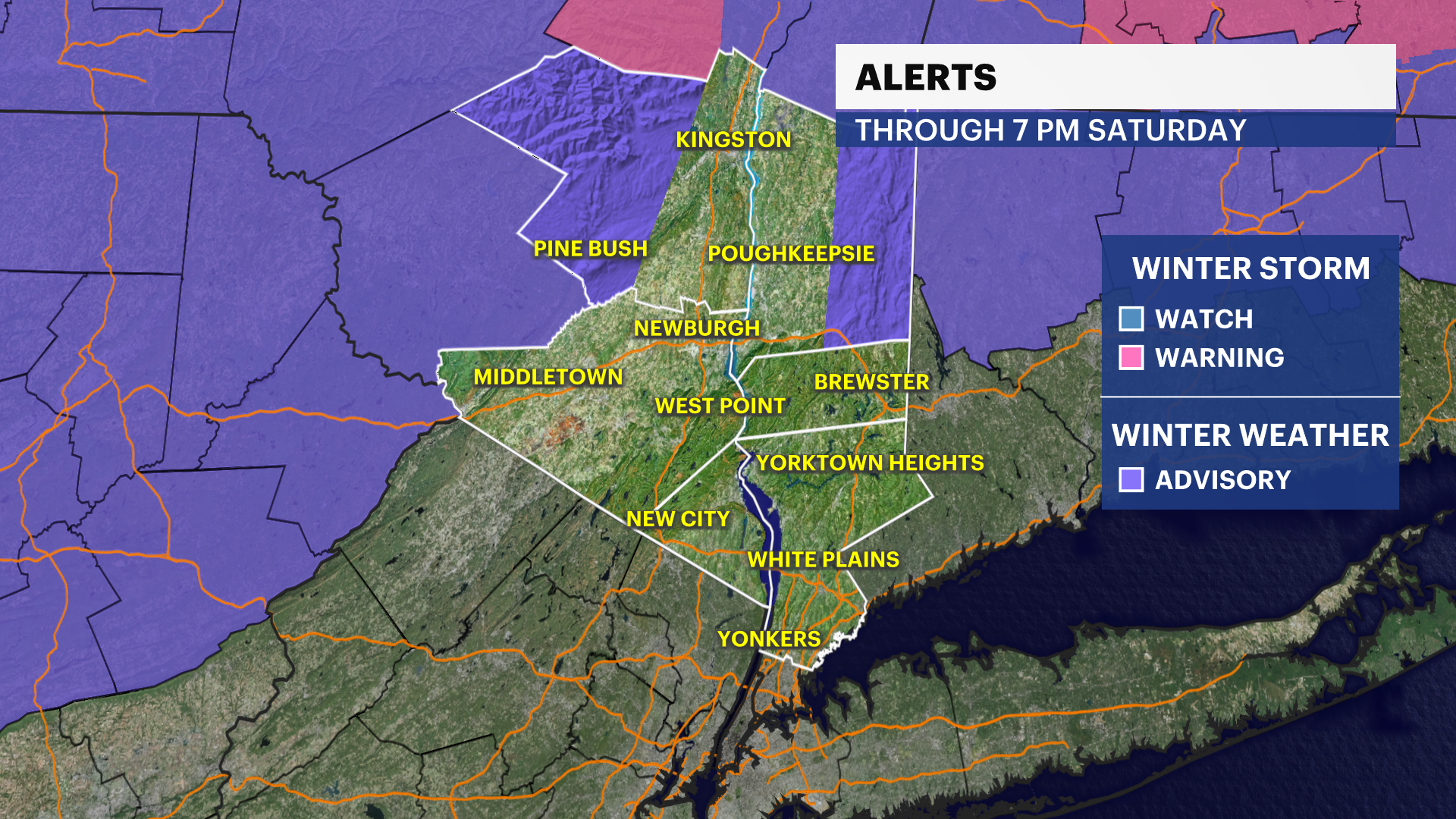
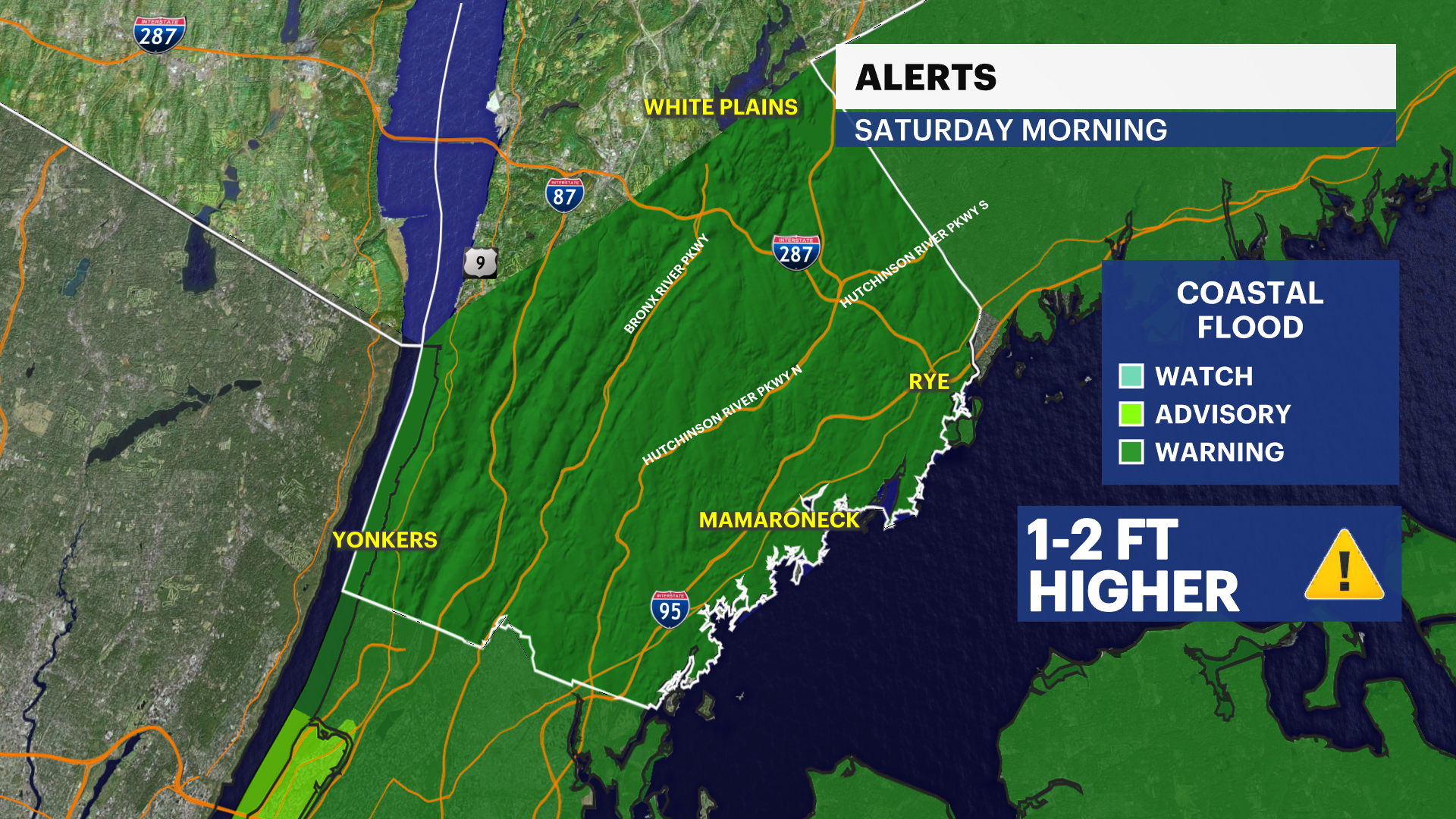
NEW: Coastal flood warning at high tide Saturday morning along the Sound Shore.
NOW: Precipitation continues through Saturday morning. There could be strong to potentially damaging winds overnight with isolated thunderstorms.
NEXT: Drying out and warming up the rest of the weekend.
FORECAST:
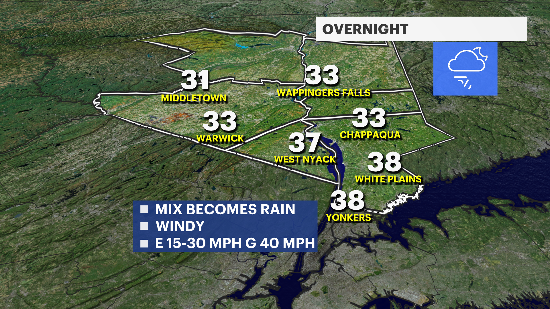
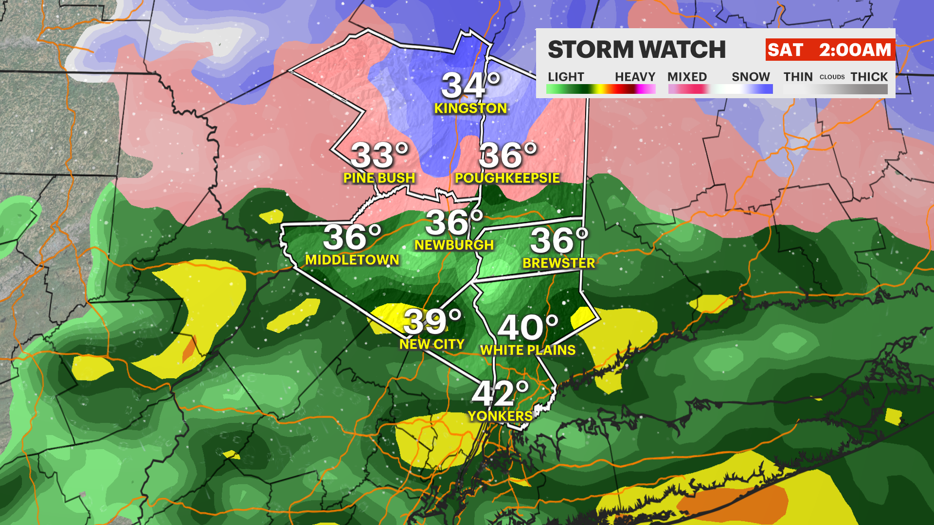
OVERNIGHT: Southwest rain to snow and sleet turns back into all rain for the lower Hudson Valley early. Little to no accumulation for Rockland and Westchester counties. Ulster and Dutchess counties will see snow through midnight, but change into sleet or mix during the early morning. Over 3 inches is possible north of I-84. Windy with gusts over 40 mph expected.
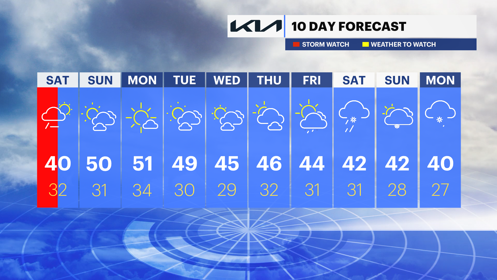
SATURDAY: Cloudy with some rain or snow showers early. Clearing into the afternoon. Highs near 40, lows in the 30s.

SUNDAY: Partly sunny with highs near 50. Lows near 31.
MONDAY: Mostly sunny with highs in the 50s. Lows in the 30s.
MIDWEEK: Pleasant weather expected through Thursday with seasonably mild temperatures. Rain or snow returns next Friday with colder weather through mid-month.
More from News 12
2:09

Emergency sewer repair project in Greenburgh stinks – but it’s necessary, officials say
1:57

Chilly morning, pleasant afternoon Sunday in the Hudson Valley
1:58

Residents learn more about $12.9M facelift proposal for Nanuet Public Library
0:48

Rain doesn't damper celebration at 13th annual Italian Feast and Festival in Tappan
0:53

Nearly $2 million to fund intelligence center, body cameras for Orange County law enforcement
2:00
