STORM WATCH: Heavy rain, strong wind and icy conditions for the Hudson Valley ahead of Christmas
Storm Watch Team Meteorologist Meredith Garofalo says heavy rain and strong winds are expected to impact holiday travel the end of this week.
•
Dec 21, 2022, 12:25 PM
•
Updated 665 days ago
Share:
More Stories
1:45

How to spot the A3 comet before it disappears into the cosmos
2ds ago0:48

Family formerly from Ardsley shares experience of evacuating during Hurricane Milton
5ds ago5:45

Milton gains strength in Gulf of Mexico as Florida prepares for another major storm
11ds ago1:21

Local organizations collect donations for communities affected by Hurricane Helene
14ds ago2:09

Fall is the toughest time for asthma sufferers. Here's how to stay ahead of symptoms
26ds ago1:50

What's the weather? News 12 meteorologist Julian Seawright plans the rest of your week
29ds ago1:45
How to spot the A3 comet before it disappears into the cosmos
2ds ago0:48
Family formerly from Ardsley shares experience of evacuating during Hurricane Milton
5ds ago5:45
Milton gains strength in Gulf of Mexico as Florida prepares for another major storm
11ds ago1:21
Local organizations collect donations for communities affected by Hurricane Helene
14ds ago2:09
Fall is the toughest time for asthma sufferers. Here's how to stay ahead of symptoms
26ds ago1:50
What's the weather? News 12 meteorologist Julian Seawright plans the rest of your week
29ds agoNOW: Precipitation begins late Thursday morning.
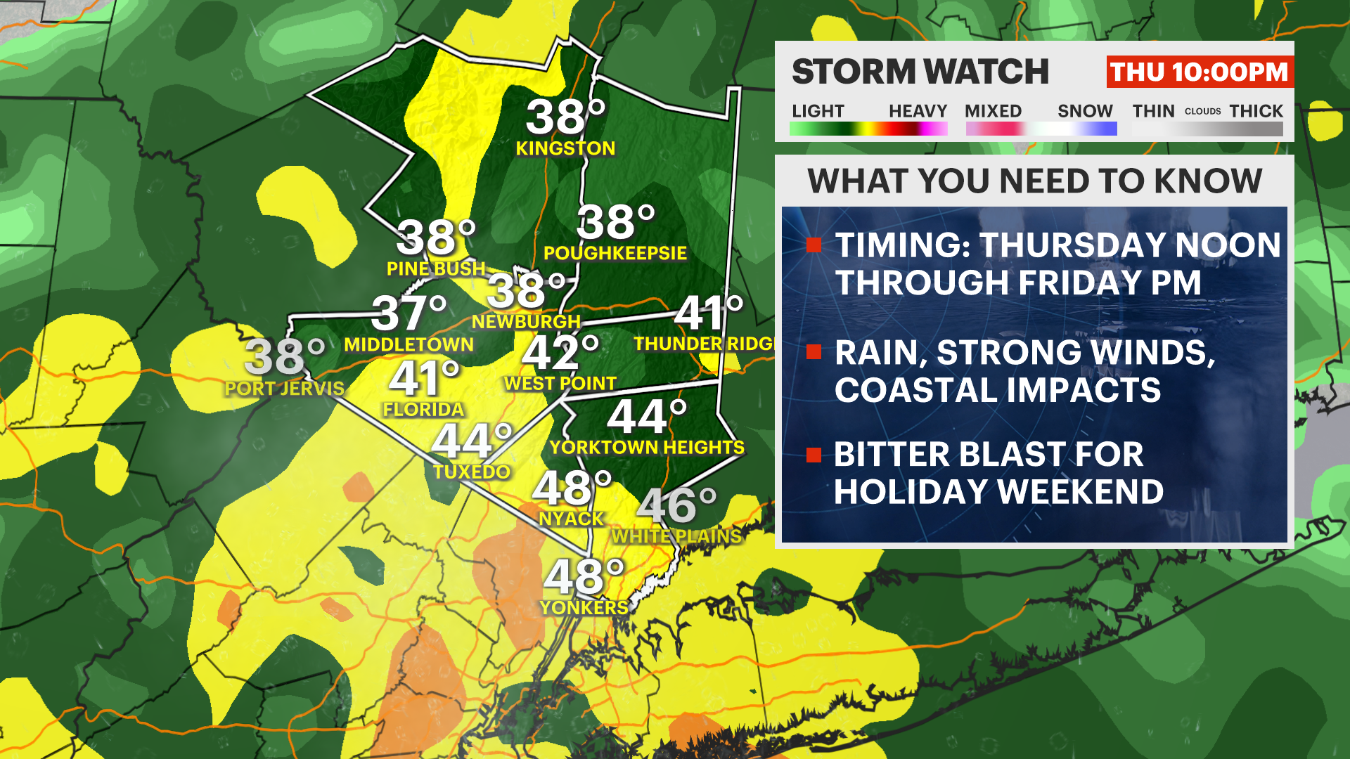
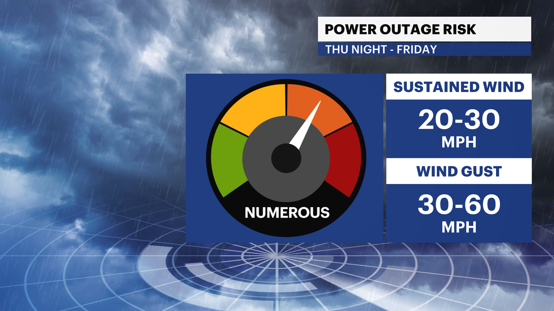
NEXT: STORM WATCH - Significant rain and wind and a dramatic drop in temperature/icy conditions will impact holiday travel Thursday evening into Friday.
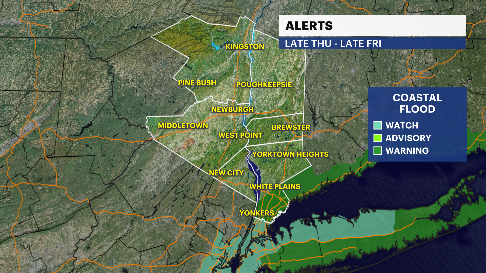
A coastal flooding warning was issued for the Sound Shore for widespread minor to moderate localized flooding near the waterfront and shoreline between 8 a.m. - 1 p.m. Friday.
Storm Watch Team Meteorologist Meredith Garofalo says heavy rain and strong winds are expected to impact holiday travel the end of this week.
FORECAST:
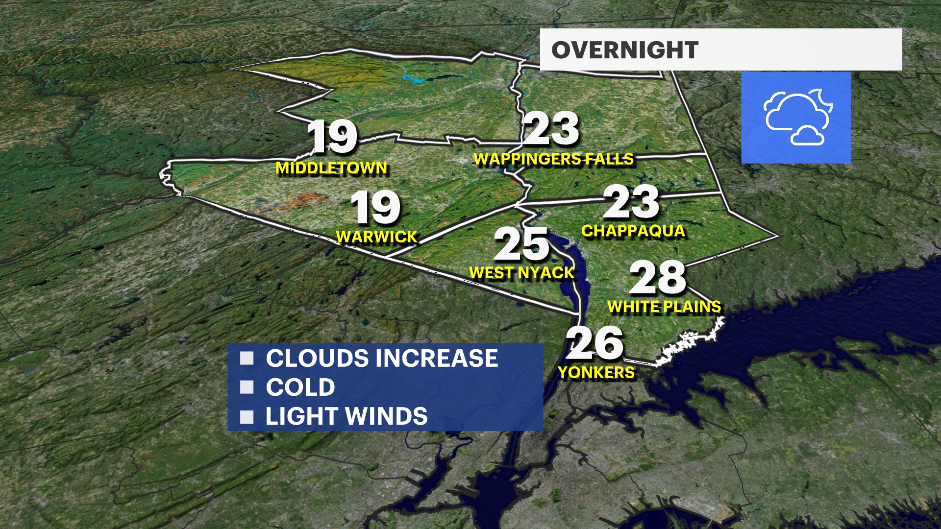
OVERNIGHT: Increasing clouds. Lows around 28.
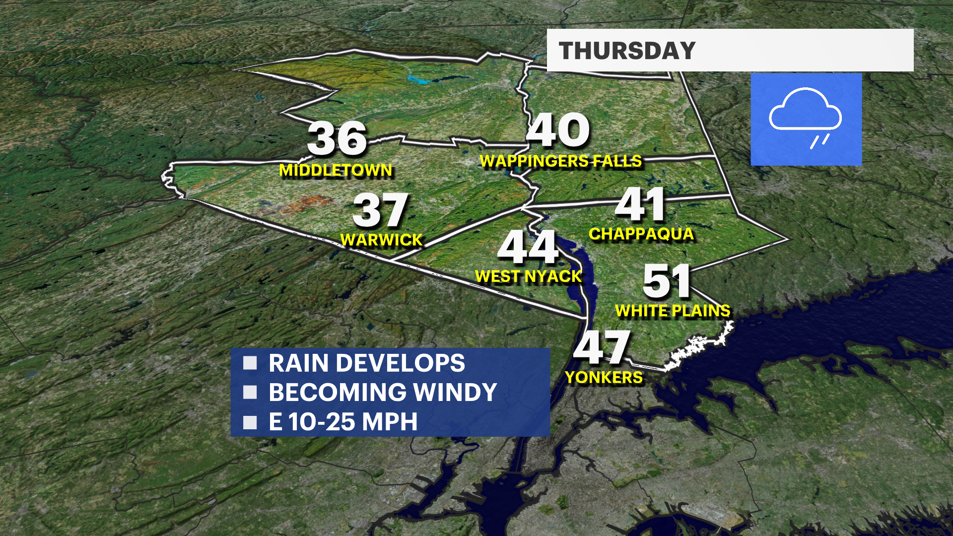
THURSDAY: STORM WATCH - Cloudy and dry to start. Rain develops late-morning and becomes steadier and heavier into the evening. Isolated storms are possible. Temperatures gradually rise into and through the 40s. It will become windy with gusts overnight between 30 and 50 mph. Power outages likely. Temperatures continue to rise overnight into the 50s.
FRIDAY: STORM WATCH - BITTER BLAST - Temperatures in the 50s to start. Wet and windy with rain totals between 1 and 3 inches. Localized flooding is likely. Wind gusts between 30 and 60 mph. Rain may briefly end as a wintry mix or wet snow, not amounting to much. However, temperatures will crash into the teens and 20s Friday afternoon through the evening. This can lead to a dangerous flash freeze, icy travel in time for the evening commute.
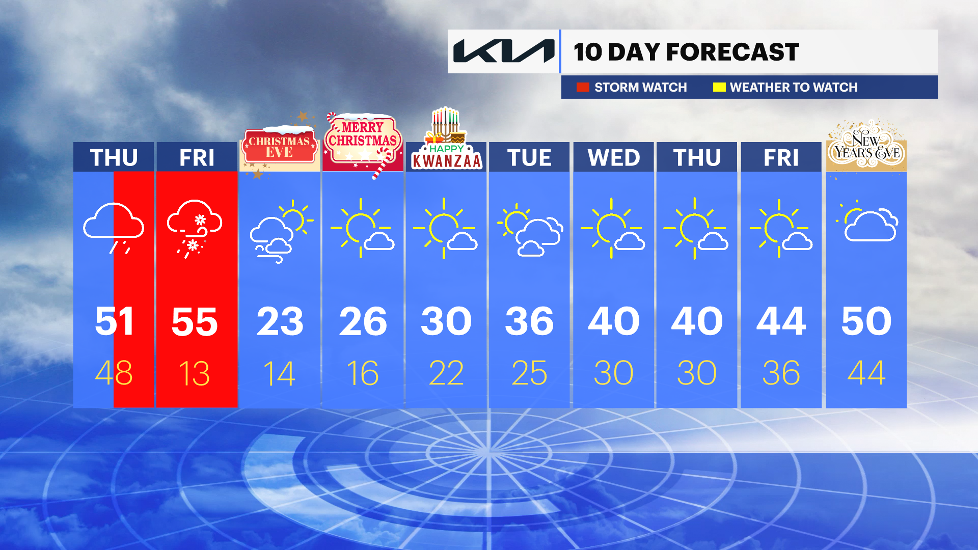
SATURDAY - CHRISTMAS EVE: BITTER BLAST - Sun and clouds, breezy and frigid. Highs around 23, but it will feel much colder with the wind. Lows near 14.
SUNDAY - CHRISTMAS DAY: BITTER BLAST - Mostly sunny and still very cold. Highs around 26. Lows around 16.
MONDAY: Mostly to partly sunny. Still cold. Highs around 30. Lows around 22.
More from News 12
1:51

Police: Retired NYPD officer, wife dead in apparent murder-suicide in Yonkers
2:06

Warmup for the Hudson Valley starts Friday; dry weather continues
0:50

Judge dismisses criminal conviction tied to ex-Orange County assistant DA accused in federal bribery probe
4:42

Crime Files: The Larry Ray Tapes - Shocking, Exclusive Interview with Larry Ray
1:37

Hundreds celebrated in Westchester for completing Launch1000
0:32
