Mostly cloudy with temperatures in the 30s; bitter blast with -20 wind chills by Friday
News 12 Storm Watch Team Meteorologist Matt Hammer says it will be in the 30s and 40s for most of the week before a cold blast moves in, dropping temps into the teens and single digits.
•
Jan 30, 2023, 12:10 PM
•
Updated 585 days ago
Share:
More Stories
2:09

Saturn to be visible this weekend, with best viewing on Sunday
22h ago1:39

Why has hurricane season quieted down?
2ds ago
LIVE BLOG: News 12 weather updates
10ds ago1:04

Cooler temperature trend into start of meteorological fall
10ds ago1:34

Greenwood Lake leaders warn visitors to use common sense in the heat
10ds ago2:26

Heat & humidity strengthen, storm chances weaken, to bring a pleasant end to week
11ds ago2:09
Saturn to be visible this weekend, with best viewing on Sunday
22h ago1:39
Why has hurricane season quieted down?
2ds agoLIVE BLOG: News 12 weather updates
10ds ago1:04
Cooler temperature trend into start of meteorological fall
10ds ago1:34
Greenwood Lake leaders warn visitors to use common sense in the heat
10ds ago2:26
Heat & humidity strengthen, storm chances weaken, to bring a pleasant end to week
11ds agoNOW: Spotty shower or snowflake overnight.
NEXT: Much cooler tomorrow. Bitter blast Friday and Saturday.
News 12 Storm Watch Team Meteorologist Matt Hammer says it will be in the 30s and 40s for most of the week before a cold blast moves in, dropping temps into the teens and single digits.
FORECAST:
TONIGHT: Spotty shower or snow flurry. A few slick spots possible. Lows around 32 degrees.
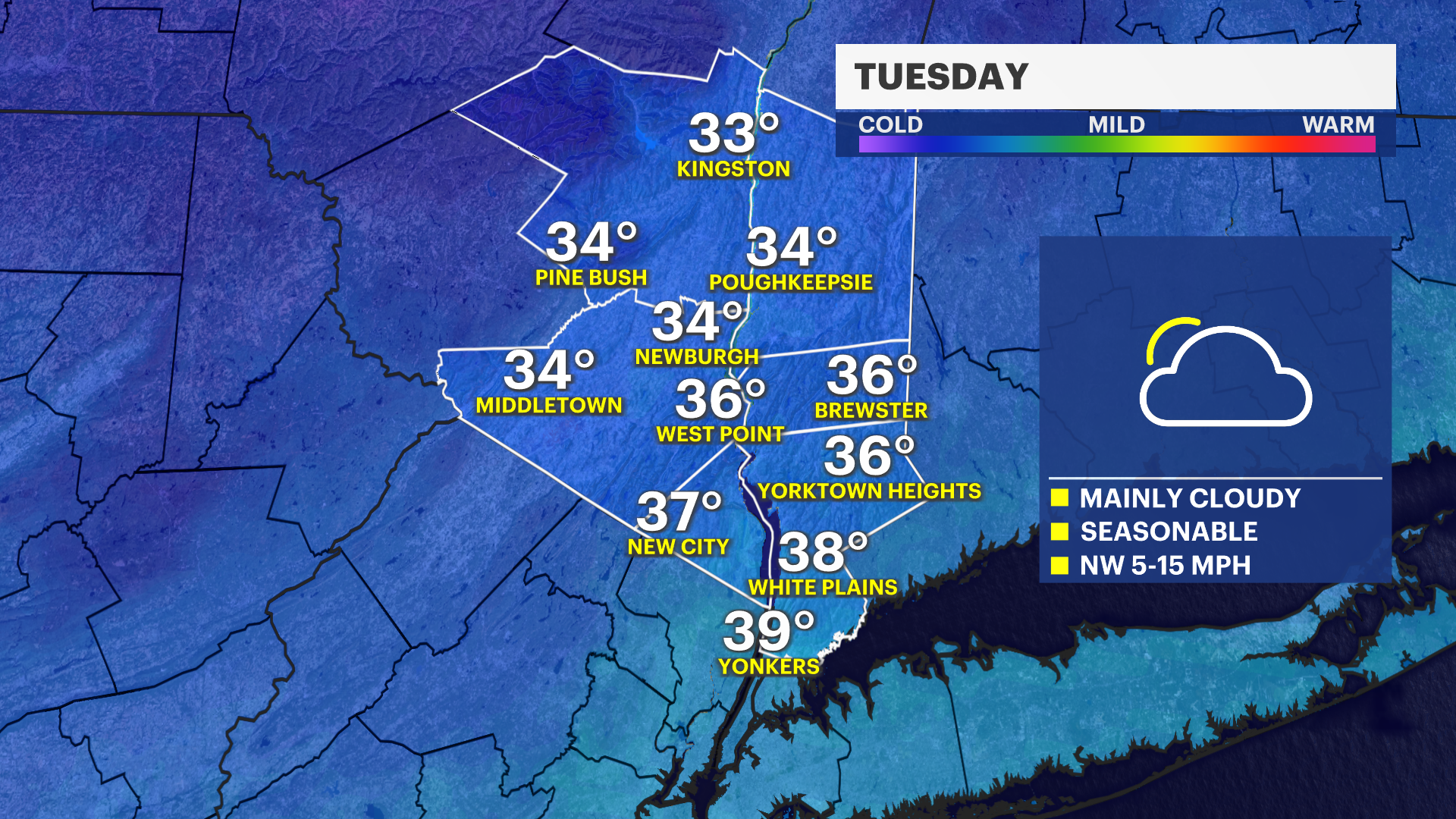
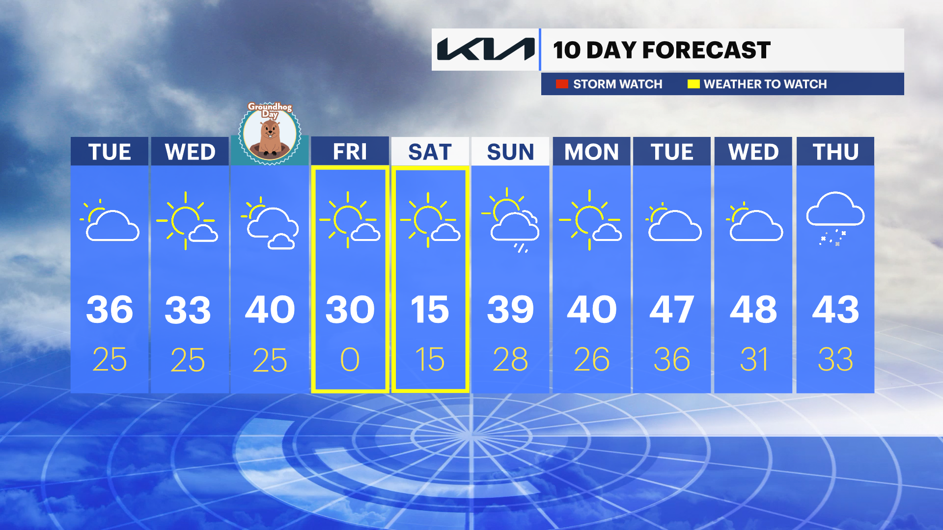
TUESDAY: Mainly cloudy to partly sunny. Snow flurries are possible in Westchester or Rockland overnight. Highs around 36 degrees. Lows around 25.
WEDNESDAY: Sunny and colder with highs around 33 degrees. Lows around 25 degrees.
THURSDAY: GROUNDHOG DAY -- Partly sunny to mostly cloudy. Stray rain or snow shower to the south late in the day. Highs around 40. Lows around 25.
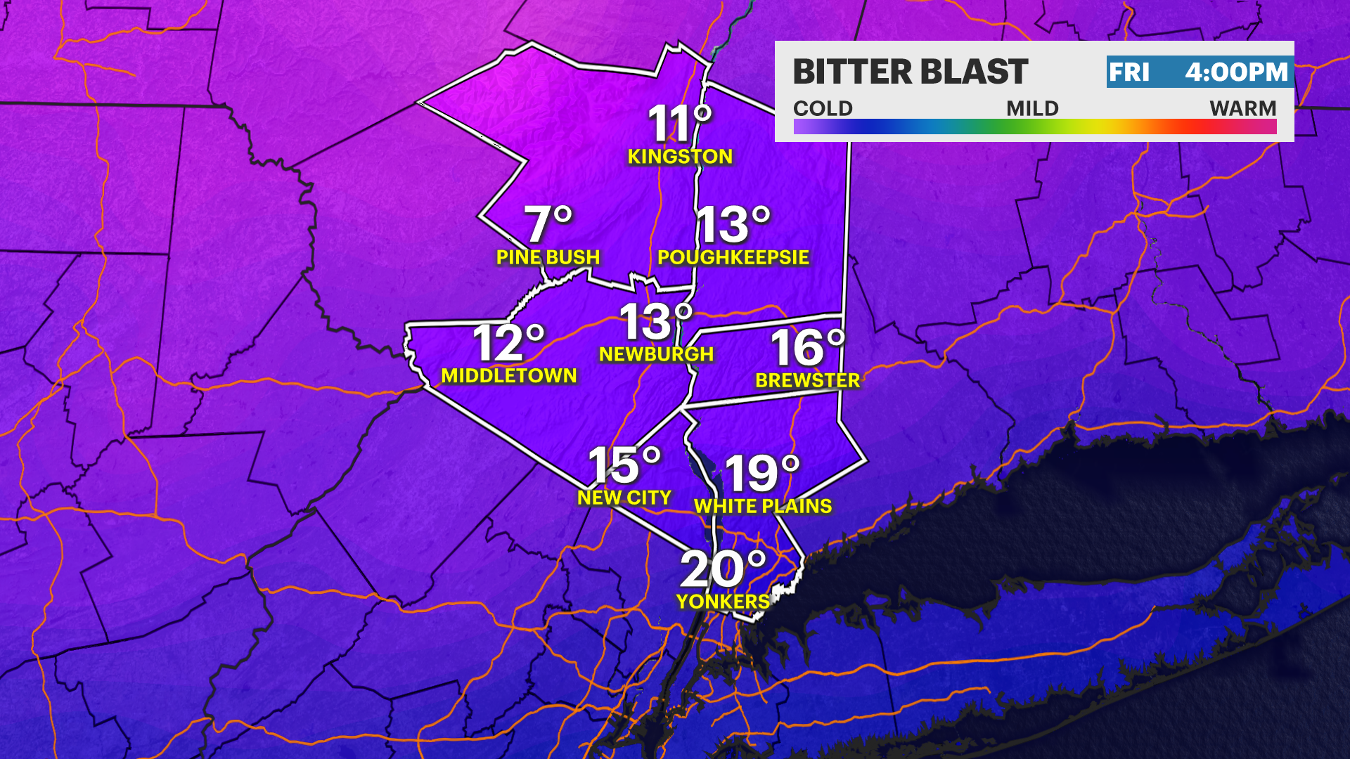
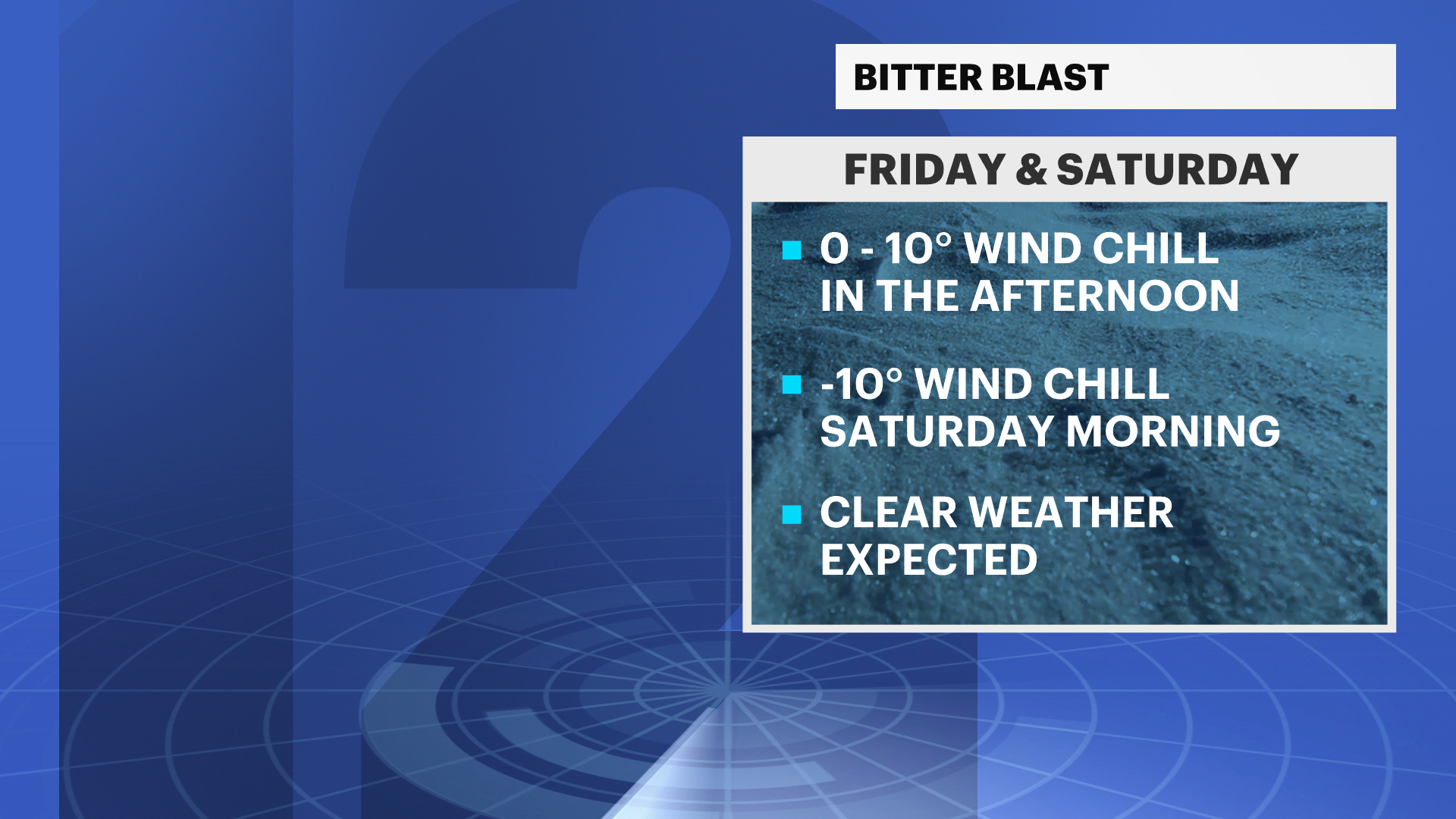
FRIDAY: BITTER BLAST -- Sunny, windy and bitterly cold. Wind chills may be as low as -20 in spots Friday evening into Saturday morning.
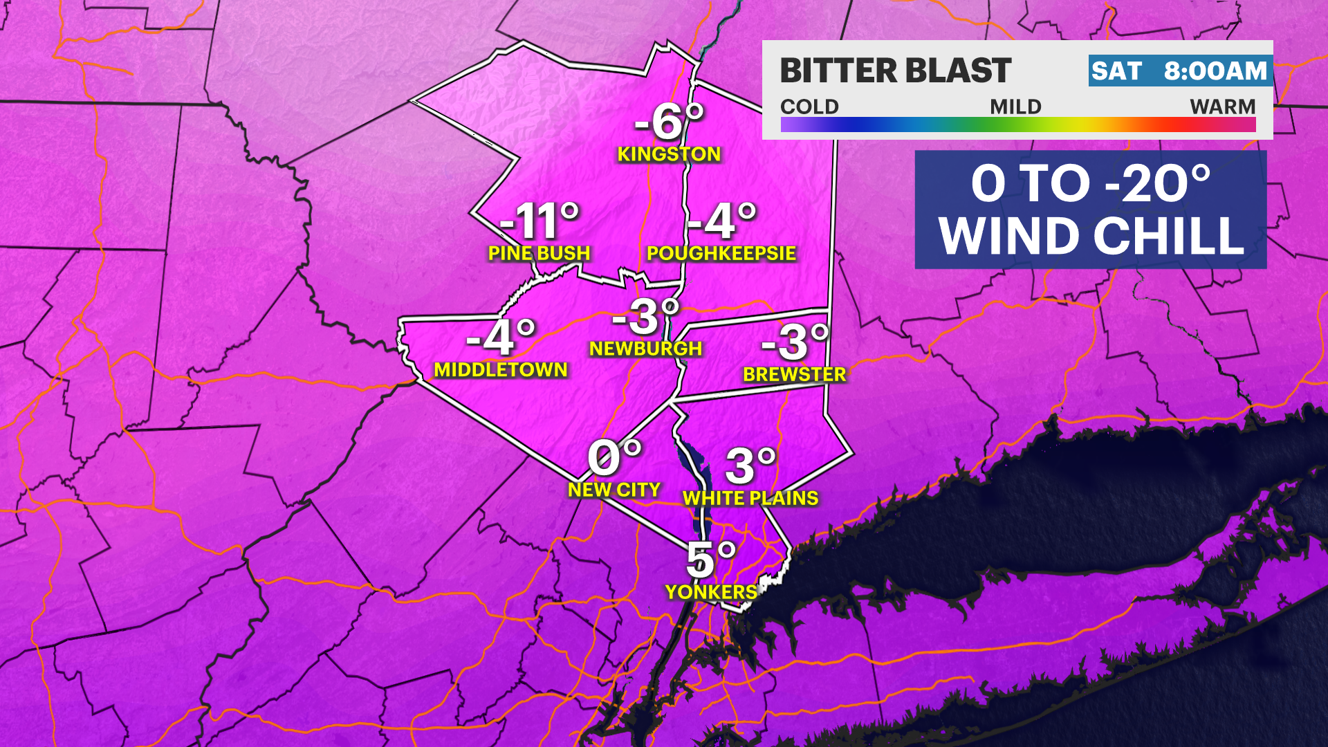
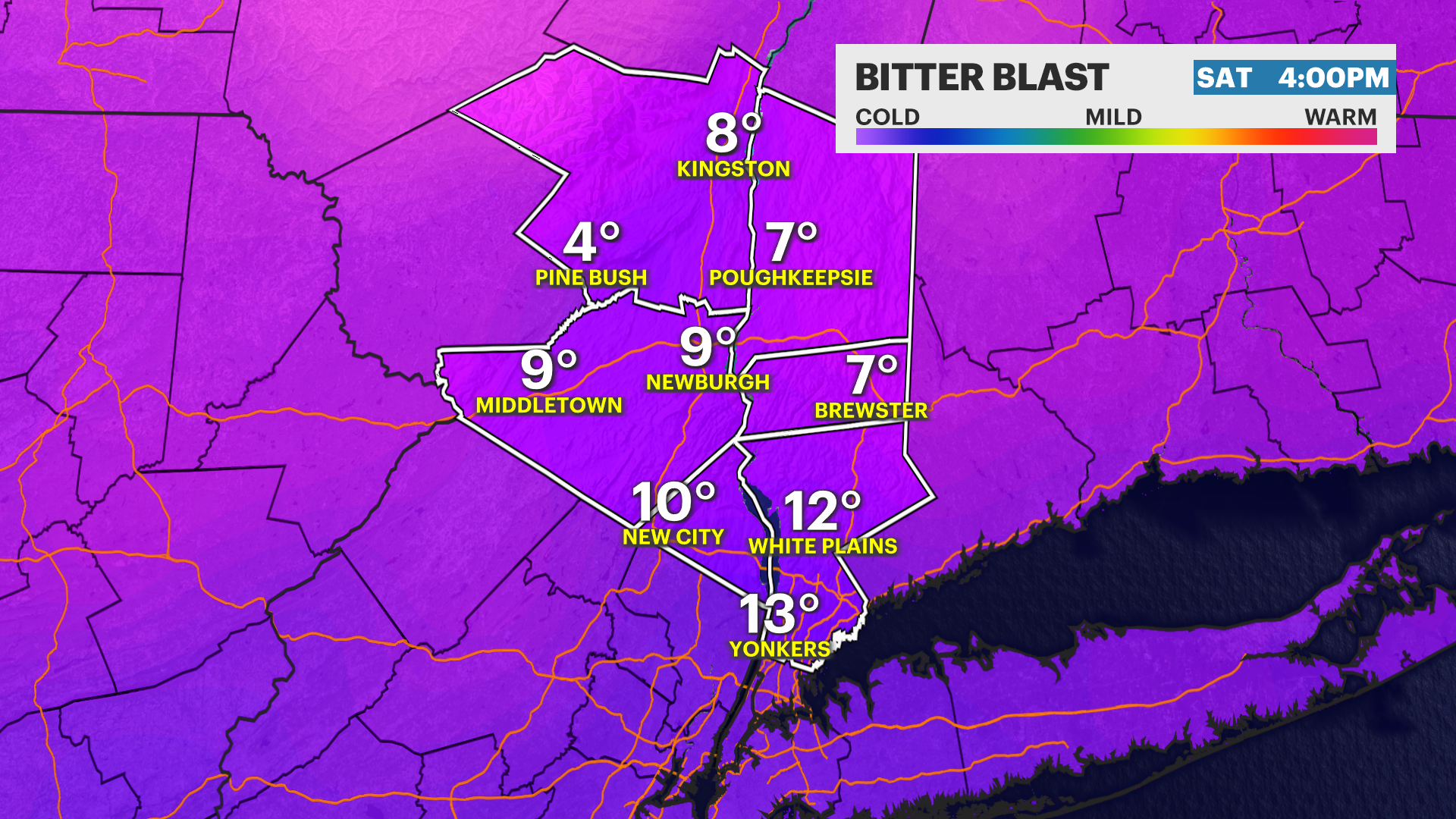
SATURDAY: BITTER BLAST -- Sunny, lingering wind to start the day and bitter cold. Highs around 15 degrees, but wind chills below zero.
SUNDAY: Partly sunny to mostly cloudy with rain showers developing later in the day. Much milder. Highs around 39 degrees. Lows around 28.
More from News 12
2:09

Emergency sewer repair project in Greenburgh stinks – but it’s necessary, officials say
1:57

Chilly morning, pleasant afternoon Sunday in the Hudson Valley
1:58

Residents learn more about $12.9M facelift proposal for Nanuet Public Library
0:48

Rain doesn't damper celebration at 13th annual Italian Feast and Festival in Tappan
0:53

Nearly $2 million to fund intelligence center, body cameras for Orange County law enforcement
2:00
