Cool, sunny Wednesday ahead of late week warmup in the Hudson Valley
Storm Watch Team Meteorologist Alex Calamia says it will be cool on Wednesday, but record-warm temperatures are possible Friday.
•
Apr 18, 2023, 10:10 AM
•
Updated 548 days ago
Share:
More Stories
1:45

How to spot the A3 comet before it disappears into the cosmos
2ds ago0:48

Family formerly from Ardsley shares experience of evacuating during Hurricane Milton
5ds ago5:45

Milton gains strength in Gulf of Mexico as Florida prepares for another major storm
11ds ago1:21

Local organizations collect donations for communities affected by Hurricane Helene
14ds ago2:09

Fall is the toughest time for asthma sufferers. Here's how to stay ahead of symptoms
26ds ago1:50

What's the weather? News 12 meteorologist Julian Seawright plans the rest of your week
29ds ago1:45
How to spot the A3 comet before it disappears into the cosmos
2ds ago0:48
Family formerly from Ardsley shares experience of evacuating during Hurricane Milton
5ds ago5:45
Milton gains strength in Gulf of Mexico as Florida prepares for another major storm
11ds ago1:21
Local organizations collect donations for communities affected by Hurricane Helene
14ds ago2:09
Fall is the toughest time for asthma sufferers. Here's how to stay ahead of symptoms
26ds ago1:50
What's the weather? News 12 meteorologist Julian Seawright plans the rest of your week
29ds agoNEW: Chilly overnight, seasonable Wednesday.
NEXT: Near-record warm Friday, but changes are on the way. Rain arrives Sunday
Storm Watch Team Meteorologist Alex Calamia says it will be cool on Wednesday, but record-warm temperatures are possible Friday.
FORECAST:
TONIGHT: Partly cloudy and chilly with lows around 40 degrees. Patchy frost in Orange, Ulster and Dutchess counties.
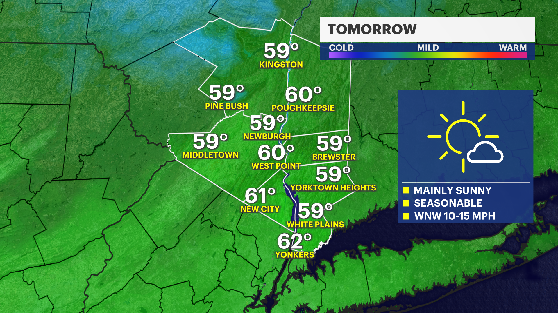
WEDNESDAY: Mostly sunny. Highs around 60 degrees.
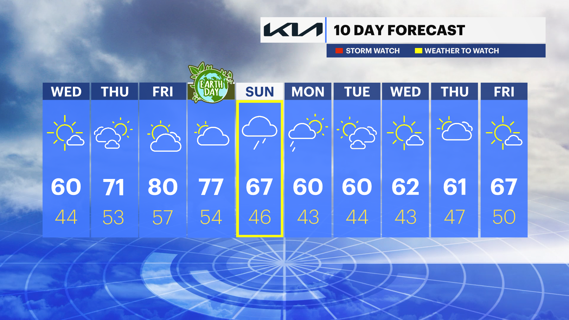
WEDNESDAY NIGHT: Mostly cloudy. A stray shower is possible early Thursday morning around sunrise. Lows around 44 degrees.
THURSDAY: Sun and clouds. Warmer in the afternoon. Highs around 71 degrees. Lows near 53 degrees.
FRIDAY: Mostly sunny and much warmer with increasing clouds later in the day. A stray shower possible. Near record warm. Highs around 81. Overnight lows near 57 degrees.
SATURDAY: Mostly cloudy. A passing shower is possible. Warm with highs in the mid-70s. Lows in the mid-50s.
SUNDAY: WEATHER TO WATCH - Rain is expected. A few pockets of heavy rain is possible. Rain may exceed 1 inch in spots. Highs in the 60s. Lows in the 40s.
NEXT WEEK: Dry and cooler. Highs in the 60s with lows in the 40s.
More from News 12
1:51

Police: Retired NYPD officer, wife dead in apparent murder-suicide in Yonkers
2:06

Warmup for the Hudson Valley starts Friday; dry weather continues
0:50

Judge dismisses criminal conviction tied to ex-Orange County assistant DA accused in federal bribery probe
4:42

Crime Files: The Larry Ray Tapes - Shocking, Exclusive Interview with Larry Ray
1:37

Hundreds celebrated in Westchester for completing Launch1000
0:32
