More Stories


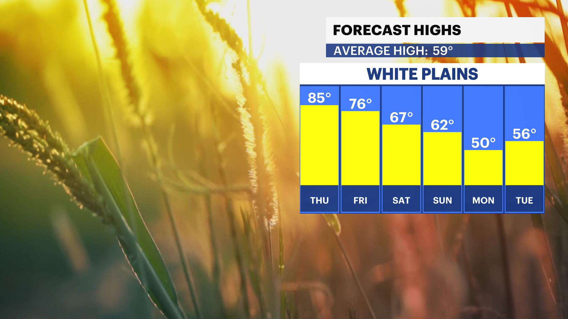
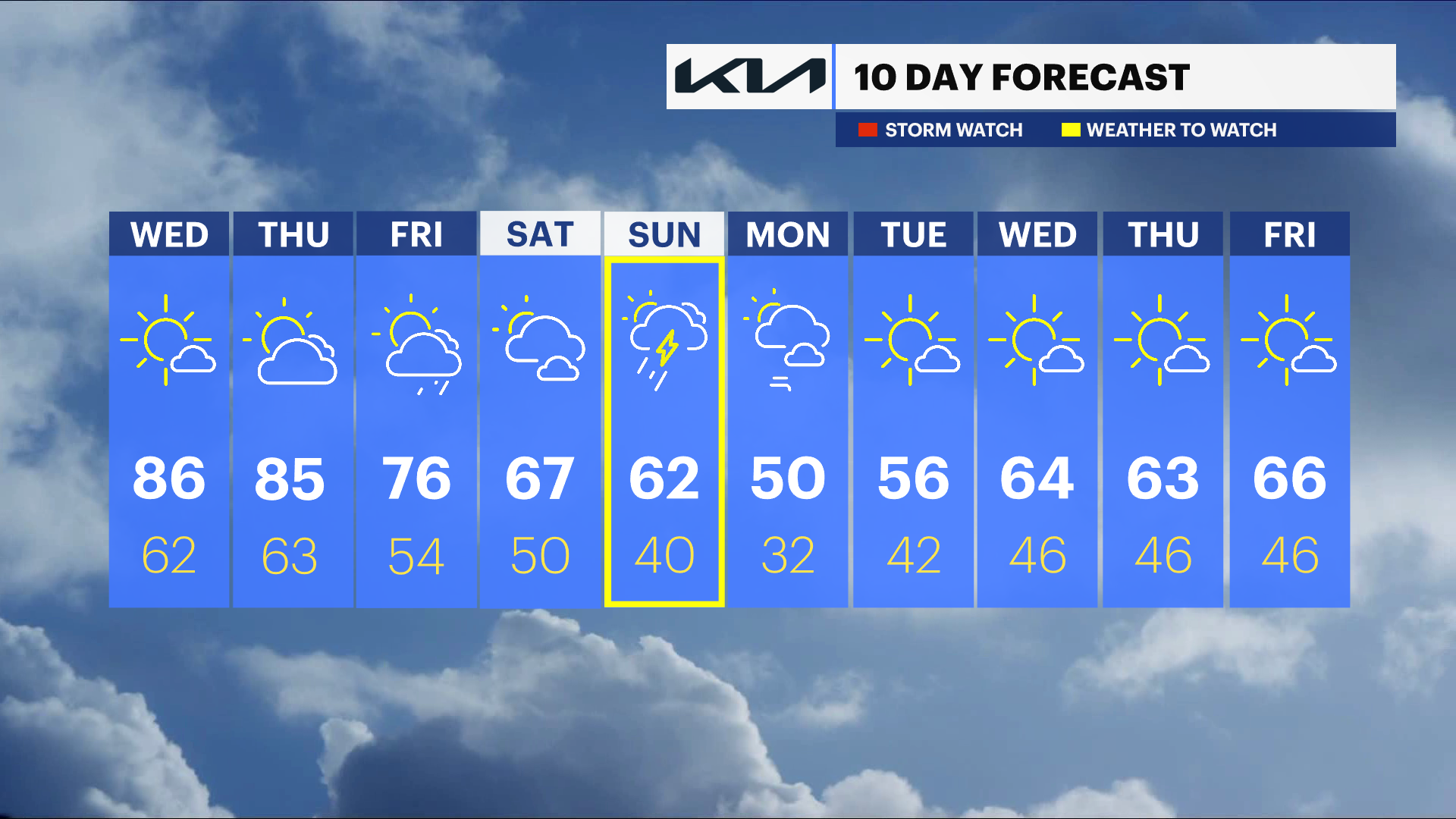
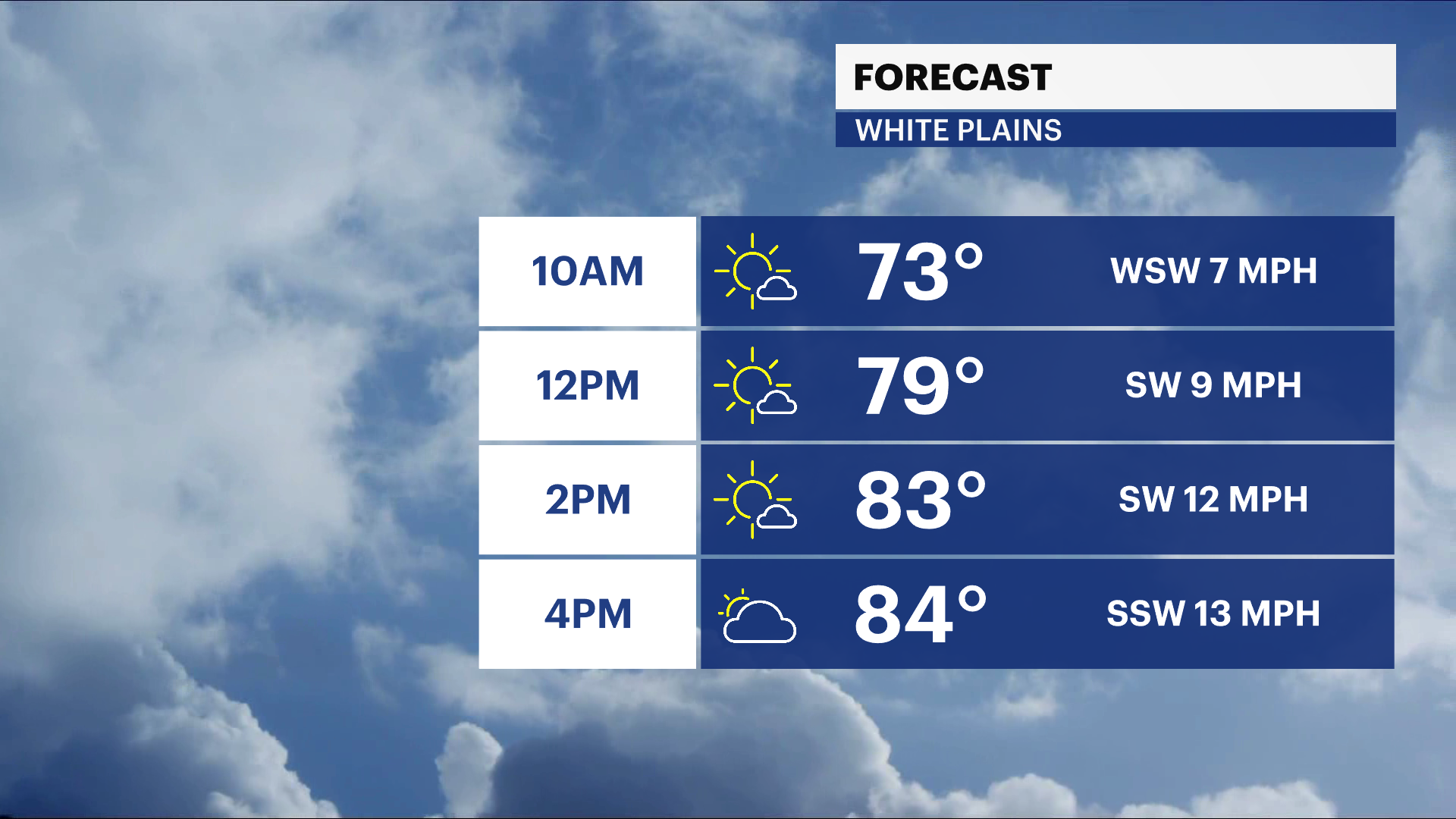
Wednesday: Get ready for some record-breaking heat across the Hudson Valley today. Temperatures are expected to soar well above what’s typical for this time of year, making it feel much more like the middle of summer than spring. If you’re heading out, you’ll definitely notice the warmth, and it could challenge or even break daily records in some spots. The record for the date is 83 degrees, and this will most likely be broken.
Thursday: The unusually warm weather sticks around, with temperatures staying far above average. The record for Thursday is 88 degrees. It is not impossible to break this record, but it is unlikely. While it will still feel very summery, there’s also a chance for a few showers or thunderstorms to pop up later in the day, especially during the afternoon and evening hours. Not everyone will see rain, but it’s something to keep an eye on if you have outdoor plans.
Friday: Another very warm day is on the way, though the pattern starts to get a little more unsettled. Clouds may build at times, and scattered showers or thunderstorms could develop later in the day. Even with that, temperatures will remain much higher than normal, continuing this stretch of early-season heat. This will be the first of a two step cool down.
Sunday: A big change arrives as a strong cold front moves through the Hudson Valley during the afternoon. This front will likely bring a round of showers and possibly a thunderstorm as it passes through. Behind it, much cooler air moves in, and by Sunday night into early next week, temperatures will drop to below normal levels, a noticeable shift from the heat we started with.
Early next week: Below normal temperatures for Monday and Tuesday with highs only in the 50s.