Warm sunny stretch arrives as temperatures climb above average this week
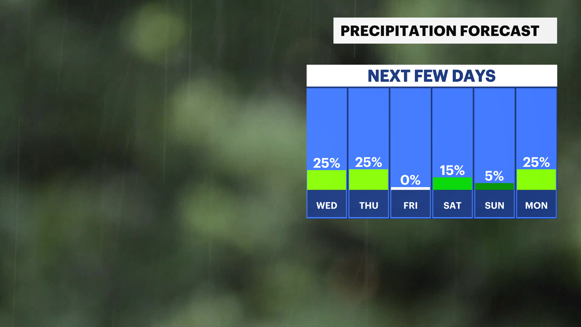
The rest of the week looks nicer and warmer for outdoor plans in Westchester County and the Lower Hudson Valley other than a spotty shower late Wednesday into Thursday.
Share:
More Stories


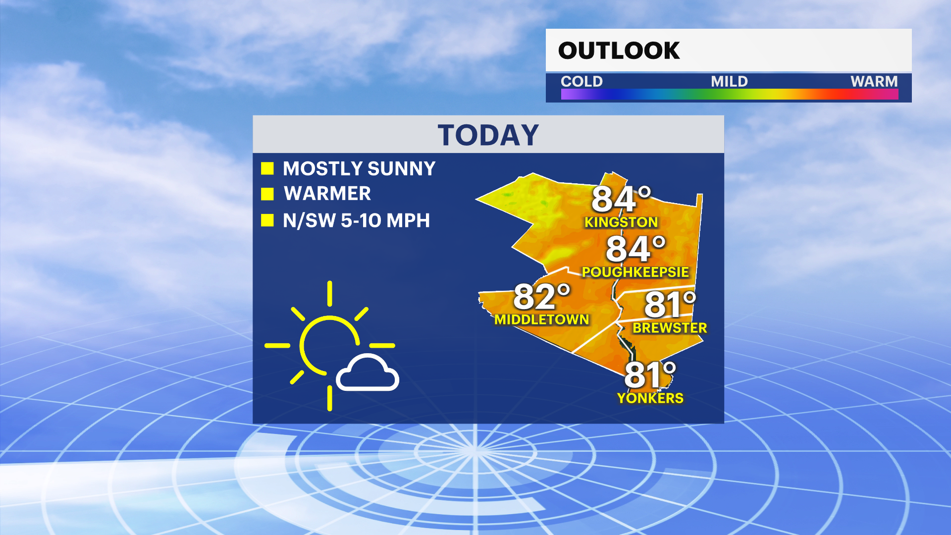
Pleasant weather has settled in across the Hudson Valley with sunshine and warm temperatures.
Conditions today feature mostly sunny skies, a light breeze and highs in the upper 70s to low 80s.
That puts temperatures slightly above the typical high of 72 degrees for this time of year.
The warm trend is expected to continue through the week with plenty of sunshine and limited rain chances.
A few isolated storms are possible Wednesday afternoon.
Light showers could move through Thursday morning.
Beyond that, conditions look quiet heading into the weekend.
Forecasters say the weekend will bring seasonable temperatures and dry weather.