Mix of sun and clouds before spotty Friday afternoon shower for the Hudson Valley
News 12 Storm Watch Team Meteorologist Addison Green says there's a chance of spotty showers on Friday afternoon.
Jun 1, 2023, 10:53 AM
•
Updated 323 days ago
Share:
News 12 Storm Watch Team Meteorologist Addison Green says there is a chance of a spotty shower for Friday afternoon.
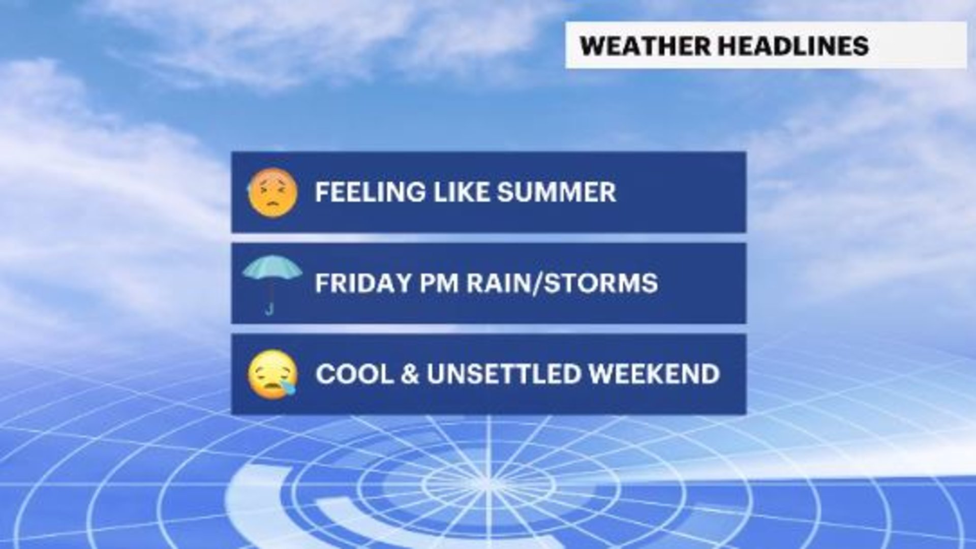
WHAT'S NEW: Get ready for a summer-like day for Friday with hazy, warm and muggy air and a potential for record breaking temperatures. There is also a chance for scattered showers and isolated storms for the afternoon/evening rush.
WHAT'S NEXT: The weekend will be much cooler by comparison, with temperatures down by double digit numbers and scattered showers for Saturday and breezy winds at times.


FORECAST:
OVERNIGHT: Fairly clear skies with mild temperatures. Lows in the upper-50s to low-60s.


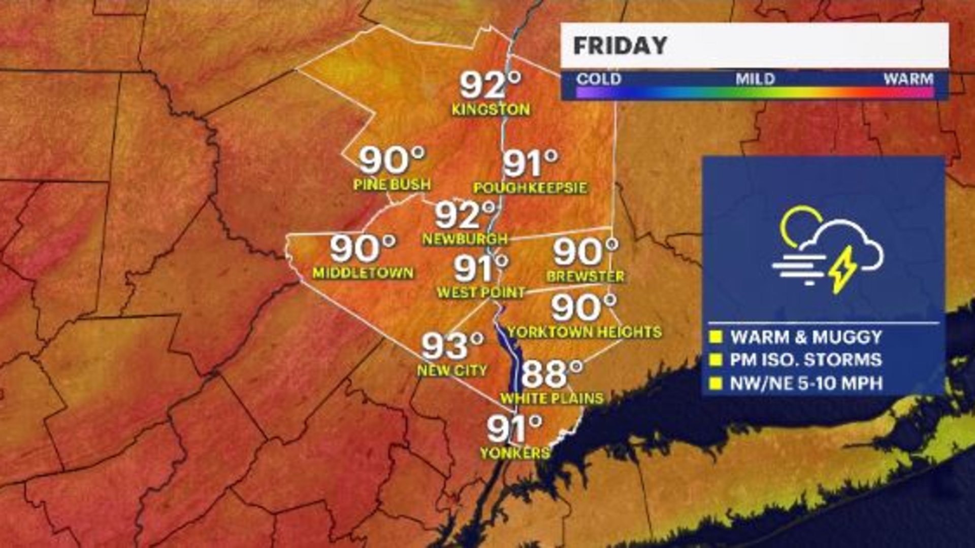
FRIDAY: Mostly sunny to partly cloudy, feeling a little humid with a chance of afternoon/evening showers and storms with a cold front approaching. Highs in the upper-80s to low-90s. Lows in the upper-50s to low-60s.


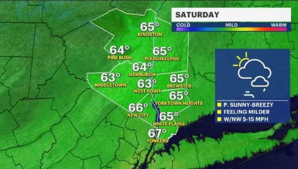
SATURDAY: Mostly cloudy, breezy winds and scattered showers, cooler temperatures. Highs in the mid-60s. Lows in the upper-40s to low-50s.

SUNDAY: Partly cloudy with breezy winds. Highs in the upper-60s. Lows in the upper-40s to low-50s.
MONDAY: Partly cloudy with a light breeze. Highs in the upper-60s to low-70s. Lows in the mid-50s.
TUESDAY: Mostly cloudy with some scattered showers. Highs in the low-70s. Lows in the mid-50s.
WEDNESDAY: Mix of sun and clouds with scattered rain shower chances. Highs in the low-70s. Lows in the low-50s.
THURSDAY: Partly cloudy. Highs in the mid-70s. Lows in the mid-50s.
FRIDAY: Mostly sunny. Highs in the mid-70s. Lows in the mid-50s.
SATURDAY: Mostly sunny and warm. Highs in the upper-70s to low-80s. Lows in the upper-50s.
SUNDAY: Mostly sunny and still warm. Highs in the upper-70s to low-80s. Lows in the mid-50s.