Sun and clouds with mild temps Monday for the Hudson Valley
The Hudson Valley will see sun and clouds with mild temperatures on Monday.
Top Stories


WHAT YOU NEED TO KNOW
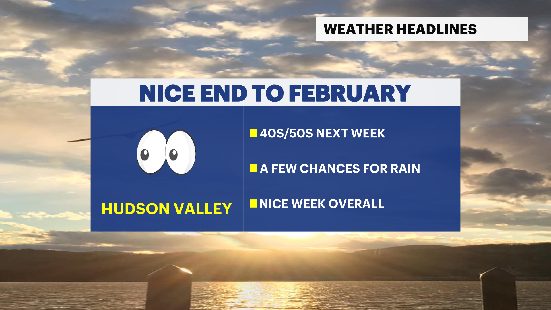
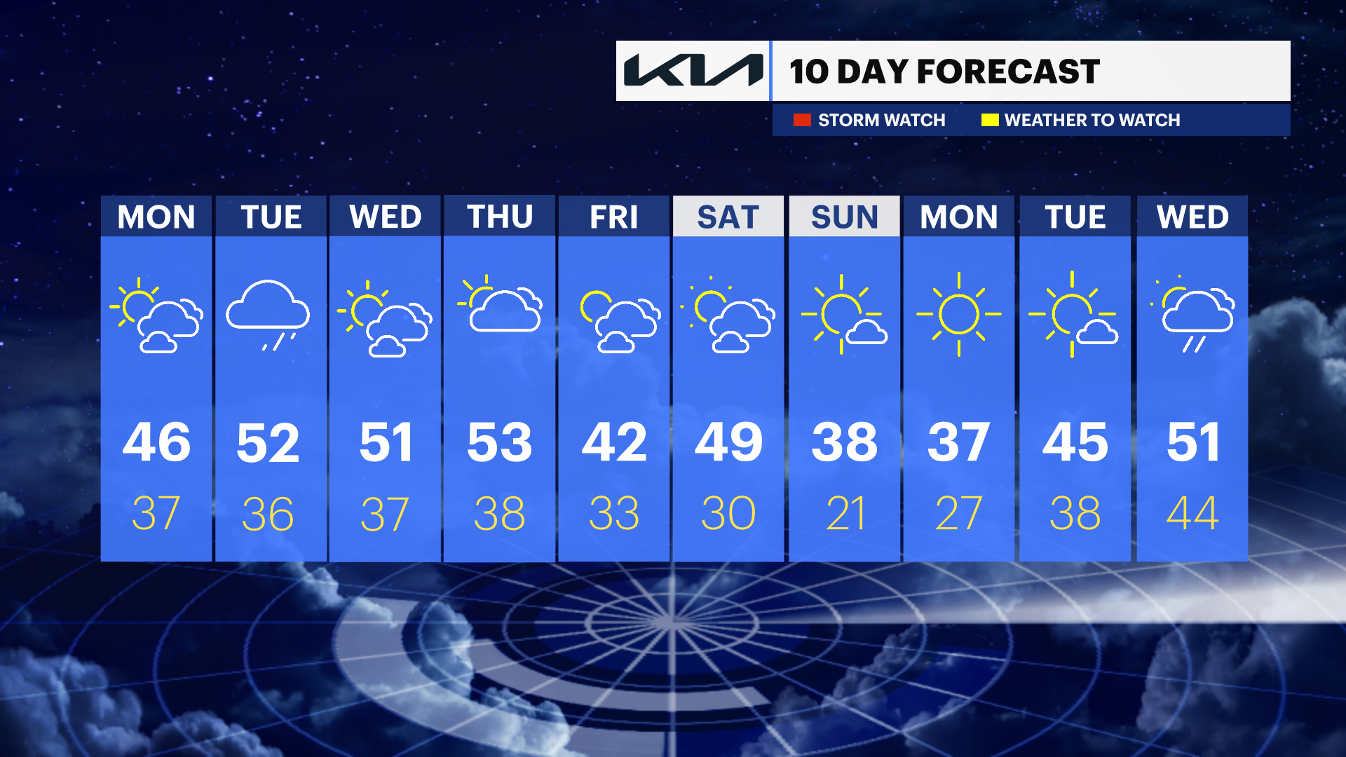
- Mild stretch of temperatures in the 40s and 50s for next week.
- Clouds will mix with sunshine throughout the week.
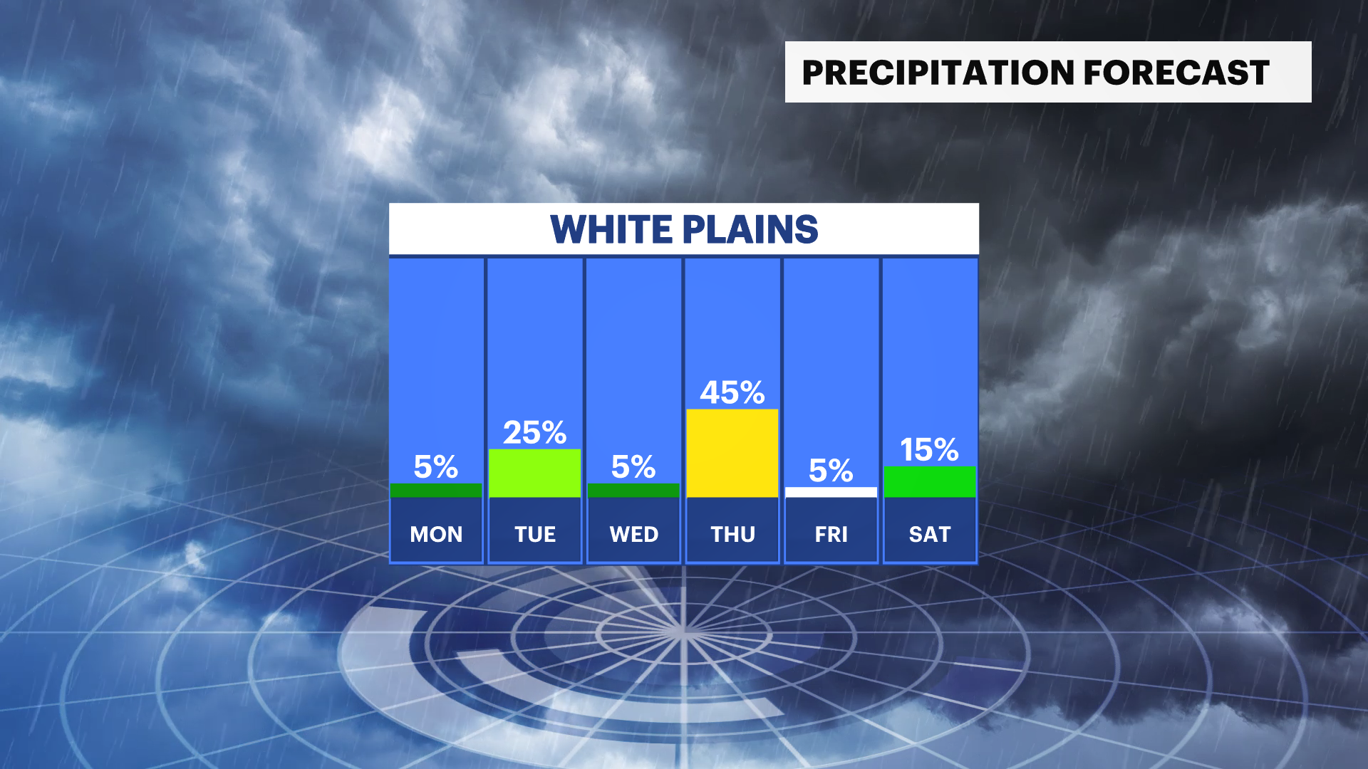
- A few rain shower chances Tuesday afternoon and evening, and Thursday afternoon and evening.
- Colder temperatures return next Sunday.
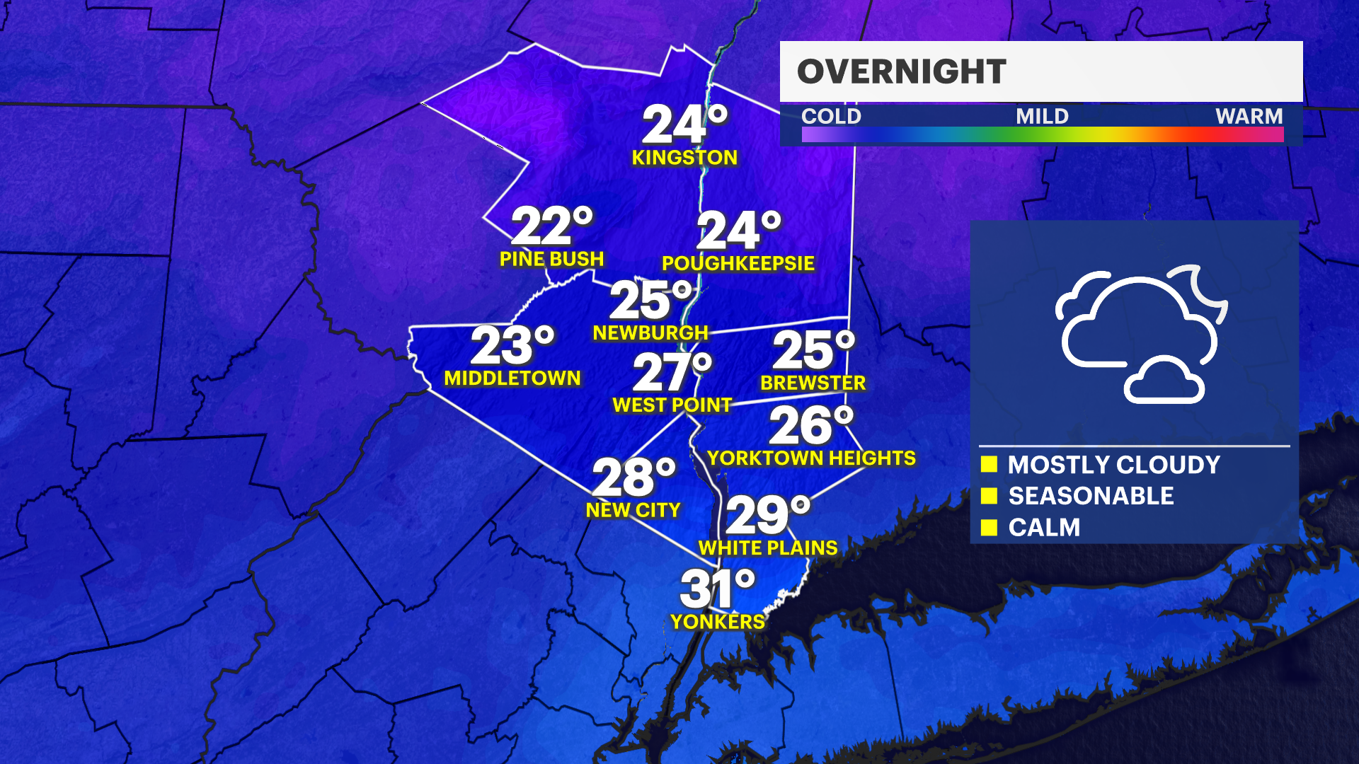
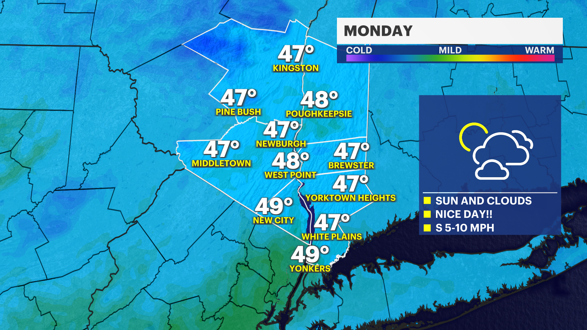
After such a rollercoaster of a winter season, the last week of February provides a taste of spring into the start of March. Prepare for next week to start off with mild temperatures, especially through Monday afternoon. Skies will have sunshine and clouds mixing in, light winds and very nice feels throughout the day. Monday night, skies are expected to be cloudy once more and will carry into Tuesday.
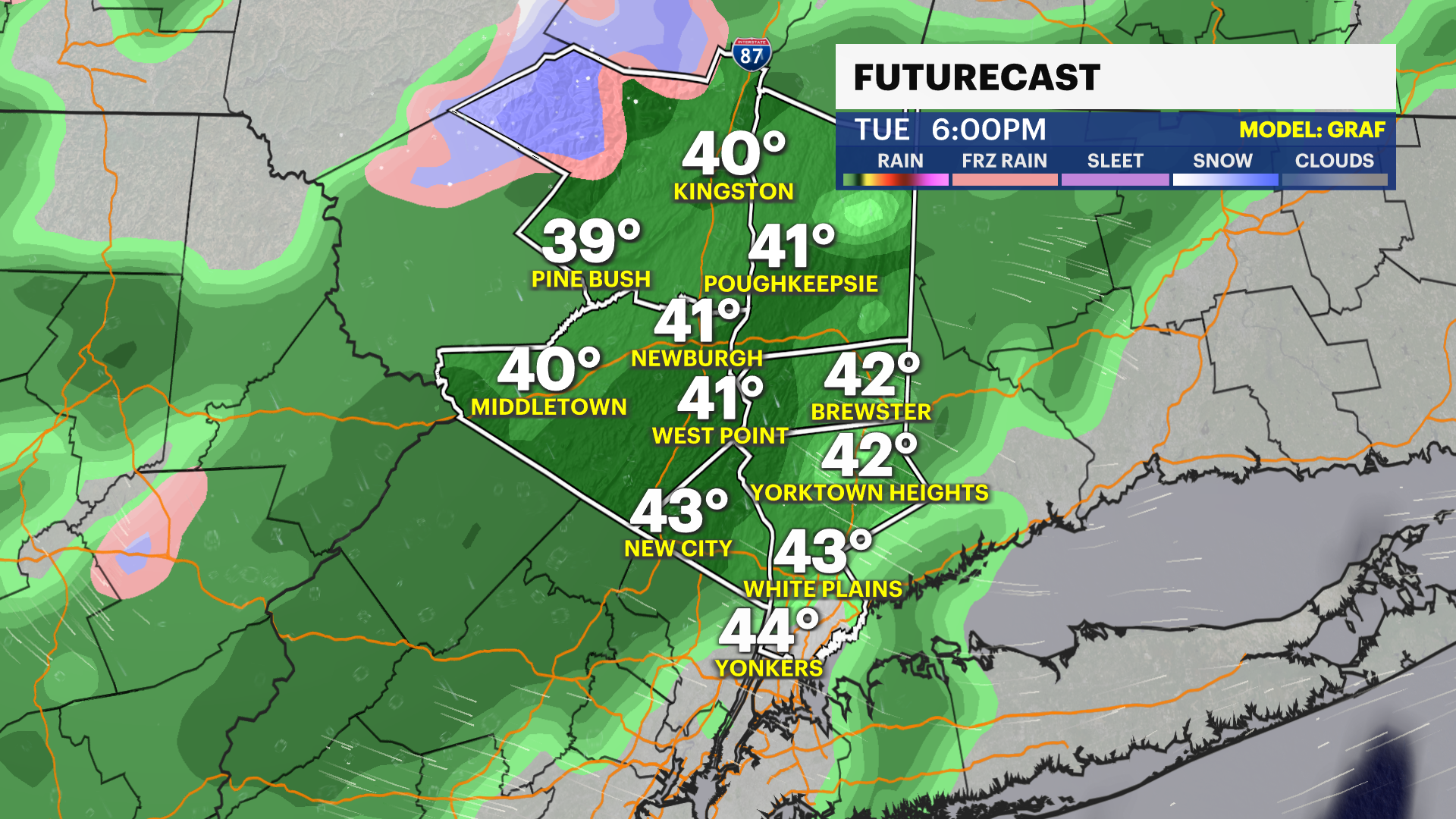
Tuesday will see temperatures to be a little milder breaking into the 50s. There is a chance for rain showers Tuesday late afternoon, early evening around the commute. Light to moderate showers are expected and will end by early Tuesday night.
Wednesday will remain mild, with cloudy skies and some breaks of sunshine. A dry day, and very nice still. The milder temperatures of upper-40s and low-50s will continue through Friday. Thursday evening there is another chance for some rain showers. Keeping the raingear nearby will be advisable for Tuesday afternoon and evening, and Thursday afternoon and evening. Conditions dry out again with mild temperatures on Friday.
The next cold snap will come Sunday of next weekend.