Shower chances will fade with cooler temps along the way today
The umbrella will not be needed much longer as fairer skies move in along with a surge in warmth this weekend
More Stories


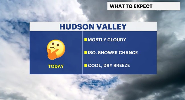
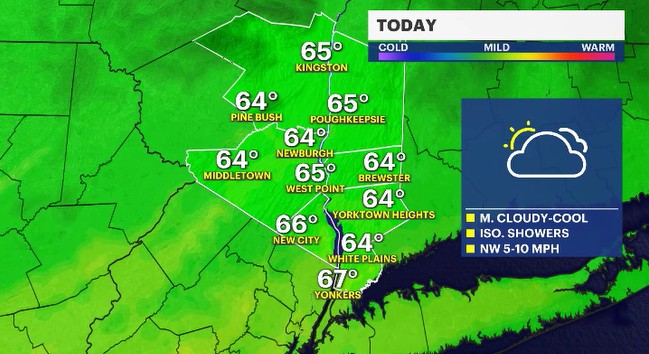
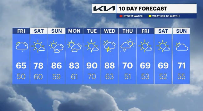
While we needed the umbrella yesterday, we won't be needing it for much longer. An isolated shower chance is out there today as a storm system pulls away from the Hudson Valley. A cool and dry breeze will come in behind it, shutting down our shower chance as we go through the day today. Temperatures are expected to be several degrees cooler than average.
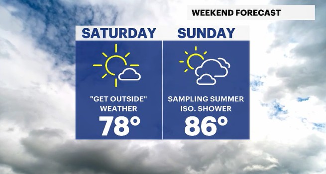
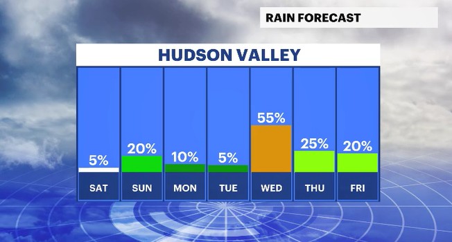
Over the course of the weekend, the temperatures will be trending in the opposite direction from today. With high pressure from the Central Plains moving to the East Coast, and then offshore, we'll have a southwesterly flow of air helping to push warm air up this way. Temperatures will climb to about 10-20 degrees warmer than average from Saturday, all the way into Wednesday of next week. That will be music to many's ears as we have had a relatively cool Spring up for quite some time. While the temps climb, the shower chances will remain low, for the most part.
There is a shower chance Sunday, albeit it is very small, and then a bigger one by Wednesday. This second chance will come from a large storm system moving towards the East Coast. It will have the potential to bring afternoon rain and storms to the region for Wednesday, with showers wrapping up Thursday morning. Cooler air will come along the way with a return to more seasonal temperatures for the end of the work week.
ALMANAC:
Average High: 69 | Average Low: 50
Record High: 85 (2004) | Record Low: 37 (1971)
Sunrise: 5:37 a.m. | Sunset: 8:06 p.m.
THE FORECAST:
TODAY: Isolated showers are possible at times during the day. Most locations will be trending dry. Highs: mid-60s.
TONIGHT: Mostly cloudy with isolated showers at times. Lows: mid to upper 40s.
SATURDAY: Mostly sunny and with a pleasantly warm feeling. Highs: upper 70s. Lows: upper 50s to low 60s.
SUNDAY: A mix of sun and clouds with very warm temperatures. Highs: mid-80s. Lows: upper 50s to low 60s.
MONDAY: A mix of sun and clouds with very warm temperatures. Highs: low 80s. Lows: upper 50s to low 60s.