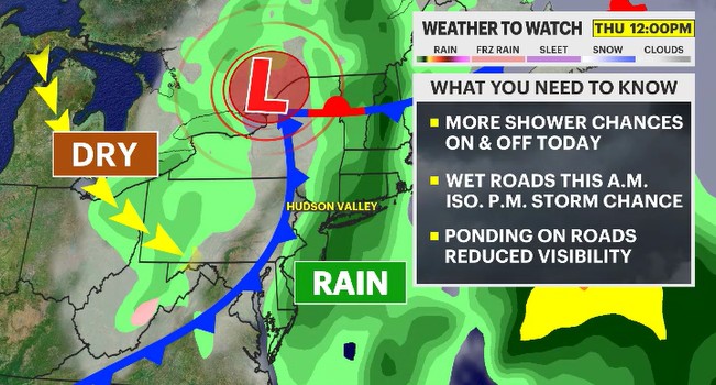
Weather to Watch: Showers will come and go with a spotty downpour
Keep the umbrella around for another day with unsettled weather hanging around the region
More Stories


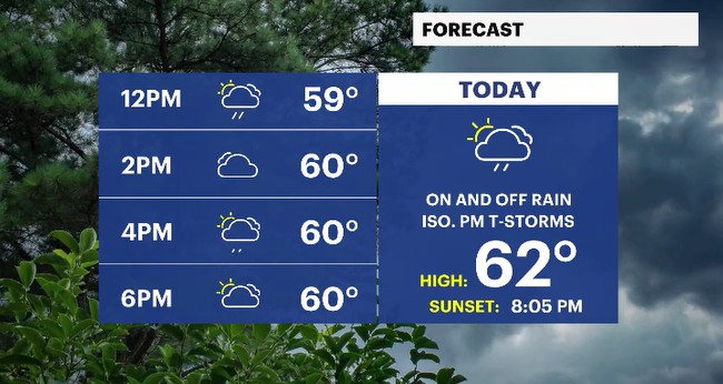
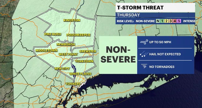
The wet weather will linger through the region today as an area of low pressure slowly moves through up above. As a result, sigh, we have to deal with more unsettled weather out there today in the form of passing showers with an isolated afternoon thunderstorm chance. If we do see a storm develop, it would be non-severe. Meaning, it would not producing any severe elements like hail, damaging gusts nor tornadoes. It would produce a gusty downpour which could briefly reduce visibility.
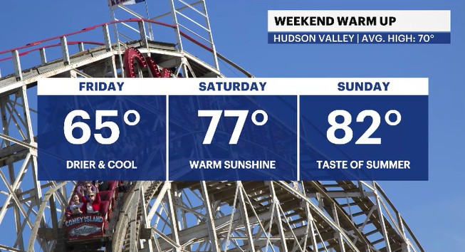
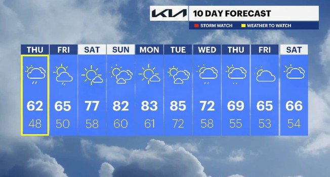
Tomorrow has fairer weather slowly moving in as the low pressure departs the region. A spotty shower or two can't be ruled out for Friday, but most locations will trend drier with a mix of sun and clouds.
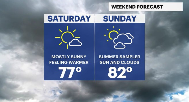
The upcoming weekend is one you won't want to miss by spending time inside! We have a delightful warm up on the way, with both days running about 10-15 degrees above average for the Hudson Valley. Mostly sunny skies will be around on Saturday with a mix of sun and clouds for Sunday. There is a small shower chance for the second half of the weekend, but most locations will trend dry.
The warm temps won't stop when the weekend ends! Instead, the warmth will continue to move into the Hudson Valley with temperatures rising into the mid-80s, and some spots may inch closer to 90 degrees by Tuesday afternoon. Sadly though, the warmth will fade away as a system moves towards the area by Wednesday, bringing a rain chance along the way.
ALMANAC:
Average High: 69 | Average Low: 49
Record High: 83 (1991) | Record Low: 34 (1996)
Sunrise: 5:38 a.m. | Sunset: 8:05 p.m.
THE FORECAST:
TODAY: WEATHER TO WATCH - Mostly cloudy with scattered showers, on & off, through the day. There is a small chance for isolated thunderstorms in the afternoon. Highs: upper 50s to low 60s.
TONIGHT: Mostly cloudy with isolated showers at times. Lows: mid-to-upper 40s.
FRIDAY: Spotty showers are possible at times during the day. Most locations will see a gradual clearing in the skies. Highs: mid-60s. Lows: upper 40s to low 50s.
SATURDAY: Mostly sunny and feeling warmer. Highs: upper 70s. Lows: upper 50s.
SUNDAY: Mix of sun and clouds with very warm temperatures. Highs: low 80s. Lows: upper 50s to low 60s.