Sunglasses today, umbrellas tomorrow. Rollercoaster weather moves into the Hudson Valley
Fair skies hang around through this Friday but rain chances are rising for the weekend.


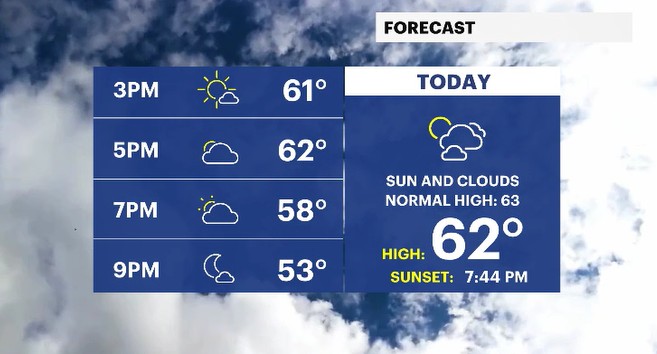
We will wrap up the work week in the Hudson Valley with pleasant skies and seasonal temperatures. A mix of sun and clouds moves in throughout the day as temperatures rise into the low 60s. The normal high for this time of year is 63 degrees, and many locations will get towards those levels. Later today, into tonight, expect to see mostly cloudy skies though as a system starts to approach the region.
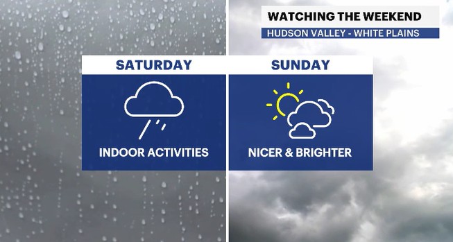
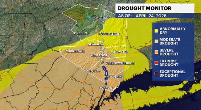
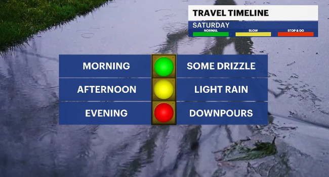
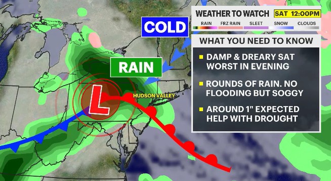
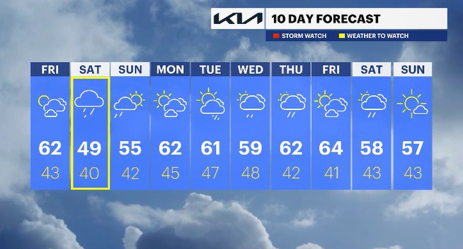
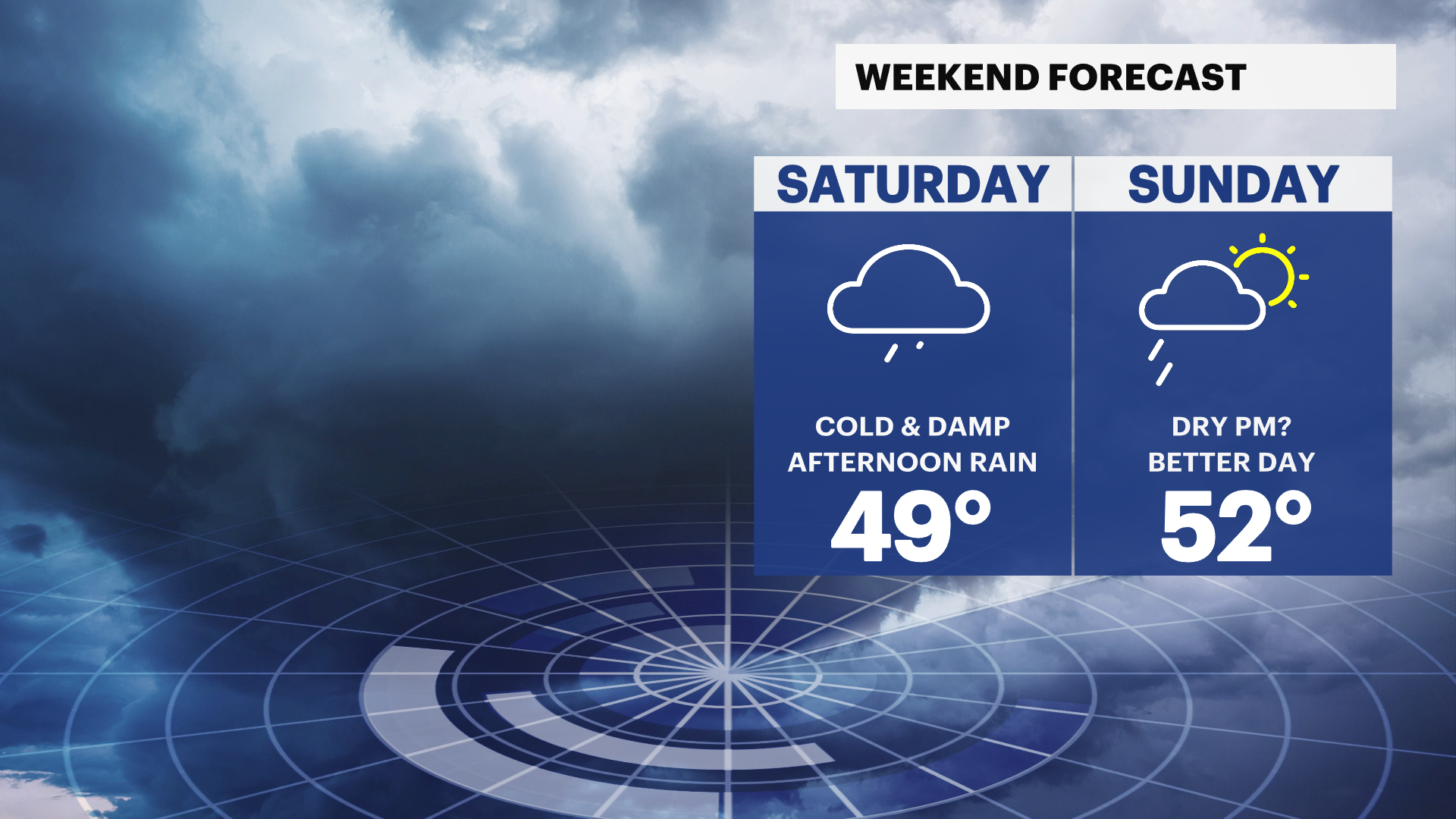
The weekend will start off cloudy and sadly turn dreary. A system passes by just to the south of the region, but will keep us covered in rain, starting in the midday hours and lasting into early Sunday morning. The Saturday morning hours will be the best time to run some errands or take care of chores outside as light drizzle to light showers will come through. But by the midday hours, pack up those activities and head inside, as the rain will become widespread and fall at a moderate pace through the rest of the day. We sorely need the rain though, and thankfully we are getting it gradually through the day. Several locations in the region are experiencing some drought conditions. The nearly one inch of rain fall will go a long way to helping the parched lands soak up some moisture.
Sunday will see the rain wrap up early in the day with sunny breaks to come around for the rest of the day. Temperatures will start to improve into the mid-50s across the region. That is running cooler than average but better than how Saturday will be. The combination of the clouds, rain and breeze off the Long Island Sound will have Saturday's daytime highs trending at record cold levels.
Monday will be nice and pleasant, but showers return soon. By Tuesday afternoon, rain starts to come back our way and will be around through the middle of the week.
ALMANAC:
Average High: 63 | Average Low: 43
Record High: 86 (2001) | Record Low: 31 (2002)
Sunrise: 6:02 a.m. | Sunset: 7:44 p.m.
THE FORECAST:
TODAY: Sun and clouds with temps near seasonal levels. Highs: low to mid-60s.
TONIGHT: Mostly cloudy with some spotty drizzle. Lows: upper 30s to mid-40s.
SATURDAY: WEATHER TO WATCH - Mainly cloudy to overcast and cool with rounds of rain through the day. Highs: upper 40s to low 50s. Lows: upper 30s to low 40s.
SUNDAY: Showers fade early in the morning to a mix of sun and clouds. Highs: mid-50s. Lows: low 40s
MONDAY: Mix of sun and clouds. Highs: low 60s. Lows: mid-40s.