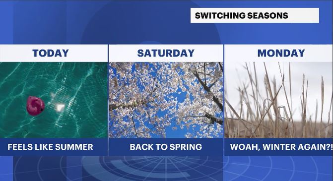
A summer feeling will linger before a gradual cooldown moves in
Temperature records may be set today, but a cool down is in sight!
More Stories
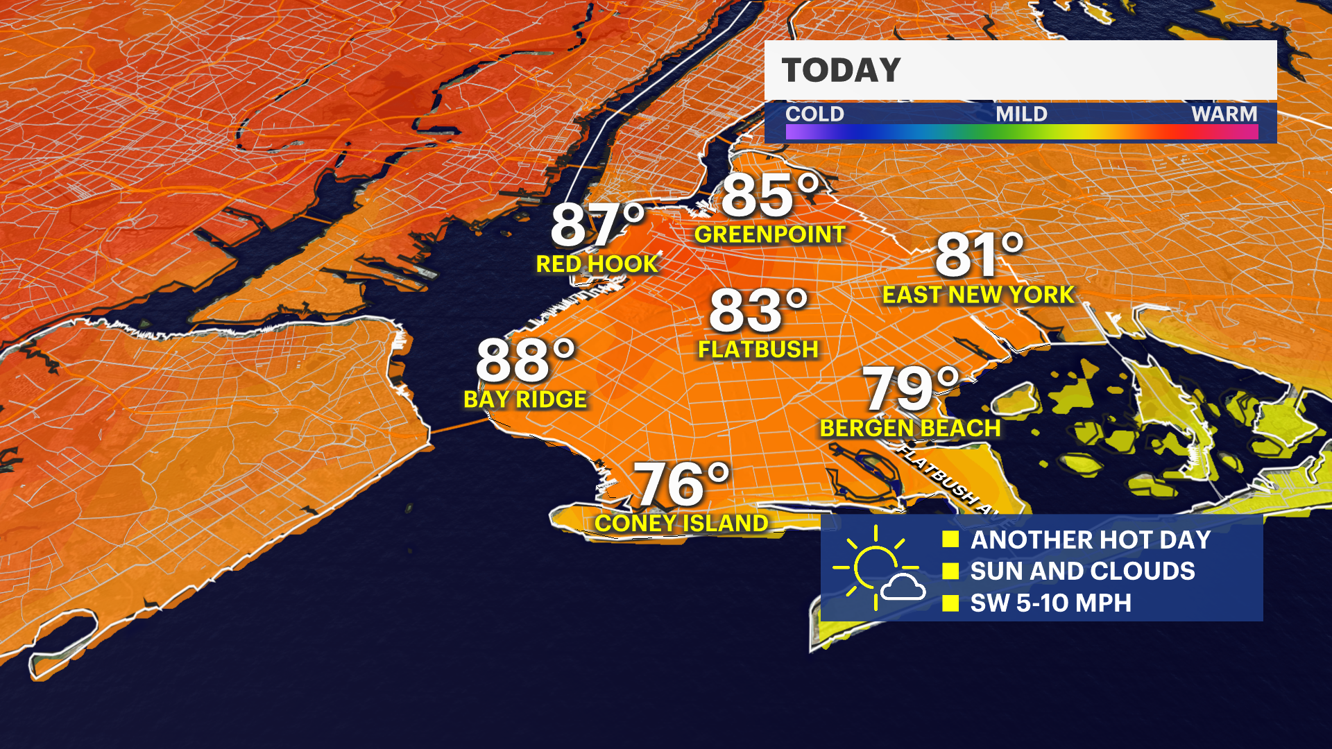
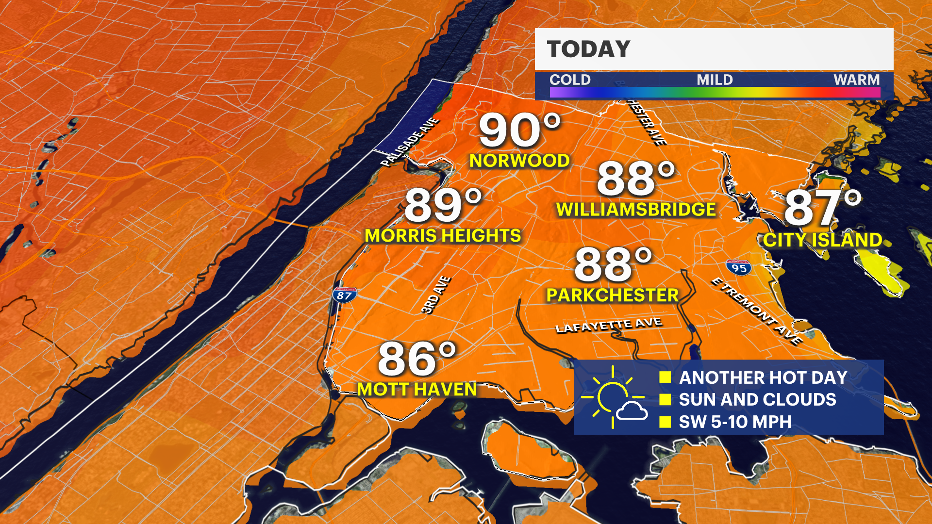
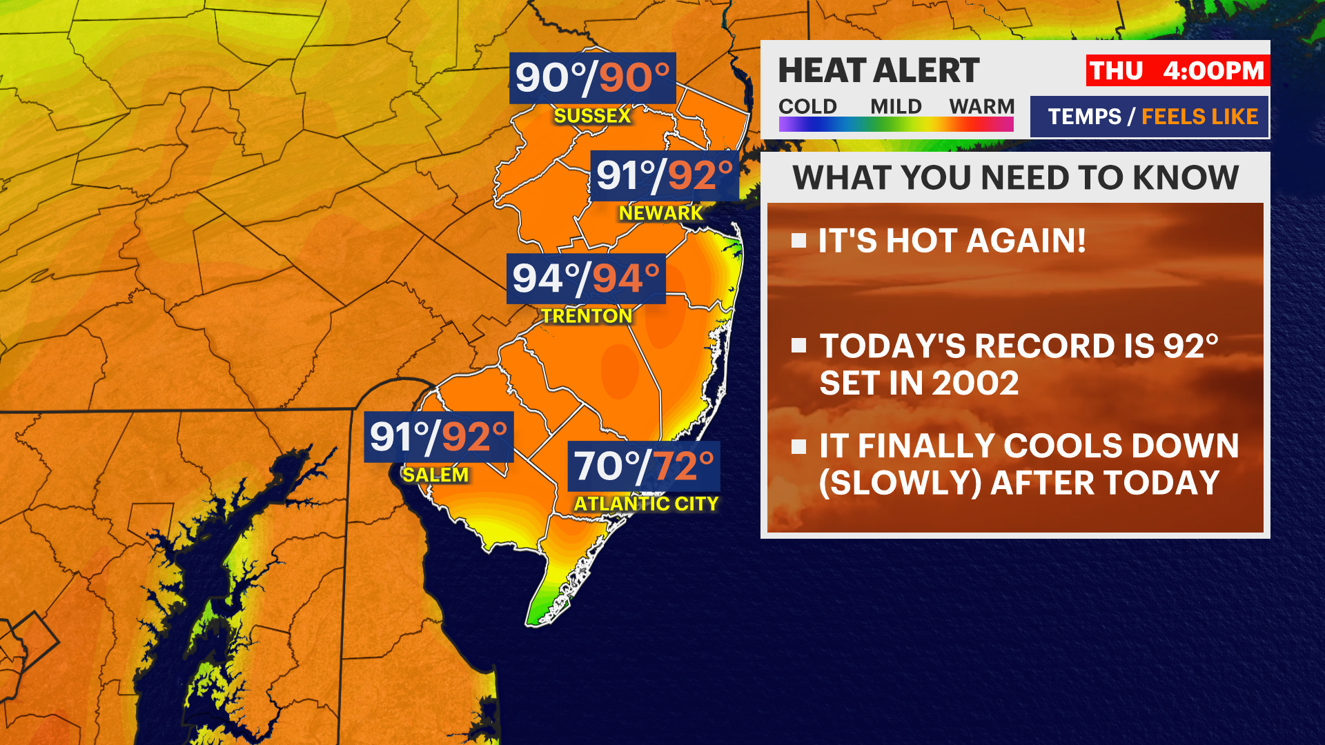
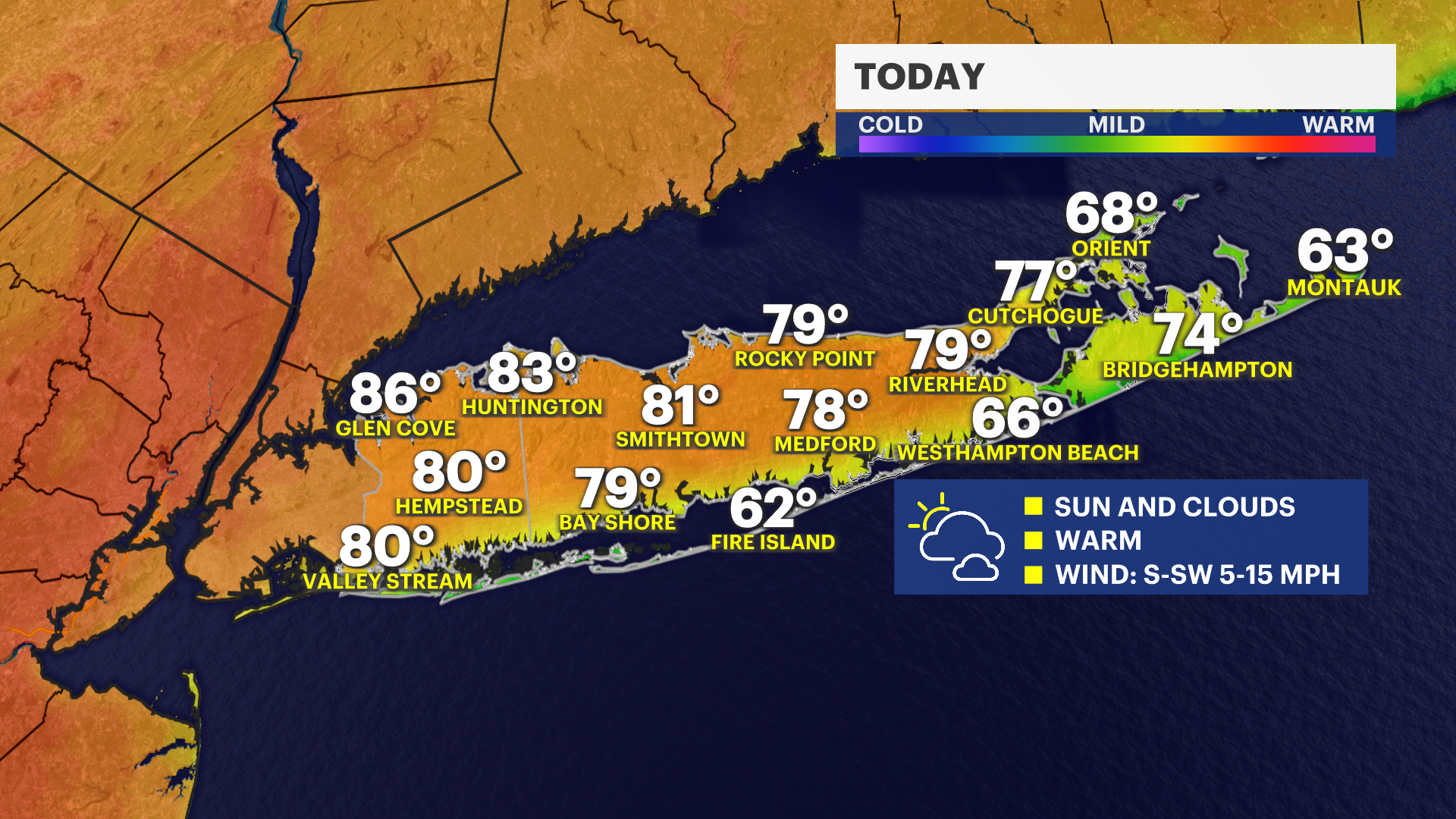
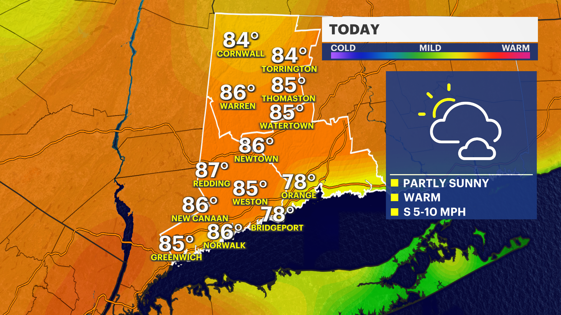

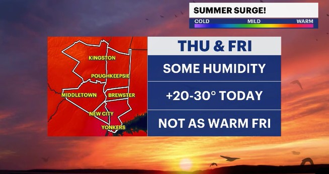
The summer surge continues today with a chance for seeing more daytime records falling.
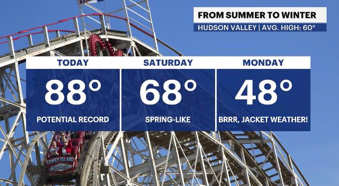
The record high for today in White Plains is 88 degrees, and we are forecast to hit that number later this afternoon. Along the way, this Thursday, is some humidity in the air, which would make the afternoon feeling a touch muggy. The sunglasses, short sleeves, and shorts will be coming out again today but don't plan on putting away your long sleeves and jeans just yet. There are some undesirable changes on the way.
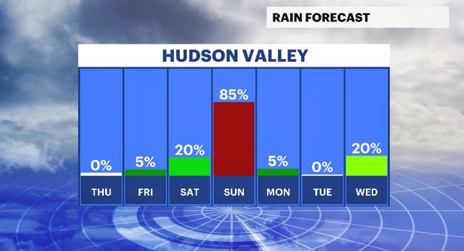
Overnight tonight, a weak cold front will pass by. This will bring a passing shower chance, mainly for areas north and west of Westchester, Putnam & Orange Counties. A drier and slightly cooler breeze will follow the cold front for Friday, with high temps running into the 70s. That is still running above the normal high of 60 degrees for this time of year. Over the weekend, we will see another chance for showers to pop up on Sunday. Another cold front will slowly pass through for the day, bringing rounds of rain and a cooler breeze.
After that system clears out, temperatures will turn colder for Monday. In fact, it will be quite a shock to the system to see high temps struggling to get into the upper 40s. That temp trend is more typical for mid-March. But, don't worry. Temperatures will bounce back to normal levels for the rest of the work week to follow.
ALMANAC:
Average High: 60 | Average Low: 40
Record High: 88 (2002) | Record Low: 26 (1981)
Sunrise: 6:14 a.m. | Sunset: 7:36 p.m.
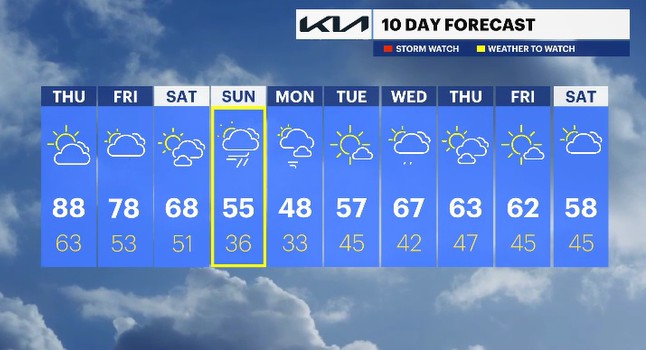
THE FORECAST:
TODAY: Mostly sunny and potentially record warm temps with some humidity. Record: 88 (2002). Highs: mid to upper 80s.
TONIGHT: Partly cloudy with temps near normal levels. Lows: low to mid-60s.
FRIDAY: Mostly cloudy with spotty shower chances. Highs: upper 70s. Lows: low 50s.
SATURDAY: A mix of sun and clouds with mild temps. Highs: upper 60s. Lows: upper 40s to low 50s.
SUNDAY: WEATHER TO WATCH -Mostly cloudy to overcast skies with rounds of rain through the day. Highs: mid-50s. Lows: mid-30s.