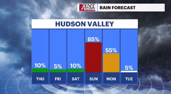
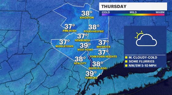
Mix of sun and clouds with a chance of flurries for Thursday in the Hudson Valley
News 12 Storm Watch Team Meteorologist Addison Green says the Hudson Valley will see partly sunny to mostly cloudy skies with light snow shower on Thursday.
More Stories
News 12 Storm Watch Team Meteorologist Addison Green says the Hudson Valley will see a mix of sun and clouds with the possibility of flurries on Thursday.
WHAT'S NOW: A chill will continue to be felt across the region overnight into Thursday. The first night of Hanukkah will have temperatures feeling into the upper-20s and low-30s.
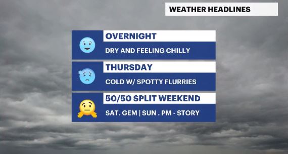
WHAT'S NEW: Expect the temperatures to feel better by Friday as milder air moves this way. The region will have near normal levels on Friday and then trend above average over the weekend. A record high could be challenged before Sunday is over.
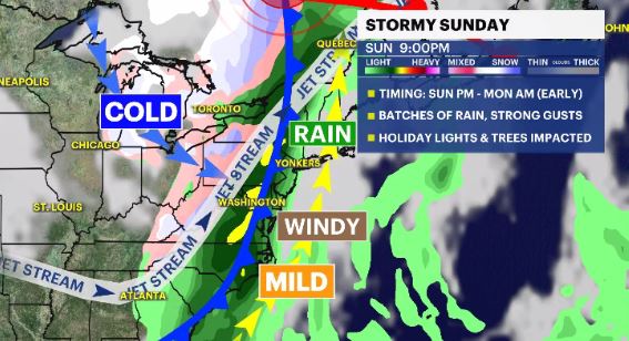
WHAT'S NEXT: A storm system will approach by Sunday, helping to boost the temperatures, but also to bring rain and wind to the area. The timing, amount of rain and wind gust range still has some question marks around it, but loose articles, like holiday decorations, could be impacted Sunday night.
FORECAST:
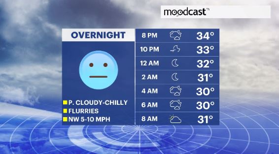
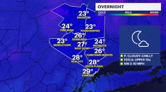
OVERNIGHT: Partly cloudy, chilly with a light, northwesterly breeze. Lows in the mid- to upper-20s.
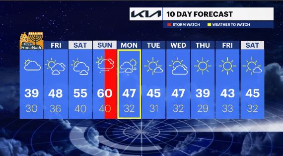
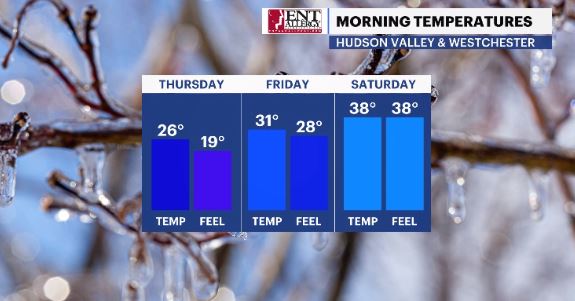
THURSDAY -- FIRST NIGHT OF HANUKKAH: A mix of sun and clouds with some possible flurries. Highs in the upper-30s to low-40s. Lows in the upper-20s to low-30s.
FRIDAY: Partly cloudy and breezy at times with temps bouncing back. Highs in the mid- to upper-40s. Lows in the mid-30s.
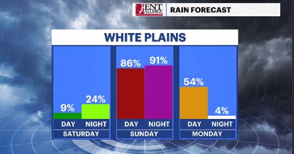
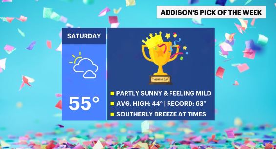
SATURDAY -- PICK OF THE WEEK: A mix of sun and clouds with above average temperatures. Highs in the low- to mid -50s. Lows in the upper-30s to low-40s.
SUNDAY -- WET AND WINDY (P.M.): Mostly cloudy in the morning to overcast in the afternoon with batches of showers to moderate rains and gusty winds. Highs in the upper-50s to low-60s. The record high in 1966 was 61 degrees. Lows in the upper-30s to low-40s.
MONDAY -- WET AND WINDY (A.M.): Decreasing clouds with breezy winds and feeling cooler. Highs in the mid-40s. Lows in the upper-20s to low-30s.
TUESDAY: Mostly sunny. Highs in the low- to mid-40s. Lows in the upper-20s to low-30s.
WEDNESDAY: Partly cloudy. Highs in the mid-40s. Lows in the upper-20s to low-30s.
THURSDAY: Mainly sunny. Highs in the upper-30s to low-40s. Lows in the upper-20s to low-30s.
FRIDAY: Mainly sunny. Highs in the upper-30s to low-40s. Lows in the upper-20s to low-30s.
SATURDAY: Mostly sunny. Highs in the low- to mid-40s. Lows in the upper-20s to low-30s.