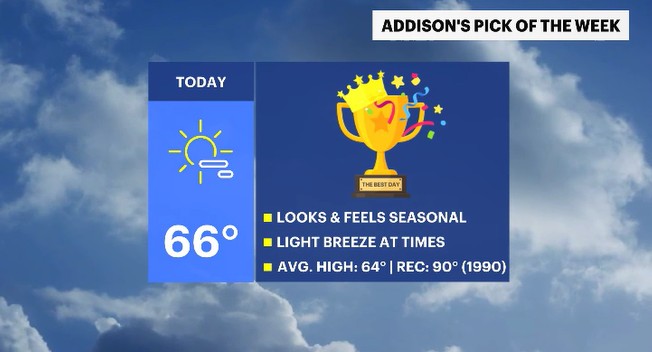
We start with the Pick of the Week in the Hudson Valley today!
Sunny skies, seasonal temperatures & a pleasant breeze are around today. But showers are in sight as well as a cool down.
Top Stories

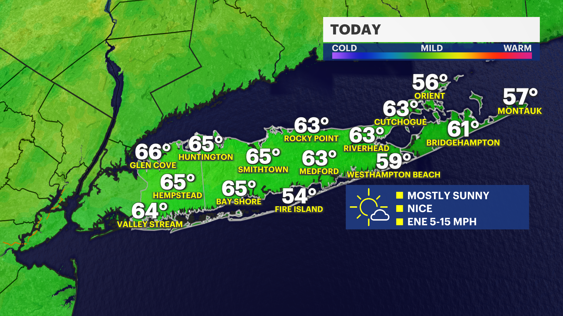


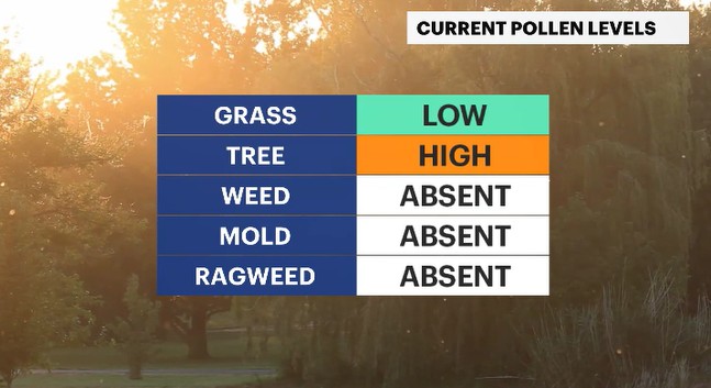
After a soggy start to this past weekend, with the rain falling through the entire day and temperatures feeling rather chilly, we will see conditions to continue to trend In an upward direction. Today is going to be a pleasant day with seasonal temperatures and lots of sunshine. As a result of this, we have the Pick of the Week today! It is going to be feeling wonderful, especially compared to how things have been and how they will be. While the weather will be delightful, there will be a concern for tree pollen to run high.
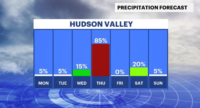
Cloud cover will increase through the day on Tuesday with the shower potential running low. But that chance will increase for Wednesday as a storm system approaches the region. Lookout for the umbrellas to come in the evening hours as rain moves into the Hudson Valley. The showers will linger through the first half of Thursday as temperatures will trend on the cool side. Drier weather moves in for late Thursday into Friday as breezy winds will be the story to wrap up the work week.
For the weekend ahead, the first one of the new month of May, there will be another shower chance to pop up for Saturday. But both weekend days could run below average, with highs into the 50s.
ALMANAC:
Average High: 64 | Average Low: 44
Record High: 90 (1990) | Record Low: 31 (2002)
Sunrise: 5:58 a.m. | Sunset: 7:47 p.m.
THE FORECAST:
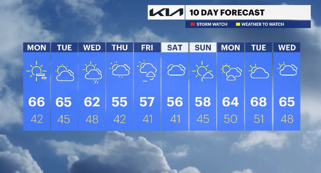
TODAY: PICK OF THE WEEK - Lots of sunshine with seasonal temperatures and a pleasant breeze. Highs: mid-60s.
TONIGHT: Mostly clear and cool. Lows: low to mid-40s.
TUESDAY: Mostly sunny to mostly cloudy. Highs: mid-60s. Lows: mid-40s.
WEDNESDAY: Mostly sunny to cloudy with a chance for showers in the second half of the day. Highs: low 60s. Lows: upper 40s
THURSDAY: Mostly cloudy with showers through the first half of the day. Highs: mid-50s. Lows: low 40s.