STORM WATCH: Prepare for a wet, breezy and cool weekend with travel impacts
It is mostly cloudy with drizzle around overnight into Saturday morning ahead of heavier rain and windier conditions into Sunday.
More Stories


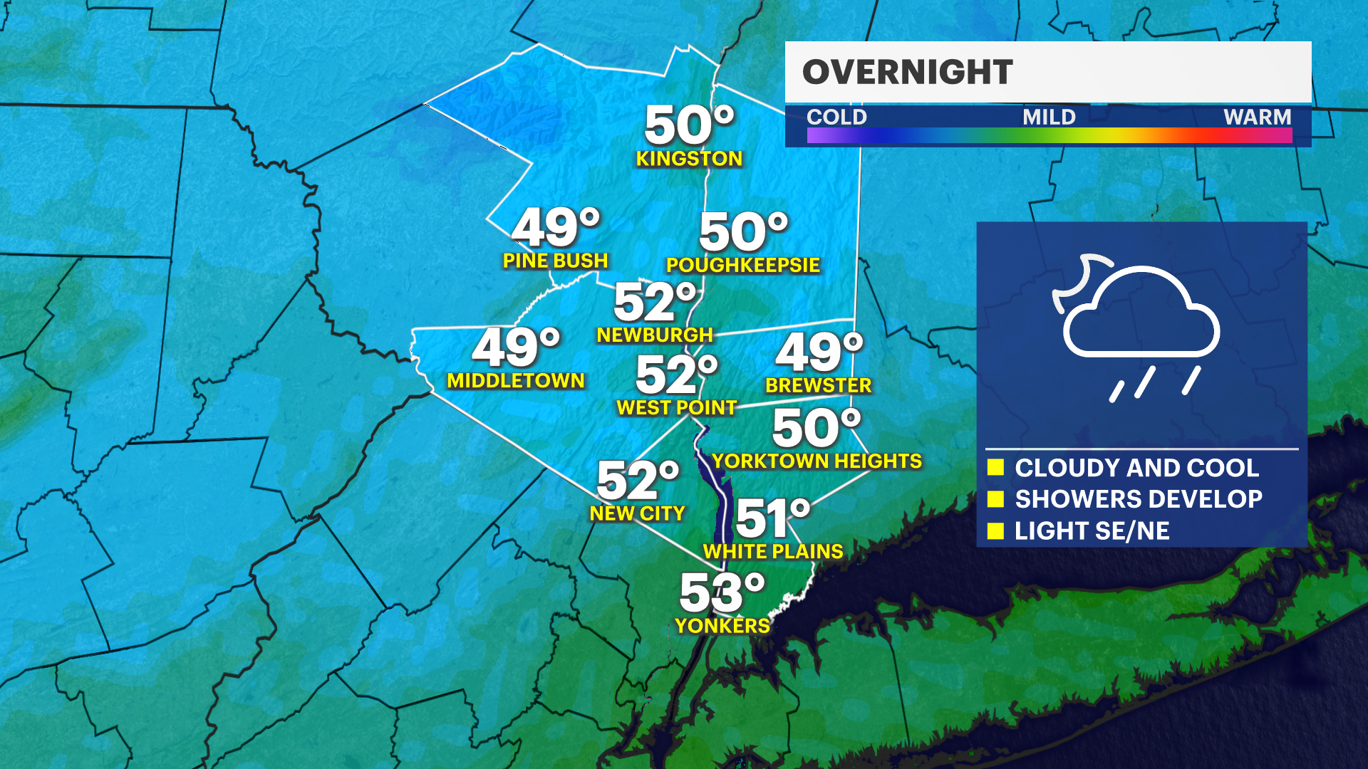
OVERNIGHT INTO SATURDAY MORNING
Spotty light rain and drizzle will be around overnight into Saturday morning. Keep a rain jacket and umbrella with you all weekend starting Saturday morning. Any light rain and drizzle will become more widespread through Saturday morning and it will be a cool start to the day with early morning temperatures in the upper 40s to lower 50s.
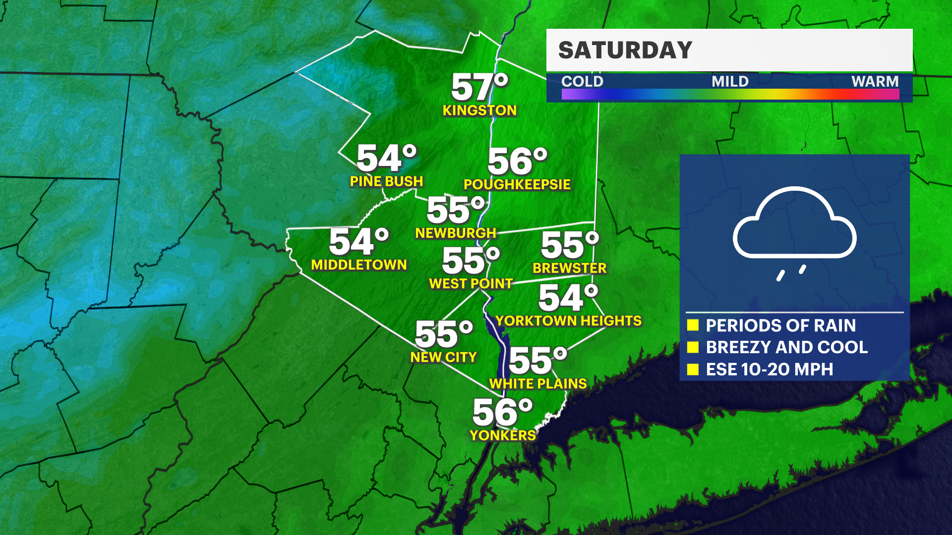
STEADIER RAIN DEVELOPS SATURDAY
Rounds of steadier moderate rain will move in for the late morning, afternoon and evening on Saturday. It will not be too heavy just yet, but you will probably think of it as a miserable day with rainy conditions paired with much chillier temperatures. High temperatures will only get into the middle and upper 50s and it can feel chillier with an east wind around 10 to 20 mph.
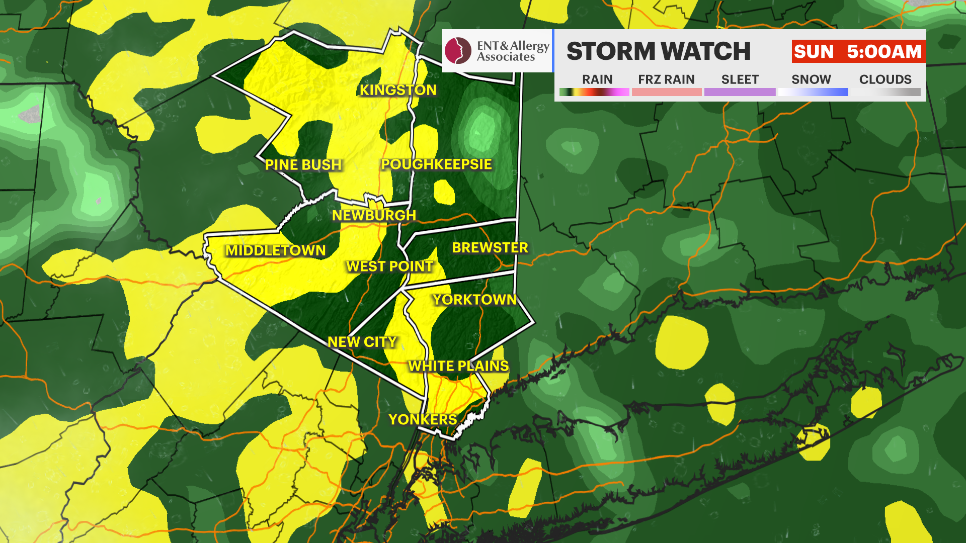
HEAVIER RAIN INTO SUNDAY MORNING
You'll notice heavier rain and breezier conditions developing Saturday evening and this will last right through Sunday morning. Travel will be slowed by heavy rain overnight Saturday into Sunday morning. Wind gusts can reach around 15 to 25 mph at times, too. Expect delays and possibly even some cancellations at area airports as well.
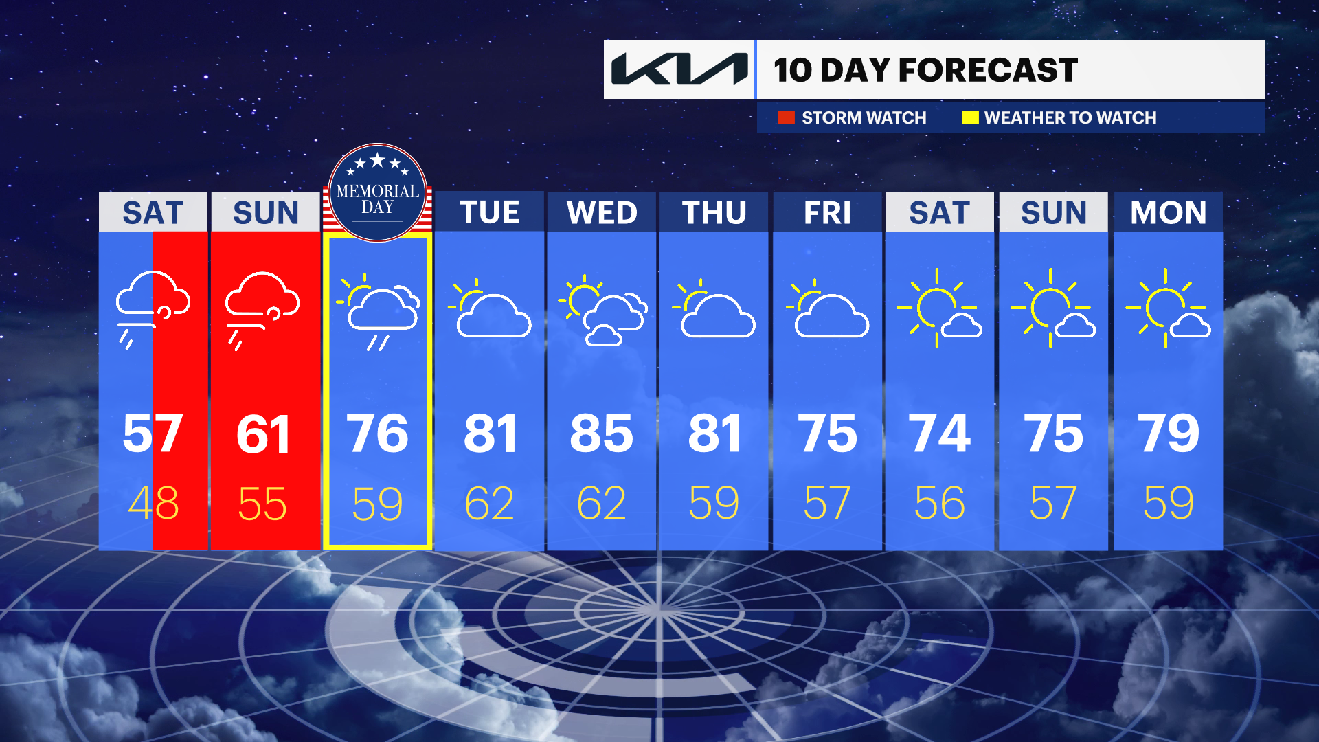
MEMORIAL DAY MONDAY
There is still some hope for Monday! It is definitely not perfect, but showers look a bit spottier at this time and temperatures will be warming into the upper 60s to middle 70s. Stay with News 12 for important forecast updates through the weekend!
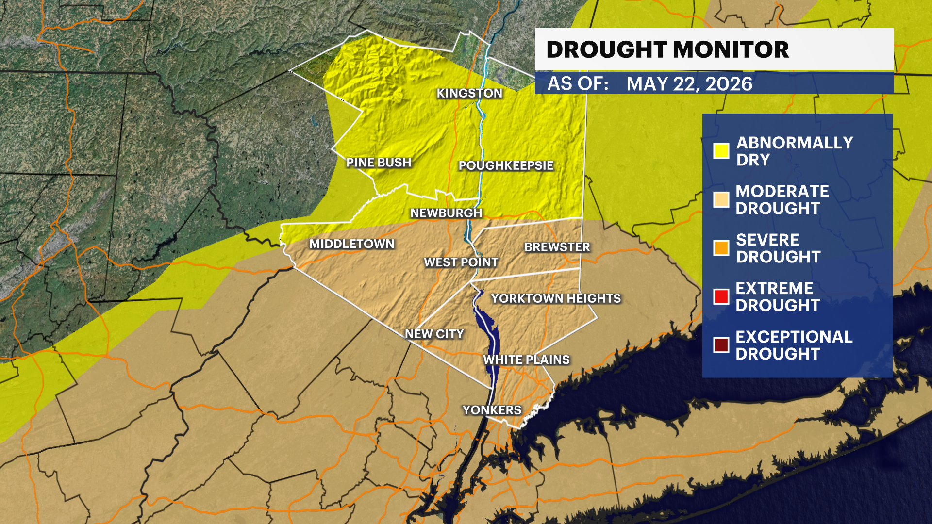
LOCAL DROUGHT CONDITIONS
As you may already know from Thursday's updates, the Lower Hudson Valley continues in a moderate drought. This weekend's rain, which can be significant, between 1 and 2 inches, can help put a dent in these drought conditions. This weekend's rain will be reflected in next Thursday's drought monitor update.
EXTENDED FORECAST
TUESDAY: Mainly cloudy with a few breaks of sun. Highs around 81 degrees. Lows near 62 degrees.
WEDNESDAY: Sun and clouds. Highs around 85 degrees. Lows near 62 degrees.
THURSDAY: Mostly cloudy. Highs around 81 degrees. Chance for a passing shower. Lows near 59 degrees.
FRIDAY: Partly sunny to mostly cloudy. Chance for a shower. Highs around 75 degrees. Lows near 57 degrees.