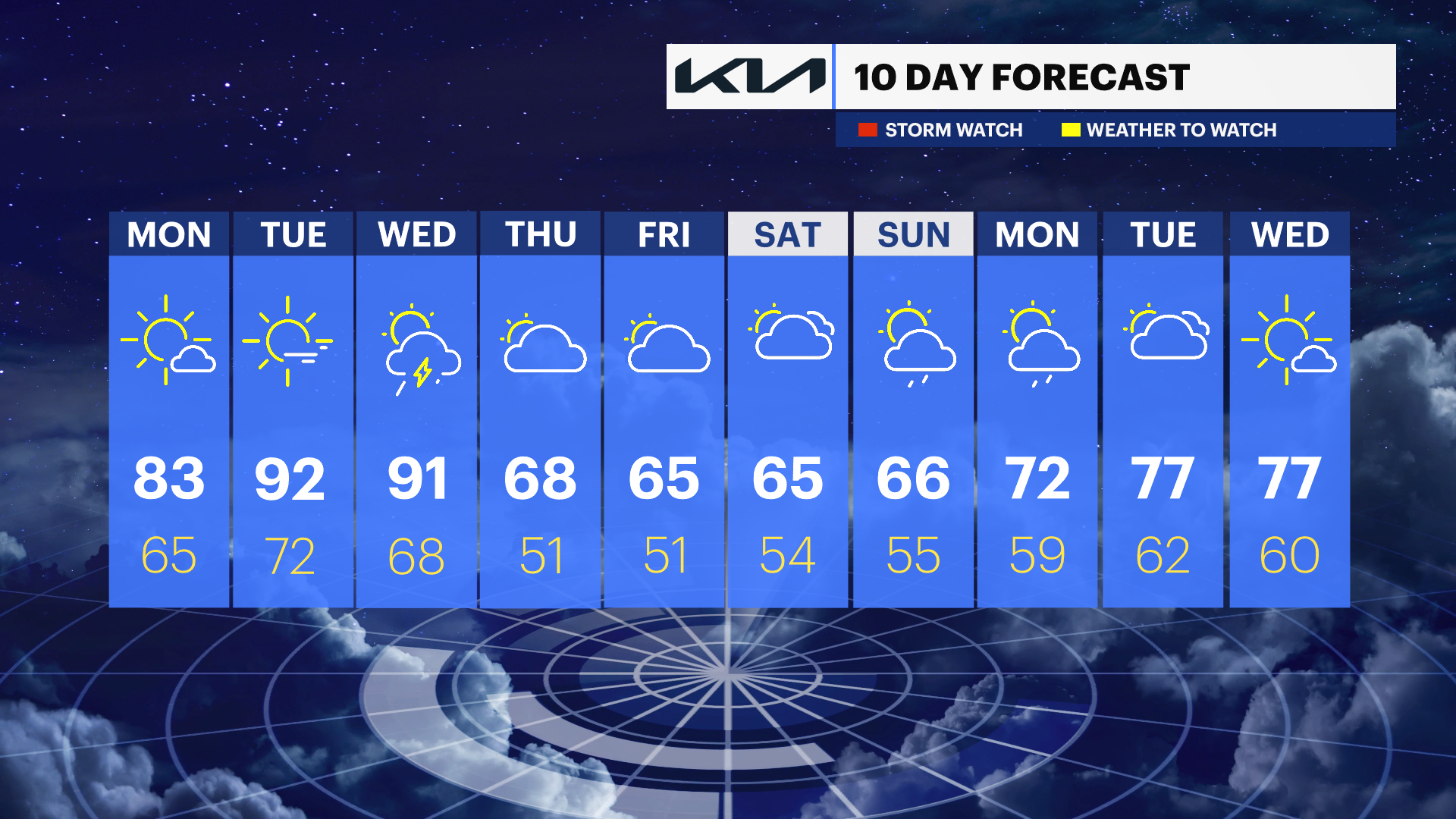
Summer-like heat continues across the Hudson Valley before midweek storms bring cooler temperatures
Temperatures surge into the upper 80s and 90s through Wednesday before showers, thunderstorms, and cooler air return later this week.
More Stories


FORECAST
Overnight
A mild and breezy overnight is expected across the Hudson Valley, with partly cloudy skies and comfortably warm temperatures for this time of year.
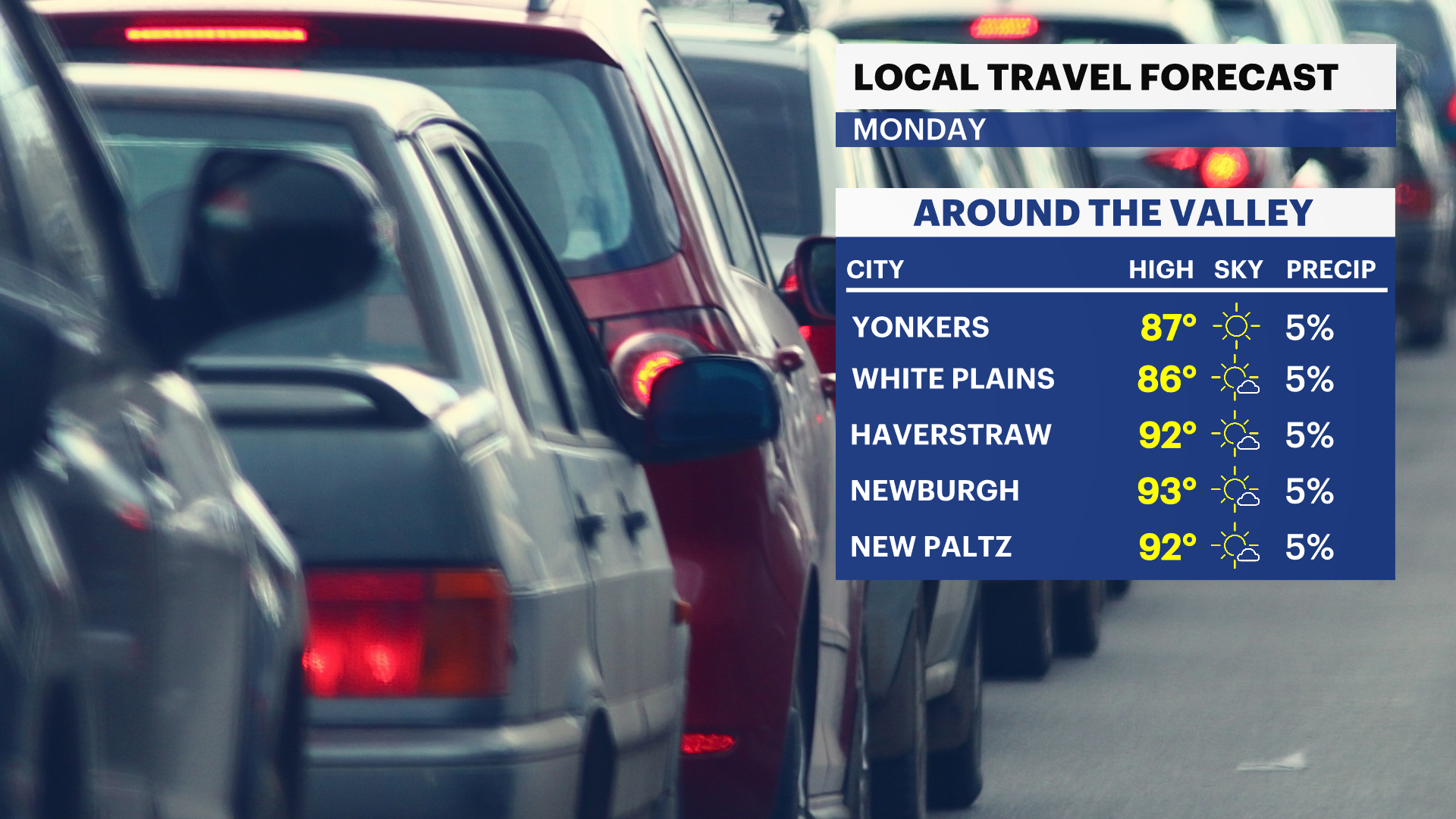
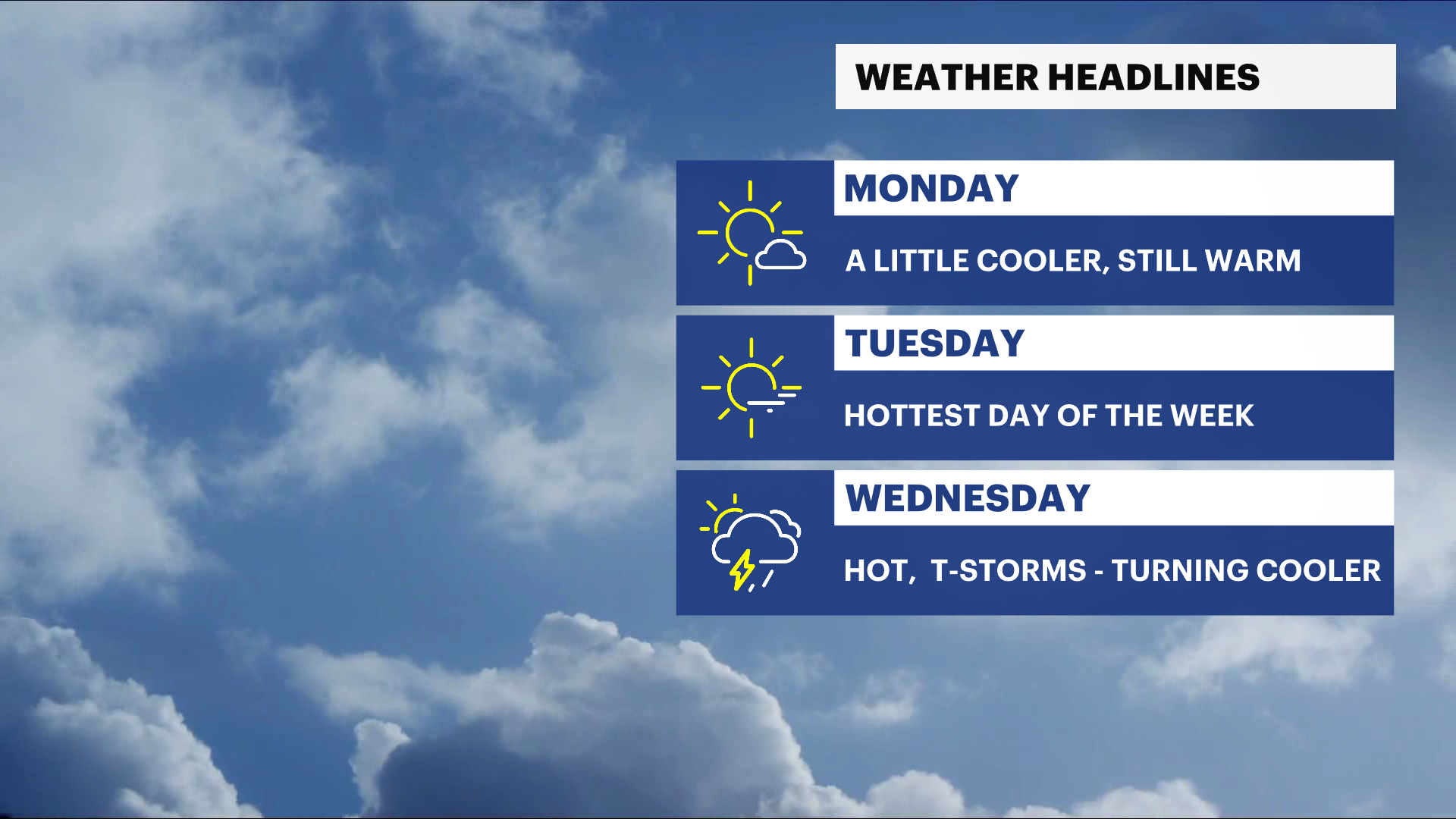
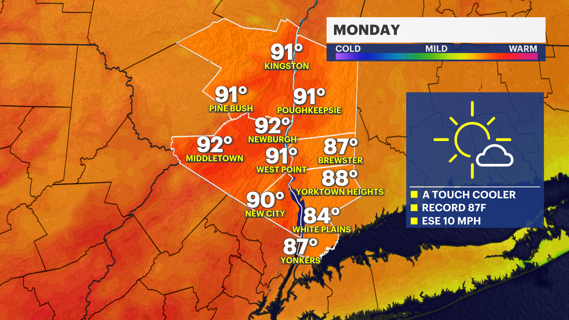
Monday
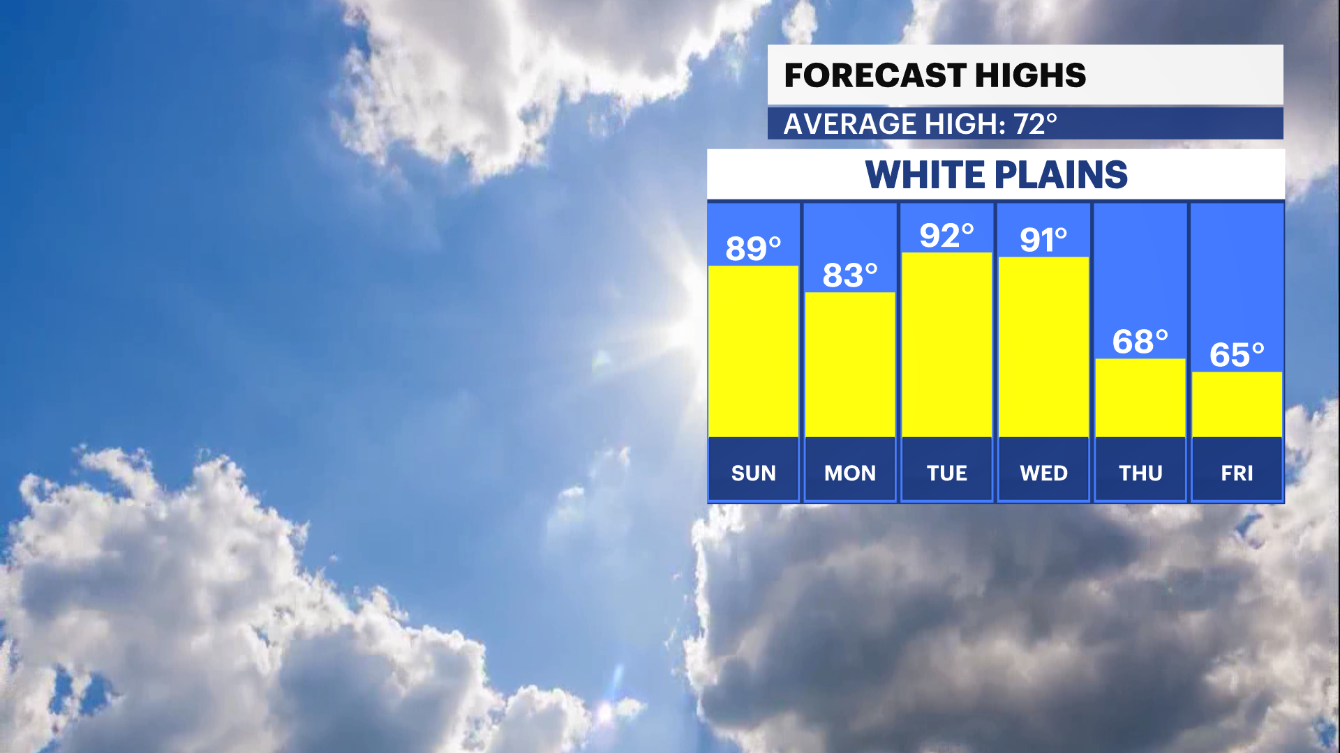
A weak backdoor cold front slides into the region, knocking temperatures down slightly compared to the weekend. Even with the minor cooldown, it will still feel quite warm with a mix of sunshine and clouds through the day. Areas farther north and west may still push close to 90 during the afternoon.
Monday Night
Partly cloudy and mild overnight, with a light breeze continuing. Humidity levels slowly begin increasing ahead of another surge of summer-like warmth heading into Tuesday.
Tuesday
The hottest weather of the stretch arrives with temperatures climbing into the upper 80s and low to mid-90s across much of the Hudson Valley. Strong sunshine and a gusty southwest breeze will make it feel much more like midsummer than May. Humidity levels also begin creeping upward during the afternoon and evening hours.
Tuesday Night
Warm and increasingly muggy overnight with partly cloudy skies continuing. A stray late-day or evening thunderstorm cannot be completely ruled out, although most areas should stay dry.
Wednesday
Another very warm and somewhat humid day is expected ahead of an approaching cold front. Temperatures may not get quite as hot as earlier forecasts suggested because the front is now expected to arrive sooner. Clouds will increase during the afternoon followed by scattered showers and thunderstorms, some capable of producing heavy downpours and gusty winds. The overall severe weather threat currently appears fairly low.
Thursday
The cold front pushes east of the region, bringing temperatures back closer to normal for late May. Humidity levels drop noticeably with improving conditions through the day, although a lingering shower cannot be ruled out early on.
Late Week and Next Weekend
More seasonable temperatures settle into the Hudson Valley heading into Friday with quieter weather expected overall. There are early indications that another chance of rain may develop sometime next weekend as a stalled boundary nearby begins lifting back northward.
Outdoor Reminder
With several unusually warm days expected, anyone spending extended time outdoors should stay hydrated and take breaks from the heat, especially during the hottest part of the afternoon Tuesday and Wednesday.