Sunny and breezy Sunday, followed by an early week warm surge for the Hudson Valley
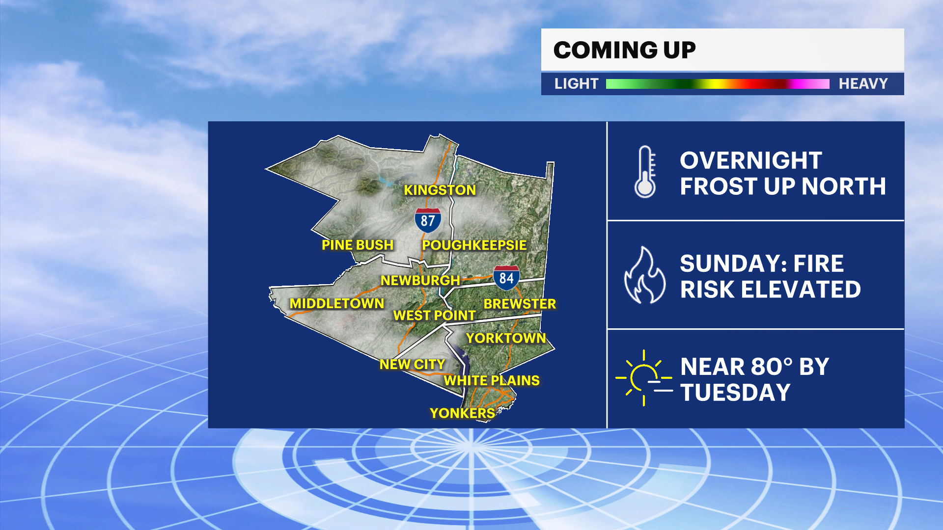
There is an elevated fire risk on Sunday, followed by summer-like warmth early in the week.
More Stories


FORECAST
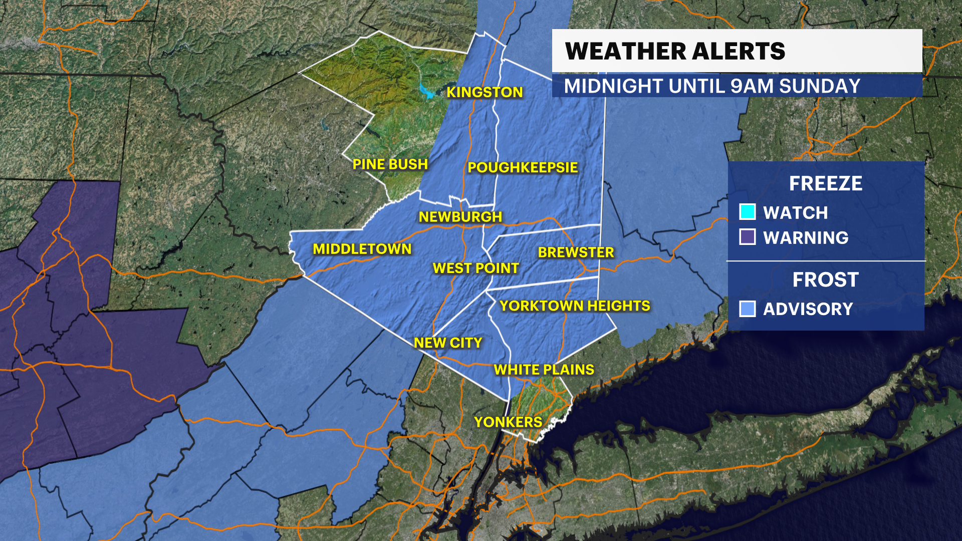
There is a frost advisory in effect from midnight to Sunday 9 a.m. for Northern Westchester, Orange, Putnam and Rockland counties. Frost could harm sensitive outdoor vegetation. Sensitive outdoor plants may be killed if left uncovered.
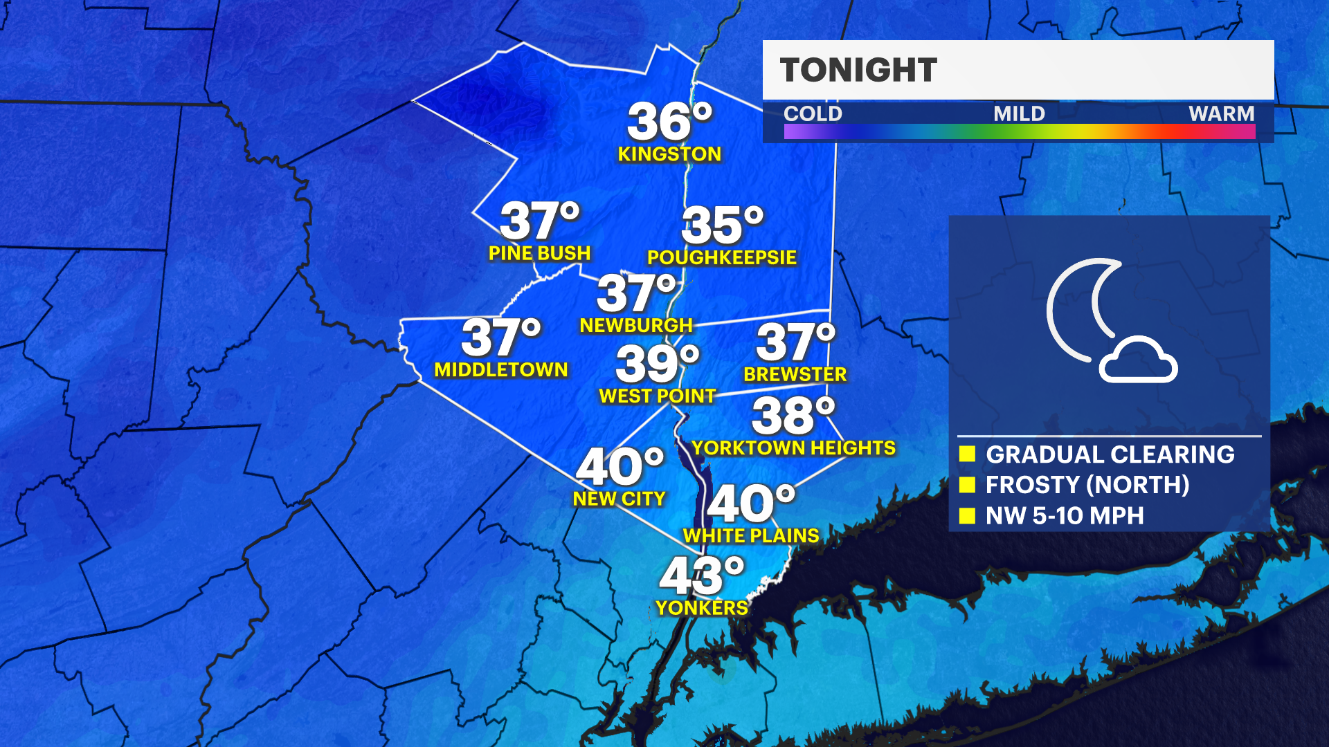
Overnight: Skies gradually clear and temperatures drop, especially across the northern Hudson Valley where it will get cold enough for frost to form by early morning. Temperatures dip into the mid-30s in colder spots, which could damage sensitive plants if left uncovered.
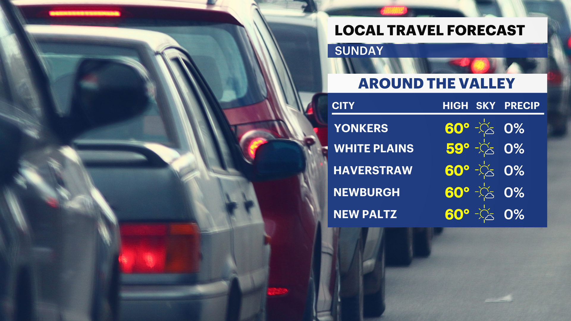
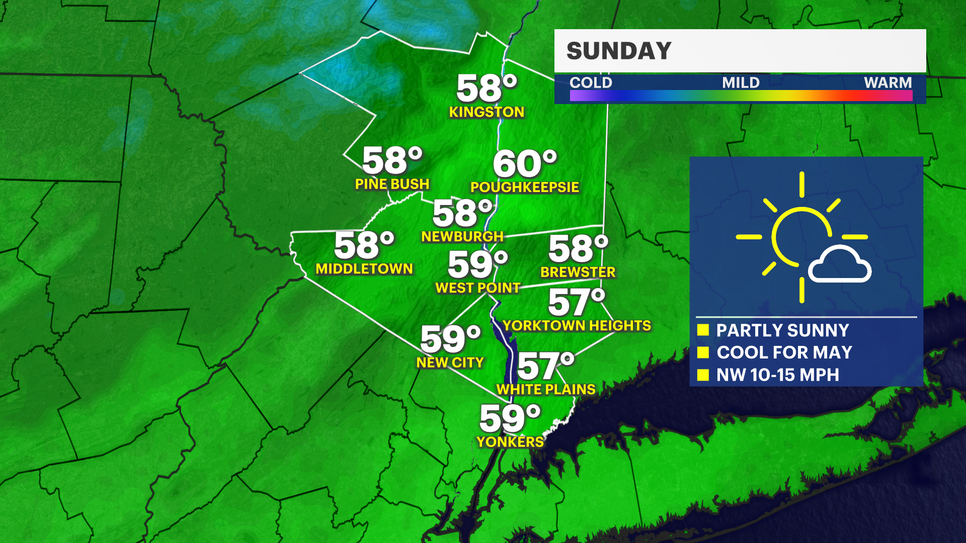
Sunday: Sunshine returns, but it will be breezy and very dry. Gusty winds combined with low humidity will create an increased risk for fires to spread from late morning into early evening, so outdoor burning is not advised. The burn ban remains in effect through May 14.
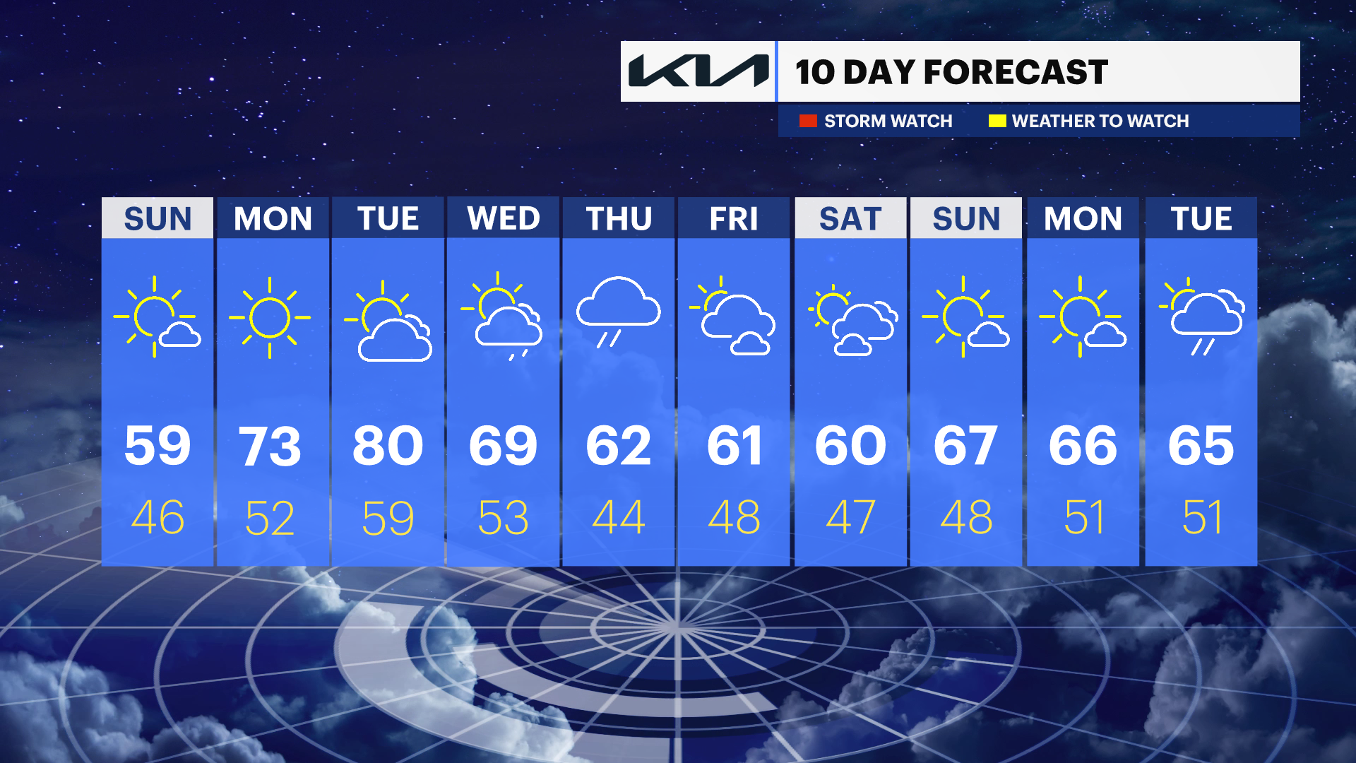
Monday: A warming trend begins with seasonable, comfortable weather. Temperatures reach the upper 60s to low 70s in the Hudson Valley under a mix of sun and clouds.
Tuesday: It turns much warmer, with temperatures climbing well above normal. Expect temperatures in the 70s to near 80 across the Hudson Valley for an early taste of summer.
Wednesday into Thursday night: A slow-moving storm system brings multiple rounds of rain and possible thunderstorms. Periods of heavier rain may develop, which could lead to localized impacts across the Hudson Valley.