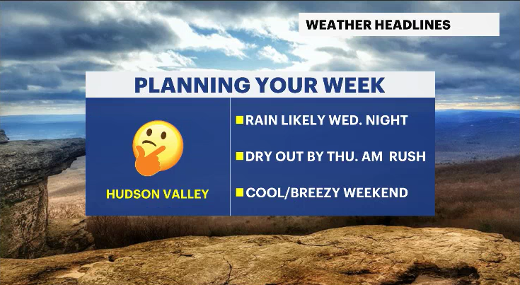
Midweek rain before cooler finish to the week for the Hudson Valley
Evening showers Wednesday bring a needed soaking before breezy, cooler air settles in through the weekend.
More Stories


WHAT TO KNOW:
The overnight period will be dry.
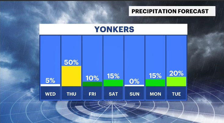
Wednesday remains relatively quiet through the day with limited changes to the forecast. Clouds linger, but most locations stay dry until the evening hours. Rain is expected to develop around 8 p.m., becoming steadier overnight and continuing into early Thursday morning.
This system will provide a beneficial soaking rainfall, with most areas expected to pick up between 0.5" to 0.75" of rain. Showers should come to an end before sunrise on Thursday to allow a drier start to the day.
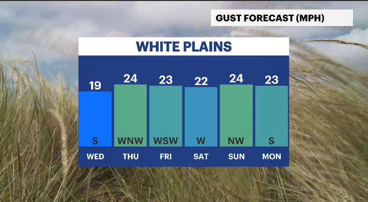
Conditions turn breezy but not overly harsh behind the system. Wind gusts are expected to top out around 25 mph Thursday afternoon, with temperatures reaching the upper 50s. The cooldown will be noticeable but not dramatic.
A cooler-than-average pattern settles in from Thursday into the weekend. High temperatures will generally remain in the upper 50s, gradually approaching the low 60s by the weekend. Breezy conditions persist but without strong gusts.
Rain chances continue to diminish, looking ahead to the first weekend of May. A system previously being monitored now appears likely to remain to the south, keeping Saturday mainly dry with clouds and cooler air in place. While not perfect, conditions look improved compared to last weekend’s washout.
THE FORECAST:
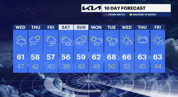
OVERNIGHT: Mostly cloudy and cool, with a few early showers north. Lows in the mid-40s.
WEDNESDAY: Mostly cloudy. Rain develops after 8 p.m. Highs in the upper 50s to low 60s. Lows in the mid- to upper 40s.
THURSDAY: Showers end before sunrise, then breezy and cooler. Highs in the upper 50s. Lows in the low 40s.
FRIDAY: Partly sunny and breezy. Highs in the mid- to upper 50s. Lows in the upper 30s to low 40s.